ROCK wrote:That’s a real pretty NON invest for early morning.I have seen ULLs and a puff of clouds get more love...
Well it’s approaching dmax, but yeah it’s looking pretty nice
Moderator: S2k Moderators

ROCK wrote:That’s a real pretty NON invest for early morning.


drezee wrote:Forex,
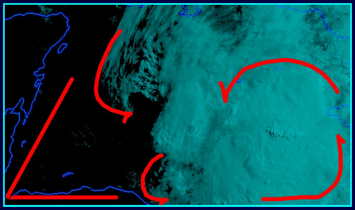
You are looking at the mid to high level clouds. The near surface clouds are from the E and SSE at best. Trough only

NDG wrote:I don't see any signs of a surface circulation this morning, there's a trough just to the east of Nica that is wide open.
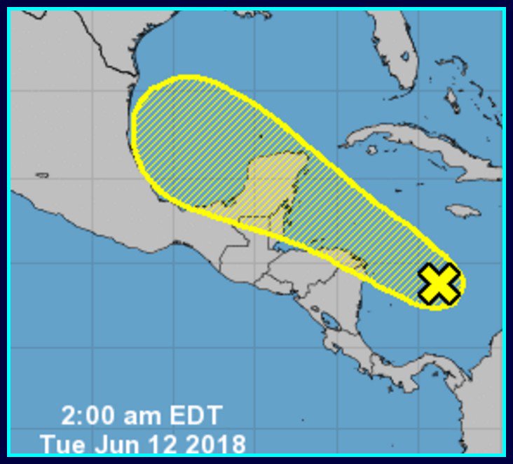
Euro is coming out to be the winner on this event
Nederlander wrote:NDG wrote:I don't see any signs of a surface circulation this morning, there's a trough just to the east of Nica that is wide open.
Euro is coming out to be the winner on this event
Not sure how you can say that with so much certainty.. GFS wasn’t showing development until GOM and the EURO had nothing...
Users browsing this forum: Beef Stew, Christiana, KirbyDude25, Stormybajan, tolakram and 83 guests