TTAA00 KNHC DDHHMM
Tropical Weather Outlook
NWS National Hurricane Center Miami FL
800 AM EDT Fri Aug 10 2018
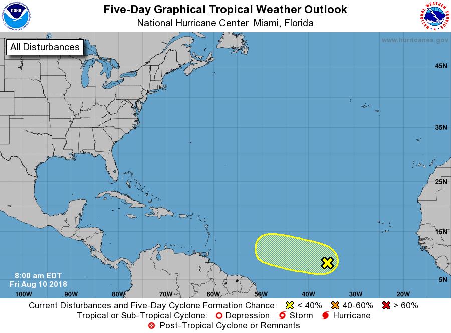
For the North Atlantic...Caribbean Sea and the Gulf of Mexico:
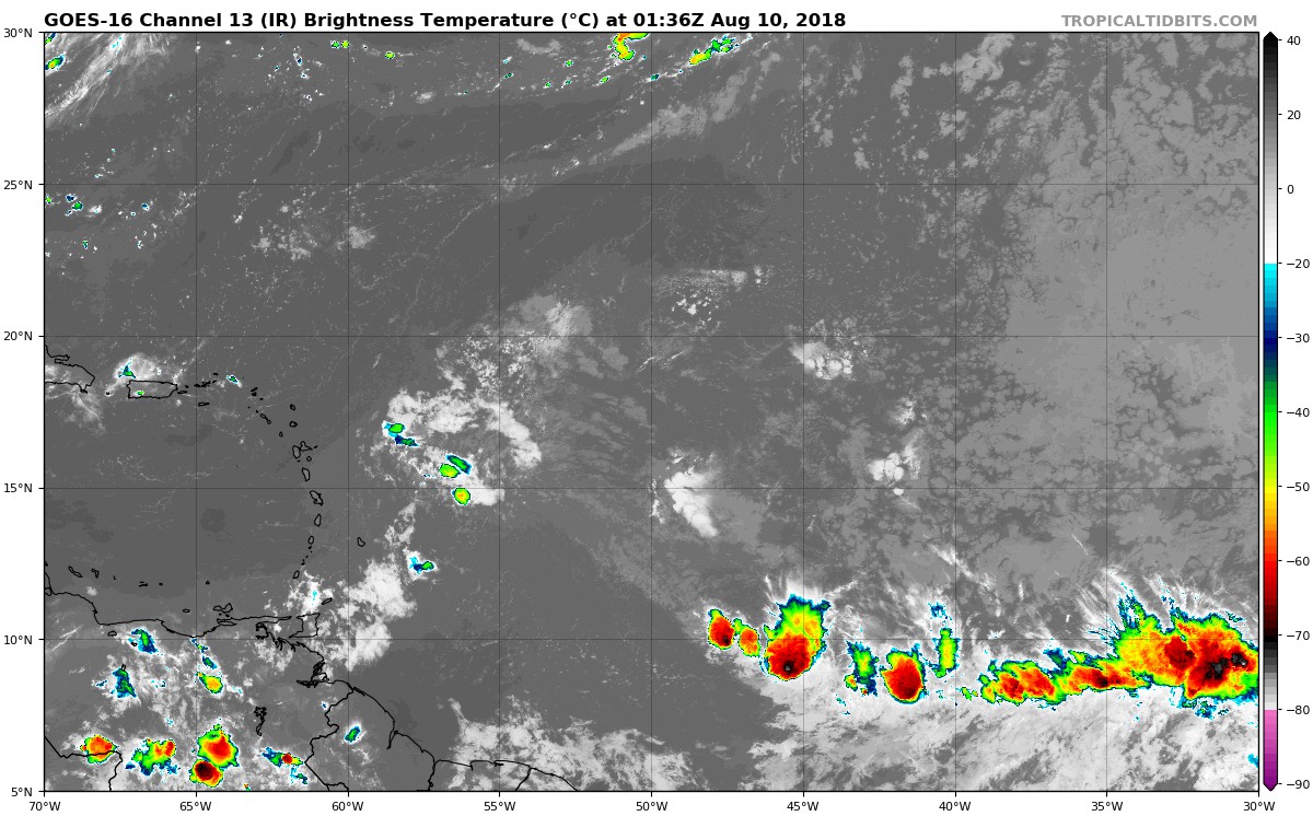
1. An area of disturbed weather is located about midway between Africa
and the Lesser Antilles. Environmental conditions are expected to
become conducive for some gradual development while the system moves
slowly west over the next few days. By the middle of next week,
stronger upper-level winds could limit the chance for further
development.
* Formation chance through 48 hours...low...10 percent.
* Formation chance through 5 days...low...20 percent.
Forecaster Zelinsky