


Tue, 23 Jul 2019 05:41:53 +0000
000
ABNT20 KNHC 230541
TWOAT
Tropical Weather Outlook
NWS National Hurricane Center Miami FL
200 AM EDT Tue Jul 23 2019
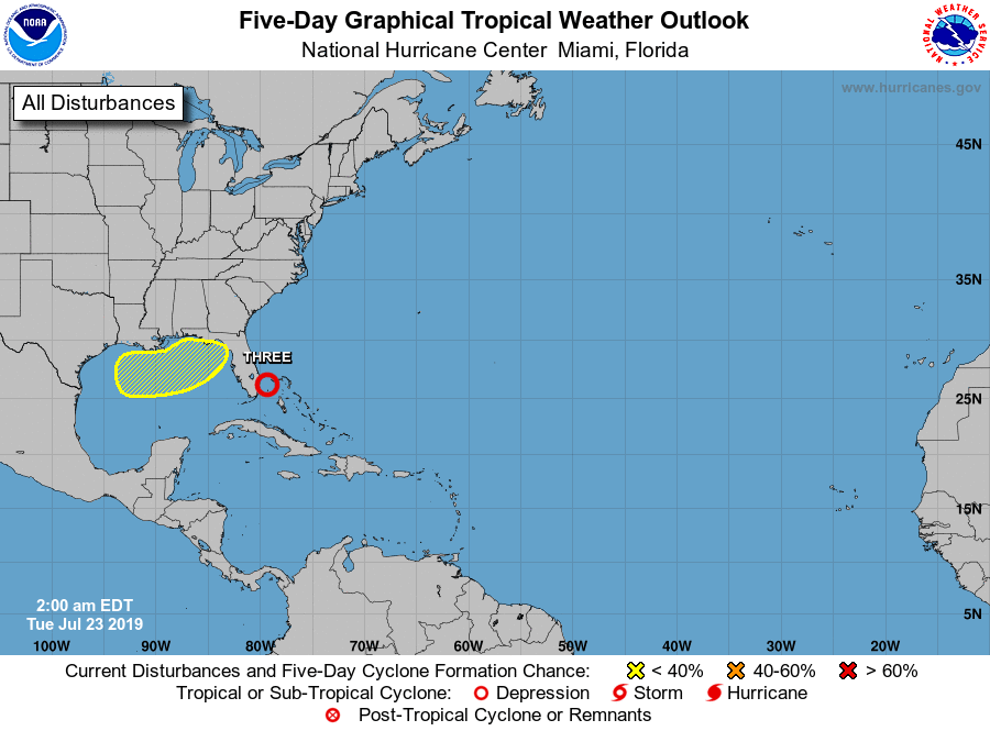
For the North Atlantic...Caribbean Sea and the Gulf of Mexico:
The National Hurricane Center is issuing advisories on Tropical
Depression Three, located between the southeastern Florida coast
and Grand Bahama.
A non-tropical low pressure area could form over the northern Gulf
of Mexico by late Wednesday or Thursday. Thereafter, this system
has the potential to acquire subtropical or tropical characteristics
while it moves slowly eastward to northeastward over warm waters
through the end of the week.
* Formation chance through 48 hours...low...near 0 percent.
* Formation chance through 5 days...low...20 percent.
&&
Public Advisories on Tropical Depression Three are issued under WMO
header WTNT33 KNHC and under AWIPS header MIATCPAT3.
Forecast/Advisories on Tropical Depression Three are issued under
WMO header WTNT23 KNHC and under AWIPS header MIATCMAT3.
$$
Forecaster Stewart


 ....another yawner. Wake me up when the season begins.