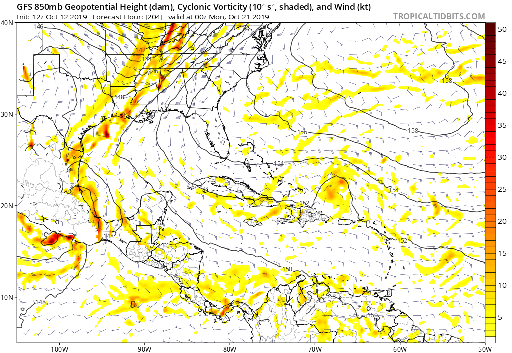
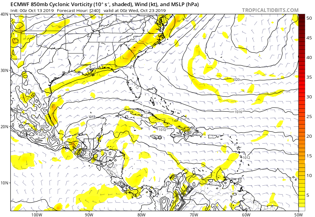
GFS has a strong area of vorticity heading towards Bahamas:
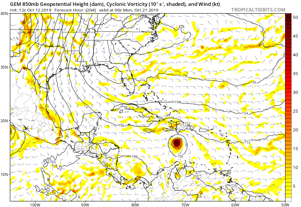
CMC going with a strengthening cyclone further south:
Moderator: S2k Moderators


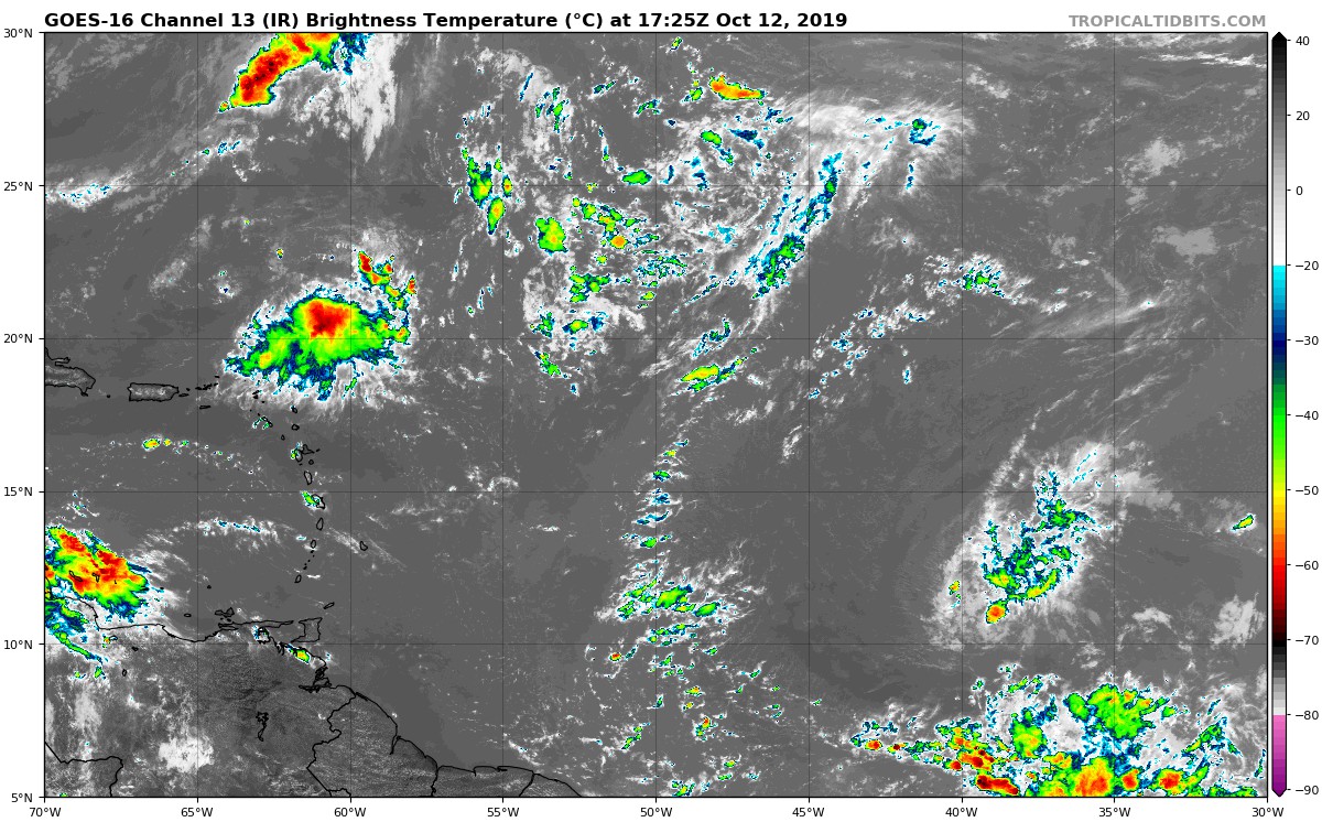
gatorcane wrote:Some model support for development of this sleeper wave further west. It is the area between 10N and 15N on right-side of image below:
https://i.postimg.cc/d3f7fJ1F/goes16-ir-catl-201910121725.jpg
GFS has a strong area of vorticity heading towards Bahamas:
https://i.postimg.cc/sD35G2FB/gfs-z850-vort-watl-35.png
CMC going with a strengthening cyclone further south:
https://i.postimg.cc/VsgdTBT6/gem-z850-vort-watl-35.png
colbroe wrote:A 1012 low is now attached to this sleeper wave.

colbroe wrote:A 1012 low is now attached to this sleeper wave.


SFLcane wrote:colbroe wrote:A 1012 low is now attached to this sleeper wave.
No real model signal.
0 eps members


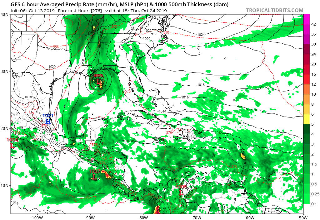
gatorcane wrote:06Z GFS through the Straits and into the GOM hour 276. But does this originate from this wave or something else?
https://i.postimg.cc/nzbqfbJt/gfs-mslp-pcpn-watl-46.png

gatorcane wrote:Likely not mentioned because climatology would suggest no development that far out. Visible loop shows an impressive spin that is for sure. Looks like it is moving WSW:
https://www.tropicaltidbits.com/sat/sat ... t=vis-swir
Users browsing this forum: No registered users and 139 guests

