

Moderator: S2k Moderators


CyclonicFury wrote:Wow! 00z EPS starting to light up around August 23-28.
https://i.imgur.com/KaxY1jk_d.jpg?maxwidth=640&shape=thumb&fidelity=medium
captainbarbossa19 wrote:CyclonicFury wrote:Wow! 00z EPS starting to light up around August 23-28.
https://i.imgur.com/KaxY1jk_d.jpg?maxwidth=640&shape=thumb&fidelity=medium
It's hard to tell from the image, but it looks like a few models are showing a potential hurricane in the NW Caribbean/Gulf of Mexico. Let's see if this trend continues.
SFLcane wrote:Active look of the african coast on the EPS.
https://i.imgur.com/H9ZGF2a.png
https://i.imgur.com/E94MMsC.png
https://i.imgur.com/eGvUwtZ.png


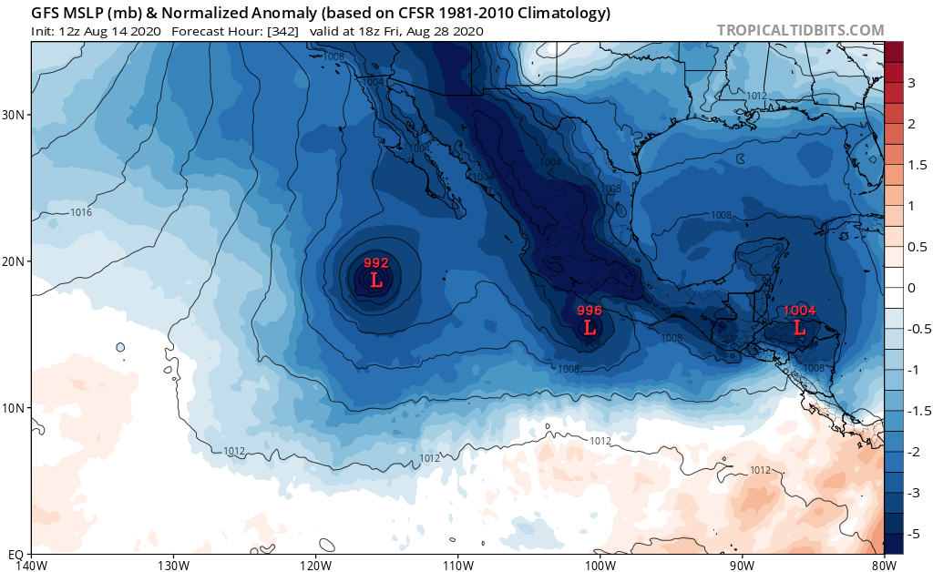
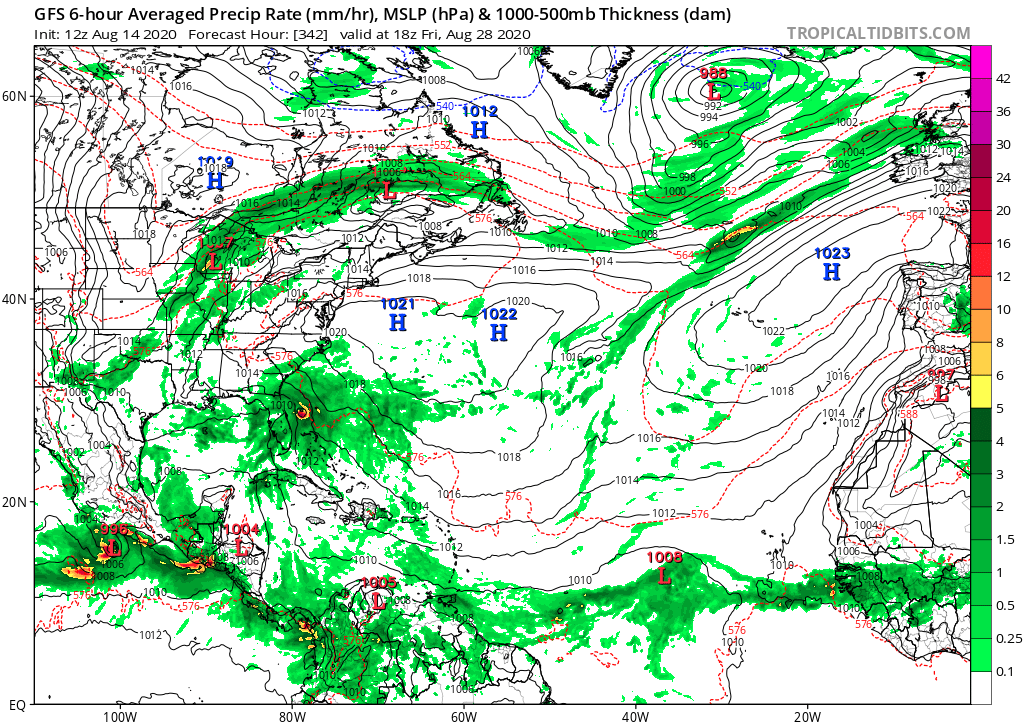
gatorcane wrote:12Z GFS continues to keep the activity on the EPAC side and even into the super-long range. It does have a vigorous wave traversing there Atlantic MDR which it shows reaching the SW Atlantic by end-of-month (this wave will need watching) but looks like the GFS is not showing the lid coming off or anything that is climatologically abnormal rest of this month:
https://i.postimg.cc/jdfXpznK/gfs-mslpa-Norm-epac-58.png
https://i.postimg.cc/fbc1DG3z/gfs-mslp-pcpn-atl-57.png


mcheer23 wrote:GEFS-PARA has been all systems go later this month pretty much every run...


gatorcane wrote:12Z GFS continues to keep the activity on the EPAC side and even into the super-long range. It does have a vigorous wave traversing there Atlantic MDR which it shows reaching the SW Atlantic by end-of-month (this wave will need watching) but looks like the GFS is not showing the lid coming off or anything that is climatologically abnormal rest of this month:
https://i.postimg.cc/jdfXpznK/gfs-mslpa-Norm-epac-58.png
https://i.postimg.cc/fbc1DG3z/gfs-mslp-pcpn-atl-57.png

aspen wrote:18z GFS is showing even more EPac activity after 7 days than the last few runs. It just won’t give up.

tarheelprogrammer wrote:aspen wrote:18z GFS is showing even more EPac activity after 7 days than the last few runs. It just won’t give up.
Or it could be on to something? More EPAC activity could shut down parts of the western Atlantic and keep storms weaker. Starting to lean towards more named storms than my original estimate but less hurricanes/majors.


