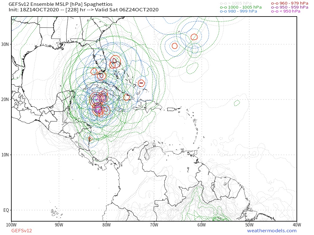
A broad area of low pressure could form by early next week over
the southwestern Caribbean Sea. Some gradual development of the
system will be possible thereafter while it moves slowly
west-northwestward.
* Formation chance through 48 hours...low...near 0 percent.
* Formation chance through 5 days...low...20 percent.
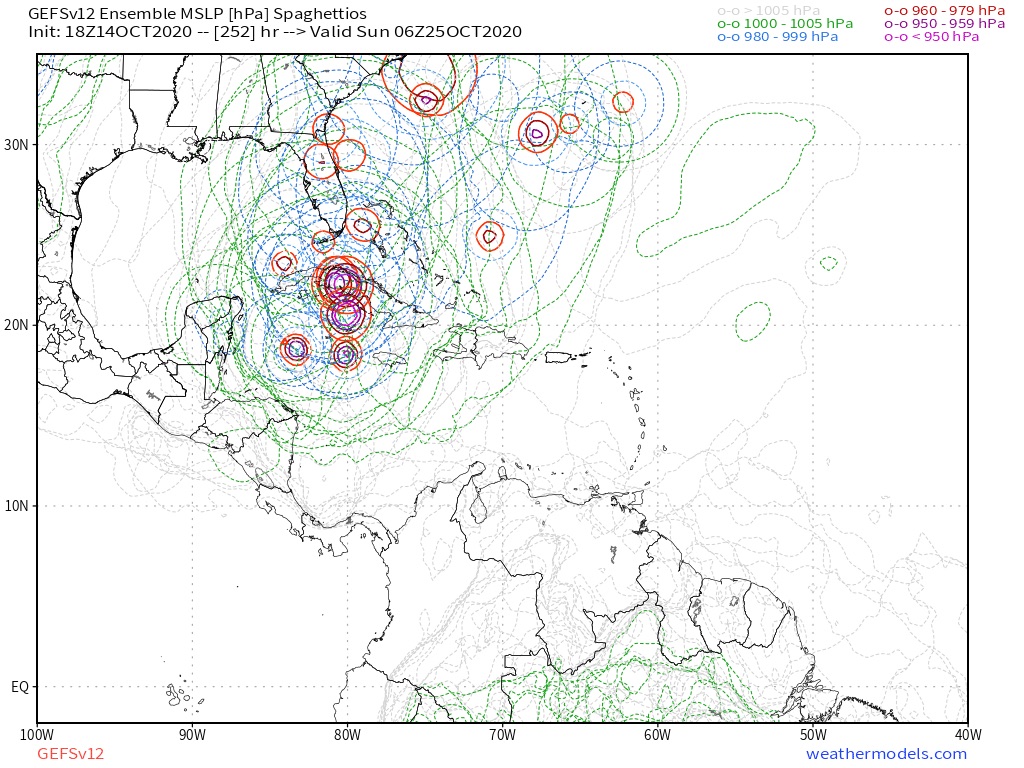
the southwestern Caribbean Sea. Some gradual development of the
system will be possible thereafter while it moves slowly
west-northwestward.
* Formation chance through 48 hours...low...near 0 percent.
* Formation chance through 5 days...low...20 percent.