2021 Indicators: SST's / SAL / MSLP / Shear / Steering / Instability / Sat Images

This is the general tropical discussion area. Anyone can take their shot at predicting a storms path.

Moderator: S2k Moderators

Forum rules

The posts in this forum are NOT official forecasts and should not be used as such. They are just the opinion of the poster and may or may not be backed by sound meteorological data. They are NOT endorsed by any professional institution or STORM2K. For official information, please refer to products from the National Hurricane Center and National Weather Service.

Help Support Storm2K
Message
Author
User avatar
chaser1
S2K Supporter
S2K Supporter
Posts: 4680
Age: 63
Joined: Sat Oct 15, 2005 5:59 pm
Location: Longwood, Fl

Re: 2021 Indicators: SST's / SAL / MSLP / Shear / Steering / Instability / Sat Images

#4041 Postby chaser1 » Sun Oct 17, 2021 11:30 am

Ubuntwo wrote:
Hammy wrote:September and October really are behaving like 2007 save for the MDR being more favorable.

Gulf: Two Cat 1 hurricanes and a depression in the in 2007, one storm and one Cat 1 in 2021.
Caribbean: 2007 had Cat 5 Felix early in the month and then literally nothing until October 27. This year has gone without a storm in the Caribbean since late August.
Subtropics: Two short lived subtropical storms in 2007 with both transitioning; 2021 similarly only two short-lived subtropical storms, with neither transitioning fully.
MDR: 2007 saw 3/1/0. This was the biggest difference in performance, with 2021 producing 5/2/2.

https://twitter.com/AndyHazelton/status/1449731427583631366


After reading Andy Hazelton's reference to 2007 being the closest analogue to this year, I was curious about what other large scale variables seemed to be at play and were similarly occurring at this time. Both 2007 and 2021 similarly exhibiting a late season transition to La Nina, however I found the following particularly interesting:

"At the beginning of 2007, the Outgoing Longwave Radiation (OLR) Index was strongly negative, which reflected the enhanced tropical convection and cloudiness across the equatorial Pacific. However, this changed significantly in June when the OLR Index increased to a monthly value of +0.6. Subsequently, the OLR Index has been positive, and the index increased to +1.4 in October, which was the highest value of the year. The most recent monthly averaged OLR Index was again positive, but with a slightly lower value of +0.8 in November. The OLR Index increased significantly in December to a positive monthly value of +2.2, and similar to the SOI this was the highest value of the 2007/2008 La Niña." (this from the National Centers for Environmental Information El Nino Southern Oscillation annual report Nov, 2007 - https://www.ncdc.noaa.gov/sotc/enso/200713 ).

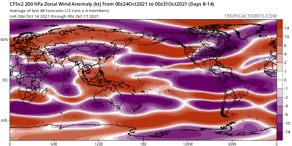
The current (10/16) forecast for MJO related anomalies using GEFS operational forecast for 6-15 day indicates a negative flip in the OLR index primarily for the E. Pacific initially, but with significantly more favorable conditions in the E. PAC as well as the E. GOM and Central & East Caribbean toward the second half of that 6-15 day cycle. Perhaps that time frame better coincides with the eventual passing of the anticipated Kelvin Wave around end of Oct.? In years past where the MJO seemed to play a significant factor, we'd typically await for the EPAC to light up for about a week and then waited for it's transition to then propagate eastward into the Caribbean. Remains to be seen if this late season forecast blip will actually pan out.

Some noteworthy comparisons of 2021 and that year shows 2007 ended with a fairly active 15/6/2 season but and primarily exhibited a lot of "slop" storms. Still, 2007 did product a pair of Cat 5 storms (Dean and Felix) which went on to torch Central America and Yucatan. Interestingly enough and in spite of the very high OLR, a late season hurricane did form (Oct 28 - Nov. 2) just east of PR tracking into the north/central Caribbean impacting DR and central Cuba. Oddly one other short lived TS in December (12/11 - 12/13) also formed east of PR and tracked westward to impact PR & Hispaniola (contrary to more typical Climo development in the W. Carib).
Last edited by chaser1 on Sun Oct 17, 2021 11:38 am, edited 1 time in total.
4 likes   
Personal Forecast Disclaimer:
The posts in this forum are NOT official forecast and should not be used as such. They are just the opinion of the poster and may or may not be backed by sound meteorological data. They are NOT endorsed by any professional institution or storm2k.org. For official information, please refer to the NHC and NWS products.


AlphaToOmega
Category 5
Category 5
Posts: 1448
Joined: Sat Jun 26, 2021 10:51 am
Location: Somewhere in Massachusetts

Re: 2021 Indicators: SST's / SAL / MSLP / Shear / Steering / Instability / Sat Images

#4042 Postby AlphaToOmega » Sun Oct 17, 2021 11:33 am

For October and November 2021 not to feature a major hurricane, we would likely have to have a Strong La Nina (>1.5 C). Since the start of the satellite era, the only +AMO years with -ENSO that did not feature major hurricanes in either October or November were Strong La Ninas (exempli gratia 2007 and 2010).
1 likes   

User avatar
chaser1
S2K Supporter
S2K Supporter
Posts: 4680
Age: 63
Joined: Sat Oct 15, 2005 5:59 pm
Location: Longwood, Fl

Re: 2021 Indicators: SST's / SAL / MSLP / Shear / Steering / Instability / Sat Images

#4043 Postby chaser1 » Sun Oct 17, 2021 11:35 am

AlphaToOmega wrote:Here is the 1991-2020 climatology

Number Named systems Hurricanes Major Hurricanes
1 Jun 20 Aug 11 Sep 1
2 Jul 17 Aug 26 Sep 19
3 Aug 3 Sep 7 Oct 28
4 Aug 15 Sep 16 -
5 Aug 22 Sep 28 -
6 Aug 29 Oct 15 -
7 Sep 3 Nov 15 -
8 Sep 9 - -
9 Sep 16 - -
10 Sep 22 - -
11 Oct 2 - -
12 Oct 11 - -
13 Oct 25 - -
14 Nov 19 - -


I'm not sure i'm following this correctly? You sure this represents the entirety of the 29 year period shown?
0 likes   
Personal Forecast Disclaimer:
The posts in this forum are NOT official forecast and should not be used as such. They are just the opinion of the poster and may or may not be backed by sound meteorological data. They are NOT endorsed by any professional institution or storm2k.org. For official information, please refer to the NHC and NWS products.


zhukm29
Tropical Storm
Tropical Storm
Posts: 219
Joined: Tue Aug 28, 2018 2:37 pm

Re: 2021 Indicators: SST's / SAL / MSLP / Shear / Steering / Instability / Sat Images

#4044 Postby zhukm29 » Sun Oct 17, 2021 11:39 am

Quite some timing for a suppressive Kelvin wave to come in when the MJO arrives for probably the last time during the favorable part of the season, especially during a MJO dependent season. If you had told me 0 storms would form in October during the last week in September, I wouldn't believe it - but now it is actually looking more and more plausible (although I still think we will get at least one during the final week). Good news for the Caribbean though, especially after 2020.

2007 only had one more NS before November 30 (technically two to end the year, but Olga was a rare December storm that isn't guaranteed to happen), so what a tease it would be if we missed the auxiliary list :lol:
0 likes   

AlphaToOmega
Category 5
Category 5
Posts: 1448
Joined: Sat Jun 26, 2021 10:51 am
Location: Somewhere in Massachusetts

Re: 2021 Indicators: SST's / SAL / MSLP / Shear / Steering / Instability / Sat Images

#4045 Postby AlphaToOmega » Sun Oct 17, 2021 11:51 am

Ah yes, a VERY suppressed look for the Atlantic :D

Image
1 likes   

User avatar
Category5Kaiju
Category 5
Category 5
Posts: 3348
Age: 22
Joined: Thu Dec 24, 2020 12:45 pm
Location: Seattle

Re: 2021 Indicators: SST's / SAL / MSLP / Shear / Steering / Instability / Sat Images

#4046 Postby Category5Kaiju » Sun Oct 17, 2021 12:05 pm

AlphaToOmega wrote:Ah yes, a VERY suppressed look for the Atlantic :D

https://i.postimg.cc/V6HkQBNs/cfs-avg-chi200-Mean-global-2.png


We'll see if that verifies or not, but if it does and still nothing forms in the Atlantic even in the last week or few days of October, then at that point I think it can be safely assumed that the MJO propagation may not be entirely to blame for the inactivity in the Atlantic and that there's something else more bizarre going on.
2 likes   
Unless explicitly stated, all information covered in my posts is based on my opinions and observations. Please refer to a professional meteorologist or an accredited weather research agency otherwise, especially if serious decisions must be made in the event of a potentially life-threatening tropical storm or hurricane.

User avatar
SFLcane
S2K Supporter
S2K Supporter
Posts: 9606
Age: 46
Joined: Sat Jun 05, 2010 1:44 pm
Location: Lake Worth Florida

Re: 2021 Indicators: SST's / SAL / MSLP / Shear / Steering / Instability / Sat Images

#4047 Postby SFLcane » Sun Oct 17, 2021 12:25 pm

aspen wrote:Funny how the Atlantic started behaving the opposite of a Nina year as soon as the Nina officially developed. Is there a La Niña version of a Modoki El Niño, where the Nina results in unfavorable conditions across the Atlantic?


This response isn't really because of La Nina. Just a combo of unfavorable MJO plus overall convective response. It's not a La Nina thing
4 likes   

User avatar
SFLcane
S2K Supporter
S2K Supporter
Posts: 9606
Age: 46
Joined: Sat Jun 05, 2010 1:44 pm
Location: Lake Worth Florida

Re: 2021 Indicators: SST's / SAL / MSLP / Shear / Steering / Instability / Sat Images

#4048 Postby SFLcane » Sun Oct 17, 2021 12:34 pm

AlphaToOmega wrote:Ah yes, a VERY suppressed look for the Atlantic :D

https://i.postimg.cc/V6HkQBNs/cfs-avg-chi200-Mean-global-2.png


Looks more favorable. We'll see if anything can consolidate
0 likes   

User avatar
WiscoWx02
Category 1
Category 1
Posts: 340
Age: 21
Joined: Sat Jul 31, 2021 8:09 pm
Location: Minnesota

Re: 2021 Indicators: SST's / SAL / MSLP / Shear / Steering / Instability / Sat Images

#4049 Postby WiscoWx02 » Sun Oct 17, 2021 12:38 pm

 https://twitter.com/AndyHazelton/status/1449731427583631366


2007 seems to be coming up a lot, we still had cat 1 hurricane Noel that year though at the end of October. Just something to remember.
2 likes   

User avatar
Hammy
Category 5
Category 5
Posts: 5594
Age: 40
Joined: Fri May 25, 2012 5:25 pm
Contact:

Re: 2021 Indicators: SST's / SAL / MSLP / Shear / Steering / Instability / Sat Images

#4050 Postby Hammy » Sun Oct 17, 2021 1:52 pm

CFS continues to show nothing discernable, though hinting at an EPAC system making it into the Gulf later in the month.
0 likes   
The above post is not official and should not be used as such. It is the opinion of the poster and may or may not be backed by sound meteorological data. It is not endorsed by any professional institution or storm2k.org. For official information, please refer to the NHC and NWS products.

User avatar
Category5Kaiju
Category 5
Category 5
Posts: 3348
Age: 22
Joined: Thu Dec 24, 2020 12:45 pm
Location: Seattle

Re: 2021 Indicators: SST's / SAL / MSLP / Shear / Steering / Instability / Sat Images

#4051 Postby Category5Kaiju » Sun Oct 17, 2021 3:20 pm

Just a question out of curiosty, but were there any times (like in the years since CFS or Tropical Tidbit model-watching really became a commonly performed thing among hurricane trackers) where the models collectively thought that development of some storm or hurricane would occur on the EPAC side, only for them to be completely wrong with development on the Atlantic side, or for the models to flat out miss the genesis of some Atlantic storm that went on to become a decent strength system (like not a pop up, weak TS)?
0 likes   
Unless explicitly stated, all information covered in my posts is based on my opinions and observations. Please refer to a professional meteorologist or an accredited weather research agency otherwise, especially if serious decisions must be made in the event of a potentially life-threatening tropical storm or hurricane.

AlphaToOmega
Category 5
Category 5
Posts: 1448
Joined: Sat Jun 26, 2021 10:51 am
Location: Somewhere in Massachusetts

Re: 2021 Indicators: SST's / SAL / MSLP / Shear / Steering / Instability / Sat Images

#4052 Postby AlphaToOmega » Sun Oct 17, 2021 3:23 pm

Image
Image

The CFSv2 shows zonal wind anomalies of -4 to -6 knots in the Caribbean. Last year, -4 to -10 knot anomalies for zonal wind were observed in the Caribbean. This year is also forecast to have lower zonal wind anomalies than last year. The CFSv2 shows favorable shear and VP patterns, which is expected in a -ENSO year. The lack of activity is very likely a result of an unfavorable MJO phase and not because of an unfavorable base state. Something similar happened this August; as the MJO was transitioning from Phase VIII to Phase I, the models had difficulty foreseeing activity, which is why storms such as Grace formed with very little model support.
1 likes   

User avatar
wxman57
Moderator-Pro Met
Moderator-Pro Met
Posts: 22480
Age: 66
Joined: Sat Jun 21, 2003 8:06 pm
Location: Houston, TX (southwest)

Re: 2021 Indicators: SST's / SAL / MSLP / Shear / Steering / Instability / Sat Images

#4053 Postby wxman57 » Sun Oct 17, 2021 3:46 pm

chaser1 wrote:
AlphaToOmega wrote:Here is the 1991-2020 climatology

Number Named systems Hurricanes Major Hurricanes
1 Jun 20 Aug 11 Sep 1
2 Jul 17 Aug 26 Sep 19
3 Aug 3 Sep 7 Oct 28
4 Aug 15 Sep 16 -
5 Aug 22 Sep 28 -
6 Aug 29 Oct 15 -
7 Sep 3 Nov 15 -
8 Sep 9 - -
9 Sep 16 - -
10 Sep 22 - -
11 Oct 2 - -
12 Oct 11 - -
13 Oct 25 - -
14 Nov 19 - -


I'm not sure i'm following this correctly? You sure this represents the entirety of the 29 year period shown?


That's a 30-yr period, by the way. The average number of NS/H/MH is 14/7/3. You can see the full data here: https://www.nhc.noaa.gov/climo/

It's supposed to represent the average date that each NS, H, and MH forms. What caught my eye was the average date of the 3rd MH forming is Oct 28. I cannot find a single case of the 3rd MH forming past about the 3rd week of October, much less an average of the 28th. A number of seasons had less than 3 major hurricanes. I suppose that skewed the results later? Dates for NS and H formation look good. Average first hurricane forming Aug 11 looks good. In fact, the trend is later since 1950, when the average date was earlier in August. Hurricanes are trending later and named storms are earlier, most likely due to better detection of weak storms far out to sea, naming of subtropical storms, and changing naming criteria (trending more liberal).
4 likes   

User avatar
Hammy
Category 5
Category 5
Posts: 5594
Age: 40
Joined: Fri May 25, 2012 5:25 pm
Contact:

Re: 2021 Indicators: SST's / SAL / MSLP / Shear / Steering / Instability / Sat Images

#4054 Postby Hammy » Sun Oct 17, 2021 4:05 pm

Category5Kaiju wrote:Just a question out of curiosty, but were there any times (like in the years since CFS or Tropical Tidbit model-watching really became a commonly performed thing among hurricane trackers) where the models collectively thought that development of some storm or hurricane would occur on the EPAC side, only for them to be completely wrong with development on the Atlantic side, or for the models to flat out miss the genesis of some Atlantic storm that went on to become a decent strength system (like not a pop up, weak TS)?


The GFS and Euro have done this frequently, but the GFS has just as often shown things that aren't there. The Canadian however doesn't have a history of doing this--the instances where the GFS/Euro missed storms still had the Canadian and CFS showing some kind of development.
1 likes   
The above post is not official and should not be used as such. It is the opinion of the poster and may or may not be backed by sound meteorological data. It is not endorsed by any professional institution or storm2k.org. For official information, please refer to the NHC and NWS products.

User avatar
aspen
Category 5
Category 5
Posts: 8055
Joined: Sat Oct 12, 2019 7:10 pm
Location: Connecticut, USA

Re: 2021 Indicators: SST's / SAL / MSLP / Shear / Steering / Instability / Sat Images

#4055 Postby aspen » Sun Oct 17, 2021 5:54 pm

*pokes the Atlantic* C’mon, do something

*pokes worldwide tropics* C’mon, do something normal
9 likes   
Irene '11 Sandy '12 Hermine '16 5/15/2018 Derecho Fay '20 Isaias '20 Elsa '21 Henri '21 Ida '21

I am only a meteorology enthusiast who knows a decent amount about tropical cyclones. Look to the professional mets, the NHC, or your local weather office for the best information.

AlphaToOmega
Category 5
Category 5
Posts: 1448
Joined: Sat Jun 26, 2021 10:51 am
Location: Somewhere in Massachusetts

Re: 2021 Indicators: SST's / SAL / MSLP / Shear / Steering / Instability / Sat Images

#4056 Postby AlphaToOmega » Sun Oct 17, 2021 6:13 pm

It is probably only a matter of time before development is showed on the models. As they say, models show nothing until they show something. There is a forecasted favorable upper-level pattern for the Caribbean. :lol: :lol:

Image
Image
Image
2 likes   

User avatar
Category5Kaiju
Category 5
Category 5
Posts: 3348
Age: 22
Joined: Thu Dec 24, 2020 12:45 pm
Location: Seattle

Re: 2021 Indicators: SST's / SAL / MSLP / Shear / Steering / Instability / Sat Images

#4057 Postby Category5Kaiju » Sun Oct 17, 2021 6:33 pm

aspen wrote:*pokes the Atlantic* C’mon, do something

*pokes worldwide tropics* C’mon, do something normal


The Atlantic right now after being told to produce at least one NS by October's end:

Image
7 likes   
Unless explicitly stated, all information covered in my posts is based on my opinions and observations. Please refer to a professional meteorologist or an accredited weather research agency otherwise, especially if serious decisions must be made in the event of a potentially life-threatening tropical storm or hurricane.

User avatar
SFLcane
S2K Supporter
S2K Supporter
Posts: 9606
Age: 46
Joined: Sat Jun 05, 2010 1:44 pm
Location: Lake Worth Florida

Re: 2021 Indicators: SST's / SAL / MSLP / Shear / Steering / Instability / Sat Images

#4058 Postby SFLcane » Sun Oct 17, 2021 6:58 pm

AlphaToOmega wrote:It is probably only a matter of time before development is showed on the models. As they say, models show nothing until they show something. There is a forecasted favorable upper-level pattern for the Caribbean. :lol: :lol:

https://i.postimg.cc/V6HkQBNs/cfs-avg-chi200-Mean-global-2.png
https://i.postimg.cc/pTSz3JHR/cfs-avg-u200a-Mean-global-1.png
https://i.postimg.cc/FRz0PnwT/cfs-avg-u200a-Mean-global-2.png


Gulf and Florida definitely done for the year.
1 likes   

User avatar
skyline385
Category 5
Category 5
Posts: 2444
Age: 33
Joined: Wed Aug 26, 2020 11:15 pm
Location: Palm Beach County FL

2021 Indicators: SST's / SAL / MSLP / Shear / Steering / Instability / Sat Images

#4059 Postby skyline385 » Sun Oct 17, 2021 9:29 pm

AlphaToOmega wrote:It is probably only a matter of time before development is showed on the models. As they say, models show nothing until they show something. There is a forecasted favorable upper-level pattern for the Caribbean. :lol: :lol:

Image
Image
Image

Think that's not going to be enough, there is still tons of shear on the models along with plenty of dry air. The cold fronts also keep dropping and there looks to be a major one coming around Oct 30th over the SE coast.
0 likes   

User avatar
Hammy
Category 5
Category 5
Posts: 5594
Age: 40
Joined: Fri May 25, 2012 5:25 pm
Contact:

Re: 2021 Indicators: SST's / SAL / MSLP / Shear / Steering / Instability / Sat Images

#4060 Postby Hammy » Sun Oct 17, 2021 9:39 pm

skyline385 wrote:
AlphaToOmega wrote:It is probably only a matter of time before development is showed on the models. As they say, models show nothing until they show something. There is a forecasted favorable upper-level pattern for the Caribbean. :lol: :lol:

https://i.postimg.cc/V6HkQBNs/cfs-avg-chi200-Mean-global-2.png
https://i.postimg.cc/pTSz3JHR/cfs-avg-u200a-Mean-global-1.png
https://i.postimg.cc/FRz0PnwT/cfs-avg-u200a-Mean-global-2.png

Think that's not going to be enough, there is still tons of shear on the models along with plenty of dry air. The cold fronts also keep dropping and there looks to be a major one coming around Oct 30th over the SE coast.


Never trust the long range models regarding fronts, the GFS always overplays them.
4 likes   
The above post is not official and should not be used as such. It is the opinion of the poster and may or may not be backed by sound meteorological data. It is not endorsed by any professional institution or storm2k.org. For official information, please refer to the NHC and NWS products.


Return to “Talkin' Tropics”

Who is online

Users browsing this forum: cheezyWXguy, gib, kevin, Kohlecane, MEANINGLESS_NUMBERS and 76 guests