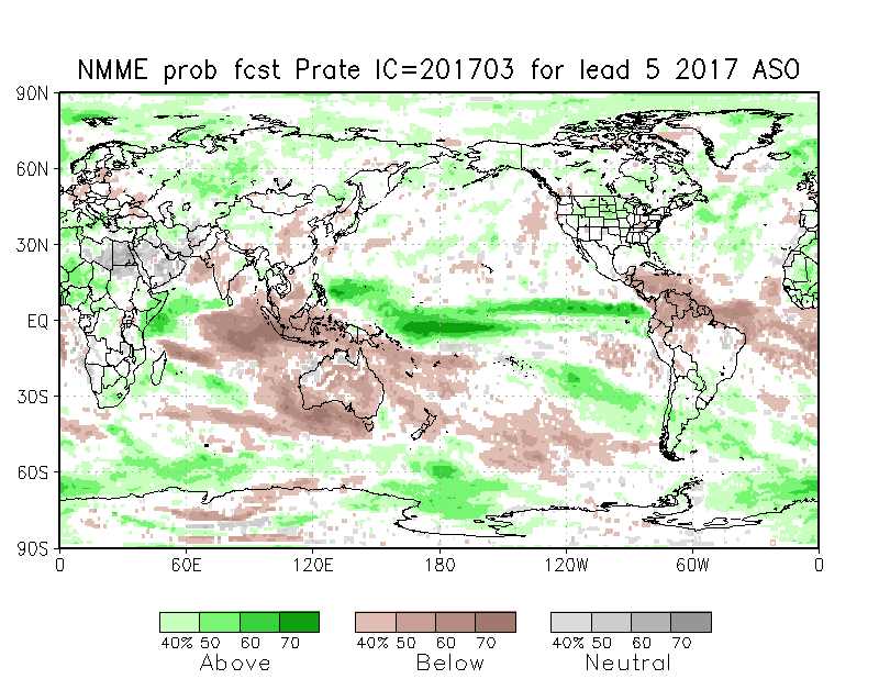
2021 Indicators: SST's / SAL / MSLP / Shear / Steering / Instability / Sat Images

This is the general tropical discussion area. Anyone can take their shot at predicting a storms path.

Moderator: S2k Moderators

Forum rules

The posts in this forum are NOT official forecasts and should not be used as such. They are just the opinion of the poster and may or may not be backed by sound meteorological data. They are NOT endorsed by any professional institution or STORM2K. For official information, please refer to products from the National Hurricane Center and National Weather Service.

Help Support Storm2K
Message
Author
User avatar
ElectricStorm
Category 5
Category 5
Posts: 4523
Age: 23
Joined: Tue Aug 13, 2019 11:23 pm
Location: Skiatook, OK / Norman, OK

Re: 2021 Indicators: SST's / SAL / MSLP / Shear / Steering / Instability / Sat Images

#181 Postby ElectricStorm » Wed Apr 07, 2021 8:44 am

Category5Kaiju wrote:
tolakram wrote:Out of curiosity, has any pre-season prediction of general tracks been anywhere close to accurate? Every spring we seem to go through some of these discussions with no regard for how any of these have verified in the past. Not that there's anything wrong with analyzing what the models are saying. :)


I may not be the best person to ask given I am no professional met but rather a 19-year old wx geek who started closely tracking hurricanes in 2018, but what I have heard 2017 started off with a pretty OTS signal but ended up being a devastating landfall year. Of course, 2017 was also expected to be an El Nino year, which do tend to favor OTS tracks. However, then you have La Nina years like 2010 or 2011 where many storms are OTS

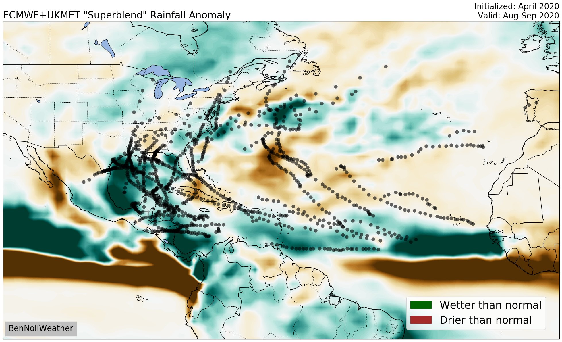
I remember there was a period last year that people were talking about a lot of OTS tracks and uh... That didn't happen
1 likes   
I am in no way a professional. Take what I say with a grain of salt as I could be totally wrong. Please refer to the NHC, NWS, or SPC for official information.

Boomer Sooner!

User avatar
chaser1
S2K Supporter
S2K Supporter
Posts: 4680
Age: 63
Joined: Sat Oct 15, 2005 5:59 pm
Location: Longwood, Fl

Re: 2021 Indicators: SST's / SAL / MSLP / Shear / Steering / Instability / Sat Images

#182 Postby chaser1 » Wed Apr 07, 2021 10:17 am

tolakram wrote:Out of curiosity, has any pre-season prediction of general tracks been anywhere close to accurate? Every spring we seem to go through some of these discussions with no regard for how any of these have verified in the past. Not that there's anything wrong with analyzing what the models are saying. :)


Fantastic question and one that I would love to have further explored. I personally have put greater thought into this topic each pre-season and would be interesting if some prior season predictions verified (or busted). This would be a bit time consuming but something I may take some time to do going back and reading some prior year threads.
0 likes   
Personal Forecast Disclaimer:
The posts in this forum are NOT official forecast and should not be used as such. They are just the opinion of the poster and may or may not be backed by sound meteorological data. They are NOT endorsed by any professional institution or storm2k.org. For official information, please refer to the NHC and NWS products.


User avatar
Category5Kaiju
Category 5
Category 5
Posts: 3346
Age: 22
Joined: Thu Dec 24, 2020 12:45 pm
Location: Seattle

Re: 2021 Indicators: SST's / SAL / MSLP / Shear / Steering / Instability / Sat Images

#183 Postby Category5Kaiju » Wed Apr 07, 2021 10:34 am

To be fair, the bottomline is that in the "typical" busy season, you should expect to have some storms that go OTS and some storms that make landfall. Also, since the GoM, Caribbean, and West Atlantic that are near land tend to have the highest skin ssts as well as the most profound UOHC compared to the rest of the ocean (well, Lorenzo is the one exception I can think of), Cat 5s are always going to be a possible land hazard every season in this vicinity.
0 likes   
Unless explicitly stated, all information covered in my posts is based on my opinions and observations. Please refer to a professional meteorologist or an accredited weather research agency otherwise, especially if serious decisions must be made in the event of a potentially life-threatening tropical storm or hurricane.

User avatar
Dylan
Professional-Met
Professional-Met
Posts: 337
Age: 29
Joined: Mon May 31, 2010 9:50 am
Location: New Orleans, LA

Re: 2021 Indicators: SST's / SAL / MSLP / Shear / Steering / Instability / Sat Images

#184 Postby Dylan » Wed Apr 07, 2021 4:37 pm

Just some food for thought...

Looking back at global SSTA pattern since warm AMO started in 1995, I think a blend of 1999, 2000, and 2001 look like the best analogs when comparing to today’s global SSTA pattern.

Top similarities include a generally warm than average Atlantic, along with -PDO & La Niña/Cool-ENSO signature in the Pacific.

Differences: Overall global SSTA pattern generally looks warmer.

1999/2000/2001 Mean Atlantic Hurricane Activity:

TS: 14
H: 8.3
MH: 4
ACE: 135.3
4 likes   
Georges('98), Allison('01), Isidore('02), Lili('02), Frances('04) Ivan('04), Cindy('05), Katrina('05), Rita('05), Gustav('08), Isaac('12), Matthew('16), Harvey('17), Irma('17), Nate ('17), Ida ('21).

User avatar
toad strangler
S2K Supporter
S2K Supporter
Posts: 4162
Joined: Sun Jul 28, 2013 3:09 pm
Location: Earth
Contact:

Re: 2021 Indicators: SST's / SAL / MSLP / Shear / Steering / Instability / Sat Images

#185 Postby toad strangler » Wed Apr 07, 2021 5:26 pm

tolakram wrote:Out of curiosity, has any pre-season prediction of general tracks been anywhere close to accurate? Every spring we seem to go through some of these discussions with no regard for how any of these have verified in the past. Not that there's anything wrong with analyzing what the models are saying. :)


I disregard all track discussion this far out.
0 likes   

User avatar
Kingarabian
S2K Supporter
S2K Supporter
Posts: 15432
Joined: Sat Aug 08, 2009 3:06 am
Location: Honolulu, Hawaii

Re: 2021 Indicators: SST's / SAL / MSLP / Shear / Steering / Instability / Sat Images

#186 Postby Kingarabian » Wed Apr 07, 2021 5:41 pm

 https://twitter.com/cyclonicwx/status/1378749756185395206


Eric Webb also mentioned that for cool-neutral/La Nina to prevail this upcoming hurricane season, it will be important for the tropics to warm up over the Atlantic. It would help keep the rising branch of the Walker circulation over the Atlantic vs. the EPAC.
1 likes   
RIP Kobe Bryant

User avatar
DorkyMcDorkface
Category 2
Category 2
Posts: 691
Age: 26
Joined: Mon Sep 30, 2019 1:32 pm
Location: Mid-Atlantic

Re: 2021 Indicators: SST's / SAL / MSLP / Shear / Steering / Instability / Sat Images

#187 Postby DorkyMcDorkface » Wed Apr 07, 2021 6:07 pm

Kingarabian wrote:https://twitter.com/cyclonicwx/status/1378749756185395206/

Eric Webb also mentioned that for cool-neutral/La Nina to prevail this upcoming hurricane season, it will be important for the tropics to warm up over the Atlantic. It would help keep the rising branch of the Walker circulation over the Atlantic vs. the EPAC.

If prior years are anything to go by the West African Monsoon should help with this as the season draws closer, but we'll see.
1 likes   
Floyd 1999 | Isabel 2003 | Hanna 2008 | Irene 2011 | Sandy 2012 | Isaias 2020

User avatar
HurricaneEnzo
Category 2
Category 2
Posts: 723
Joined: Wed Mar 14, 2018 12:18 pm
Location: Newport, NC (Hurricane Alley)

Re: 2021 Indicators: SST's / SAL / MSLP / Shear / Steering / Instability / Sat Images

#188 Postby HurricaneEnzo » Thu Apr 08, 2021 8:07 am

Fully expect the MDR to be at or slightly above average by the time the season starts. We've seen the last couple of years doesn't take long for this area to warm up.
0 likes   
Bertha 96' - Fran 96' - Bonnie 98' - Dennis 99' - Floyd 99' - Isabel 03' - Alex 04' - Ophelia 05' - Irene 11' - Arthur 14' - Matthew 16' - Florence 18' - Dorian 19' - Isaias 20' (countless other tropical storms and Hurricane swipes)

I am not a Professional Met just an enthusiast. Get your weather forecasts from the Pros!

Shell Mound
Category 5
Category 5
Posts: 2434
Age: 31
Joined: Thu Sep 07, 2017 3:39 pm
Location: St. Petersburg, FL → Scandinavia

Re: 2021 Indicators: SST's / SAL / MSLP / Shear / Steering / Instability / Sat Images

#189 Postby Shell Mound » Thu Apr 08, 2021 9:08 am

tolakram wrote:Out of curiosity, has any pre-season prediction of general tracks been anywhere close to accurate?

Yes. Aside from the Caribbean, including the Leeward Islands, the March 2017 NMME correctly showed + precipitation over the Gulf, Florida, and the Sargasso Sea (SW Atlantic) during ASO ‘17, along with hints of relatively higher (average to slightly above) precipitation over the MDR in the same region that featured the genesis of Irma, Jose, Lee, and Maria. Additionally, the combined runs of the NMME/EC/UKMET in April 2020 were largely “spot on” in regard to activity during the peak of the 2020 Atlantic hurricane season. So these long-range models do show some skill even five to six months beforehand.
Image
Image
Image
Image
 https://twitter.com/BenNollWeather/status/1333425301158694912


Last edited by Shell Mound on Thu Apr 08, 2021 9:27 am, edited 6 times in total.
0 likes   
CVW / MiamiensisWx / Shell Mound
The posts in this forum are NOT official forecasts and should not be used as such. They are just the opinion of the poster and may or may not be backed by sound meteorological data. They are NOT endorsed by any professional institution or STORM2K. For official information, please refer to products from the NHC and NWS.

Shell Mound
Category 5
Category 5
Posts: 2434
Age: 31
Joined: Thu Sep 07, 2017 3:39 pm
Location: St. Petersburg, FL → Scandinavia

Re: 2021 Indicators: SST's / SAL / MSLP / Shear / Steering / Instability / Sat Images

#190 Postby Shell Mound » Thu Apr 08, 2021 9:10 am

Bad news: the April ‘21 NMME shows a very active MDR with long-tracking systems heading into the Leeward Islands, Bahamas, and FL, à la 2017:

Image
Image

Also, note that the overall Walker circulation still seems to remain in Niña mode (especially the dry C/WPAC + wet MC). A threatening signature.
0 likes   
CVW / MiamiensisWx / Shell Mound
The posts in this forum are NOT official forecasts and should not be used as such. They are just the opinion of the poster and may or may not be backed by sound meteorological data. They are NOT endorsed by any professional institution or STORM2K. For official information, please refer to products from the NHC and NWS.

User avatar
cycloneye
Admin
Admin
Posts: 139011
Age: 67
Joined: Thu Oct 10, 2002 10:54 am
Location: San Juan, Puerto Rico

Re: 2021 Indicators: SST's / SAL / MSLP / Shear / Steering / Instability / Sat Images

#191 Postby cycloneye » Thu Apr 08, 2021 9:19 am

:uarrow: I see Caribbean dry for ASO.
0 likes   
Visit the Caribbean-Central America Weather Thread where you can find at first post web cams,radars
and observations from Caribbean basin members Click Here

NXStumpy_Robothing
Category 1
Category 1
Posts: 325
Age: 23
Joined: Fri Jun 05, 2020 11:50 pm
Location: North Georgia

Re: 2021 Indicators: SST's / SAL / MSLP / Shear / Steering / Instability / Sat Images

#192 Postby NXStumpy_Robothing » Thu Apr 08, 2021 9:20 am

 https://twitter.com/AndyHazelton/status/1380155465863208971


Neat little tweet from Hazelton discussing the most recent NMME run.
0 likes   
Undergraduate Meteorology Student, Georgia Institute of Technology

User avatar
aspen
Category 5
Category 5
Posts: 8054
Joined: Sat Oct 12, 2019 7:10 pm
Location: Connecticut, USA

Re: 2021 Indicators: SST's / SAL / MSLP / Shear / Steering / Instability / Sat Images

#193 Postby aspen » Thu Apr 08, 2021 10:41 am

If those moisture forecasts stick and don’t change once the SPB passes, it’s looking like 2021 will be far less of a “close-to-home” year than 2020, and the bulk of its strongest storms could be out in the open Atlantic or near the northern Caribbean due to a general moist MDR and a strong Africa rising branch. In other words, more of a 2010/2011/2017 type year in terms of where the strongest storms form and go.
0 likes   
Irene '11 Sandy '12 Hermine '16 5/15/2018 Derecho Fay '20 Isaias '20 Elsa '21 Henri '21 Ida '21

I am only a meteorology enthusiast who knows a decent amount about tropical cyclones. Look to the professional mets, the NHC, or your local weather office for the best information.

User avatar
DorkyMcDorkface
Category 2
Category 2
Posts: 691
Age: 26
Joined: Mon Sep 30, 2019 1:32 pm
Location: Mid-Atlantic

Re: 2021 Indicators: SST's / SAL / MSLP / Shear / Steering / Instability / Sat Images

#194 Postby DorkyMcDorkface » Thu Apr 08, 2021 11:02 am

This appears to be a major factor in why the CSU went high with the forecast they released today.

 https://twitter.com/AndyHazelton/status/1380172586072600583


1 likes   
Floyd 1999 | Isabel 2003 | Hanna 2008 | Irene 2011 | Sandy 2012 | Isaias 2020

User avatar
Category5Kaiju
Category 5
Category 5
Posts: 3346
Age: 22
Joined: Thu Dec 24, 2020 12:45 pm
Location: Seattle

Re: 2021 Indicators: SST's / SAL / MSLP / Shear / Steering / Instability / Sat Images

#195 Postby Category5Kaiju » Thu Apr 08, 2021 12:24 pm

Just saying, but according to CSU, 2021 is exhibiting traits similar to a hybrid of 1996, 2001, 2008, 2011, and 2017. Two of those seasons were hyperactive (with 2008 pretty darn close), and to be honest I do think that this season has the potential to be an ACE-dumper.
0 likes   
Unless explicitly stated, all information covered in my posts is based on my opinions and observations. Please refer to a professional meteorologist or an accredited weather research agency otherwise, especially if serious decisions must be made in the event of a potentially life-threatening tropical storm or hurricane.

User avatar
Category5Kaiju
Category 5
Category 5
Posts: 3346
Age: 22
Joined: Thu Dec 24, 2020 12:45 pm
Location: Seattle

Re: 2021 Indicators: SST's / SAL / MSLP / Shear / Steering / Instability / Sat Images

#196 Postby Category5Kaiju » Thu Apr 08, 2021 7:00 pm

Iceresistance wrote:Do Y'all have a bad feeling about a 2013 Sneak attack? I do have that feeling . . .


Is there a specific reason why you think that to be the case? Just curious of course :D
0 likes   
Unless explicitly stated, all information covered in my posts is based on my opinions and observations. Please refer to a professional meteorologist or an accredited weather research agency otherwise, especially if serious decisions must be made in the event of a potentially life-threatening tropical storm or hurricane.

User avatar
Iceresistance
Category 5
Category 5
Posts: 8909
Age: 20
Joined: Sat Oct 10, 2020 9:45 am
Location: Tecumseh, OK/Norman, OK

Re: 2021 Indicators: SST's / SAL / MSLP / Shear / Steering / Instability / Sat Images

#197 Postby Iceresistance » Thu Apr 08, 2021 8:33 pm

Category5Kaiju wrote:
Iceresistance wrote:Do Y'all have a bad feeling about a 2013 Sneak attack? I do have that feeling . . .


Is there a specific reason why you think that to be the case? Just curious of course :D


An expected La Nina failed to develop & El Nino-like conditions were present in the Atlantic . . .
0 likes   
Bill 2015 & Beta 2020

Winter 2020-2021 :cold:

All observations are in Tecumseh, OK unless otherwise noted.

Winter posts are focused mainly for Oklahoma & Texas.

Take any of my forecasts with a grain of salt, refer to the NWS, SPC, and NHC for official information

Never say Never with weather! Because ANYTHING is possible!

User avatar
ElectricStorm
Category 5
Category 5
Posts: 4523
Age: 23
Joined: Tue Aug 13, 2019 11:23 pm
Location: Skiatook, OK / Norman, OK

Re: 2021 Indicators: SST's / SAL / MSLP / Shear / Steering / Instability / Sat Images

#198 Postby ElectricStorm » Thu Apr 08, 2021 8:48 pm

Iceresistance wrote:
Category5Kaiju wrote:
Iceresistance wrote:Do Y'all have a bad feeling about a 2013 Sneak attack? I do have that feeling . . .


Is there a specific reason why you think that to be the case? Just curious of course :D


An expected La Nina failed to develop & El Nino-like conditions were present in the Atlantic . . .

It was a lot more than that though... A lot more complicated factors than just ENSO. A combination of everything that caused 2013 to do what it did is probably not going to happen for a very long time...
0 likes   
I am in no way a professional. Take what I say with a grain of salt as I could be totally wrong. Please refer to the NHC, NWS, or SPC for official information.

Boomer Sooner!

User avatar
cycloneye
Admin
Admin
Posts: 139011
Age: 67
Joined: Thu Oct 10, 2002 10:54 am
Location: San Juan, Puerto Rico

Re: 2021 Indicators: SST's / SAL / MSLP / Shear / Steering / Instability / Sat Images

#199 Postby cycloneye » Thu Apr 08, 2021 9:20 pm

Ok folks. Let's return to discuss about the 2021 indicators, thank you.
2 likes   
Visit the Caribbean-Central America Weather Thread where you can find at first post web cams,radars
and observations from Caribbean basin members Click Here

User avatar
SFLcane
S2K Supporter
S2K Supporter
Posts: 9606
Age: 46
Joined: Sat Jun 05, 2010 1:44 pm
Location: Lake Worth Florida

Re: 2021 Indicators: SST's / SAL / MSLP / Shear / Steering / Instability / Sat Images

#200 Postby SFLcane » Fri Apr 09, 2021 10:16 am

So much for that cool MDR and Atlantic. If this comes to pass some of those seasonal predictions could be on the low side. :eek:

 https://twitter.com/bennollweather/status/1380532200240734210


4 likes   


Return to “Talkin' Tropics”

Who is online

Users browsing this forum: No registered users and 81 guests