(watch ex-peter get split)
Moderator: S2k Moderators

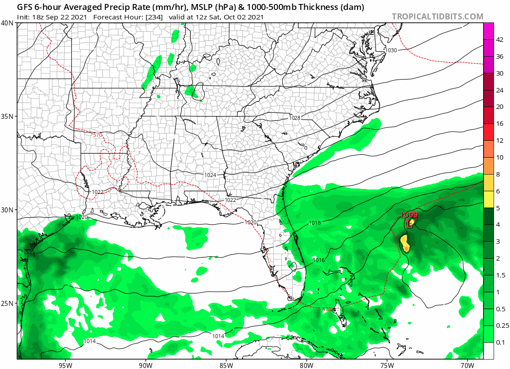
Ubuntwo wrote:18z GFS has a west-moving TC in the SW Atlantic, originating from some of Peter's remnant vorticity interacting with an upper level low. The model has been on and off with this developing, but this run has a bonafide tropical storm. Another impulse to watch moving forward.
(watch ex-peter get split)
https://imgur.com/oVzLpVw
Teban54 wrote:Ubuntwo wrote:18z GFS has a west-moving TC in the SW Atlantic, originating from some of Peter's remnant vorticity interacting with an upper level low. The model has been on and off with this developing, but this run has a bonafide tropical storm. Another impulse to watch moving forward.
(watch ex-peter get split)
https://imgur.com/oVzLpVw
If that develops, would it still be named Peter? Or would that be Teresa or Victor?
boca wrote:This is the first time Florida getting hit by a model storm all season.
SFLcane wrote:18z euro is weaker and further SW.


Teban54 wrote:[Possible Disturbance in the Gulf]
0z GFS again shows a 998 mb storm in the Gulf at 300 hrs, and makes landfall in the Big Bend at 978 mb. The precursor seems to be the cutoff low near Florida that helped steer TD18/Sam OTS. At 222 hrs, it starts to show some vorticity that passes through the Florida Straits, loops around the west tip of Cuba before heading into the Gulf.
Keep in mind GFS is the only model that shows the cutoff low for now.
https://i.ibb.co/zbJJJYr/gfs-z850-vort-atl-fh0-366.gif


SFLcane wrote:Lol What…
https://i.postimg.cc/66Vwj7Dq/6-BA57-E19-4914-49-D1-91-D4-F5-D2-F07-A0274.gif
toad strangler wrote:SFLcane wrote:Lol What…
https://i.postimg.cc/66Vwj7Dq/6-BA57-E19-4914-49-D1-91-D4-F5-D2-F07-A0274.gif
6Z GFS does something similar


mpic wrote:I am confused. I have always been told and believed that you never let your guard down or declare the season over in Texas until the middle of October. A Met that I follow, trust and who has never in the past been wrong just declared that Texas is in the clear for the season. Is this true?
tolakram wrote:mpic wrote:I am confused. I have always been told and believed that you never let your guard down or declare the season over in Texas until the middle of October. A Met that I follow, trust and who has never in the past been wrong just declared that Texas is in the clear for the season. Is this true?
True? Impossible to answer IMO, this met apparently believes it.
mpic wrote:tolakram wrote:mpic wrote:I am confused. I have always been told and believed that you never let your guard down or declare the season over in Texas until the middle of October. A Met that I follow, trust and who has never in the past been wrong just declared that Texas is in the clear for the season. Is this true?
True? Impossible to answer IMO, this met apparently believes it.
We have a cold front coming through which is typical for Sept. Next week will be back in the 90s with high humidity. This is unusual for him so maybe he's in some kind of crisis. I hope he's right but people follow him religiously.
Users browsing this forum: pepecool20, Teban54 and 156 guests