Disturbance over the western Mediterranean sea
Moderator: S2k Moderators
Forum rules
The posts in this forum are NOT official forecasts and should not be used as such. They are just the opinion of the poster and may or may not be backed by sound meteorological data. They are NOT endorsed by any professional institution or STORM2K. For official information, please refer to products from the National Hurricane Center and National Weather Service.
- Europa non è lontana
- Tropical Depression

- Posts: 93
- Joined: Wed Nov 11, 2020 10:01 pm
Disturbance over the western Mediterranean sea
A disturbance with closed circulation and sporadic convection is currently in between the islands of Menorca and Sardinia. 12z and 18z model runs from a variety of global models, including the ICON, UKMet, ECMWF, ACCESS-G, and CMC, suggest the possibility of development of this system into a weak subtropical or tropical depression over the next couple of days. There is broad agreement across most models suggesting the low will be between 1010 and 1005 mbar over the Tyrrhenian Sea in two days or so. The system will track over the island of Sardinia, the Tyrrhenian Sea, and either Sicily or the southern Italian peninsula over the next three days. The most limiting factors are land interaction and shear, which will be high over the system's lifespan.
7 likes
- Europa non è lontana
- Tropical Depression

- Posts: 93
- Joined: Wed Nov 11, 2020 10:01 pm
Disturbance over the western Mediterranean sea
Large bursts of convection have occurred during the night, with the convection displaced to the east of the LLC by high shear and -50C cloud tops present. An ASCAT pass from 2100 UTC shows a slightly elongated, closed circulation, and 30kt winds. Landfall is likely to occur between Aristanis/Oristano and L'Alguer/Alghero at about 2000z. Marine traffic is largely avoiding the disturbance, so no ship reports are available. I will update the thread with satellite imagery once the sun rises.
3 likes
- Europa non è lontana
- Tropical Depression

- Posts: 93
- Joined: Wed Nov 11, 2020 10:01 pm
Disturbance over the western Mediterranean sea
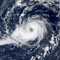
Cloud tops on the north-east side of the disturbance are currently at -60C, and shear is acting intensely on the system. The first natural colour satellite images of the day are coming in as the sun is rising:


4 likes
Re: Disturbance over the western Mediterranean sea
Thanks for keeping us updated.
0 likes
Personal Forecast Disclaimer:
The posts in this forum are NOT official forecast and should not be used as such. They are just the opinion of the poster and may or may not be backed by sound meteorological data. For official information, please refer to the NHC and NWS products.
The posts in this forum are NOT official forecast and should not be used as such. They are just the opinion of the poster and may or may not be backed by sound meteorological data. For official information, please refer to the NHC and NWS products.
- Europa non è lontana
- Tropical Depression

- Posts: 93
- Joined: Wed Nov 11, 2020 10:01 pm
Re: Disturbance over the western Mediterranean sea
Convection has diminished over the day, with the height of the activity near the LLC being some VHTs firing off on the NW and E sides of the LLC. Shear has significantly inhibited the potential of this system, which will make landfall in Sardinia in the next few hours. There is limited potential for further development once the disturbance crosses Sardinia, but the shear environment is not very favourable in the Tyrrhenian Sea either. Overall, chances for development into a subtropical or tropical cyclone have decreased since the night.
3 likes
- Europa non è lontana
- Tropical Depression

- Posts: 93
- Joined: Wed Nov 11, 2020 10:01 pm
Disturbance over the Tyrrhenian Sea
Over the night, the disturbance moved over the island of Sardinia, and is now over the Tyrrhenian Sea. Shear is still very high, displacing the minimal convection to the northeast and east of the LLC. Cloud tops are currently at about -60C. The disturbance is moving southeast and should make landfall on Sicily within the next 12 to 18 hours. In 24 hours, the disturbance will be over the Ionian Sea. At this stage, it is increasingly unlikely that it will develop enough to be classifiable as a tropical or subtropical system before likely dissipation over the Ionian Sea in 36 to 48 hours.
1 likes
- DanieleItalyRm
- Category 1

- Posts: 486
- Age: 38
- Joined: Mon Sep 22, 2008 7:52 am
- Location: Rome - Italy - Mediterranean sea
Re: Disturbance over the western Mediterranean sea
There is therefore only a Disturbance left. Quite right?
Thanks for keeping us updated on Medieterranean systems.
Thanks for keeping us updated on Medieterranean systems.
1 likes
- Vince_and_Grace_fan
- Category 1

- Posts: 315
- Joined: Thu Nov 03, 2016 9:25 am
- Location: Szombathely (Hungary)
Re: Disturbance over the western Mediterranean sea
Some models tryed to develop this system into a weak storm over the Ionian Sea in the past days, but due to the high shear it never had a real development chance. Although it has a nice convective structure now with a poleward outflow channel in the upper levels, the low level circulatin looks quite disorganised, rather a convergnce than a closed low.
1 likes
Who is online
Users browsing this forum: cycloneye, duilaslol, Google Adsense [Bot], NotSparta, South Texas Storms and 92 guests


