
Oh NOW the GFS develops this, after a bunch of models trended weaker and it hasn’t shown anything in days lmao I’m done
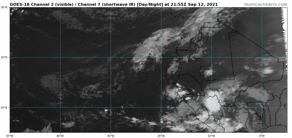
Strong Tropical Wave to emerge from West Africa today (Is Invest 95L)
Moderator: S2k Moderators
Forum rules

The posts in this forum are NOT official forecasts and should not be used as such. They are just the opinion of the poster and may or may not be backed by sound meteorological data. They are NOT endorsed by any professional institution or STORM2K. For official information, please refer to products from the National Hurricane Center and National Weather Service.
Re: Strong Tropical Wave to emerge from West Africa on Monday
Oh NOW the GFS develops this, after a bunch of models trended weaker and it hasn’t shown anything in days lmao I’m done
2 likes
Irene '11 Sandy '12 Hermine '16 5/15/2018 Derecho Fay '20 Isaias '20 Elsa '21 Henri '21 Ida '21
I am only a meteorology enthusiast who knows a decent amount about tropical cyclones. Look to the professional mets, the NHC, or your local weather office for the best information.
I am only a meteorology enthusiast who knows a decent amount about tropical cyclones. Look to the professional mets, the NHC, or your local weather office for the best information.


Re: Strong Tropical Wave to emerge from West Africa on Monday
aspen wrote:
Oh NOW the GFS develops this, after a bunch of models trended weaker and it hasn’t shown anything in days lmao I’m done
Model watching has been a trip this season
0 likes
-
SFLcane

- S2K Supporter

- Posts: 9606
- Age: 46
- Joined: Sat Jun 05, 2010 1:44 pm
- Location: Lake Worth Florida
Re: Strong Tropical Wave to emerge from West Africa on Monday
Gfs wakes up lol…
Icon dips sw at the end of its run.
Icon dips sw at the end of its run.
0 likes
-
Blown Away

- S2K Supporter
- Posts: 9861
- Joined: Wed May 26, 2004 6:17 am
Re: Strong Tropical Wave to emerge from West Africa on Monday
SFLcane wrote:Gfs wakes up lol…
Icon dips sw at the end of its run.
Nicholas not enhancing Bahama low as much and ridging is building back in stronger than previous runs.
0 likes
Hurricane Eye Experience: David 79, Irene 99, Frances 04, Jeanne 04, Wilma 05...
Hurricane Brush Experience: Andrew 92, Erin 95, Floyd 99, Matthew 16, Irma 17, Ian 22, Nicole 22…
Hurricane Brush Experience: Andrew 92, Erin 95, Floyd 99, Matthew 16, Irma 17, Ian 22, Nicole 22…
-
Category5Kaiju

- Category 5

- Posts: 3357
- Age: 22
- Joined: Thu Dec 24, 2020 12:45 pm
- Location: Seattle
Re: Strong Tropical Wave to emerge from West Africa on Monday
aspen wrote:
Oh NOW the GFS develops this, after a bunch of models trended weaker and it hasn’t shown anything in days lmao I’m done
GFS after many runs of showing jack squat: “Ok, ok, I get it I get it! Fine, I show a TC now
1 likes
Unless explicitly stated, all information covered in my posts is based on my opinions and observations. Please refer to a professional meteorologist or an accredited weather research agency otherwise, especially if serious decisions must be made in the event of a potentially life-threatening tropical storm or hurricane.
Re: Strong Tropical Wave to emerge from West Africa on Monday
Happy Hour GEFS says the Happy Hour GFS is a western outlier.
0 likes
Personal Forecast Disclaimer:
The posts in this forum are NOT official forecasts and should not be used as such. They are just the opinion of the poster and may or may not be backed by sound meteorological data. They are NOT endorsed by any professional institution or storm2k.org. For official information, please refer to the NHC and NWS products.
The posts in this forum are NOT official forecasts and should not be used as such. They are just the opinion of the poster and may or may not be backed by sound meteorological data. They are NOT endorsed by any professional institution or storm2k.org. For official information, please refer to the NHC and NWS products.
-
gatorcane

- S2K Supporter
- Posts: 23499
- Age: 46
- Joined: Sun Mar 13, 2005 3:54 pm
- Location: Boca Raton, FL
Re: Strong Tropical Wave to emerge from West Africa on Monday
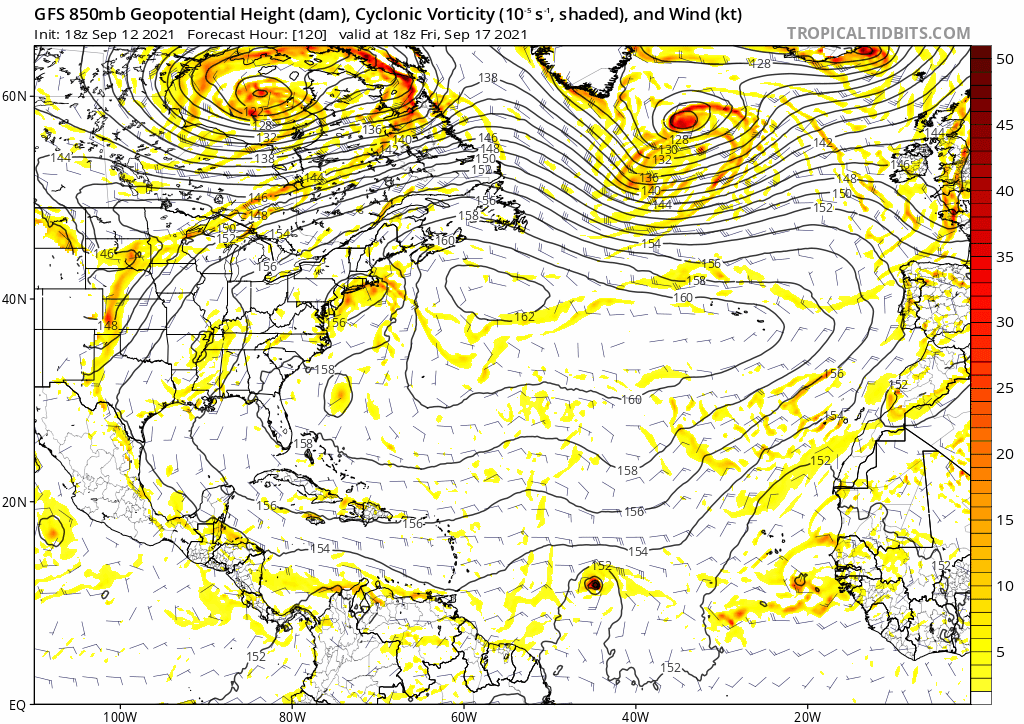
Saved 18Z GFS from 120 hour animation, recurve well east of the Lesser Antilles. Notable the model now picks up on genesis as some have mentioned.
0 likes

Re: Strong Tropical Wave to emerge from West Africa on Monday
aspen wrote:
Oh NOW the GFS develops this, after a bunch of models trended weaker and it hasn’t shown anything in days lmao I’m done
GFS when other models are trending weaker:

8 likes
Re: Strong Tropical Wave to emerge from West Africa on Monday
The GFS’ track would make future Odette one hell of an ACE maker: several days over the southern MDR, a brief weakening phase due to a PVS (although this would have less of an impact of Odette is stronger than the GFS shows when at 55W), and several more days within the extremely high SSTs of the region west of 60W and south of 30N. This track also just barely misses the Leeward Islands, Bermuda, and Atlantic Canada — a potentially very strong but mercifully OTS long-tracker. I could easily see it becoming a Cat 4 at some point and being another 30-40 ACE storm.
1 likes
Irene '11 Sandy '12 Hermine '16 5/15/2018 Derecho Fay '20 Isaias '20 Elsa '21 Henri '21 Ida '21
I am only a meteorology enthusiast who knows a decent amount about tropical cyclones. Look to the professional mets, the NHC, or your local weather office for the best information.
I am only a meteorology enthusiast who knows a decent amount about tropical cyclones. Look to the professional mets, the NHC, or your local weather office for the best information.
-
cycloneye

- Admin

- Posts: 139067
- Age: 67
- Joined: Thu Oct 10, 2002 10:54 am
- Location: San Juan, Puerto Rico
Re: Strong Tropical Wave to emerge from West Africa on Monday
A tropical wave is expected to emerge off the west coast of Africa
on Monday. Environmental conditions are forecast to be conducive
for some gradual development of this system thereafter, and a
tropical depression could form later this week while it moves
westward at 10 to 15 mph across the eastern tropical Atlantic Ocean.
* Formation chance through 48 hours...low...20 percent.
* Formation chance through 5 days...medium...60 percent.
0 likes
Visit the Caribbean-Central America Weather Thread where you can find at first post web cams,radars
and observations from Caribbean basin members Click Here
and observations from Caribbean basin members Click Here
-
SFLcane
- S2K Supporter
- Posts: 9606
- Age: 46
- Joined: Sat Jun 05, 2010 1:44 pm
- Location: Lake Worth Florida
Re: Strong Tropical Wave to emerge from West Africa on Monday
aspen wrote:The GFS’ track would make future Odette one hell of an ACE maker: several days over the southern MDR, a brief weakening phase due to a PVS (although this would have less of an impact of Odette is stronger than the GFS shows when at 55W), and several more days within the extremely high SSTs of the region west of 60W and south of 30N. This track also just barely misses the Leeward Islands, Bermuda, and Atlantic Canada — a potentially very strong but mercifully OTS long-tracker. I could easily see it becoming a Cat 4 at some point and being another 30-40 ACE storm.
this can easily make it to the islands and potentially further westward. Lots of moving parts.
1 likes
-
Hurricaneman

- Category 5
- Posts: 7281
- Age: 43
- Joined: Tue Aug 31, 2004 3:24 pm
- Location: central florida
Re: Strong Tropical Wave to emerge from West Africa on Monday
A PVS is forecasted near the islands on the GFS that would weaken this around there but there’s no guarantee that this will recurve due to a weaker system just look at a certain storm in 1992 that went through a PVS, weakened significantly and came out the other end and rapidly deepened and got under the ridge which it would have gone out to sea if it didn’t have the PVS shear, not expecting this anywhere near south Florida like that one but this could put a scare on the east coast of the ridge is any stronger
1 likes
-
Hurricaneman
- Category 5
- Posts: 7281
- Age: 43
- Joined: Tue Aug 31, 2004 3:24 pm
- Location: central florida
Re: Strong Tropical Wave to emerge from West Africa on Monday
Looks like a Floyd type setup, we’ll see as it could be anything from no development to major hurricane within shouting distance of the east coast
1 likes

Re: Strong Tropical Wave to emerge from West Africa on Monday
Now I just want the wave to dissipate immediately, so that I don't have to stretch my head while reading the debates on whether it will form in the first place, not to mention where it will go.
As if trying to find Nicholas' LLC wasn't frustrating enough.
As if trying to find Nicholas' LLC wasn't frustrating enough.
0 likes
-
gatorcane
- S2K Supporter
- Posts: 23499
- Age: 46
- Joined: Sun Mar 13, 2005 3:54 pm
- Location: Boca Raton, FL
Re: Strong Tropical Wave to emerge from West Africa on Monday
Saved loop, definitely some noticeable spin and it is still over land. I can see why models have liked development in at least some of the recent runs:
4 likes
-
Spacecoast

- Category 2

- Posts: 687
- Joined: Thu Aug 31, 2017 2:03 pm
Re: Strong Tropical Wave to emerge from West Africa on Monday
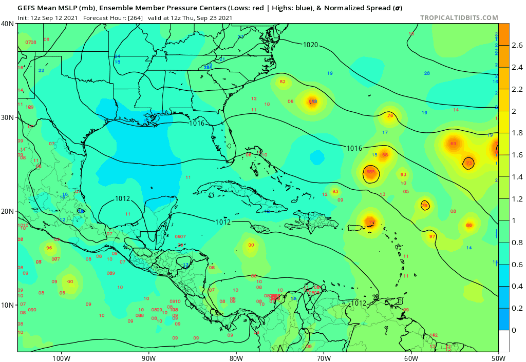
Ok, now comparing the last two GEFS runs:
Taken as a group, perhaps a little stronger, less spread, and slightly???? further westward?
noticeable left turn in last part of 18z run
IDK, judge for yourselves...


I wish they would show AEMN
Taken as a group, perhaps a little stronger, less spread, and slightly???? further westward?
noticeable left turn in last part of 18z run
IDK, judge for yourselves...
I wish they would show AEMN
Last edited by Spacecoast on Sun Sep 12, 2021 8:00 pm, edited 1 time in total.
0 likes
Re: Strong Tropical Wave to emerge from West Africa on Monday
Of 31 members of the 18Z GEFS, 4 hit the SE US 9/25-8 (2 FL and 2 NC) and one of the 2 NC hits (a skirter) then goes up the coast.
3 likes
Personal Forecast Disclaimer:
The posts in this forum are NOT official forecasts and should not be used as such. They are just the opinion of the poster and may or may not be backed by sound meteorological data. They are NOT endorsed by any professional institution or storm2k.org. For official information, please refer to the NHC and NWS products.
The posts in this forum are NOT official forecasts and should not be used as such. They are just the opinion of the poster and may or may not be backed by sound meteorological data. They are NOT endorsed by any professional institution or storm2k.org. For official information, please refer to the NHC and NWS products.
-
toad strangler

- S2K Supporter
- Posts: 4162
- Joined: Sun Jul 28, 2013 3:09 pm
- Location: Earth
- Contact:
Re: Strong Tropical Wave to emerge from West Africa on Monday
gatorcane wrote:Saved 18Z GFS from 120 hour animation, recurve well east of the Lesser Antilles. Notable the model now picks up on genesis as some have mentioned.
https://i.postimg.cc/ryKJzQpb/gfs-z850-vort-atl-fh120-240.gif
At the 200 hourISH time frame that is NOT WELL EAST of the LA

0 likes
Who is online
Users browsing this forum: No registered users and 201 guests