MarioProtVI wrote:WalterWhite wrote:MarioProtVI wrote:Hyperactivity threshold is impossible at this point barring some 2020 late season repeat (not happening). Philippe’s been underwhelming and it is definitely not becoming the ACE grinder it was though to become. October may produce something but it’s a wildcard especially in El Niño years. I think 130-135 is where we finish.
Hyperactivity is very much possible. The mean OND ACE for 2013-2022 is 34.9. If the Atlantic just adds 30 more ACE for the rest of the season (which is BELOW the mean), we would already have about 156 ACE, which is quite close to the hyperactivity threshold.
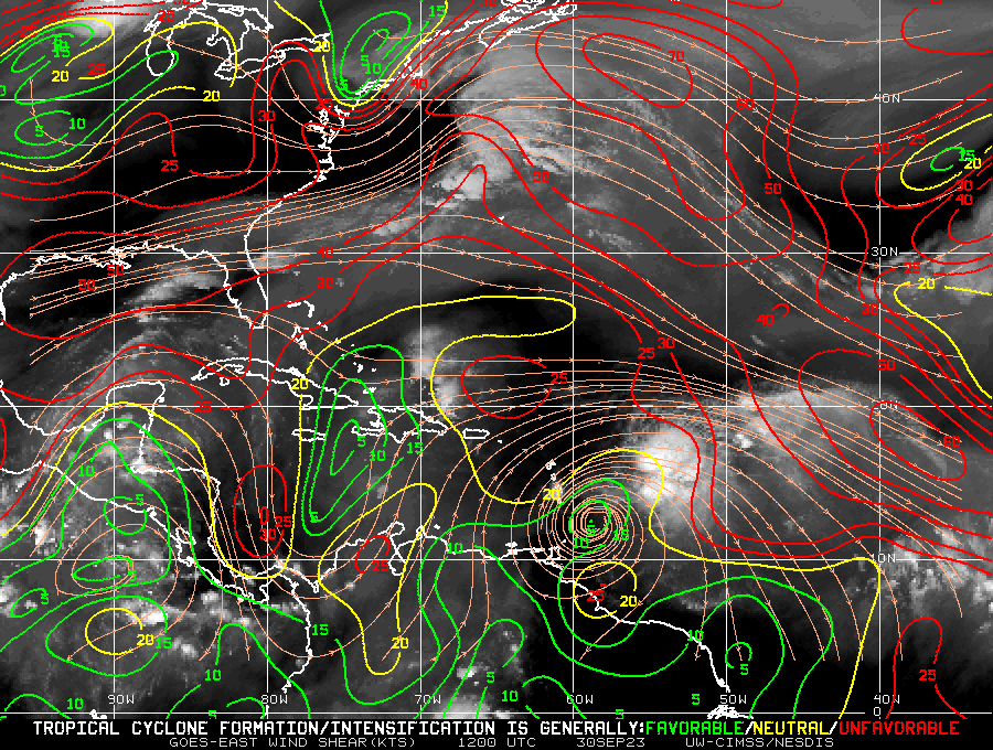
Octobers for the most part of the last decade sans 2016, 2018 and 2020 have been underwhelming, since the Caribbean doesn’t seem to want to produce any major hurricanes, meaning the best shot is in the subtropics. Just because models say October is favorable doesn’t mean it’ll be active, I’ve see this part happen over and over again - where people expect a decent October and it ends up producing either weak sloppy TSs or short lived C1s in the subtropics, both which generate on average only 3-5 ACE. I don’t expect 2023 to deviate from that especially with El Niño. So no, hyperactivity is dead in the water and people seem to be wishcasting.
The other question is why isn't the Caribbean producing the large in size monster cat4s and cat5s like they did in the past despite being so active and warm the Atl these days?
I mean like your Ivan's, Gilbert's, Wilmas, Dennis, Mitch, Isidore. When we do get a cat4 or cat5 in the Caribbean Sea now they seem to be more compact in size and not the insane 180mph monsters like Mitch.
I mean bombing out in the Caribbean, not waiting until getting into the Gulf like Michael or Ian to reach their peak.