2023 Tropical Waves

This is the general tropical discussion area. Anyone can take their shot at predicting a storms path.

Moderator: S2k Moderators

Forum rules

The posts in this forum are NOT official forecasts and should not be used as such. They are just the opinion of the poster and may or may not be backed by sound meteorological data. They are NOT endorsed by any professional institution or STORM2K. For official information, please refer to products from the National Hurricane Center and National Weather Service.

Help Support Storm2K
Message
Author
User avatar
cycloneye
Admin
Admin
Posts: 139132
Age: 67
Joined: Thu Oct 10, 2002 10:54 am
Location: San Juan, Puerto Rico

Re: 2023 Tropical Waves

#141 Postby cycloneye » Thu Aug 10, 2023 11:53 am

Extratropical94 wrote:You can still access all of their text products at https://tgftp.nws.noaa.gov/data/raw/.

Just look for the header of the product you want. You can find it at the top of every text product.
For instance, the tropical weather discussions for the Atlantic are listed under header AXNT20

AXNT20 KNHC 101144
TWDAT

Tropical Weather Discussion
NWS National Hurricane Center Miami FL
1205 UTC Thu Aug 10 2023


If you go to https://tgftp.nws.noaa.gov/data/raw/, then click on the directory with the same first two letters as the header you look for (ax/), you will see all products with headers starting with these two letters.

TWD :rarrow: https://tgftp.nws.noaa.gov/data/raw/ax/ ... twd.at.txt

This also works for TWOs (ABNT20 for the Atlantic, ABPZ20 for the East Pacific), advisories (WTNT/WTPA/WTPZ) and lots of other stuff :)
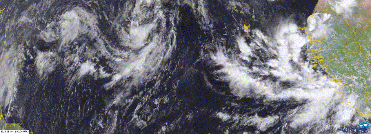
From the current discussion:

An eastern Atlantic tropical wave has its axis along 23W, south
of 17N, and is moving slowly westward at 5-10 kt. Scattered
moderate convection is observed from 06N to 11N and east of 27W.

Another eastern Atlantic tropical wave has its axis along 36W/37W,
south of 17N, and is moving slowly westward at 5 kt. Scattered
moderate convection is noted from 05N to 09N and between 28W and
44W.

An eastern Caribbean tropical wave has its axis along 65W, south
of 20N, moving W at 20 kt. Scattered moderate convection is
evident from 16N to 18N and between 65W and 67W.

A central Caribbean tropical wave has its axis along 77W, south
of 21N, moving W at 10 kt. No significant convection is noted
over water.


Thanks for the links. I still can't find the ones for TWO of North Atlantic and Pacific. :sadly:
1 likes   
Visit the Caribbean-Central America Weather Thread where you can find at first post web cams,radars
and observations from Caribbean basin members Click Here

User avatar
Extratropical94
Professional-Met
Professional-Met
Posts: 3535
Age: 29
Joined: Wed Oct 20, 2010 6:36 am
Location: Hamburg, Germany
Contact:

Re: 2023 Tropical Waves

#142 Postby Extratropical94 » Thu Aug 10, 2023 12:03 pm

cycloneye wrote:
Thanks for the links. I still can't find the ones for TWO of North Atlantic and Pacific. :sadly:


Here you go!
ATL (ABNT20): https://tgftp.nws.noaa.gov/data/raw/ab/ ... two.at.txt
EPAC (ABPZ20): https://tgftp.nws.noaa.gov/data/raw/ab/ ... two.ep.txt
2 likes   
54° 11' 59'' N, 9° 9' 20'' E
Boomer Sooner!
Go Broncos! Go Cards! Go Niners!
- Daniel

User avatar
cycloneye
Admin
Admin
Posts: 139132
Age: 67
Joined: Thu Oct 10, 2002 10:54 am
Location: San Juan, Puerto Rico

Re: 2023 Tropical Waves

#143 Postby cycloneye » Thu Aug 10, 2023 12:10 pm

Extratropical94 wrote:
cycloneye wrote:
Thanks for the links. I still can't find the ones for TWO of North Atlantic and Pacific. :sadly:


Here you go!
ATL (ABNT20): https://tgftp.nws.noaa.gov/data/raw/ab/ ... two.at.txt
EPAC (ABPZ20): https://tgftp.nws.noaa.gov/data/raw/ab/ ... two.ep.txt


Again thanks.
1 likes   
Visit the Caribbean-Central America Weather Thread where you can find at first post web cams,radars
and observations from Caribbean basin members Click Here

User avatar
cycloneye
Admin
Admin
Posts: 139132
Age: 67
Joined: Thu Oct 10, 2002 10:54 am
Location: San Juan, Puerto Rico

Re: 2023 Tropical Waves

#144 Postby cycloneye » Thu Aug 10, 2023 12:15 pm

cycloneye wrote:
Extratropical94 wrote:
cycloneye wrote:
Thanks for the links. I still can't find the ones for TWO of North Atlantic and Pacific. :sadly:


Here you go!
ATL (ABNT20): https://tgftp.nws.noaa.gov/data/raw/ab/ ... two.at.txt
EPAC (ABPZ20): https://tgftp.nws.noaa.gov/data/raw/ab/ ... two.ep.txt


Again thanks.


Saved all the links of TWD's and TWO's to not have to be asking for them in the future. :D Also have them to use like what is going on today with the NHC site that has been out.
2 likes   
Visit the Caribbean-Central America Weather Thread where you can find at first post web cams,radars
and observations from Caribbean basin members Click Here

User avatar
cycloneye
Admin
Admin
Posts: 139132
Age: 67
Joined: Thu Oct 10, 2002 10:54 am
Location: San Juan, Puerto Rico

Re: 2023 Tropical Waves

#145 Postby cycloneye » Fri Aug 11, 2023 9:00 am

Waves at 12:05 UTC on 8/11/23.

The axis of an Atlantic Ocean tropical wave is near 22W, from 17N
southward, moving westward about 10 to 15 knots. Scattered
moderate and isolated strong convection is noted from 05N to 10N
between 20W and 25W.

The axis of an Atlantic Ocean tropical wave is near 44W, from 17N
southward, moving westward about 10 to 15 knots. Isolated moderate
convection is noted from 04N to 08N between 40W and 45W.

The axis of a Caribbean Sea tropical wave is near 72W, from 20N
southward, moving westward from 15 knots to 20 knots. Scattered
moderate convection is noted S of Hispaniola.
0 likes   
Visit the Caribbean-Central America Weather Thread where you can find at first post web cams,radars
and observations from Caribbean basin members Click Here

User avatar
cycloneye
Admin
Admin
Posts: 139132
Age: 67
Joined: Thu Oct 10, 2002 10:54 am
Location: San Juan, Puerto Rico

Re: 2023 Tropical Waves

#146 Postby cycloneye » Sat Aug 12, 2023 6:26 am

Waves at 12:05 UTC on 8/12/23.

The axis of an Atlantic Ocean tropical wave is near 26W/27W, from
16N southward, moving westward around 10 knots. Scattered moderate
and isolated strong convection is noted from 05N to 10N between
24W and 29W.

The axis of an Atlantic Ocean tropical wave is near 52W, from 17N
southward, moving westward about 10 to 15 knots. Scattered
moderate convection is noted from 05N to 10N between 48W and 52W.

The axis of a Caribbean Sea tropical wave is near 80W, from 20N
southward, moving westward about 15 knots to 20 knots. Scattered
moderate to strong convection is noted S of 11N between 76W and
82W.
0 likes   
Visit the Caribbean-Central America Weather Thread where you can find at first post web cams,radars
and observations from Caribbean basin members Click Here

User avatar
cycloneye
Admin
Admin
Posts: 139132
Age: 67
Joined: Thu Oct 10, 2002 10:54 am
Location: San Juan, Puerto Rico

Re: 2023 Tropical Waves

#147 Postby cycloneye » Sat Aug 12, 2023 7:40 am

This is the wave to watch down the road.

Image
1 likes   
Visit the Caribbean-Central America Weather Thread where you can find at first post web cams,radars
and observations from Caribbean basin members Click Here

User avatar
cycloneye
Admin
Admin
Posts: 139132
Age: 67
Joined: Thu Oct 10, 2002 10:54 am
Location: San Juan, Puerto Rico

Re: 2023 Tropical Waves

#148 Postby cycloneye » Sun Aug 13, 2023 6:20 am

Waves at 12:05 UTC on 8/13/23.

The axis of an Atlantic Ocean tropical wave is near 30W, from 16N
southward, moving westward from 10 knots to 15 knots. Scattered
moderate convection is noted from 06N to 09N between 31W and 35W.

The axis of an Atlantic Ocean tropical wave is near 60W, from 20N
southward, moving westward from 10 knots to 15 knots. Scattered
moderate convection is noted from 10N to 14N between 58W and 62W.

The axis of a Caribbean Sea tropical wave is near 85W, from 20N
southward, moving westward from 10 knots to 15 knots. Scattered
moderate and isolated strong convection is noted in the NW
Caribbean.
0 likes   
Visit the Caribbean-Central America Weather Thread where you can find at first post web cams,radars
and observations from Caribbean basin members Click Here

User avatar
cycloneye
Admin
Admin
Posts: 139132
Age: 67
Joined: Thu Oct 10, 2002 10:54 am
Location: San Juan, Puerto Rico

Re: 2023 Tropical Waves

#149 Postby cycloneye » Mon Aug 14, 2023 8:28 am

Only two waves on 12:05 UTC on 8/14/23.

The axis of an Atlantic Ocean tropical wave is near 37W, from 16N
southward, moving westward from 10 knots to 15 knots. Isolated
moderate convection is noted from 08N to 10N between 38W and 40W.

The axis of a Caribbean Sea tropical wave is near 71W, from 20N
southward, moving westward from 10 knots to 15 knots. Scattered
moderate convection is noted within 90 nm of the wave axis N of
15N.
0 likes   
Visit the Caribbean-Central America Weather Thread where you can find at first post web cams,radars
and observations from Caribbean basin members Click Here

User avatar
cycloneye
Admin
Admin
Posts: 139132
Age: 67
Joined: Thu Oct 10, 2002 10:54 am
Location: San Juan, Puerto Rico

Re: 2023 Tropical Waves

#150 Postby cycloneye » Tue Aug 15, 2023 6:58 am

Waves at 12:05 UTC on 8/15/23.

The axis of a tropical wave is over west Africa near 12W/13W and S
of 20N. Scattered moderate and isolated strong convection is noted
from 08N to 19N between 09W and 18W. The tropical wave is
forecast to move off the west coast of Africa tonight or early
Wednesday. Some slow development of this system is possible late
this week or over the weekend while it moves generally west-
northwestward or northwestward across the eastern Atlantic.
Environmental conditions are expected to become unfavorable for
development by early next week. There is currently a low chance
for tropical cyclone development in the next 7 days.

The axis of an Atlantic Ocean tropical wave is near 30W, from 16N
southward, moving westward at around 10 knots. Scattered moderate
convection is noted from 07N to 17N between 27W and 34W.

The axis of an Atlantic Ocean tropical wave is near 54W, from 15N
southward, moving westward around 15 knots to 20 knots. Scattered
moderate convection is noted from 06N to 13N between 54W and 60W.

The axis of a Caribbean Sea tropical wave is near 77W, from 20N
southward, moving westward at 15 knots to 20 knots. Scattered
moderate and isolated strong convection is noted near the wave
axis S of 12N.
0 likes   
Visit the Caribbean-Central America Weather Thread where you can find at first post web cams,radars
and observations from Caribbean basin members Click Here

User avatar
cycloneye
Admin
Admin
Posts: 139132
Age: 67
Joined: Thu Oct 10, 2002 10:54 am
Location: San Juan, Puerto Rico

Re: 2023 Tropical Waves

#151 Postby cycloneye » Wed Aug 16, 2023 6:37 am

Waves at 12:05 UTC on 8/16/23.

The axis of a tropical wave is just off the coast of Africa near
17W from 18N southward, moving W at 10-15 kt. Scattered moderate
and isolated strong convection is noted from 12N to 17N E of 20W.
This system is forecast to move toward the west-northwest, with
an area of low pressure forming in a couple of days near or just
to the west of the Cabo Verde Islands. Further development of the
low is possible over the weekend before environmental conditions
become unfavorable early next week.

The axis of a tropical wave is in the central Atlantic near
37W/38W, from 19N southward, moving W at 15 kt. Scattered
moderate and isolated strong convection is noted from 07N to 13N
between 32W and 41W. A perturbation has developed in association
to the tropical wave within the monsoon trough. The tropical wave
will continue moving westward while this perturbation remains in
its wake. Environmental conditions appear conducive for gradual
development of this perturbation, and a tropical depression could
form during the next several days while moving toward the west or
west- northwest across the central tropical Atlantic.

The axis of a tropical wave is in the E Caribbean near 63W, from
18N southward, moving W at 15-20 kt. Scattered moderate convection
is noted from 10N to 13N between 58W and 62W.

The axis of a tropical wave is moving across Central America near
86W, from the Gulf of Honduras southward into the east Pacific,
moving W at 15-20 kt. Scattered showers are occurring in the Gulf
of Honduras.
0 likes   
Visit the Caribbean-Central America Weather Thread where you can find at first post web cams,radars
and observations from Caribbean basin members Click Here

User avatar
cycloneye
Admin
Admin
Posts: 139132
Age: 67
Joined: Thu Oct 10, 2002 10:54 am
Location: San Juan, Puerto Rico

Re: 2023 Tropical Waves

#152 Postby cycloneye » Thu Aug 17, 2023 12:17 pm

Waves at 18:05 UTC on 8/17/23.

Eastern Tropical Atlantic (AL98):
A broad area of low pressure, centered near 15N28W at 1009 mb, is
partially associated with a tropical wave with an axis along 28W.
It is moving WNW around 10 kt and is producing a broad area of
disorganized scattered moderate convection from 09N to 17N between
22W and 32W. These showers and thunderstorms are impacting the
Cabo Verde Islands. Further development of this low is possible
while it moves toward the west-northwest or northwest at around 10
mph across the eastern tropical Atlantic, and a tropical
depression could form over the weekend before environmental
conditions become unfavorable for development early next week. The
system has a medium chance of tropical cyclone development within
48 hours.

Central Tropical Atlantic (AL99):
A 1008 mb low pressure is centered near 12N39W, or about 900 nm
WSW of the Cabo Verde Islands. Scattered moderate to isolated
strong convection is noted from 07N to 12N between 32W and 42W.
Environmental conditions appear conducive for gradual development
of this system, and a tropical depression could form during the
next several days while it moves WNW at around 10 kt across the
central tropical Atlantic. This system has a medium chance of
tropical cyclone development within 48 hours.

Please refer to the latest NHC Tropical Weather Outlook at
www.hurricanes.gov for more details on both special features.

...TROPICAL WAVES...

Please see Special Features section above for information on a
tropical wave along 28W that has induced low pressure formation
and that has a potential for tropical development.

A central Atlantic tropical wave has its axis near 48W, south of
20N, moving westward at around 15 kt. Scattered moderate and
isolated strong convection is noted from 05N to 12N between 42W
and 52W.

An eastern Caribbean tropical wave has its axis near 69W, from
Hispaniola southward, moving westward at around 15 kt. Scattered
moderate convection is noted near the northern portion of the
wave in the vicinity of Hispaniola and Puerto Rico.
0 likes   
Visit the Caribbean-Central America Weather Thread where you can find at first post web cams,radars
and observations from Caribbean basin members Click Here

User avatar
cycloneye
Admin
Admin
Posts: 139132
Age: 67
Joined: Thu Oct 10, 2002 10:54 am
Location: San Juan, Puerto Rico

Re: 2023 Tropical Waves

#153 Postby cycloneye » Fri Aug 18, 2023 9:05 am

Waves at 12:05 UTC on 8/18/23.

A tropical wave is along 31N through the low pressure mentioned in
the Special Features section, moving west with the low pressure at
5 to 10 kt. Scattered moderate convection is evident from 90 to
180 nm in the northwest quadrant of the low, and from 09N to 12N
between 32W and 35W.

A western Atlantic tropical wave has its axis near 52W from 06N
to 19N. It is moving westward near 15 kt. Scattered moderate and
isolated strong convection is depicted from 10N to 13N between
50W and 55W.

A Caribbean tropical wave has its axis near 75W, or from the
western part of Haiti to just inland Colombia, moving west at 10
to 15 kt. No significant convection is evident at this time.
0 likes   
Visit the Caribbean-Central America Weather Thread where you can find at first post web cams,radars
and observations from Caribbean basin members Click Here

User avatar
cycloneye
Admin
Admin
Posts: 139132
Age: 67
Joined: Thu Oct 10, 2002 10:54 am
Location: San Juan, Puerto Rico

Re: 2023 Tropical Waves

#154 Postby cycloneye » Sat Aug 19, 2023 6:28 am

Waves at 12:05 UTC on 8/19/23.

A central Atlantic tropical wave has its axis along 57W (AL90),
south of 18N, moving westward at 10-15 kt. Scattered moderate to
isolated strong convection is noted from from 08N to 13N between
55W-61W. Some gradual development of this system is possible this
weekend and during the early and middle parts of next week while
it moves westward to west-northwestward across the Lesser Antilles
and over the eastern and central Caribbean Sea. The disturbance
has a low chance of development in the next 48 hours.

A western Caribbean tropical wave has its axis along 80W, south
of 26N, extending from the NW Bahamas, central Cuba and to central
Panama. The wave is moving westward at 10 to 15 kt. Scattered
moderate convection is evident across the northern half of the
wave N of 20N between 74W-78W. By early next week, a broad area
of low pressure is expected to form as the northern portion of the
wave moves across the eastern Gulf of Mexico. Some slow
development of this system is possible thereafter, and a tropical
depression could form as it moves westward and approaches the
western Gulf of Mexico coastline by the middle of next week. The
disturbance has a low chance of development in the next 48 hours
0 likes   
Visit the Caribbean-Central America Weather Thread where you can find at first post web cams,radars
and observations from Caribbean basin members Click Here

ChrisH-UK
Category 1
Category 1
Posts: 424
Joined: Sat May 29, 2021 8:22 am

Re: 2023 Tropical Waves

#155 Postby ChrisH-UK » Sat Aug 19, 2023 11:41 am

All 4 waves in the MDR.

Source - https://col.st/20Mfw

Image
1 likes   

User avatar
cycloneye
Admin
Admin
Posts: 139132
Age: 67
Joined: Thu Oct 10, 2002 10:54 am
Location: San Juan, Puerto Rico

Re: 2023 Tropical Waves

#156 Postby cycloneye » Sun Aug 20, 2023 6:24 am

Waves at 12:05 UTC on 8/20/23.

A new tropical wave extends from 06N to 21N along 21W, moving
west at 10 to 15 kt. Scattered moderate isolated strong convection
is from 08N to 18N and E of 27W. Environmental conditions appear
conducive for gradual development of this system, and a tropical
depression could form later this week while it moves west-
northwestward across the eastern tropical Atlantic.

A western Caribbean tropical wave is evident along 85W south of
22N, moving west at 10 to 15 kt. Scattered moderate convection are
noted W of 82W.
0 likes   
Visit the Caribbean-Central America Weather Thread where you can find at first post web cams,radars
and observations from Caribbean basin members Click Here

User avatar
cycloneye
Admin
Admin
Posts: 139132
Age: 67
Joined: Thu Oct 10, 2002 10:54 am
Location: San Juan, Puerto Rico

Re: 2023 Tropical Waves

#157 Postby cycloneye » Mon Aug 21, 2023 8:35 am

Waves at 12:05 UTC on 8/21/23.

Invest 92L is associated with a tropical wave located near the
Cabo Verde Islands. A 1008 mb low pressure is noted along the wave
near 15N26W. Scattered moderate convection prevail from 15N to
19N from 20W to 29W. Seas in this area range between 6-8 ft.
Environmental conditions appear conducive for gradual development
of this system, and a tropical depression is likely to form later
this week while it moves west-northwestward across the eastern
tropical Atlantic. The chance of tropical development is medium
in the next 48 hours.


A tropical wave has its axis along 91W, south of 21N, moving
westward at 10-15 kt. The wave is helping to enhance the
development of scattered showers and thunderstorms across the EPAC
waters.
0 likes   
Visit the Caribbean-Central America Weather Thread where you can find at first post web cams,radars
and observations from Caribbean basin members Click Here

User avatar
cycloneye
Admin
Admin
Posts: 139132
Age: 67
Joined: Thu Oct 10, 2002 10:54 am
Location: San Juan, Puerto Rico

Re: 2023 Tropical Waves

#158 Postby cycloneye » Tue Aug 22, 2023 8:11 am

Waves at 12:05 UTC on 8/22/23.

A tropical wave is near 32W from 21N southward through a 1009 mb
low (AL92) at 16N32W. It is moving west at 10 kt. Scattered
moderate convection is found from 13N to 19N between 31W and 35W.
Environmental conditions appear generally conducive for gradual
development of this system, and a tropical depression could form
later this week while it moves west-northwestward across the
eastern tropical Atlantic. There is a low chance of tropical
cyclone formation within the next 2 days and a medium chance
through 7 days.

The northern tip of a tropical wave along 96W is producing
scattered showers over the western Bay of Campeche. It should exit
the basin later today.
0 likes   
Visit the Caribbean-Central America Weather Thread where you can find at first post web cams,radars
and observations from Caribbean basin members Click Here

zzzh
Category 2
Category 2
Posts: 531
Joined: Thu Sep 02, 2021 1:13 pm

Re: 2023 Tropical Waves

#159 Postby zzzh » Tue Aug 22, 2023 6:11 pm

Image
:lol:
0 likes   

User avatar
cycloneye
Admin
Admin
Posts: 139132
Age: 67
Joined: Thu Oct 10, 2002 10:54 am
Location: San Juan, Puerto Rico

Re: 2023 Tropical Waves

#160 Postby cycloneye » Wed Aug 23, 2023 7:19 am

Only one wave at 12:05 UTC on 8/23/23.

A tropical wave is near 35W from 07N to 22N through a 1009 mb low
pressure (AL92) centered at 16N35W, and moving west around 10 kt.
Scattered showers are noted from 14.5N to 21N between 31W and 39W.
Environmental conditions are forecast to become more conducive
for some development late this week. The chance of development
within the next 48 hours is low. The system is expected to move
WNW to NW across the central tropical Atlantic into the weekend.
Refer to the latest NHC Tropical Weather Outlook at
www.hurricanes.gov for more details.
0 likes   
Visit the Caribbean-Central America Weather Thread where you can find at first post web cams,radars
and observations from Caribbean basin members Click Here


Return to “Talkin' Tropics”

Who is online

Users browsing this forum: Google Adsense [Bot], Hybridstorm_November2001, RomP and 176 guests