Convective Blowup Over the SW GOMEX
Moderator: S2k Moderators
Forum rules

The posts in this forum are NOT official forecasts and should not be used as such. They are just the opinion of the poster and may or may not be backed by sound meteorological data. They are NOT endorsed by any professional institution or STORM2K. For official information, please refer to products from the National Hurricane Center and National Weather Service.
-
jaguars_22
- Category 1

- Posts: 493
- Joined: Tue Jun 20, 2017 2:26 pm
Convective Blowup Over the SW GOMEX
I know some of the models showed some slight turning in vorticity in short term… I wonder if this could be a short lived home brew?
0 likes

Re: Bay Of Campeche Flareup
Well, its overall convection improved overnight into the early morning hours. See if it hangs around, moves inland or just dissipates. But I sure need some rain over here in Biloxi, come this way convection.
0 likes
-
wxman57

- Moderator-Pro Met

- Posts: 22482
- Age: 66
- Joined: Sat Jun 21, 2003 8:06 pm
- Location: Houston, TX (southwest)
Re: Convective Blowup Over the SW GOMEX
Models have been seeing this weak feature for days. Current models take it inland into the TX coast tonight and tomorrow, providing us with the best chance of rain in three weeks. No tropical development before it moves inland in 18-24 hrs.
1 likes

Re: Convective Blowup Over the SW GOMEX
wxman57 wrote:Models have been seeing this weak feature for days. Current models take it inland into the TX coast tonight and tomorrow, providing us with the best chance of rain in three weeks. No tropical development before it moves inland in 18-24 hrs.
How far in-land will this travel. Will bastrop/Austin area receive any rain? Need to make decision to fertilize the hayfields or not.
0 likes
Re: Convective Blowup Over the SW GOMEX
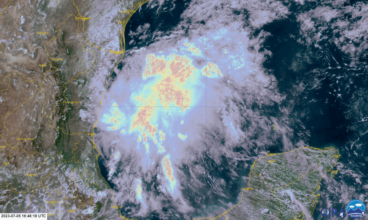
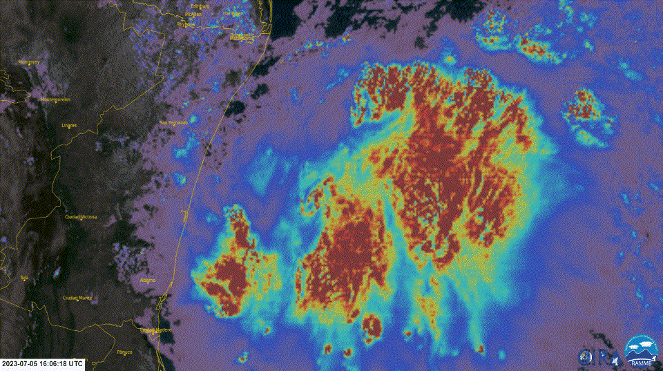
Mostly going to be a rain maker for Texas. This is a loop using GOES-16 Geo Colour with Optical Depth to show what is happening inside. Source - https://col.st/mOEa6
0 likes
Re: Convective Blowup Over the SW GOMEX
Just noticed something in the last few frames of that loop. It looks like it is trying to form up. I have zoomed in a bit and adjusted it the cloud structure looks like it is starting to form a centre of rotation and bands. However this will probably end to be nothing too close to the shore, not enough time to get organised however we have seen these thing pop up out of nowhere in to storms before.
Optical Depth measures how far down the it can see it a handy way to see the structure of a storm.
Optical Depth measures how far down the it can see it a handy way to see the structure of a storm.
0 likes
-
cycloneye

- Admin

- Posts: 139093
- Age: 67
- Joined: Thu Oct 10, 2002 10:54 am
- Location: San Juan, Puerto Rico
Re: Convective Blowup Over the SW GOMEX
0 likes
Visit the Caribbean-Central America Weather Thread where you can find at first post web cams,radars
and observations from Caribbean basin members Click Here
and observations from Caribbean basin members Click Here
-
wxman57
- Moderator-Pro Met
- Posts: 22482
- Age: 66
- Joined: Sat Jun 21, 2003 8:06 pm
- Location: Houston, TX (southwest)
Re: Convective Blowup Over the SW GOMEX
Any rotation you see on satellite is WAY above the surface, like at 500mb (18,000 ft). Zero chance of tropical development before it moves into Texas tonight. Looks like it is running into a NE-SW trof axis along the TX coast tonight, so don't expect the precip to move very far inland. I hope it at least gets to Houston. Grass is brown now.
2 likes
Who is online
Users browsing this forum: duilaslol, HurricaneFan, KirbyDude25, ljmac75, StPeteMike, weatherwindow and 112 guests