gatorcane wrote:Yep looks like the GFS has come to its senses and has caved to the Euro.
What? Euro wasn't even showing any development at all, even in the subtropics, until just a handful runs ago.
Moderator: S2k Moderators

gatorcane wrote:Yep looks like the GFS has come to its senses and has caved to the Euro.


Teban54 wrote:gatorcane wrote:Yep looks like the GFS has come to its senses and has caved to the Euro.
What? Euro wasn't even showing any development at all, even in the subtropics, until just a handful runs ago.
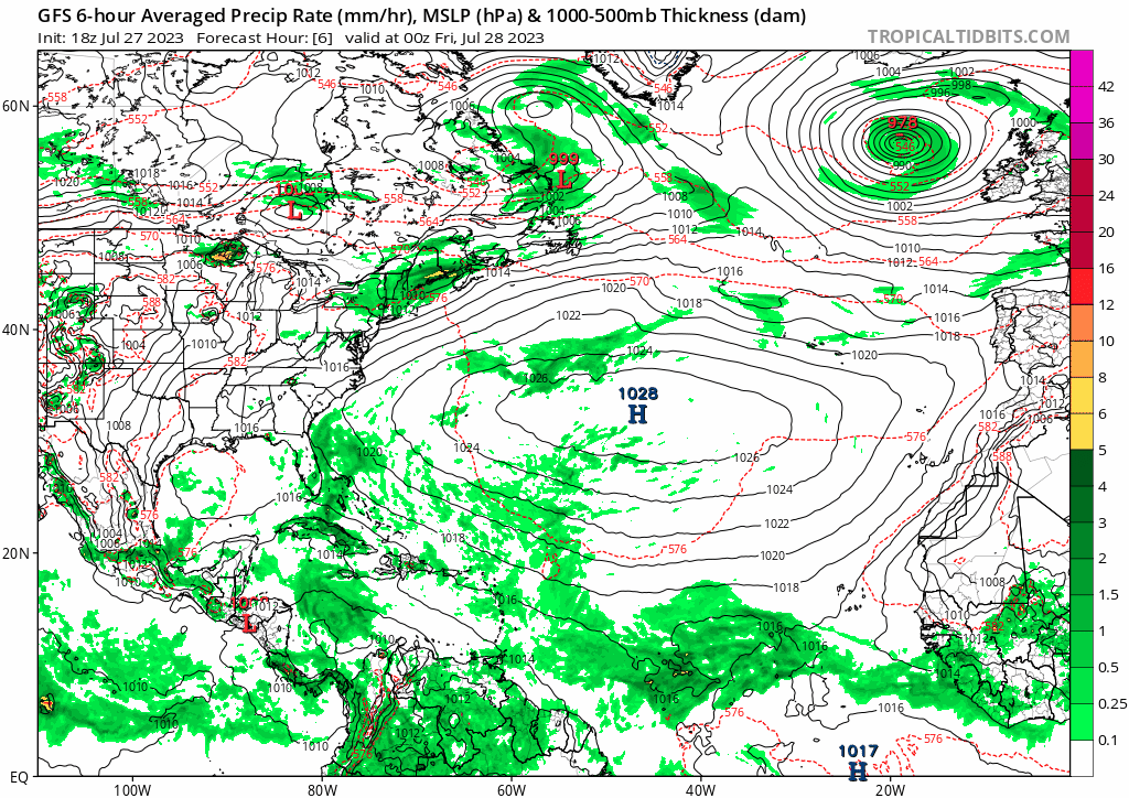

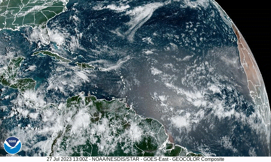
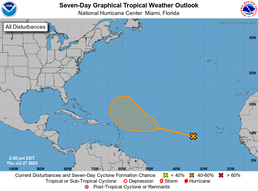
tropicwatch wrote:The high pressure over the Atlantic must be forecast to weaken for the NHC to have development shaded area north of the Islands. Right now though it looks like it will continue westward.


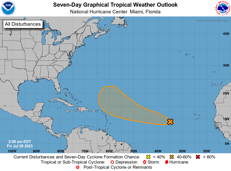
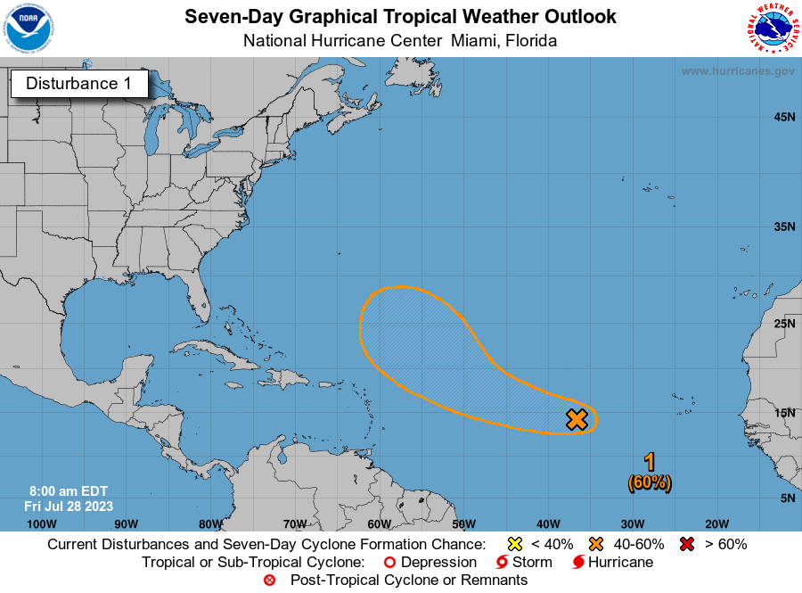
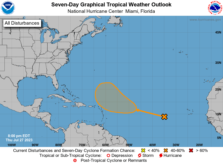
tropicwatch wrote:Surprised it is not tagged as an Invest yet.


tropicwatch wrote:Surprised it is not tagged as an Invest yet.

Users browsing this forum: cycloneye, REDHurricane, Stormybajan and 263 guests