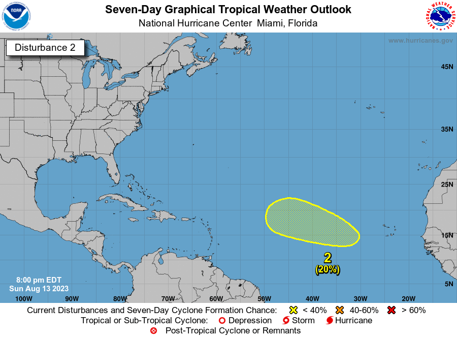
2. Central Tropical Atlantic:
Another area of low pressure could develop by the middle to latter
portion of this week over the east-central tropical Atlantic
several hundred miles southwest of the Cabo Verde Islands.
Some slow development of this system is also possible as it moves
west-northwestward over the central tropical Atlantic.
* Formation chance through 48 hours...low...near 0 percent.
* Formation chance through 7 days...low...20 percent.