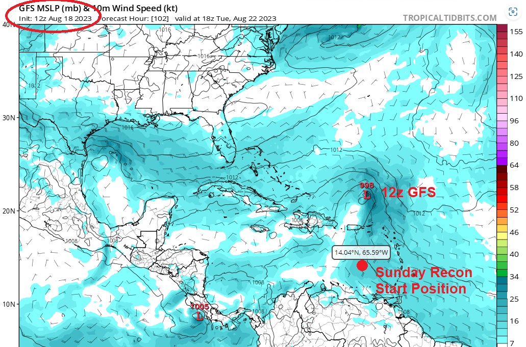
cycloneye wrote:Recon for Sunday.POSSIBLE LOW-LEVEL INVEST MISSION
OVER THE EASTERN CARIBBEAN NEAR 14.0N 65.5W FOR 20/1800Z.
TW seems to be moving a little faster than the 12z model runs and still W.
Moderator: S2k Moderators


cycloneye wrote:Recon for Sunday.POSSIBLE LOW-LEVEL INVEST MISSION
OVER THE EASTERN CARIBBEAN NEAR 14.0N 65.5W FOR 20/1800Z.
cycloneye wrote:Recon for Sunday.POSSIBLE LOW-LEVEL INVEST MISSION
OVER THE EASTERN CARIBBEAN NEAR 14.0N 65.5W FOR 20/1800Z.


Blown Away wrote:cycloneye wrote:Recon for Sunday.POSSIBLE LOW-LEVEL INVEST MISSION
OVER THE EASTERN CARIBBEAN NEAR 14.0N 65.5W FOR 20/1800Z.
[url]https://i.postimg.cc/x8kJsxmQ/60151644.gif [/url]
TW seems to be moving a little faster than the 12z model runs and still W.
Blown Away wrote:I think it's time to tag this Invest 90L??

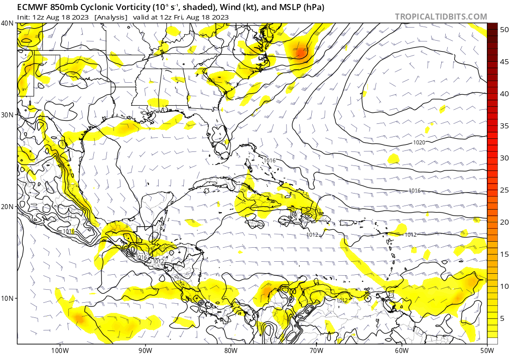

gatorcane wrote:Looks like the Euro has a much more realistic outcome now as strong troughiness dominates the Western Atlantic not to mention quite a bit of shear until it is out of the tropical latitudes. Now it is aligned more with the GFS and CMC:
https://i.postimg.cc/nL9K76hH/ec-fast-uv850-vort-watl-fh0-240.gif
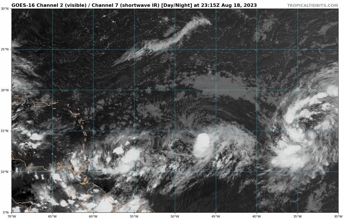

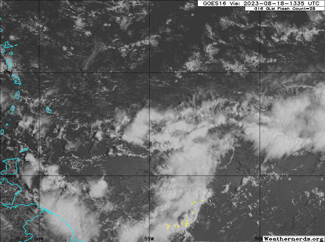
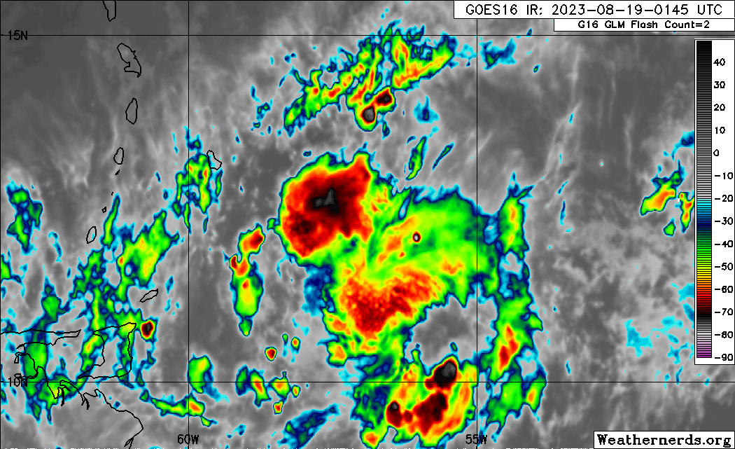
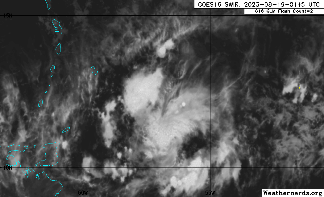
Blown Away wrote:[url]https://i.postimg.cc/XJc3chzc/goes16-vis-swir-catl.gif [/url]
Probably not much at the surface, but starting to get the look of consolidating.
At 8pm the NHC estimated the center @11N/54W, if there is a circulation center it’s farther west @11N/57W… JMHO

ScottNAtlanta wrote:Blown Away wrote:[url]https://i.postimg.cc/XJc3chzc/goes16-vis-swir-catl.gif [/url]
Probably not much at the surface, but starting to get the look of consolidating.
At 8pm the NHC estimated the center @11N/54W, if there is a circulation center it’s farther west @11N/57W… JMHO
We should be thankful for the dry air in the MDR...we would be in a world of trouble if it wasn't there


SouthDadeFish wrote:Things I don't understand:
1) Why this isn't an Invest.
2) Why the genesis odds are so low.
But I respect NHC's expertise. We'll see.
cycloneye wrote:SouthDadeFish wrote:Things I don't understand:
1) Why this isn't an Invest.
2) Why the genesis odds are so low.
But I respect NHC's expertise. We'll see.
And is close to the islands.
Users browsing this forum: StPeteMike, weatherSnoop and 112 guests

