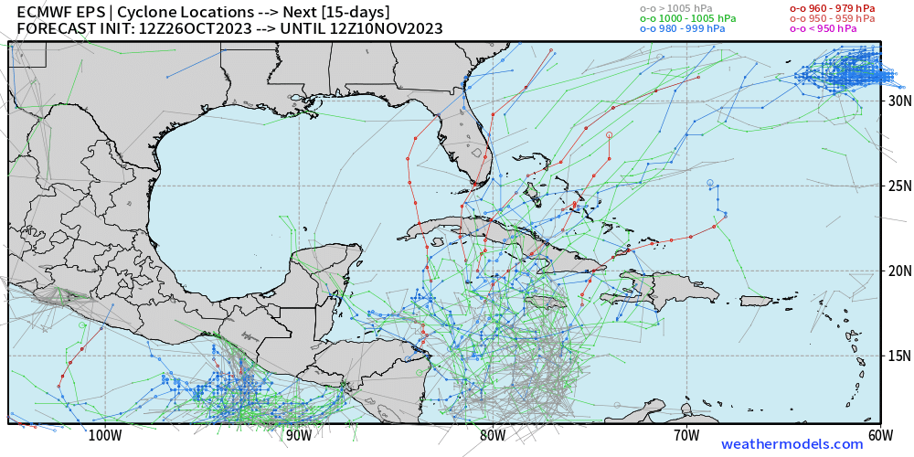
Western Caribbean Sea:
A broad area of low pressure is forecast to develop over the
southwestern Caribbean Sea during the next few days. Environmental
conditions could support some slow development of this system early
next week while it moves generally northward over western or central
portions of the basin.
* Formation chance through 48 hours...low...near 0 percent.
* Formation chance through 7 days...low...20 percent.
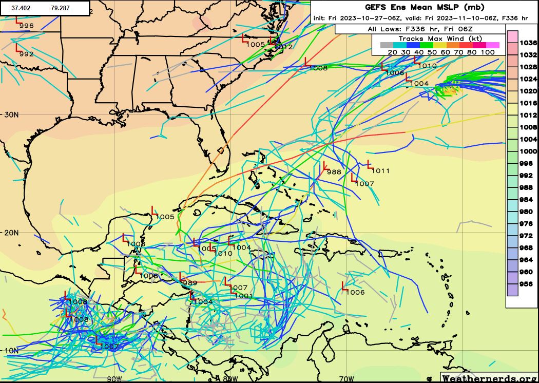