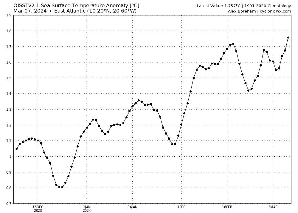
wxman57 wrote:I've often said that you could boil the water in the tropics and that wouldn't necessarily generate more hurricanes. Water temperature can lead to stronger hurricanes, given a favorable environment, but it won't make more hurricanes. That said, warm water combined with developing El Nino and a predicted +NAO may mean that the Caribbean may finally open up to long-tracked hurricanes moving through. Watch out in PR, Luis. Significantly increased risk to the islands of the northern Caribbean, Bahamas, and Florida. Also an increased risk all along the Gulf Coast and SE U.S. Coast through Virginia.
The threat is real folks take it seriously 3 months to go!