NotSparta wrote:Kingarabian wrote:NotSparta wrote:
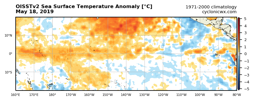
Yeah, it's pretty likely El Niño ends, at least for a point. Just isn't enough heat anymore, and after this WWB, next round of Niño forcing doesn't look to arrive until June.
I think the February WWB made the Niño too strong, too early, rather than a month later like in 2015, so -ve feedbacks kicked in, which began the decay of El Niño
We have the same problem again similar to March where the buoys and GODAS are showing different subsurface depictions.
Doesn't seem like that to me. In March they were multiple °C apart, but the current differences can be chalked up to resolution differences
It's almost a 3.5C swing with those PENTAD/GODAS showing -2C @ the surface and the buoys showing a suppressed thermocline with +1.5C in between.