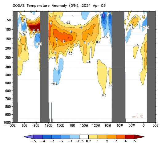
cycloneye wrote:Cool Neutral from September.
[url]https://twitter.com/climatesociety/status/1405590640096854020[url]
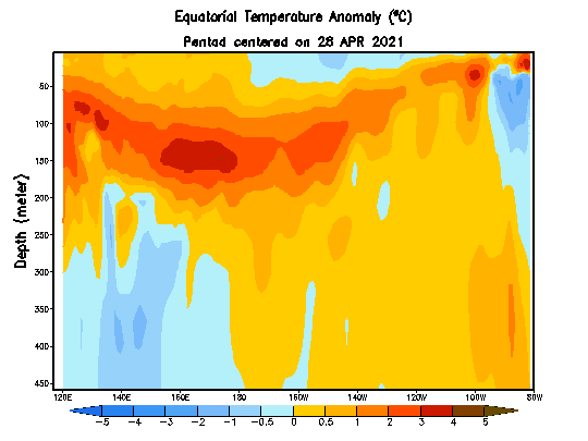
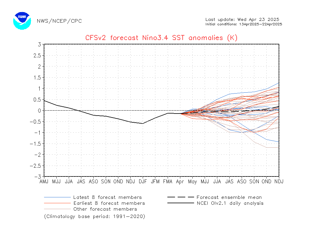
That consensus line is verifying pretty badly. Likely due to the NASA and the GEM_NEMO weighing it down. Nearly all Nino 3.4 measures are at 0.0C or higher.