#13674 Postby Dean_175 » Fri Nov 03, 2023 6:58 am
dexterlabio wrote:Wouldn't this help the chances of a second-year Niño?
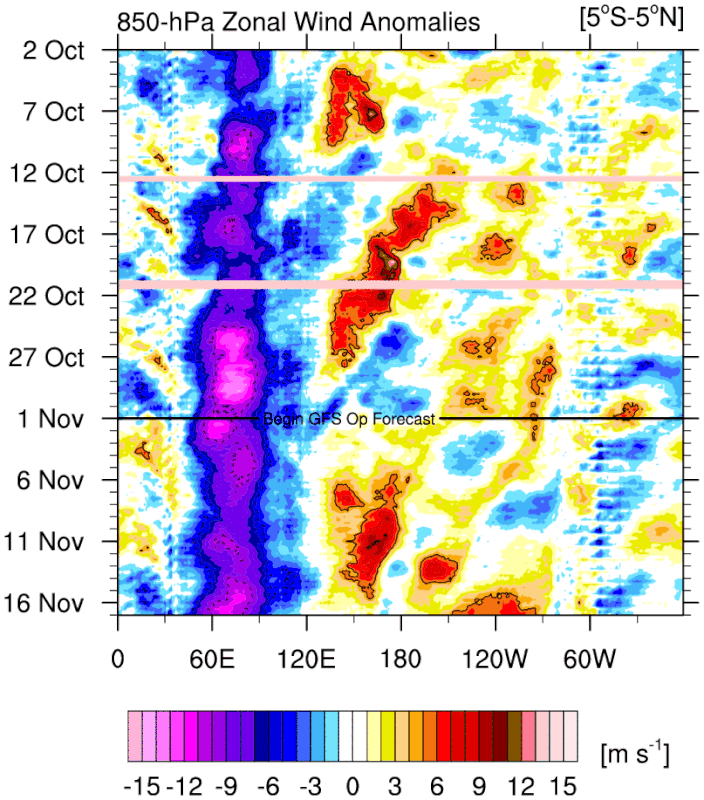
No, second year El Nino events are usually events that begin without much atmospheric coupling (like 2014) or begin late in the year like 1986 and therefore have abnormal coupling to the seasonal cycle. It will help push some more warm water east to boost the peak of this year but not likely to produce warm ENSO next year. There is decent model support for the creation of a subsurface cool pool that will spread eastward in 2024, possibly leading to La Nina, but almost certainly ending El Nino. Going by climatology, this event has been strong enough for long enough to produce negative feedback and the end of the event next year. Despite being a positive feedback coupled interaction, ENSO events are self limiting/are part of an oscillation and El Nino does not typically extend to two northern hemisphere winters. For example, while there was WWB activity in early 2016 and early 1998, both years evolved into La Nina due to changes in the distribution of Pacific equatorial ocean heat content. Since 1950, only one strong (>1.5C ONI) El Nino was followed by another El Nino (1957 was strong and 1958 was weak).
In short, a WWB now is just an indication the atmosphere is responding typically to an El Nino ocean.
Last edited by
Dean_175 on Fri Nov 03, 2023 7:28 am, edited 7 times in total.
4 likes
All posts by Dean_175 are NOT official forecasts and should not be used as such. They are just the opinion of the poster and may or may not be backed by sound meteorological data. They are NOT endorsed by any professional institution or storm2k.org. For official information, please refer to the NHC and NWS products.