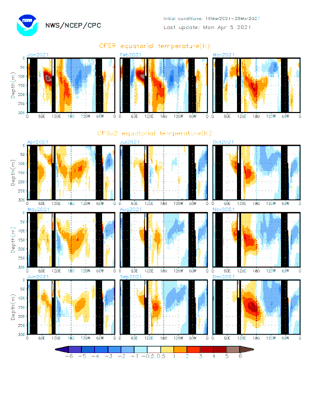
ENSO Updates (2007 thru 2023)

This is the general tropical discussion area. Anyone can take their shot at predicting a storms path.

Moderator: S2k Moderators

Forum rules

The posts in this forum are NOT official forecasts and should not be used as such. They are just the opinion of the poster and may or may not be backed by sound meteorological data. They are NOT endorsed by any professional institution or STORM2K. For official information, please refer to products from the National Hurricane Center and National Weather Service.

Help Support Storm2K
Message
Author
User avatar
aspen
Category 5
Category 5
Posts: 8057
Joined: Sat Oct 12, 2019 7:10 pm
Location: Connecticut, USA

Re: ENSO Updates

#11941 Postby aspen » Mon Apr 26, 2021 10:03 am

Category5Kaiju wrote:
euro6208 wrote:In summary, the WPAC will have a very active season no matter what the state of ENSO.


Even last year, the WPAC got 23 named storms; unless you have something go very wrong like in 2010 or 2017, the WPAC really does not "care" about the ENSO state; in fact, as seen in years like 2008, 2010, and 2020, even if conditions are unfavorable for the WPAC, there has only been like three or four documented years when no Cat 5 super typhoon was every generated.

+/-ENSO states do impact the frequency of powerful storms, the ratio of majors to total named storms, and the tracks and formation hotspots. For example, 2017 was a cool neutral and saw a lot of SCS slop with very few majors and no official Cat 5, while 2018 was a warm neutral/weak Niño with half a dozen long-tracking Cat 5s, four of which (Jebi, Mangkhut, Kong-Rey, and Yutu) have arguments for being 155-165 kt.

But Kaiju and euro are right, the WPac will likely produce something big even if it’s a Niña. Seems like a decent number of Niña years have this single ultra-intense Philippines storm — Zeb in 1998, Megi in 2010, and Goni in 2020.
2 likes   
Irene '11 Sandy '12 Hermine '16 5/15/2018 Derecho Fay '20 Isaias '20 Elsa '21 Henri '21 Ida '21

I am only a meteorology enthusiast who knows a decent amount about tropical cyclones. Look to the professional mets, the NHC, or your local weather office for the best information.

User avatar
Iceresistance
Category 5
Category 5
Posts: 8915
Age: 20
Joined: Sat Oct 10, 2020 9:45 am
Location: Tecumseh, OK/Norman, OK

Re: ENSO Updates

#11942 Postby Iceresistance » Mon Apr 26, 2021 10:10 am

aspen wrote:
Category5Kaiju wrote:
euro6208 wrote:In summary, the WPAC will have a very active season no matter what the state of ENSO.


Even last year, the WPAC got 23 named storms; unless you have something go very wrong like in 2010 or 2017, the WPAC really does not "care" about the ENSO state; in fact, as seen in years like 2008, 2010, and 2020, even if conditions are unfavorable for the WPAC, there has only been like three or four documented years when no Cat 5 super typhoon was every generated.

+/-ENSO states do impact the frequency of powerful storms, the ratio of majors to total named storms, and the tracks and formation hotspots. For example, 2017 was a cool neutral and saw a lot of SCS slop with very few majors and no official Cat 5, while 2018 was a warm neutral/weak Niño with half a dozen long-tracking Cat 5s, four of which (Jebi, Mangkhut, Kong-Rey, and Yutu) have arguments for being 155-165 kt.

But Kaiju and euro are right, the WPac will likely produce something big even if it’s a Niña. Seems like a decent number of Niña years have this single ultra-intense Philippines storm — Zeb in 1998, Megi in 2010, and Goni in 2020.


Surigae in 2021 meets the criteria for Very Intense Philippine Typhoon during a La Niña?

Also, was 2019 a La Niña year?
0 likes   
Bill 2015 & Beta 2020

Winter 2020-2021 :cold:

All observations are in Tecumseh, OK unless otherwise noted.

Winter posts are focused mainly for Oklahoma & Texas.

Take any of my forecasts with a grain of salt, refer to the NWS, SPC, and NHC for official information

Never say Never with weather! Because ANYTHING is possible!

User avatar
Kingarabian
S2K Supporter
S2K Supporter
Posts: 15435
Joined: Sat Aug 08, 2009 3:06 am
Location: Honolulu, Hawaii

Re: ENSO Updates

#11943 Postby Kingarabian » Mon Apr 26, 2021 10:12 am

aspen wrote:
Category5Kaiju wrote:
euro6208 wrote:In summary, the WPAC will have a very active season no matter what the state of ENSO.


Even last year, the WPAC got 23 named storms; unless you have something go very wrong like in 2010 or 2017, the WPAC really does not "care" about the ENSO state; in fact, as seen in years like 2008, 2010, and 2020, even if conditions are unfavorable for the WPAC, there has only been like three or four documented years when no Cat 5 super typhoon was every generated.

+/-ENSO states do impact the frequency of powerful storms, the ratio of majors to total named storms, and the tracks and formation hotspots. For example, 2017 was a cool neutral and saw a lot of SCS slop with very few majors and no official Cat 5, while 2018 was a warm neutral/weak Niño with half a dozen long-tracking Cat 5s, four of which (Jebi, Mangkhut, Kong-Rey, and Yutu) have arguments for being 155-165 kt.

But Kaiju and euro are right, the WPac will likely produce something big even if it’s a Niña. Seems like a decent number of Niña years have this single ultra-intense Philippines storm — Zeb in 1998, Megi in 2010, and Goni in 2020.


The WPAC already produced something big 8-) . There is a correlation for years that have high ACE prior to May 1 and +ENSO.
0 likes   
RIP Kobe Bryant

User avatar
aspen
Category 5
Category 5
Posts: 8057
Joined: Sat Oct 12, 2019 7:10 pm
Location: Connecticut, USA

Re: ENSO Updates

#11944 Postby aspen » Mon Apr 26, 2021 10:13 am

Iceresistance wrote:
aspen wrote:
Category5Kaiju wrote:
Even last year, the WPAC got 23 named storms; unless you have something go very wrong like in 2010 or 2017, the WPAC really does not "care" about the ENSO state; in fact, as seen in years like 2008, 2010, and 2020, even if conditions are unfavorable for the WPAC, there has only been like three or four documented years when no Cat 5 super typhoon was every generated.

+/-ENSO states do impact the frequency of powerful storms, the ratio of majors to total named storms, and the tracks and formation hotspots. For example, 2017 was a cool neutral and saw a lot of SCS slop with very few majors and no official Cat 5, while 2018 was a warm neutral/weak Niño with half a dozen long-tracking Cat 5s, four of which (Jebi, Mangkhut, Kong-Rey, and Yutu) have arguments for being 155-165 kt.

But Kaiju and euro are right, the WPac will likely produce something big even if it’s a Niña. Seems like a decent number of Niña years have this single ultra-intense Philippines storm — Zeb in 1998, Megi in 2010, and Goni in 2020.


Surigae in 2021 meets the criteria for Very Intense Philippine Typhoon during a La Niña?

Also, was 2019 a La Niña year?

2019 was also warm neutral/weak Niño. Development was generally east-based instead of west-based like Niña/cool years. Hagibis and Bualoi were long-tracking Cat 5s, and Halong remained quite east for its entire life.
0 likes   
Irene '11 Sandy '12 Hermine '16 5/15/2018 Derecho Fay '20 Isaias '20 Elsa '21 Henri '21 Ida '21

I am only a meteorology enthusiast who knows a decent amount about tropical cyclones. Look to the professional mets, the NHC, or your local weather office for the best information.

User avatar
Iceresistance
Category 5
Category 5
Posts: 8915
Age: 20
Joined: Sat Oct 10, 2020 9:45 am
Location: Tecumseh, OK/Norman, OK

Re: ENSO Updates

#11945 Postby Iceresistance » Mon Apr 26, 2021 10:17 am

aspen wrote:
Iceresistance wrote:
aspen wrote:+/-ENSO states do impact the frequency of powerful storms, the ratio of majors to total named storms, and the tracks and formation hotspots. For example, 2017 was a cool neutral and saw a lot of SCS slop with very few majors and no official Cat 5, while 2018 was a warm neutral/weak Niño with half a dozen long-tracking Cat 5s, four of which (Jebi, Mangkhut, Kong-Rey, and Yutu) have arguments for being 155-165 kt.

But Kaiju and euro are right, the WPac will likely produce something big even if it’s a Niña. Seems like a decent number of Niña years have this single ultra-intense Philippines storm — Zeb in 1998, Megi in 2010, and Goni in 2020.


Surigae in 2021 meets the criteria for Very Intense Philippine Typhoon during a La Niña?

Also, was 2019 a La Niña year?

2019 was also warm neutral/weak Niño. Development was generally east-based instead of west-based like Niña/cool years. Hagibis and Bualoi were long-tracking Cat 5s, and Halong remained quite east for its entire life.


2019 seemed like a La Niña because of the twin Cat 5s in the Atlantic (Dorian (The Defying Dorian that will never Die! :eek: ) & Lorenzo)
1 likes   
Bill 2015 & Beta 2020

Winter 2020-2021 :cold:

All observations are in Tecumseh, OK unless otherwise noted.

Winter posts are focused mainly for Oklahoma & Texas.

Take any of my forecasts with a grain of salt, refer to the NWS, SPC, and NHC for official information

Never say Never with weather! Because ANYTHING is possible!

User avatar
Kingarabian
S2K Supporter
S2K Supporter
Posts: 15435
Joined: Sat Aug 08, 2009 3:06 am
Location: Honolulu, Hawaii

Re: ENSO Updates

#11946 Postby Kingarabian » Mon Apr 26, 2021 10:19 am

Category5Kaiju wrote:https://www.cpc.ncep.noaa.gov/products/CFSv2/imagesInd3/TEQMon.gif

Also by the way, this is what the CFV2 is predicting in terms of equatorial sst anomalies.

Compared to the beginning of the month, this CFS sub surface graphic shows the model correcting towards a warmer subsurface through JJA:
Image
1 likes   
RIP Kobe Bryant

User avatar
Category5Kaiju
Category 5
Category 5
Posts: 3359
Age: 22
Joined: Thu Dec 24, 2020 12:45 pm
Location: Seattle

Re: ENSO Updates

#11947 Postby Category5Kaiju » Mon Apr 26, 2021 11:46 am

Iceresistance wrote:
aspen wrote:
Iceresistance wrote:
Surigae in 2021 meets the criteria for Very Intense Philippine Typhoon during a La Niña?

Also, was 2019 a La Niña year?

2019 was also warm neutral/weak Niño. Development was generally east-based instead of west-based like Niña/cool years. Hagibis and Bualoi were long-tracking Cat 5s, and Halong remained quite east for its entire life.


2019 seemed like a La Niña because of the twin Cat 5s in the Atlantic (Dorian (The Defying Dorian that will never Die! :eek: ) & Lorenzo)


Interestingly, had Dorian not happened (and to a certain extent Lorenzo), 2019 really would not have been a memorable season. Interestingly as well, seasons like 1969, 1992, and 2019 that occurred right after the death of an El Nino each featured a very nasty Category 5 hurricane.
0 likes   
Unless explicitly stated, all information covered in my posts is based on my opinions and observations. Please refer to a professional meteorologist or an accredited weather research agency otherwise, especially if serious decisions must be made in the event of a potentially life-threatening tropical storm or hurricane.

Shell Mound
Category 5
Category 5
Posts: 2434
Age: 31
Joined: Thu Sep 07, 2017 3:39 pm
Location: St. Petersburg, FL → Scandinavia

Re: ENSO Updates

#11948 Postby Shell Mound » Mon Apr 26, 2021 11:59 am

Category5Kaiju wrote:
Iceresistance wrote:
aspen wrote:2019 was also warm neutral/weak Niño. Development was generally east-based instead of west-based like Niña/cool years. Hagibis and Bualoi were long-tracking Cat 5s, and Halong remained quite east for its entire life.


2019 seemed like a La Niña because of the twin Cat 5s in the Atlantic (Dorian (The Defying Dorian that will never Die! :eek: ) & Lorenzo)


Interestingly, had Dorian not happened (and to a certain extent Lorenzo), 2019 really would not have been a memorable season. Interestingly as well, seasons like 1969, 1992, and 2019 that occurred right after the death of an El Nino each featured a very nasty Category 5 hurricane.

1969, like 2019, was actually a bookended, or back-to-back, Niño. (2018 transitioned directly from La Niña to El Niño, but still featured significant impacts, due to the Niño being “Modoki.”) 1992 transitioned directly from El Niño to cool neutral ENSO. As far as 2021 is concerned, perhaps I am being overly aggressive in regard to the impact of the submarine warm pool, given that a stronger + signature at the subsurface may still be needed to induce full transition to warm neutral or + ENSO by ASO. But I think some people are still underestimating the potential for either warm neutral ENSO or weak Niño conditions this year. We shall see.
0 likes   
CVW / MiamiensisWx / Shell Mound
The posts in this forum are NOT official forecasts and should not be used as such. They are just the opinion of the poster and may or may not be backed by sound meteorological data. They are NOT endorsed by any professional institution or STORM2K. For official information, please refer to products from the NHC and NWS.

User avatar
Category5Kaiju
Category 5
Category 5
Posts: 3359
Age: 22
Joined: Thu Dec 24, 2020 12:45 pm
Location: Seattle

Re: ENSO Updates

#11949 Postby Category5Kaiju » Mon Apr 26, 2021 12:28 pm

Shell Mound wrote:
Category5Kaiju wrote:
Iceresistance wrote:
2019 seemed like a La Niña because of the twin Cat 5s in the Atlantic (Dorian (The Defying Dorian that will never Die! :eek: ) & Lorenzo)


Interestingly, had Dorian not happened (and to a certain extent Lorenzo), 2019 really would not have been a memorable season. Interestingly as well, seasons like 1969, 1992, and 2019 that occurred right after the death of an El Nino each featured a very nasty Category 5 hurricane.

1969, like 2019, was actually a bookended, or back-to-back, Niño. (2018 transitioned directly from La Niña to El Niño, but still featured significant impacts, due to the Niño being “Modoki.”) 1992 transitioned directly from El Niño to cool neutral ENSO. As far as 2021 is concerned, perhaps I am being overly aggressive in regard to the impact of the submarine warm pool, given that a stronger + signature at the subsurface may still be needed to induce full transition to warm neutral or + ENSO by ASO. But I think some people are still underestimating the potential for either warm neutral ENSO or weak Niño conditions this year. We shall see.


So theoretically speaking if this year were to be a weak Nino or warm neutral does that mean 2022 would have a greater chance of being another El Nino year or La Nina year or is there like no way to really tell or predict in advance?
0 likes   
Unless explicitly stated, all information covered in my posts is based on my opinions and observations. Please refer to a professional meteorologist or an accredited weather research agency otherwise, especially if serious decisions must be made in the event of a potentially life-threatening tropical storm or hurricane.

User avatar
Iceresistance
Category 5
Category 5
Posts: 8915
Age: 20
Joined: Sat Oct 10, 2020 9:45 am
Location: Tecumseh, OK/Norman, OK

Re: ENSO Updates

#11950 Postby Iceresistance » Mon Apr 26, 2021 12:32 pm

Category5Kaiju wrote:
Shell Mound wrote:
Category5Kaiju wrote:
Interestingly, had Dorian not happened (and to a certain extent Lorenzo), 2019 really would not have been a memorable season. Interestingly as well, seasons like 1969, 1992, and 2019 that occurred right after the death of an El Nino each featured a very nasty Category 5 hurricane.

1969, like 2019, was actually a bookended, or back-to-back, Niño. (2018 transitioned directly from La Niña to El Niño, but still featured significant impacts, due to the Niño being “Modoki.”) 1992 transitioned directly from El Niño to cool neutral ENSO. As far as 2021 is concerned, perhaps I am being overly aggressive in regard to the impact of the submarine warm pool, given that a stronger + signature at the subsurface may still be needed to induce full transition to warm neutral or + ENSO by ASO. But I think some people are still underestimating the potential for either warm neutral ENSO or weak Niño conditions this year. We shall see.


So theoretically speaking if this year were to be a weak Nino or warm neutral does that mean 2022 would have a greater chance of being another El Nino year or La Nina year or is there like no way to really tell or predict in advance?

I'm thinking that 2022 is likely an El Nino . . .
0 likes   
Bill 2015 & Beta 2020

Winter 2020-2021 :cold:

All observations are in Tecumseh, OK unless otherwise noted.

Winter posts are focused mainly for Oklahoma & Texas.

Take any of my forecasts with a grain of salt, refer to the NWS, SPC, and NHC for official information

Never say Never with weather! Because ANYTHING is possible!

User avatar
Iceresistance
Category 5
Category 5
Posts: 8915
Age: 20
Joined: Sat Oct 10, 2020 9:45 am
Location: Tecumseh, OK/Norman, OK

Re: ENSO Updates

#11951 Postby Iceresistance » Mon Apr 26, 2021 12:32 pm

Category5Kaiju wrote:
Shell Mound wrote:
Category5Kaiju wrote:
Interestingly, had Dorian not happened (and to a certain extent Lorenzo), 2019 really would not have been a memorable season. Interestingly as well, seasons like 1969, 1992, and 2019 that occurred right after the death of an El Nino each featured a very nasty Category 5 hurricane.

1969, like 2019, was actually a bookended, or back-to-back, Niño. (2018 transitioned directly from La Niña to El Niño, but still featured significant impacts, due to the Niño being “Modoki.”) 1992 transitioned directly from El Niño to cool neutral ENSO. As far as 2021 is concerned, perhaps I am being overly aggressive in regard to the impact of the submarine warm pool, given that a stronger + signature at the subsurface may still be needed to induce full transition to warm neutral or + ENSO by ASO. But I think some people are still underestimating the potential for either warm neutral ENSO or weak Niño conditions this year. We shall see.


So theoretically speaking if this year were to be a weak Nino or warm neutral does that mean 2022 would have a greater chance of being another El Nino year or La Nina year or is there like no way to really tell or predict in advance?

I'm thinking that 2022 is likely an El Nino . . .
0 likes   
Bill 2015 & Beta 2020

Winter 2020-2021 :cold:

All observations are in Tecumseh, OK unless otherwise noted.

Winter posts are focused mainly for Oklahoma & Texas.

Take any of my forecasts with a grain of salt, refer to the NWS, SPC, and NHC for official information

Never say Never with weather! Because ANYTHING is possible!

User avatar
DorkyMcDorkface
Category 2
Category 2
Posts: 698
Age: 26
Joined: Mon Sep 30, 2019 1:32 pm
Location: Mid-Atlantic

Re: ENSO Updates

#11952 Postby DorkyMcDorkface » Tue Apr 27, 2021 3:05 pm

New Bureau of Meteorology (BOM) plume has flipped towards the cooler side of neutral by JJA.
Image

The April 10th mean was above 0C (warm neutral) by the summer trimonthly period.
Image
4 likes   
Floyd 1999 | Isabel 2003 | Hanna 2008 | Irene 2011 | Sandy 2012 | Isaias 2020

User avatar
Category5Kaiju
Category 5
Category 5
Posts: 3359
Age: 22
Joined: Thu Dec 24, 2020 12:45 pm
Location: Seattle

Re: ENSO Updates

#11953 Postby Category5Kaiju » Tue Apr 27, 2021 4:35 pm

DorkyMcDorkface wrote:New Bureau of Meteorology (BOM) plume has flipped towards the cooler side of neutral by JJA.
https://i.ibb.co/FzPQTXJ/sst-Outlooks-nino34-hr-1.png

The April 10th mean was above 0C (warm neutral) by the summer trimonthly period.
https://i.ibb.co/FsjDfVc/sst-Outlooks-nino34-hr-2.png


Wait isn't 0.5 C the threshold for a Nino or Nina?
0 likes   
Unless explicitly stated, all information covered in my posts is based on my opinions and observations. Please refer to a professional meteorologist or an accredited weather research agency otherwise, especially if serious decisions must be made in the event of a potentially life-threatening tropical storm or hurricane.

User avatar
DorkyMcDorkface
Category 2
Category 2
Posts: 698
Age: 26
Joined: Mon Sep 30, 2019 1:32 pm
Location: Mid-Atlantic

Re: ENSO Updates

#11954 Postby DorkyMcDorkface » Tue Apr 27, 2021 4:41 pm

Category5Kaiju wrote:
DorkyMcDorkface wrote:New Bureau of Meteorology (BOM) plume has flipped towards the cooler side of neutral by JJA.
https://i.ibb.co/FzPQTXJ/sst-Outlooks-nino34-hr-1.png

The April 10th mean was above 0C (warm neutral) by the summer trimonthly period.
https://i.ibb.co/FsjDfVc/sst-Outlooks-nino34-hr-2.png


Wait isn't 0.5 C the threshold for a Nino or Nina?

BoM's threshold for El Niño (La Niña) is higher (lower) than the CPC's. I personally am not the biggest fan of it either but eh.
1 likes   
Floyd 1999 | Isabel 2003 | Hanna 2008 | Irene 2011 | Sandy 2012 | Isaias 2020

User avatar
Kingarabian
S2K Supporter
S2K Supporter
Posts: 15435
Joined: Sat Aug 08, 2009 3:06 am
Location: Honolulu, Hawaii

Re: ENSO Updates

#11955 Postby Kingarabian » Tue Apr 27, 2021 6:08 pm

DorkyMcDorkface wrote:New Bureau of Meteorology (BOM) plume has flipped towards the cooler side of neutral by JJA.
[url]https://i.ibb.co/FzPQTXJ/sst-Outlooks-nino34-hr-1.png[url]

The April 10th mean was above 0C (warm neutral) by the summer trimonthly period.
[url]https://i.ibb.co/FsjDfVc/sst-Outlooks-nino34-hr-2.png[url]

Very similar to the CFS.
0 likes   
RIP Kobe Bryant

User avatar
GrayLancer18
Tropical Depression
Tropical Depression
Posts: 88
Joined: Mon Sep 02, 2019 2:45 pm
Contact:

Re: ENSO Updates

#11956 Postby GrayLancer18 » Wed Apr 28, 2021 11:57 am

0 likes   
Hugo (1989) Hortense (1996) Georges (1998) Jeanne (2004) Irene (2011) Maria (2017)

I am NOT a professional meteorologist nor weather professional. Opinions are my own.
Consult with NHC and NOAA for official forecasts and advisories.

User avatar
Kingarabian
S2K Supporter
S2K Supporter
Posts: 15435
Joined: Sat Aug 08, 2009 3:06 am
Location: Honolulu, Hawaii

Re: ENSO Updates

#11957 Postby Kingarabian » Wed Apr 28, 2021 3:12 pm

Here is a comparison of the 850mb wind anomalies 5 day average ending on April 28 2021, 2011, 2008, and 2000:
Image

La Nina forcing was much more prevalent over the dateline in those years compared to 2021. And it wasn't just the last week of April. The entire month of April for those years had above average trades blowing across the CPAC compared to 2021.
https://www.pmel.noaa.gov/tao/drupal/disdel/
1 likes   
RIP Kobe Bryant

User avatar
AnnularCane
S2K Supporter
S2K Supporter
Posts: 2635
Joined: Thu Jun 08, 2006 9:18 am
Location: Wytheville, VA

Re: ENSO Updates

#11958 Postby AnnularCane » Wed Apr 28, 2021 3:32 pm

Pardon my ignorance, but what exactly is a Modoki La Nina and what does it mean for the Atlantic? I know about the Modoki El Nino but don't know much about the La Nina.
0 likes   
"But it never rained rain. It never snowed snow. And it never blew just wind. It rained things like soup and juice. It snowed mashed potatoes and green peas. And sometimes the wind blew in storms of hamburgers." -- Judi Barrett, Cloudy with a Chance of Meatballs

User avatar
DorkyMcDorkface
Category 2
Category 2
Posts: 698
Age: 26
Joined: Mon Sep 30, 2019 1:32 pm
Location: Mid-Atlantic

Re: ENSO Updates

#11959 Postby DorkyMcDorkface » Wed Apr 28, 2021 3:58 pm

AnnularCane wrote:Pardon my ignorance, but what exactly is a Modoki La Nina and what does it mean for the Atlantic? I know about the Modoki El Nino but don't know much about the La Nina.

La Niña Modoki is just a Niña with the coolest anomalies concentrated further west in the CPAC, just like how El Niño Modoki is the opposite with the warmest anomalies concentrated over there.

Some recent La Niña Modoki years include:

2008
Image
2011
Image
2016
Image
5 likes   
Floyd 1999 | Isabel 2003 | Hanna 2008 | Irene 2011 | Sandy 2012 | Isaias 2020

User avatar
DorkyMcDorkface
Category 2
Category 2
Posts: 698
Age: 26
Joined: Mon Sep 30, 2019 1:32 pm
Location: Mid-Atlantic

Re: ENSO Updates

#11960 Postby DorkyMcDorkface » Wed Apr 28, 2021 4:06 pm

Kingarabian wrote:Here is a comparison of the 850mb wind anomalies 5 day average ending on April 28 2021, 2011, 2008, and 2000:
https://i.imgur.com/05qYSbh.png

La Nina forcing was much more prevalent over the dateline in those years compared to 2021. And it wasn't just the last week of April. The entire month of April for those years had above average trades blowing across the CPAC compared to 2021.
https://www.pmel.noaa.gov/tao/drupal/disdel/

Wondering if the strength of those ENSO events played a role in the persistence of the Niña forcing into the spring? 1999-2000, 2007-08 and 2010-11 were each solidly in the "strong" category (each dipped below -1.5 over the winter) while 2020-21 was more of a moderate event. Could hold little to no relevance in actuality but I was thinking about whether or not it might.
1 likes   
Floyd 1999 | Isabel 2003 | Hanna 2008 | Irene 2011 | Sandy 2012 | Isaias 2020


Return to “Talkin' Tropics”

Who is online

Users browsing this forum: duilaslol, Google Adsense [Bot], HurricaneFan and 222 guests