Strong Wave with low in Eastern Atlantic

This is the general tropical discussion area. Anyone can take their shot at predicting a storms path.

Moderator: S2k Moderators

Forum rules

The posts in this forum are NOT official forecasts and should not be used as such. They are just the opinion of the poster and may or may not be backed by sound meteorological data. They are NOT endorsed by any professional institution or STORM2K. For official information, please refer to products from the National Hurricane Center and National Weather Service.

Help Support Storm2K
Message
Author
User avatar
Meso
Category 5
Category 5
Posts: 1609
Age: 38
Joined: Mon Aug 09, 2004 12:14 pm
Location: South Africa
Contact:

Strong Wave with low in Eastern Atlantic

#1 Postby Meso » Mon Sep 03, 2007 12:38 am

60 More hours or so till the tropical wave which has been represented for ages on the GFS emerges off the coast of Africa.
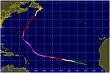
I`m really thinking this is going to develop just from the number of models latching onto it and due to the persistence.So one can use this thread for the model runs since they aren't long term anymore,Sat imagery of the wave and other C.Verdes conditions.

Image
GFS 102 Hours

Image
NOGAPS 132 Hours

Image
UKMET 144 Hours

Image
CMC 144 Hours

Image
MM5 114 Hours

Image
EURO 192 Hours

So every model shows a low pressure,the EURO being the most conservative as usual,but still showing a low pressure with winds associated.

Image
Image will update as automatically
0 likes   

User avatar
Stephanie
S2K Supporter
S2K Supporter
Posts: 23843
Age: 62
Joined: Thu Feb 06, 2003 9:53 am
Location: Glassboro, NJ

Re: Wave to move off Africa This Week

#2 Postby Stephanie » Mon Sep 03, 2007 10:11 am

WHOA!!

What the heck is the CMC showing at 144 hrs off the Carolina coast??? :eek:
0 likes   

User avatar
Meso
Category 5
Category 5
Posts: 1609
Age: 38
Joined: Mon Aug 09, 2004 12:14 pm
Location: South Africa
Contact:

#3 Postby Meso » Mon Sep 03, 2007 10:18 am

Heh,yeah.. It's been rather on the intense side of that system.Wouldn't be surprised to see it develop,but probably not THAT deep.

And as for this wave,the new GFS will be coming out in about 10 minutes,so can see what it's showing this time.


http://www.nrlmry.navy.mil/sat-bin/disp ... C_SCALE=15
Large Sat Image
0 likes   

User avatar
Stephanie
S2K Supporter
S2K Supporter
Posts: 23843
Age: 62
Joined: Thu Feb 06, 2003 9:53 am
Location: Glassboro, NJ

Re: Wave to move off Africa This Week

#4 Postby Stephanie » Mon Sep 03, 2007 10:22 am

That's a pretty elongated area of clouds coming off the coast.
0 likes   

User avatar
Meso
Category 5
Category 5
Posts: 1609
Age: 38
Joined: Mon Aug 09, 2004 12:14 pm
Location: South Africa
Contact:

#5 Postby Meso » Mon Sep 03, 2007 10:24 am

Yeah,some models (UKMET,CMC,MM5) actually develop that wave too.Quite aggressively too
0 likes   

User avatar
Meso
Category 5
Category 5
Posts: 1609
Age: 38
Joined: Mon Aug 09, 2004 12:14 pm
Location: South Africa
Contact:

#6 Postby Meso » Mon Sep 03, 2007 10:45 am

Image
The 12z GFS showing the low moving off in 36 hours
0 likes   

User avatar
punkyg
Category 2
Category 2
Posts: 770
Joined: Mon Apr 23, 2007 7:37 pm
Location: sanford florida

#7 Postby punkyg » Mon Sep 03, 2007 10:48 am

So when do the models develop this wave?
right when it comes off the coast.
0 likes   

User avatar
Meso
Category 5
Category 5
Posts: 1609
Age: 38
Joined: Mon Aug 09, 2004 12:14 pm
Location: South Africa
Contact:

#8 Postby Meso » Mon Sep 03, 2007 11:13 am

Pretty much within a day after coming off the coast.


Image

The GFS still showing development
0 likes   

User avatar
Extremeweatherguy
Category 5
Category 5
Posts: 11095
Joined: Mon Oct 10, 2005 8:13 pm
Location: Florida

#9 Postby Extremeweatherguy » Mon Sep 03, 2007 11:24 am

looks pretty impressive: http://www.nco.ncep.noaa.gov/pmb/nwprod ... n_144l.gif

With lots of run-to-run consistancy, and agreement from other models, I believe that this has a legitimate chance at actually developing.
0 likes   

User avatar
punkyg
Category 2
Category 2
Posts: 770
Joined: Mon Apr 23, 2007 7:37 pm
Location: sanford florida

#10 Postby punkyg » Mon Sep 03, 2007 12:02 pm

http://cimss.ssec.wisc.edu/tropic/real- ... rmet7n.GIF
Out of this picture can you tell me which wave the models are developing.
0 likes   

User avatar
Meso
Category 5
Category 5
Posts: 1609
Age: 38
Joined: Mon Aug 09, 2004 12:14 pm
Location: South Africa
Contact:

#11 Postby Meso » Mon Sep 03, 2007 12:06 pm

I think it's the one at 5 degrees,though it's still got a way to go,so another may create more convection.Give it another 24 hours or so and one should be able to tell,but I do think it's the one at 5 degrees.And some models develop the one just off the coast too.
0 likes   

User avatar
Meso
Category 5
Category 5
Posts: 1609
Age: 38
Joined: Mon Aug 09, 2004 12:14 pm
Location: South Africa
Contact:

#12 Postby Meso » Mon Sep 03, 2007 12:40 pm

Image


12z CMC following the GFS again,really quick deepening as it moves off the coast
0 likes   

User avatar
BigA
Professional-Met
Professional-Met
Posts: 1317
Joined: Sun Jul 24, 2005 10:56 pm

Re: Wave to move off Africa This Week

#13 Postby BigA » Mon Sep 03, 2007 3:47 pm

It seems like with solid model consistancy, and the fact that we are within a week of the peak of hurricane season (and the Cape Verde season) there should be a decent shot of something forming in the next 3-5 days off Africa. I have a gut feeling, and its only a gut feeling, that this could be the first storm that really wheels around the high pressure to an extent, rather than being forced under it like Dean and Felix.
0 likes   

User avatar
Meso
Category 5
Category 5
Posts: 1609
Age: 38
Joined: Mon Aug 09, 2004 12:14 pm
Location: South Africa
Contact:

#14 Postby Meso » Mon Sep 03, 2007 5:23 pm

http://www.nco.ncep.noaa.gov/pmb/nwprod ... n_144s.gif
GFS not rapidly deepening the system this run.But fluctuations between runs are to be expected
0 likes   

User avatar
Stephanie
S2K Supporter
S2K Supporter
Posts: 23843
Age: 62
Joined: Thu Feb 06, 2003 9:53 am
Location: Glassboro, NJ

Re: Wave to move off Africa This Week

#15 Postby Stephanie » Mon Sep 03, 2007 6:57 pm

I still can't take my eye off of that thing off the East Coast. :eek:

There's a lot of consistency with the models it seems like with this next wave.
0 likes   

User avatar
fci
S2K Supporter
S2K Supporter
Posts: 3324
Joined: Tue Sep 14, 2004 10:29 am
Location: Lake Worth, FL

#16 Postby fci » Mon Sep 03, 2007 8:42 pm

I am glad that the CMC has been the "psycho" model this year since it is FRIGHTENING what it shows;
99L- a monster storm off, or right near the NC/Va coast moving towards NJ and Long Island.
A pretty deep looking storm off of Africa.

Lets remember that it showed a Hurricane here in SE FL on 8/23 though.....
0 likes   

User avatar
Meso
Category 5
Category 5
Posts: 1609
Age: 38
Joined: Mon Aug 09, 2004 12:14 pm
Location: South Africa
Contact:

#17 Postby Meso » Tue Sep 04, 2007 3:47 am

Image
The EURO once again showing a low pressure moving off with winds associated with it

http://moe.met.fsu.edu/tcgengifs/cmc/20 ... /slp24.png
00z CMC still showing it as well.Deepening it quickly.

http://moe.met.fsu.edu/tcgengifs/mm5fsu ... /slp20.png
MM5 also showing it still.

http://moe.met.fsu.edu/tcgengifs/ngp/20 ... /slp21.png
NOGAPS also showing a closed low

http://www.nco.ncep.noaa.gov/pmb/nwprod ... n_168s.gif
GFS also still showing it

http://moe.met.fsu.edu/tcgengifs/ukm/20 ... /slp24.png
UKMET too.

I think that's every model showing development of this wave that's going to emerge.
0 likes   

User avatar
Meso
Category 5
Category 5
Posts: 1609
Age: 38
Joined: Mon Aug 09, 2004 12:14 pm
Location: South Africa
Contact:

#18 Postby Meso » Tue Sep 04, 2007 12:10 pm

12z CMC

Image
0 likes   

User avatar
Roswell_Atup
Tropical Low
Tropical Low
Posts: 21
Joined: Sat Sep 01, 2007 11:57 am

Re: Wave to move off Africa This Week

#19 Postby Roswell_Atup » Wed Sep 05, 2007 6:48 am

what happened to that wave?
0 likes   

User avatar
windstorm99
S2K Supporter
S2K Supporter
Posts: 1578
Age: 47
Joined: Sat May 26, 2007 8:10 am
Location: Miami, Florida
Contact:

Re: Wave to move off Africa This Week

#20 Postby windstorm99 » Wed Sep 05, 2007 8:56 am

Jeff masters 9/5/07

African development?
The models unanimously forecast a tropical depression will develop near the Cape Verdes Islands off the coast of Africa 2-4 days from now. The models showed a similar degree of unanimity for the development of Hurricane Dean in a similar situation, so the chances of another named storm off the coast of Africa early next week are considerable.
0 likes   


Return to “Talkin' Tropics”

Who is online

Users browsing this forum: Hurricaneman and 27 guests