ATL: INVEST 92L - Models

Moderator: S2k Moderators

Message
Author
Javlin
Category 5
Category 5
Posts: 1568
Age: 62
Joined: Fri Jul 09, 2004 7:58 pm
Location: ms gulf coast

Re: ATL: INVEST 92L - Models

#161 Postby Javlin » Sat Sep 03, 2016 8:13 pm

perk wrote:
northjaxpro wrote:EURO and GFS shows the shear machine in full of force in the Caribbean down the road. Could be very tough road.ahead for 92L


The NHC did not mention any problems with shear in their latest two and they normally do if shear is in the forecast ahead of a system they are monitoring.


Shear seems to change from day to day and with the number of ULL's out there this season...
0 likes   

User avatar
beoumont
Category 1
Category 1
Posts: 473
Joined: Sun Jul 10, 2011 4:13 pm
Location: East Central Florida
Contact:

Re: ATL: INVEST 92L - Models

#162 Postby beoumont » Sat Sep 03, 2016 8:20 pm

CrazyC83 wrote:
AutoPenalti wrote:Well, Miami ain't happening, but a Wilma-esque track is possible.


A Wilma-esque track in mid-September? The most similar storm to Wilma (Mitch) was even later in the year.


Didn't come from the SW but Cleo hit Miami coming north out of the Carib. in August, 1964. MIA had gusts to 135 mph.

"The hurricane was the first to directly strike Miami since Hurricane King in the 1950 season.[1] Cleo intensified rapidly just prior to landfall, bringing sustained winds of 100–105 mph (160 km/h–170 km/h) with gusts to 135 mph (215 km/h) to the Miami area, due to moving over water temperatures of 30 to 32 degrees Celsius and its compact size."

Image
0 likes   
List of 79 tropical cyclones intercepted by Richard Horodner:
http://www.canebeard.com/page/page/572246.htm

User avatar
beoumont
Category 1
Category 1
Posts: 473
Joined: Sun Jul 10, 2011 4:13 pm
Location: East Central Florida
Contact:

Re: ATL: INVEST 92L - Models

#163 Postby beoumont » Sat Sep 03, 2016 8:33 pm

Javlin wrote:
perk wrote:
northjaxpro wrote:EURO and GFS shows the shear machine in full of force in the Caribbean down the road. Could be very tough road.ahead for 92L


The NHC did not mention any problems with shear in their latest two and they normally do if shear is in the forecast ahead of a system they are monitoring.


Shear seems to change from day to day and with the number of ULL's out there this season...


Current GFS has a cold low/trough rolling westward out in front of the sharp tropical wave; and weakening considerably by the time it (the upper low) reaches the western Carib. In general that scenario is very good for intensification. I can only guess the NHC is pessimistic on development because of dry air, or the they are staring at the forecast surface models a little too much.

It also happens to be Labor Day Weekend, when that magic hurricane dust is most often in the atmosphere.
2 likes   
List of 79 tropical cyclones intercepted by Richard Horodner:
http://www.canebeard.com/page/page/572246.htm

User avatar
centuryv58
Tropical Storm
Tropical Storm
Posts: 233
Age: 65
Joined: Sat Jul 30, 2016 1:24 pm
Location: Southeast Florida

Re: ATL: INVEST 92L - Models

#164 Postby centuryv58 » Sat Sep 03, 2016 8:50 pm

Javlin wrote:
perk wrote:
northjaxpro wrote:EURO and GFS shows the shear machine in full of force in the Caribbean down the road. Could be very tough road.ahead for 92L


The NHC did not mention any problems with shear in their latest two and they normally do if shear is in the forecast ahead of a system they are monitoring.


Shear seems to change from day to day and with the number of ULL's out there this season...


You both have a good point for this Invest. "Shear today, gone tomorrow" an old weather proverb.
2 likes   

LarryWx
Category 5
Category 5
Posts: 5699
Joined: Sun Sep 07, 2003 2:04 pm
Location: GA

Re: ATL: INVEST 92L - Models

#165 Postby LarryWx » Sun Sep 04, 2016 11:05 am

Despite what may look like a LLC near 15-16N, 58-59W per visible loops, the 12Z GFS has no LLC anywhere near there and only has a wave with lowest SLP well to the SW near 12N and 61W and doesn't strengthen it at all. So, as I see it, either there is no LLC and nothing will happen anytime soon or there is one and the GFS is somehow completely missing it meaning all bets are off.
Any chance that what the visible loop is showing is really a mid level circulation?
1 likes   
Personal Forecast Disclaimer:
The posts in this forum are NOT official forecasts and should not be used as such. They are just the opinion of the poster and may or may not be backed by sound meteorological data. They are NOT endorsed by any professional institution or storm2k.org. For official information, please refer to the NHC and NWS products.

User avatar
'CaneFreak
Category 5
Category 5
Posts: 1475
Joined: Mon Jun 05, 2006 10:50 am
Location: New Bern, NC

Re: ATL: INVEST 92L - Models

#166 Postby 'CaneFreak » Sun Sep 04, 2016 11:09 am

It is possible but if you look closely at the RGB, the low level clouds (brighter colors) on the south side are clearly moving northward into it and the bands on the west side are beginning to move southward. I think the GFS missed it.

http://www.ssd.noaa.gov/PS/TROP/floaters/92L/imagery/rgb_lalo-animated.gif

LarryWx wrote:Despite what may look like a LLC near 15-16N, 58-59W per visible loops, the 12Z GFS has no LLC anywhere near there and only has a wave with lowest SLP well to the SW near 12N and 61W and doesn't strengthen it at all. So, as I see it, either there is no LLC and nothing will happen anytime soon or there is one and the GFS is somehow completely missing it meaning all bets are off.
Any chance that what the visible loop is showing is really a mid level circulation?
1 likes   

LarryWx
Category 5
Category 5
Posts: 5699
Joined: Sun Sep 07, 2003 2:04 pm
Location: GA

Re: ATL: INVEST 92L - Models

#167 Postby LarryWx » Sun Sep 04, 2016 11:32 am

The very unreliable CMC (12Z) develops this as a Caribbean Cruiser similar to what it's 0Z run did fwiw.
1 likes   
Personal Forecast Disclaimer:
The posts in this forum are NOT official forecasts and should not be used as such. They are just the opinion of the poster and may or may not be backed by sound meteorological data. They are NOT endorsed by any professional institution or storm2k.org. For official information, please refer to the NHC and NWS products.

User avatar
gatorcane
S2K Supporter
S2K Supporter
Posts: 23499
Age: 46
Joined: Sun Mar 13, 2005 3:54 pm
Location: Boca Raton, FL

Re: ATL: INVEST 92L - Models

#168 Postby gatorcane » Sun Sep 04, 2016 11:33 am

12Z CMC 180 hours:

Image
1 likes   

lalearner
Tropical Wave
Tropical Wave
Posts: 2
Joined: Tue Aug 30, 2016 9:14 am

Re: ATL: INVEST 92L - Models

#169 Postby lalearner » Sun Sep 04, 2016 11:39 am

LarryWx wrote:The very unreliable CMC (12Z) develops this as a Caribbean Cruiser similar to what it's 0Z run did fwiw.


CMC predicted Hermine's path pretty well as far back as the 12z run 8/29.
1 likes   

User avatar
srainhoutx
S2K Supporter
S2K Supporter
Posts: 6919
Age: 66
Joined: Sun Jan 14, 2007 11:34 am
Location: Haywood County, NC
Contact:

Re: ATL: INVEST 92L - Models

#170 Postby srainhoutx » Sun Sep 04, 2016 11:48 am

The 12Z GFS slows the disturbance down significantly as it reaches the NW Caribbean and brings the energy associated with the wave into the Western Gulf. By next weekend a surface reflection begins to organize as a weak frontal boundary nears N Texas. The latest Super Ensembles suggest a weakness over Texas/Louisiana around the 10th to 12th which fits rather well with climatology for an organizing tropical system emerging out of the NW Caribbean Sea.
2 likes   
Carla/Alicia/Jerry(In The Eye)/Michelle/Charley/Ivan/Dennis/Katrina/Rita/Wilma/Ike/Harvey

Member: National Weather Association
Wx Infinity Forums
http://wxinfinity.com/index.php

Facebook.com/WeatherInfinity
Twitter @WeatherInfinity

User avatar
gatorcane
S2K Supporter
S2K Supporter
Posts: 23499
Age: 46
Joined: Sun Mar 13, 2005 3:54 pm
Location: Boca Raton, FL

Re: ATL: INVEST 92L - Models

#171 Postby gatorcane » Sun Sep 04, 2016 11:56 am

12Z NAVGEM shows the vorticity from 92l heading WNW over Haiti/Eastern Cuba and approaching SE Florida by day 5:

Image
1 likes   

User avatar
Rgv20
S2K Supporter
S2K Supporter
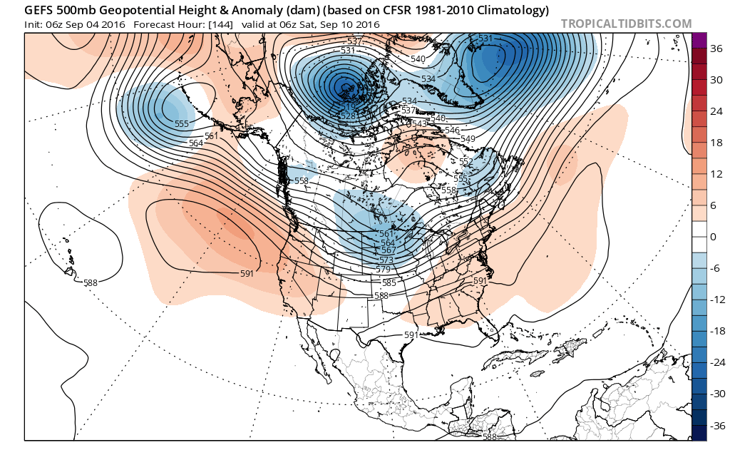
Posts: 2456
Age: 37
Joined: Wed Jan 05, 2011 5:42 pm
Location: Edinburg/McAllen Tx

Re: ATL: INVEST 92L - Models

#172 Postby Rgv20 » Sun Sep 04, 2016 12:07 pm

6zGFS Ensembles have the Ridge enough to the North that 92L should gain some Latitude once it emerges in the SW GOM in 6 days or so. 12zGFS develops 92L just east of Brownsville in 9 to 10 days.

Image
2 likes   
The following post is NOT an official forecast and should not be used as such. It is just the opinion of the poster and may or may not be backed by sound meteorological data. It is NOT endorsed by any professional institution including storm2k.org For Official Information please refer to the NHC and NWS products.

LarryWx
Category 5
Category 5
Posts: 5699
Joined: Sun Sep 07, 2003 2:04 pm
Location: GA

Re: ATL: INVEST 92L - Models

#173 Postby LarryWx » Sun Sep 04, 2016 1:03 pm

The 12Z Euro also does essentially nothing with it through hour 48
1 likes   
Personal Forecast Disclaimer:
The posts in this forum are NOT official forecasts and should not be used as such. They are just the opinion of the poster and may or may not be backed by sound meteorological data. They are NOT endorsed by any professional institution or storm2k.org. For official information, please refer to the NHC and NWS products.

User avatar
PTrackerLA
Category 5
Category 5
Posts: 5248
Age: 40
Joined: Thu Oct 10, 2002 8:40 pm
Location: Lafayette, LA

Re: ATL: INVEST 92L - Models

#174 Postby PTrackerLA » Sun Sep 04, 2016 2:31 pm

You can actually track the energy from 92L all the way to the GOM where it looks like it tries some development by day 7

Image
1 likes   

User avatar
Tireman4
S2K Supporter
S2K Supporter
Posts: 5674
Age: 58
Joined: Fri Jun 30, 2006 1:08 pm
Location: Humble, Texas
Contact:

Re: ATL: INVEST 92L - Models

#175 Postby Tireman4 » Sun Sep 04, 2016 2:32 pm

Lots of flip flopping, acreage to cover and time to focus. I am sure this will pose discussion for days to come. :)
2 likes   

User avatar
PTrackerLA
Category 5
Category 5
Posts: 5248
Age: 40
Joined: Thu Oct 10, 2002 8:40 pm
Location: Lafayette, LA

Re: ATL: INVEST 92L - Models

#176 Postby PTrackerLA » Sun Sep 04, 2016 2:40 pm

Tireman4 wrote:Lots of flip flopping, acreage to cover and time to focus. I am sure this will pose discussion for days to come. :)


Yep just something to keep an eye on since both the CMC and GFS want to spin something up in the western GOM around this timeframe.

12z GFS day 10:

Image
1 likes   

User avatar
gatorcane
S2K Supporter
S2K Supporter
Posts: 23499
Age: 46
Joined: Sun Mar 13, 2005 3:54 pm
Location: Boca Raton, FL

Re: ATL: INVEST 92L - Models

#177 Postby gatorcane » Sun Sep 04, 2016 5:54 pm

If you follow the 850mb vorticity charts closely on the 18Z GFS, I believe the weak vort it is showing in the Eastern Gulf is 92l:

Image
1 likes   

User avatar
Siker
Category 4
Category 4
Posts: 904
Age: 27
Joined: Thu Oct 25, 2012 7:36 pm
Location: Miami, FL

Re: ATL: INVEST 92L - Models

#178 Postby Siker » Sun Sep 04, 2016 5:58 pm

gatorcane wrote:If you follow the 850mb vorticity charts closely on the 18Z GFS, I believe the weak vort it is showing in the Eastern Gulf is 92l:

Image


Yes, the GFS basically splits the energy with one half feeling the tug of a trough to the north and moving into the Eastern Gulf while the other half moves across the Yucatan and into Mexico.
Last edited by Siker on Sun Sep 04, 2016 6:17 pm, edited 1 time in total.
0 likes   

User avatar
northjaxpro
S2K Supporter
S2K Supporter
Posts: 8900
Joined: Mon Sep 27, 2010 11:21 am
Location: Jacksonville, FL

Re: ATL: INVEST 92L - Models

#179 Postby northjaxpro » Sun Sep 04, 2016 6:10 pm

It may be a bit too soon to hone in down the road, but I think the weakness left behind in Hermine's aftermath may remain a very significant player in the next week or so should and if 92L can survive and advance in the coming days.
0 likes   
NEVER, EVER SAY NEVER in the tropics and weather in general, and most importantly, with life itself!!

________________________________________________________________________________________

Fay 2008 Beryl 2012 Debby 2012 Colin 2016 Hermine 2016 Julia 2016 Matthew 2016 Irma 2017 Dorian 2019

User avatar
gatorcane
S2K Supporter
S2K Supporter
Posts: 23499
Age: 46
Joined: Sun Mar 13, 2005 3:54 pm
Location: Boca Raton, FL

Re: ATL: INVEST 92L - Models

#180 Postby gatorcane » Sun Sep 04, 2016 7:27 pm

18Z NAVGEM brings 92l to South Florida similar to the 12Z. 0 to 132 hour loop showing track below:

Image
1 likes   


Return to “2016”

Who is online

Users browsing this forum: No registered users and 117 guests