
Aric Dunn wrote:Im not going to read the first few pages... just because i don't want to read the " its too dry" or "its dead" "never going to develop" crap.. especially after the first two weeks of that with pre dorian..
I hope everyone has learned to never say never.. dont declare anything dead until its inland etc..
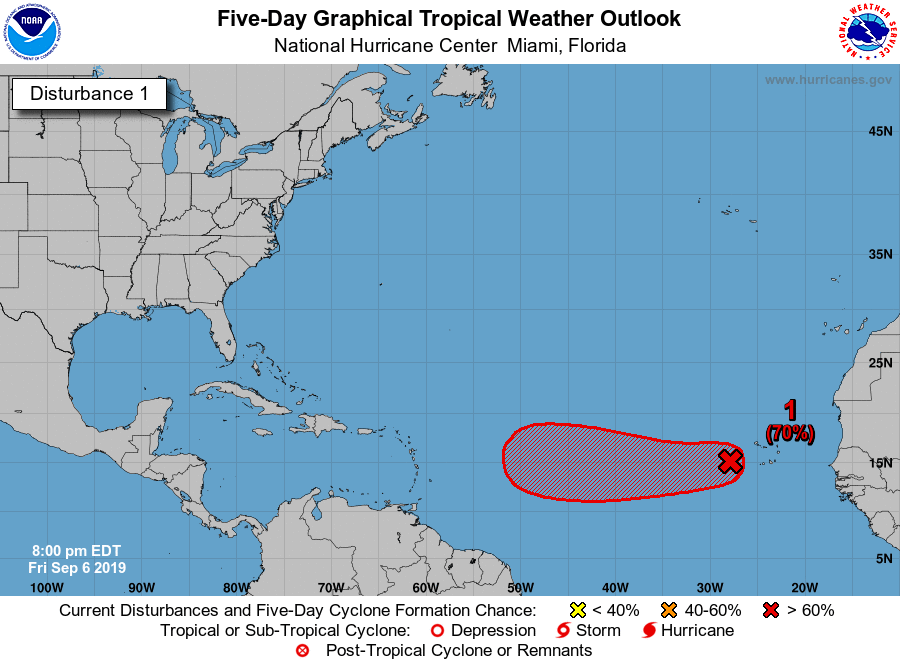
As for this wave.. as many probably have already alluded too. threat to Carib and later on the US is again rather High..
No one said that, pretty much everyone expects this to develop.


