ATL: TROPICAL DEPRESSION ALEX - DISCUSSION
Moderator: S2k Moderators
-
hurricaneCW
- Category 5

- Posts: 1773
- Joined: Wed Mar 03, 2010 6:20 am
- Location: Toms River, NJ
Re: ATL: INVEST 93L - DISCUSSION
I know the folks who are dealing with the oil do not even want to think about a possible tropical disturbance entering the gulf. We've managed to get through most of June without any big problems but we also saw the waters warm to extreme temperatures in the gulf, around the Bahamas and Florida Straits, and now off the southeast coast.
0 likes

Re: ATL: INVEST 93L - DISCUSSION
I'm assuming that this means recon is scheduled for 93L on Wednesday...
000
NOUS42 KNHC 211400
WEATHER RECONNAISSANCE FLIGHTS
CARCAH, NATIONAL HURRICANE CENTER, MIAMI, FL.
1000 AM EDT MON 21 JUNE 2010
SUBJECT: TROPICAL CYCLONE PLAN OF THE DAY (TCPOD)
VALID 22/1100Z TO 23/1100Z JUNE 2010
TCPOD NUMBER.....10-021
I. ATLANTIC REQUIREMENTS
1. NEGATIVE RECONNAISSANCE REQUIREMENTS.
2. SUCCEEDING DAY OUTLOOK: POSSIBLE LOW LEVEL
INVEST NEAR 16.ON 77.0W AT 23/1800Z.
0 likes

Re: ATL: INVEST 93L - DISCUSSION
I would suspect this will go red either tonight or in the morning if it keeps up.....banding really starting to form. Needs to get to the surface and its game on....
0 likes

Re: ATL: INVEST 93L - DISCUSSION
hurricaneCW wrote:I know the folks who are dealing with the oil do not even want to think about a possible tropical disturbance entering the gulf. We've managed to get through most of June without any big problems but we also saw the waters warm to extreme temperatures in the gulf, around the Bahamas and Florida Straits, and now off the southeast coast.
Speaking of the oil and of a possible disturbance (didn't say hurricane), here is a shot I took yesterday of the Deepwater Horizon site. Relief oil well in the foreground and the Discoverer Enterprise in the background collecting oil from the old Deepwater Horizon pipe. It may be possible for them to attach an underwater buoy to the cap so they don't have to completely remove it while seeking shelter from a storm.

Last edited by JTE50 on Mon Jun 21, 2010 1:17 pm, edited 1 time in total.
0 likes
-
srainhoutx

- S2K Supporter

- Posts: 6919
- Age: 66
- Joined: Sun Jan 14, 2007 11:34 am
- Location: Haywood County, NC
- Contact:
Re: ATL: INVEST 93L - DISCUSSION
0 likes
Carla/Alicia/Jerry(In The Eye)/Michelle/Charley/Ivan/Dennis/Katrina/Rita/Wilma/Ike/Harvey
Member: National Weather Association
Wx Infinity Forums
http://wxinfinity.com/index.php
Facebook.com/WeatherInfinity
Twitter @WeatherInfinity
Member: National Weather Association
Wx Infinity Forums
http://wxinfinity.com/index.php
Facebook.com/WeatherInfinity
Twitter @WeatherInfinity
-
Weatherfreak000
Re: ATL: INVEST 93L - DISCUSSION

Concerning 93L, this is the reality of the situation. A Gulf that can easily produce a category 5.
0 likes
-
floridasun78
- Category 5
- Posts: 3755
- Joined: Sun May 17, 2009 10:16 pm
- Location: miami fl
-
HURAKAN

- Professional-Met

- Posts: 46086
- Age: 37
- Joined: Thu May 20, 2004 4:34 pm
- Location: Key West, FL
- Contact:
Re:
floridasun78 wrote:hi all good afternoon from miami fl was 93l active today or sunday because one guy weatherunderground told me was on sunday but notice today was added to storm2k? other question is 93l same wave as 92l ? it look like part 92l want north or one is what 93l now???
The disturbance in the ECAR was upgraded to 93L this morning and it's not the same wave as 92L. It's the wave following 92L.
0 likes
-
floridasun78
- Category 5
- Posts: 3755
- Joined: Sun May 17, 2009 10:16 pm
- Location: miami fl
Re: Re:
HURAKAN wrote:floridasun78 wrote:hi all good afternoon from miami fl was 93l active today or sunday because one guy weatherunderground told me was on sunday but notice today was added to storm2k? other question is 93l same wave as 92l ? it look like part 92l want north or one is what 93l now???
The disturbance in the ECAR was upgraded to 93L this morning and it's not the same wave as 92L. It's the wave following 92L.
ok it was wave after 92l
0 likes


Re: ATL: INVEST 93L - DISCUSSION
Dang, I love this time of year. First day of summer. It's fun trying to understand the terminology and learning why this causes that and therefore. I'm back on the southcoast weather watching. It sux that I'm also water watching for oily things moving in. So far we haven't had much here. Mostly on the barrier islands.
Does anyone really know what kind of dynamics would ensue when a hurricane strikes oil? Would it slow it down?
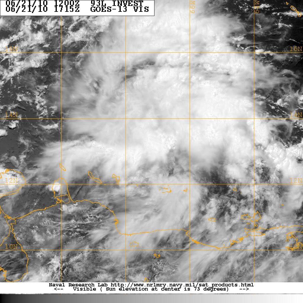
93L looks pretty healthy at the moment.
http://www.ssd.noaa.gov/goes/flt/t1/loop-vis.html
Does anyone really know what kind of dynamics would ensue when a hurricane strikes oil? Would it slow it down?
93L looks pretty healthy at the moment.
http://www.ssd.noaa.gov/goes/flt/t1/loop-vis.html
0 likes
-
Comanche

- Category 1

- Posts: 381
- Age: 52
- Joined: Wed Jul 06, 2005 9:33 am
- Location: Clear Lake City Texas
Re: Re:
floridasun78 wrote:HURAKAN wrote:floridasun78 wrote:hi all good afternoon from miami fl was 93l active today or sunday because one guy weatherunderground told me was on sunday but notice today was added to storm2k? other question is 93l same wave as 92l ? it look like part 92l want north or one is what 93l now???
The disturbance in the ECAR was upgraded to 93L this morning and it's not the same wave as 92L. It's the wave following 92L.
ok it was wave after 92l
That is correct!
0 likes
-
Aric Dunn
- Category 5
- Posts: 21228
- Age: 41
- Joined: Sun Sep 19, 2004 9:58 pm
- Location: Ready for the Chase.
- Contact:
Re: ATL: INVEST 93L - DISCUSSION
Here is the likely scenario. 93L is in a favorable upper level setup atm and should be for the next few days so that will not be a huge limiting issue. What will be though is its current position. The eastern and central carribean is nearly a 99 % no go on genesis due the dominant low level flow in that area which will keep 93L in check for the next 36hrs at a minimum. once it passes about 75w and begins to absorb the energy from ex 92L and begins to have a better channel for southerly in flow to develop than it will have a much better chance of development. with that said somethings that should of course be watched is the current inflow, which atm is pretty meager especially on the west and SW sides which again is a trouble stop to begin with in the eastern and central carribean. The low level flow in the western carribean is weak and any major disturbance such as this will have a easier time developing a surface circulation especially with the vorticity from ex 92L already in place.
If you watch the loop of the western carrib you can still clearly see the sharp inverted V from ex 92L that is basically stationary. http://www.ssd.noaa.gov/goes/east/watl/loop-rgb.html

If you watch the loop of the western carrib you can still clearly see the sharp inverted V from ex 92L that is basically stationary. http://www.ssd.noaa.gov/goes/east/watl/loop-rgb.html
0 likes
-
OuterBanker
- S2K Supporter
- Posts: 1704
- Joined: Wed Feb 26, 2003 10:53 am
- Location: Nags Head, NC
- Contact:
93 has a much better chance because of it's location. Let's remember that Blas and Celia were itcz disturbances that passed into the Pacific and formed. Unlike them though 93 should be pulled wnw or nw into the BOC or GOM. I'd guess from Mx to Fla panhandle should watch. 05's first storm also came from the same area.
0 likes
-
jasons2k

- Storm2k Executive

- Posts: 8083
- Age: 50
- Joined: Wed Jul 06, 2005 12:32 pm
- Location: The Woodlands, TX
Re: ATL: INVEST 93L - DISCUSSION
From Jeff Lindner:
Strong tropical wave over the east-central Caribbean Sea is becoming better organized.
Visible satellite images show numerous developing convective clusters, but as of yet no well defined surface circulation. Moist envelop surrounds this system of interest and strong shear in the Caribbean will be weakening over the next 24-48 hours allowing the development of favorable upper air conditions. NHC has risen the threat of TX development in the next 48 hours into the 30-50%. Conditions only get better aloft and at the surface as the system heads for the western Caribbean Sea by the end of the week.
Intensity guidance is very aggressive with this system, with SHIPS taking it well into a hurricane by days 4 and 5 which is very aggressive for a June tropical system…but it has happened before. Gulf water temperatures are now running in the low to mid 80’s and are more than warm enough to support a tropical cyclone. Models are forecasting the development of an anticyclone aloft over the system as it enters the Gulf, so conditions do look ripe for intensification.
Model guidance remains inconsistent on the potential track with various possibilities playing out. CMC and EURO are strongest and show a weakness in the southern US ridge over the central Gulf states allowing the system to gradually recurve into the eastern Gulf coast. The GFS is still showing no development at all…which is really strange for this model along with the UKMET. The NOGAPS shows a weaker system sliding WNW into the western Gulf of Mexico. Way too early to tell either way with anything.
Recon aircraft is tasked to investigate if needed on Wednesday.
0 likes
-
Weatherfreak000
Re: ATL: INVEST 93L - DISCUSSION
Aric Dunn wrote:Here is the likely scenario. 93L is in a favorable upper level setup atm and should be for the next few days so that will not be a huge limiting issue. What will be though is its current position. The eastern and central carribean is nearly a 99 % no go on genesis due the dominant low level flow in that area which will keep 93L in check for the next 36hrs at a minimum. once it passes about 75w and begins to absorb the energy from ex 92L and begins to have a better channel for southerly in flow to develop than it will have a much better chance of development. with that said somethings that should of course be watched is the current inflow, which atm is pretty meager especially on the west and SW sides which again is a trouble stop to begin with in the eastern and central carribean. The low level flow in the western carribean is weak and any major disturbance such as this will have a easier time developing a surface circulation especially with the vorticity from ex 92L already in place.
If you watch the loop of the western carrib you can still clearly see the sharp inverted V from ex 92L that is basically stationary. http://www.ssd.noaa.gov/goes/east/watl/loop-rgb.html
To make a statement like a 99% chance of non-development, not only are you going against the current thermodynamics, your also disregarding the NHC's opinion.
I'm sorry but I need to see some more evidence to your claims here. The information your providing is just "downcasting"
0 likes

I ripped 92L from the start, but I think I'm worried a bit about this one.
My forecast, not necessarily on the invest.
12 hrs - Convection bursts tonight with people calling for a TD by morning.
24 hrs - Convection wanes during afternoon. People call it dead and move on.
36 hrs - Convection bursts again. People who called it dead call for TD by morning.
48 hrs - Convection wanes....
0 likes
-
Cryomaniac
- Category 5
- Posts: 1289
- Joined: Tue Aug 15, 2006 2:26 pm
- Location: Newark, Nottinghamshire, UK
- Contact:
Re: ATL: INVEST 93L - DISCUSSION
Weatherfreak000 wrote:Aric Dunn wrote:Here is the likely scenario. 93L is in a favorable upper level setup atm and should be for the next few days so that will not be a huge limiting issue. What will be though is its current position. The eastern and central carribean is nearly a 99 % no go on genesis due the dominant low level flow in that area which will keep 93L in check for the next 36hrs at a minimum. once it passes about 75w and begins to absorb the energy from ex 92L and begins to have a better channel for southerly in flow to develop than it will have a much better chance of development. with that said somethings that should of course be watched is the current inflow, which atm is pretty meager especially on the west and SW sides which again is a trouble stop to begin with in the eastern and central carribean. The low level flow in the western carribean is weak and any major disturbance such as this will have a easier time developing a surface circulation especially with the vorticity from ex 92L already in place.
If you watch the loop of the western carrib you can still clearly see the sharp inverted V from ex 92L that is basically stationary. http://www.ssd.noaa.gov/goes/east/watl/loop-rgb.html
To make a statement like a 99% chance of non-development, not only are you going against the current thermodynamics, your also disregarding the NHC's opinion.
I'm sorry but I need to see some more evidence to your claims here. The information your providing is just "downcasting"
Also, the post could use a disclaimer.
Speaking of which:
The following is the opinion of Cryomaniac, and is not based on any evidence, meteorological or otherwise, as such it should not be used for any purpose
93L looks pretty good right now, I personally doubt we'll get anything too soon, but I think there is a real chance of a TD or TS in the next couple of days.
0 likes
-
Aric Dunn
- Category 5
- Posts: 21228
- Age: 41
- Joined: Sun Sep 19, 2004 9:58 pm
- Location: Ready for the Chase.
- Contact:
Re: ATL: INVEST 93L - DISCUSSION
Weatherfreak000 wrote:Aric Dunn wrote:Here is the likely scenario. 93L is in a favorable upper level setup atm and should be for the next few days so that will not be a huge limiting issue. What will be though is its current position. The eastern and central carribean is nearly a 99 % no go on genesis due the dominant low level flow in that area which will keep 93L in check for the next 36hrs at a minimum. once it passes about 75w and begins to absorb the energy from ex 92L and begins to have a better channel for southerly in flow to develop than it will have a much better chance of development. with that said somethings that should of course be watched is the current inflow, which atm is pretty meager especially on the west and SW sides which again is a trouble stop to begin with in the eastern and central carribean. The low level flow in the western carribean is weak and any major disturbance such as this will have a easier time developing a surface circulation especially with the vorticity from ex 92L already in place.
If you watch the loop of the western carrib you can still clearly see the sharp inverted V from ex 92L that is basically stationary. http://www.ssd.noaa.gov/goes/east/watl/loop-rgb.html
To make a statement like a 99% chance of non-development, not only are you going against the current thermodynamics, your also disregarding the NHC's opinion.
I'm sorry but I need to see some more evidence to your claims here. The information your providing is just "downcasting"
the 99 % is a climatological statistic for the eastern and central carribean and im not against the nhc .... there discussion say over the next couple days it does not say it will develop where it is at.
Last edited by Aric Dunn on Mon Jun 21, 2010 1:33 pm, edited 1 time in total.
0 likes
-
brunota2003

- S2K Supporter
- Posts: 9476
- Age: 33
- Joined: Sat Jul 30, 2005 9:56 pm
- Location: Stanton, KY...formerly Havelock, NC
- Contact:
Re: ATL: INVEST 93L - DISCUSSION
Weatherfreak000 wrote:Aric Dunn wrote:Here is the likely scenario. 93L is in a favorable upper level setup atm and should be for the next few days so that will not be a huge limiting issue. What will be though is its current position. The eastern and central carribean is nearly a 99 % no go on genesis due the dominant low level flow in that area which will keep 93L in check for the next 36hrs at a minimum. once it passes about 75w and begins to absorb the energy from ex 92L and begins to have a better channel for southerly in flow to develop than it will have a much better chance of development. with that said somethings that should of course be watched is the current inflow, which atm is pretty meager especially on the west and SW sides which again is a trouble stop to begin with in the eastern and central carribean. The low level flow in the western carribean is weak and any major disturbance such as this will have a easier time developing a surface circulation especially with the vorticity from ex 92L already in place.
If you watch the loop of the western carrib you can still clearly see the sharp inverted V from ex 92L that is basically stationary. http://www.ssd.noaa.gov/goes/east/watl/loop-rgb.html
http://img697.imageshack.us/img697/7751 ... 1dpip8.jpg
To make a statement like a 99% chance of non-development, not only are you going against the current thermodynamics, your also disregarding the NHC's opinion.
I'm sorry but I need to see some more evidence to your claims here. The information your providing is just "downcasting"
Actually, he is not saying there is only a 1% chance for development all together. What he is stating is that in the current location, 99% of the time systems do not develop there, thanks to SA interrupting the inflow into the system, along with the regular trade winds. Take note that a lot of times, even developed systems tend to stay at the same strength or even weaken in this general area.
Once it moves past this area and gets away from land, the chances for develop go back up.
0 likes
Who is online
Users browsing this forum: No registered users and 7 guests