ATL: CINDY - Post-Tropical - Discussion
Moderator: S2k Moderators
-
OntarioEggplant
- Category 1

- Posts: 312
- Joined: Sun Aug 07, 2016 11:16 am
-
weathaguyry

- Category 5

- Posts: 1272
- Age: 20
- Joined: Wed Jun 15, 2016 5:16 am
- Location: Long Island, NY
Re: ATL: CINDY - Recon
As of 17:42 UTC Jun 20, 2017:
Aircraft Position: 25.60°N 90.45°W
Bearing: 297° at 248 kt
Altitude: 298 gpm
Peak 10-second Wind: 11 kt at 181°
Extrapolated Sea-level Pressure: N/A
173300 2515N 09002W 9696 00286 //// +230 //// 218016 017 017 000 01
173330 2516N 09004W 9700 00281 //// +230 //// 219018 019 017 001 01
173400 2517N 09005W 9698 00284 //// +230 //// 221019 019 018 000 01
173430 2519N 09006W 9696 00284 //// +230 //// 213018 018 018 000 01
173500 2520N 09007W 9699 00280 //// +230 //// 210018 019 019 000 01
173530 2521N 09008W 9699 00279 //// +235 //// 209018 018 018 001 01
173600 2522N 09009W 9699 00280 //// +231 //// 204018 019 020 000 01
173630 2523N 09011W 9698 00280 //// +230 //// 200019 020 019 000 01
173700 2525N 09012W 9698 00279 //// +230 //// 200020 021 021 000 01
173730 2526N 09013W 9699 00276 //// +230 //// 196019 020 021 001 01
173800 2527N 09014W 9699 00275 //// +226 //// 194019 020 021 001 01
173830 2528N 09015W 9699 00274 //// +228 //// 189019 020 021 000 01
173900 2530N 09017W 9680 00290 //// +227 //// 190019 020 021 000 01
173930 2531N 09018W 9660 00308 //// +227 //// 190019 020 022 000 01
174000 2532N 09019W 9663 00304 //// +226 //// 189018 019 020 001 01
174030 2533N 09020W 9666 00301 //// +229 //// 185018 019 019 001 01
174100 2534N 09022W 9662 00303 //// +232 //// 183016 017 018 000 05
174130 2535N 09023W 9663 00301 //// +229 //// 180013 015 020 001 05
174200 2535N 09025W 9662 00301 //// +230 //// 180012 013 017 001 05
174230 2536N 09027W 9663 00298 //// +231 //// 181010 011 017 001 01
0 likes
My posts are only my opinions and NOT official forecasts. For official forecasts, consult the National Hurricane Center or the National Weather Service.
Irene 11', Sandy 12', Fay 20’, Isaias 20’, Elsa 21’, Henri 21’, Ida 21’
Irene 11', Sandy 12', Fay 20’, Isaias 20’, Elsa 21’, Henri 21’, Ida 21’
-
weathaguyry
- Category 5
- Posts: 1272
- Age: 20
- Joined: Wed Jun 15, 2016 5:16 am
- Location: Long Island, NY
Re: ATL: CINDY - Tropical Storm
1 likes
My posts are only my opinions and NOT official forecasts. For official forecasts, consult the National Hurricane Center or the National Weather Service.
Irene 11', Sandy 12', Fay 20’, Isaias 20’, Elsa 21’, Henri 21’, Ida 21’
Irene 11', Sandy 12', Fay 20’, Isaias 20’, Elsa 21’, Henri 21’, Ida 21’
-
cycloneye

- Admin

- Posts: 139027
- Age: 67
- Joined: Thu Oct 10, 2002 10:54 am
- Location: San Juan, Puerto Rico
Re: ATL: CINDY - Tropical Storm

0 likes
Visit the Caribbean-Central America Weather Thread where you can find at first post web cams,radars
and observations from Caribbean basin members Click Here
and observations from Caribbean basin members Click Here
-
weathaguyry
- Category 5
- Posts: 1272
- Age: 20
- Joined: Wed Jun 15, 2016 5:16 am
- Location: Long Island, NY
Re: ATL: CINDY - Recon
As of 17:52 UTC Jun 20, 2017:
Aircraft Position: 25.80°N 90.90°W
Bearing: 270° at 108 kt
Altitude: 300 gpm
Peak 10-second Wind: 45 kt at 11°
Extrapolated Sea-level Pressure: N/A
174300 2536N 09028W 9662 00297 //// +230 //// 182009 009 016 001 01
174330 2537N 09030W 9662 00296 //// +230 //// 185007 008 015 000 05
174400 2537N 09032W 9660 00295 //// +234 //// 180005 007 015 000 01
174430 2537N 09033W 9664 00294 //// +235 //// 189004 005 014 001 01
174500 2537N 09035W 9662 00294 //// +234 //// 261002 003 015 000 01
174530 2537N 09037W 9663 00292 //// +235 //// 334004 005 015 001 05
174600 2537N 09039W 9665 00289 //// +235 //// 356007 007 013 001 01
174630 2538N 09040W 9666 00289 //// +235 //// 351011 012 015 000 01
174700 2538N 09042W 9662 00292 //// +235 //// 354013 014 016 000 05
174730 2539N 09043W 9662 00291 //// +235 //// 357016 017 018 000 01
174800 2540N 09044W 9662 00292 //// +235 //// 000018 019 019 001 01
174830 2541N 09045W 9660 00294 //// +235 //// 000020 021 020 000 01
174900 2542N 09047W 9657 00297 //// +237 //// 000026 030 031 001 01
174930 2543N 09048W 9662 00294 //// +226 //// 001033 034 034 002 01
175000 2544N 09049W 9664 00291 //// +227 //// 005034 037 036 000 05
175030 2545N 09050W 9663 00295 //// +223 //// 007040 041 036 000 05
175100 2546N 09051W 9662 00296 //// +227 //// 009041 042 036 001 01
175130 2547N 09052W 9664 00295 //// +226 //// 010043 043 037 000 01
175200 2548N 09053W 9662 00298 //// +229 //// 010044 045 037 002 05
175230 2548N 09054W 9661 00300 //// +226 //// 011044 045 037 001 01
0 likes
My posts are only my opinions and NOT official forecasts. For official forecasts, consult the National Hurricane Center or the National Weather Service.
Irene 11', Sandy 12', Fay 20’, Isaias 20’, Elsa 21’, Henri 21’, Ida 21’
Irene 11', Sandy 12', Fay 20’, Isaias 20’, Elsa 21’, Henri 21’, Ida 21’
-
TeamPlayersBlue

- Category 5
- Posts: 3307
- Joined: Tue Feb 02, 2010 1:44 am
- Location: Denver/Applewood, CO
Re: ATL: CINDY - Tropical Storm
Nailed it on being stationary. LEts see where those first movements are now
0 likes
Personal Forecast Disclaimer:
The posts in this forum are NOT official forecast and should not be used as such. They are just the opinion of the poster and may or may not be backed by sound meteorological data. They are NOT endorsed by any professional institution or storm2k.org. For official information, please refer to the NHC and NWS products.
The posts in this forum are NOT official forecast and should not be used as such. They are just the opinion of the poster and may or may not be backed by sound meteorological data. They are NOT endorsed by any professional institution or storm2k.org. For official information, please refer to the NHC and NWS products.


-
Hurricane_Apu
- Tropical Storm

- Posts: 120
- Joined: Tue Aug 31, 2004 5:47 pm
-
tarheelprogrammer

- S2K Supporter

- Posts: 1793
- Joined: Mon Mar 28, 2016 9:25 pm
- Location: Raleigh, NC area (Garner, NC)
Re: ATL: CINDY - Models
mcheer23 wrote:EURO Galveston
Stronger as well. 992 mb or low at landfall can not tell.
0 likes
My posts are not official forecasts. They are just my opinion and may or may not be backed by sound meteorological data. They are NOT endorsed by any professional institution or storm2k.org. For official information, please refer to the NHC and NWS products.

Re: ATL: CINDY - Tropical Storm
Does stationary impact the anticipated westerly forecast movement?
0 likes

Re: ATL: CINDY - Tropical Storm
Hurricane_Apu wrote:Was this thing ever forecasted to stall?
It's very common for weak systems to have chaotic movement. The long term trend will be towards the WNW or so.
0 likes

Re: ATL: CINDY - Tropical Storm
Interesting that the 500 mb low and Cindy seem to be one and the same now...
1 likes
Anything I post is my personal opinion and should not used for any type of planning or lifesaving reasons. Please refer to National Weather Service forecasts.
-
weathaguyry
- Category 5
- Posts: 1272
- Age: 20
- Joined: Wed Jun 15, 2016 5:16 am
- Location: Long Island, NY
Re: ATL: CINDY - Recon
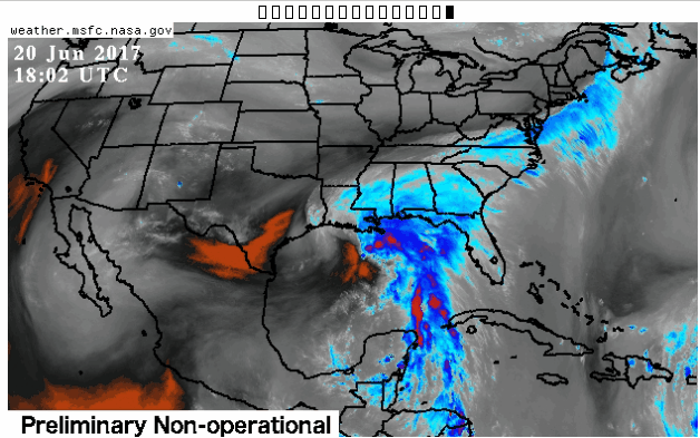
As of 18:02 UTC Jun 20, 2017:
Aircraft Position: 26.12°N 91.25°W
Bearing: 315° at 161 kt
Altitude: 313 gpm
Peak 10-second Wind: 39 kt at 28°
Extrapolated Sea-level Pressure: N/A
175300 2549N 09055W 9661 00301 //// +219 //// 011045 046 038 001 05
175330 2550N 09056W 9660 00302 //// +225 //// 012044 045 037 002 05
175400 2551N 09057W 9665 00300 //// +232 //// 013043 044 036 002 01
175430 2552N 09058W 9661 00303 //// +225 //// 015043 045 038 001 05
175500 2553N 09059W 9663 00302 //// +224 //// 017044 045 036 001 01
175530 2554N 09100W 9661 00304 //// +221 //// 019045 045 035 001 01
175600 2555N 09101W 9661 00306 //// +224 //// 019044 046 036 002 05
175630 2556N 09102W 9664 00302 //// +221 //// 016042 046 037 001 01
175700 2557N 09103W 9667 00302 //// +226 //// 017044 045 035 001 05
175730 2558N 09104W 9660 00308 //// +213 //// 018042 045 035 001 01
175800 2559N 09105W 9659 00309 //// +210 //// 023039 042 036 001 01
175830 2600N 09106W 9663 00307 //// +210 //// 025041 043 038 000 05
175900 2601N 09107W 9660 00312 //// +209 //// 022041 044 /// /// 05
175930 2601N 09109W 9664 00309 //// +212 //// 028038 040 031 000 05
180000 2602N 09111W 9658 00314 //// +221 //// 027044 045 031 002 05
180030 2603N 09112W 9658 00314 //// +216 //// 028045 045 031 001 01
180100 2604N 09113W 9662 00311 //// +214 //// 029042 045 033 002 01
180130 2605N 09114W 9664 00311 //// +212 //// 030041 042 036 000 01
180200 2606N 09114W 9662 00313 //// +213 //// 029036 039 032 001 01
180230 2607N 09115W 9662 00313 //// +216 //// 028037 039 033 000 01
0 likes
My posts are only my opinions and NOT official forecasts. For official forecasts, consult the National Hurricane Center or the National Weather Service.
Irene 11', Sandy 12', Fay 20’, Isaias 20’, Elsa 21’, Henri 21’, Ida 21’
Irene 11', Sandy 12', Fay 20’, Isaias 20’, Elsa 21’, Henri 21’, Ida 21’
-
Stormcenter
- S2K Supporter
- Posts: 6617
- Joined: Wed Sep 03, 2003 11:27 am
- Location: Houston, TX
Re: ATL: CINDY - Tropical Storm
I believe the NHC has Cindy eventually moving NW and then NNW per their 1:00pm CDT advisory but they've been saying that since yesterday.
1 likes
-
sphelps8681
- Category 2

- Posts: 673
- Joined: Thu Aug 16, 2007 5:37 pm
- Location: Somewhere over the rainbow
Re: ATL: CINDY - Tropical Storm
Latest from NHC
Satellite imagery, aircraft data, and surface observations indicate
that the low pressure system in the central Gulf of Mexico has
acquired a well-defined center, and is now Tropical Storm Cindy, the
third tropical storm of 2017.
At 100 PM CDT (1800 UTC), the center of Tropical Storm Cindy was
centered near latitude 25.9 North, longitude 90.5 West. Cindy has
been stationary for the past few hours, but the system is expected
to resume a motion toward the northwest at around 10 mph (17 km/h)
later today, and this motion is expected to continue through
Wednesday night. A turn toward the north-northwest is forecast early
Thursday. On the forecast track, Cindy is expected to approach
the coast of southwest Louisiana late Wednesday or Wednesday night,
and move inland over western Louisiana and eastern Texas on
Thursday.
Maximum sustained winds are near 45 mph (75 km/h) with higher
gusts. Little change in strength is forecast before the system
reaches the coast on Thursday.
Tropical-storm-force winds extend outward up to 205 miles (335 km),
mainly to the north and east of the center.
The estimated minimum central pressure is 999 mb (29.50 inches).
0 likes
-
tropicwatch

- Category 5
- Posts: 3205
- Age: 60
- Joined: Sat Jun 02, 2007 10:01 am
- Location: Panama City Florida
- Contact:
Re: ATL: CINDY - Tropical Storm
I'm wandering if the front might pull Cindy and the ull a little eastward.
0 likes
Tropicwatch
Agnes 72', Eloise 75, Elena 85', Kate 85', Charley 86', Florence 88', Beryl 94', Dean 95', Erin 95', Opal 95', Earl 98', Georges 98', Ivan 2004', Arlene 2005', Dennis 2005', Ida 2009' Debby 2012' Irma 2017' Michael 2018'
Agnes 72', Eloise 75, Elena 85', Kate 85', Charley 86', Florence 88', Beryl 94', Dean 95', Erin 95', Opal 95', Earl 98', Georges 98', Ivan 2004', Arlene 2005', Dennis 2005', Ida 2009' Debby 2012' Irma 2017' Michael 2018'
-
PTrackerLA

- Category 5
- Posts: 5248
- Age: 40
- Joined: Thu Oct 10, 2002 8:40 pm
- Location: Lafayette, LA
Re: ATL: CINDY - Models
12z Euro 989mb landfall at Galveston on the Hi-Res.
Last edited by PTrackerLA on Tue Jun 20, 2017 1:15 pm, edited 1 time in total.
1 likes

-
weathaguyry
- Category 5
- Posts: 1272
- Age: 20
- Joined: Wed Jun 15, 2016 5:16 am
- Location: Long Island, NY
Re: ATL: CINDY - Recon
As of 18:12 UTC Jun 20, 2017:
Aircraft Position: 26.47°N 91.60°W
Bearing: 315° at 161 kt
Altitude: 328 gpm
Peak 10-second Wind: 36 kt at 22°
Extrapolated Sea-level Pressure: N/A
180300 2608N 09116W 9664 00313 //// +217 //// 030038 040 034 003 01
180330 2610N 09117W 9665 00317 //// +215 //// 026036 039 035 001 01
180400 2611N 09117W 9660 00322 //// +217 //// 022035 037 031 002 01
180430 2612N 09119W 9658 00324 //// +220 //// 021037 038 031 002 05
180500 2613N 09120W 9662 00323 //// +222 //// 021035 038 030 001 01
180530 2614N 09121W 9661 00324 //// +223 //// 022033 034 030 001 01
180600 2615N 09122W 9663 00322 //// +224 //// 022034 035 031 000 01
180630 2616N 09123W 9663 00325 //// +226 //// 022034 036 031 000 05
180700 2617N 09124W 9664 00323 //// +224 //// 022033 034 029 002 01
180730 2618N 09125W 9662 00326 //// +225 //// 023032 034 030 000 01
180800 2619N 09126W 9663 00328 //// +224 //// 023031 032 029 000 01
180830 2620N 09127W 9665 00325 //// +229 //// 024032 034 029 001 01
180900 2621N 09128W 9660 00331 //// +227 //// 021030 033 029 001 01
180930 2622N 09130W 9662 00331 //// +232 //// 020032 032 028 001 01
181000 2623N 09131W 9666 00328 //// +232 //// 020032 033 031 002 01
181030 2624N 09132W 9665 00331 //// +223 //// 018031 033 030 002 01
181100 2625N 09133W 9669 00326 //// +224 //// 021034 035 031 003 01
181130 2626N 09134W 9662 00336 //// +229 //// 019033 036 031 001 05
181200 2627N 09135W 9655 00340 //// +225 //// 021034 035 029 001 05
181230 2628N 09136W 9669 00328 //// +224 //// 022035 036 030 001 01
0 likes
My posts are only my opinions and NOT official forecasts. For official forecasts, consult the National Hurricane Center or the National Weather Service.
Irene 11', Sandy 12', Fay 20’, Isaias 20’, Elsa 21’, Henri 21’, Ida 21’
Irene 11', Sandy 12', Fay 20’, Isaias 20’, Elsa 21’, Henri 21’, Ida 21’
Who is online
Users browsing this forum: No registered users and 64 guests