CPAC: FERNANDA - Post-Tropical

Moderator: S2k Moderators

Message
Author
User avatar
Cyclenall
Category 5
Category 5
Posts: 6627
Joined: Thu Jun 08, 2006 10:01 pm
Location: Ontario, Canada

Re: EPAC: FERNANDA - Hurricane

#401 Postby Cyclenall » Mon Jul 17, 2017 6:47 pm

Kingarabian wrote:Shear continues to decrease ahead of it and looks virtually non existent until 140W. Don't understand why the models are weakening this considerably in such conditions.

*Image*

We know why now. Not sure about "considerably" but this storm's ERC "failure" did the trick. I missed the slight restrengthening until I read more of the thread though.
0 likes   

User avatar
Kingarabian
S2K Supporter
S2K Supporter
Posts: 15434
Joined: Sat Aug 08, 2009 3:06 am
Location: Honolulu, Hawaii

Re: EPAC: FERNANDA - Hurricane

#402 Postby Kingarabian » Mon Jul 17, 2017 6:49 pm

Cyclenall wrote:
Kingarabian wrote:Shear continues to decrease ahead of it and looks virtually non existent until 140W. Don't understand why the models are weakening this considerably in such conditions.

*Image*

We know why now. Not sure about "considerably" but this storm's ERC "failure" did the trick. I missed the slight restrengthening until I read more of the thread though.


Multiple ERCs* if i May.
0 likes   
RIP Kobe Bryant

RL3AO
Moderator-Pro Met
Moderator-Pro Met
Posts: 16308
Joined: Thu Jun 14, 2007 10:03 pm
Location: NC

Re: EPAC: FERNANDA - Hurricane

#403 Postby RL3AO » Mon Jul 17, 2017 7:47 pm

ATCF Best Track
System ID: EP06 (FERNANDA)
0000 UTC Jul 18, 2017
Location: 14.4°N, 131.9°N
Central Pressure: 967 mb
Maximum Winds (1-min): 95 kt (109 mph)
Type: Category 2 Hurricane (HU)
ACE (Storm Total): 21.1175
0 likes   

Sciencerocks
Category 5
Category 5
Posts: 7286
Age: 38
Joined: Thu Jul 06, 2017 1:51 am

Re: EPAC: FERNANDA - Hurricane

#404 Postby Sciencerocks » Mon Jul 17, 2017 9:06 pm

Image
0 likes   

Sciencerocks
Category 5
Category 5
Posts: 7286
Age: 38
Joined: Thu Jul 06, 2017 1:51 am

Re: EPAC: FERNANDA - Hurricane

#405 Postby Sciencerocks » Mon Jul 17, 2017 10:02 pm

000
WTPZ41 KNHC 180240
TCDEP1

Hurricane Fernanda Discussion Number 25
NWS National Hurricane Center Miami FL EP062017
800 PM PDT Mon Jul 17 2017

Conventional satellite and two earlier GMI and GCOM-W1 microwave
images indicate partial erosion in the southeast quadrant of the
eyewall. Inner core cloud top temperatures have warmed, particularly
over the aforementioned quadrant and in the western portion. A
blend of the subjective and objective Dvorak estimates yields a
lowered initial intensity of 95 kt for this advisory. Continued
gradual weakening is forecast through the forecast period due to the
cyclone traversing cooler oceanic SSTs and moving into a more stable
and drier air mass with increasing vertical shear. The official
forecast has been adjusted down a bit from the previous forecast
based on the lowered initial intensity and follows the IVCN
multi-model consensus.

The initial motion is estimated to be northwestward, or 310/8 kt.
Global models show a large amplitude mid- to upper-level
tropospheric trough situated to the northeast of the Hawaiian
Islands lifting northeastward around the 48-hour period,
allowing the subtropical ridge to the north of Fernanda to rebuild
westward. This change in the synoptic steering pattern should
cause the cyclone to turn back toward the west-northwest and
continue in this motion through day 5. The NHC forecast track is
adjusted to the right of the previous advisory beyond day 3 and is
in between the GFS/ECMWF blend and the TVCN consensus.


FORECAST POSITIONS AND MAX WINDS

INIT 18/0300Z 14.7N 132.2W 95 KT 110 MPH
12H 18/1200Z 15.4N 133.1W 85 KT 100 MPH
24H 19/0000Z 16.2N 134.2W 75 KT 85 MPH
36H 19/1200Z 16.9N 135.4W 70 KT 80 MPH
48H 20/0000Z 17.3N 136.7W 65 KT 75 MPH
72H 21/0000Z 18.0N 139.8W 50 KT 60 MPH
96H 22/0000Z 18.6N 142.7W 35 KT 40 MPH
120H 23/0000Z 19.3N 146.0W 25 KT 30 MPH...POST-TROP/REMNT LOW

$$
Forecaster Roberts
0 likes   

Sciencerocks
Category 5
Category 5
Posts: 7286
Age: 38
Joined: Thu Jul 06, 2017 1:51 am

Re: EPAC: FERNANDA - Hurricane

#406 Postby Sciencerocks » Tue Jul 18, 2017 2:52 am

Image
0 likes   

Sciencerocks
Category 5
Category 5
Posts: 7286
Age: 38
Joined: Thu Jul 06, 2017 1:51 am

Re: EPAC: FERNANDA - Hurricane

#407 Postby Sciencerocks » Tue Jul 18, 2017 3:40 am

000
WTPZ41 KNHC 180836
TCDEP1

Hurricane Fernanda Discussion Number 26
NWS National Hurricane Center Miami FL EP062017
200 AM PDT Tue Jul 18 2017

Fernanda is gradually weakening. The eye of the hurricane is no
longer apparent in satellite images, and dry slots are evident in
microwave images over the eastern portion of the circulation. The
cloud pattern now consists of a fairly circular central dense
overcast with curved bands surrounding the convective mass. The
Dvorak CI-numbers are 5.0/90 kt from TAFB and SAB, and the ADT
values from UW-CIMSS are similar. Based on these estimates, the
initial intensity is lowered a little to 90 kt.

Fernanda is still over relatively warm sea-surface temperatures, but
it is headed for cooler waters, and by 24 hours it should be
crossing the 26 deg C isotherm. These cooler waters combined with
drier air and a significant increase in southwesterly wind shear
that begins in a few days should cause the cyclone to steadily
weaken. Fernanda is predicted to be a remnant low by the end of the
forecast period when the SHIPS model shows the shear increasing to
near 30 kt and the environmental mid-level relative humidity values
below 40 percent. The NHC intensity forecast is similar to the
previous one and generally follows the intensity model consensus.

The track forecast philosophy for Fernanda remains unchanged. The
hurricane continues to move northwestward at 8 kt toward a weakness
in the ridge caused by a mid- to upper-level trough to the northeast
of the Hawaiian Islands. This general motion is expected to
continue for the next 24 hours or so. After that time, the trough
is forecast to lift out, allowing the ridge to rebuild to the north
of the weakening system. This pattern change should cause Fernanda
to turn westward to west-northwestward. Only small changes were
made to the previous NHC track forecast, and the new one lies near
the middle of the guidance envelope.

FORECAST POSITIONS AND MAX WINDS

INIT 18/0900Z 15.4N 132.8W 90 KT 105 MPH
12H 18/1800Z 16.1N 133.7W 80 KT 90 MPH
24H 19/0600Z 16.9N 134.8W 70 KT 80 MPH
36H 19/1800Z 17.4N 136.1W 60 KT 70 MPH
48H 20/0600Z 17.8N 137.6W 55 KT 65 MPH
72H 21/0600Z 18.6N 140.6W 45 KT 50 MPH
96H 22/0600Z 19.3N 143.7W 35 KT 40 MPH
120H 23/0600Z 19.9N 147.6W 25 KT 30 MPH...POST-TROP/REMNT LOW

$$
Forecaster Cangialosi
0 likes   

User avatar
Yellow Evan
Professional-Met
Professional-Met
Posts: 15951
Age: 25
Joined: Fri Jul 15, 2011 12:48 pm
Location: Henderson, Nevada/Honolulu, HI
Contact:

Re: EPAC: FERNANDA - Hurricane

#408 Postby Yellow Evan » Tue Jul 18, 2017 2:24 pm

ening. The official intensity forecast - nearly the same as
from the previous advisory - is based upon a blend of the LGEM/SHIPS
statistical guidance and the COAMPS mesoscale hurricane model.

No scatterometer or AMSU size measurements have been available
recently, so the initial and forecast wind radii have been
maintained.

FORECAST POSITIONS AND MAX WINDS

INIT 18/1500Z 15.6N 133.3W 85 KT 100 MPH
12H 19/0000Z 16.3N 134.1W 75 KT 85 MPH
24H 19/1200Z 17.0N 135.2W 65 KT 75 MPH
36H 20/0000Z 17.5N 136.7W 55 KT 65 MPH
48H 20/1200Z 18.0N 138.3W 50 KT 60 MPH
72H 21/1200Z 18.8N 141.6W 40 KT 45 MPH
96H 22/1200Z 19.5N 145.0W 35 KT 40 MPH...POST-TROPICAL
120H 23/1200Z 20.0N 149.0W 30 KT 35 MPH...POST-TROP/REMNT LOW

$$
Forecaster Landsea
0 likes   

User avatar
Yellow Evan
Professional-Met
Professional-Met
Posts: 15951
Age: 25
Joined: Fri Jul 15, 2011 12:48 pm
Location: Henderson, Nevada/Honolulu, HI
Contact:

Re: EPAC: FERNANDA - Hurricane

#409 Postby Yellow Evan » Tue Jul 18, 2017 2:28 pm

* EAST PACIFIC SHIPS INTENSITY FORECAST *
* IR SAT DATA AVAILABLE, OHC AVAILABLE *
* FERNANDA EP062017 07/18/17 18 UTC *

TIME (HR) 0 6 12 18 24 36 48 60 72 84 96 108 120
V (KT) NO LAND 90 87 82 76 71 59 48 41 33 29 23 23 23
V (KT) LAND 90 87 82 76 71 59 48 41 33 29 23 23 23
V (KT) LGEM 90 85 79 71 64 52 43 36 30 25 22 20 18
Storm Type TROP TROP TROP TROP TROP TROP TROP TROP TROP TROP TROP TROP TROP

SHEAR (KT) 10 6 7 9 11 11 14 17 26 26 28 22 27
SHEAR ADJ (KT) 8 9 8 2 -1 1 3 9 3 5 0 6 -1
SHEAR DIR 254 261 248 249 263 255 249 233 239 227 230 226 218
SST (C) 26.4 26.2 25.9 25.7 25.4 25.0 24.8 24.7 24.9 25.1 25.3 25.6 25.9
POT. INT. (KT) 126 124 121 119 116 112 110 109 111 113 116 119 123
200 MB T (C) -52.9 -52.4 -52.5 -52.7 -52.8 -52.3 -52.5 -52.2 -52.9 -53.3 -53.9 -53.8 -54.8
200 MB VXT (C) 0.4 0.4 0.5 0.5 0.6 0.6 0.8 0.9 1.1 1.0 1.1 0.6 0.4
TH_E DEV (C) 3 4 3 3 3 3 3 4 5 5 6 7 7
700-500 MB RH 61 61 61 61 60 56 51 47 46 43 40 37 37
MODEL VTX (KT) 24 24 23 22 22 21 20 20 18 18 17 18 20
850 MB ENV VOR 38 48 57 56 62 62 45 38 26 27 16 26 21
200 MB DIV 32 41 48 42 27 8 0 6 -1 4 15 39 5
700-850 TADV 7 8 9 6 5 1 2 6 3 3 1 1 8
LAND (KM) 2282 2219 2158 2083 2009 1832 1657 1484 1292 1111 932 723 494
LAT (DEG N) 15.8 16.2 16.6 16.9 17.2 17.7 18.2 18.6 18.9 19.2 19.6 19.9 20.0
LONG(DEG W) 133.6 134.1 134.6 135.3 135.9 137.5 139.1 140.7 142.5 144.2 145.9 147.9 150.1
STM SPEED (KT) 7 6 7 7 7 8 8 8 9 8 9 10 10
HEAT CONTENT 3 1 0 0 0 0 0 0 0 0 0 0 0

FORECAST TRACK FROM OFCI INITIAL HEADING/SPEED (DEG/KT):310/ 7 CX,CY: -4/ 4
T-12 MAX WIND: 90 PRESSURE OF STEERING LEVEL (MB): 561 (MEAN=550)
GOES IR BRIGHTNESS TEMP. STD DEV. 50-200 KM RAD: 9.3 (MEAN=14.5)
% GOES IR PIXELS WITH T < -20 C 50-200 KM RAD: 90.0 (MEAN=65.0)
PRELIM RI PROB (DV .GE. 55 KT IN 48 HR): 0.0

INDIVIDUAL CONTRIBUTIONS TO INTENSITY CHANGE
6 12 18 24 36 48 60 72 84 96 108 120
----------------------------------------------------------
SAMPLE MEAN CHANGE 0. 0. 1. 1. 1. 1. 1. 1. -0. -1. -1. -2.
SST POTENTIAL -1. -3. -5. -8. -14. -21. -27. -31. -34. -36. -37. -37.
VERTICAL SHEAR MAG -1. -1. -1. -2. -1. -1. -0. -1. -2. -4. -6. -10.
VERTICAL SHEAR ADJ -1. -1. -1. -1. -2. -1. -2. -1. -1. -0. -0. -0.
VERTICAL SHEAR DIR -1. -2. -3. -4. -6. -8. -9. -10. -10. -11. -11. -10.
PERSISTENCE -0. -0. -0. -1. -1. -1. -1. -0. -0. -0. 0. 1.
200/250 MB TEMP. -0. -0. -0. -0. -0. 1. 2. 4. 5. 5. 5. 5.
THETA_E EXCESS -0. -1. -1. -2. -3. -4. -4. -5. -6. -6. -6. -6.
700-500 MB RH -0. -0. -0. -0. -0. -0. -1. -1. -2. -3. -4. -5.
MODEL VTX TENDENCY 0. -1. -1. -1. -3. -4. -6. -8. -8. -9. -7. -4.
850 MB ENV VORTICITY -0. -0. -0. -0. -0. -0. -1. -1. -1. -1. -0. -0.
200 MB DIVERGENCE -0. 0. 0. -0. -1. -1. -2. -2. -2. -2. -1. -1.
850-700 T ADVEC 0. 0. -0. -0. 0. 0. 1. 1. 1. 2. 2. 3.
ZONAL STORM MOTION -0. -0. -0. -0. -1. -1. -1. -1. -1. -1. -1. -1.
STEERING LEVEL PRES 0. -0. -0. -0. -0. -0. -0. -0. -0. -0. -0. -0.
DAYS FROM CLIM. PEAK -0. -0. -0. -0. 0. -0. -0. -0. -1. -1. -1. -1.
GOES PREDICTORS 0. 1. 1. 1. 1. 1. 2. 2. 2. 2. 2. 2.
OCEAN HEAT CONTENT -0. -1. -1. -1. -2. -2. -2. -1. -1. -1. -1. 0.
----------------------------------------------------------
TOTAL CHANGE -3. -8. -14. -19. -31. -42. -49. -57. -61. -67. -67. -67.

CURRENT MAX WIND (KT): 90. LAT, LON: 15.8 133.6

** 2017 E.PACIFIC RI INDEX EP062017 FERNANDA 07/18/17 18 UTC **
(SHIPS-RII PREDICTOR TABLE for 30 KT OR MORE MAXIMUM WIND INCREASE IN NEXT 24-h)

Predictor Value RI Predictor Range Scaled Value(0-1) % Contribution
12 HR PERSISTENCE (KT): 0.0 -22.0 to 44.0 0.33 999.0
POT = MPI-VMAX (KT) : 31.2 40.5 to 149.3 0.00 0.0
850-200 MB SHEAR (KT) : 8.8 18.9 to 1.4 0.57 999.0
HEAT CONTENT (KJ/cm2) : 0.8 0.0 to 106.7 0.01 999.0
MAXIMUM WIND (kt) : 90.0 22.5 to 132.0 0.56 999.0
D200 (10**7s-1) : 38.0 -33.0 to 156.2 0.38 999.0
STD DEV OF IR BR TEMP : 9.3 37.8 to 2.1 0.80 999.0
% AREA WITH TPW <45 mm: 19.8 62.3 to 0.0 0.68 999.0
2nd PC OF IR BR TEMP : -0.3 2.2 to -1.9 0.61 999.0
BL DRY-AIR FLUX (w/m2): 533.6 735.9 to -82.5 0.25 999.0

SHIPS Prob RI for 20kt/ 12hr RI threshold= 12% is 1.5 times sample mean ( 7.7%)
SHIPS Prob RI for 25kt/ 24hr RI threshold= 13% is 0.8 times sample mean (15.3%)
SHIPS Prob RI for 30kt/ 24hr RI threshold= 0% is 0.0 times sample mean (10.4%)
SHIPS Prob RI for 35kt/ 24hr RI threshold= 0% is 0.0 times sample mean ( 7.5%)
SHIPS Prob RI for 40kt/ 24hr RI threshold= 0% is 0.0 times sample mean ( 5.2%)
SHIPS Prob RI for 45kt/ 36hr RI threshold= 0% is 0.0 times sample mean ( 8.1%)
SHIPS Prob RI for 55kt/ 48hr RI threshold= 0% is 0.0 times sample mean ( 7.4%)
SHIPS Prob RI for 65kt/ 72hr RI threshold= 0% is 0.0 times sample mean ( 5.5%)

Matrix of RI probabilities
------------------------------------------------------------------------------
RI (kt / h) | 20/12 | 25/24 | 30/24 | 35/24 | 40/24 | 45/36 | 55/48 |65/72
------------------------------------------------------------------------------
SHIPS-RII: 11.6% 12.6% 0.0% 0.0% 0.0% 0.0% 0.0% 0.0%
Logistic: 0.7% 0.2% 0.1% 0.0% 0.0% 0.0% 0.0% 0.0%
Bayesian: 0.0% 0.0% 0.0% 0.0% 0.0% 0.0% 0.0% 0.0%
Consensus: 4.1% 4.3% 0.0% 0.0% 0.0% 0.0% 0.0% 0.0%

## ANNULAR HURRICANE INDEX (AHI) EP062017 FERNANDA 07/18/17 18 UTC ##
## STORM NOT ANNULAR, SCREENING STEP FAILED, NPASS=6 NFAIL=1 ##
## AHI= 0 (AHI OF 100 IS BEST FIT TO ANN. STRUC., 1 IS MARGINAL, 0 IS NOT ANNULAR) ##
0 likes   

User avatar
Kingarabian
S2K Supporter
S2K Supporter
Posts: 15434
Joined: Sat Aug 08, 2009 3:06 am
Location: Honolulu, Hawaii

Re: EPAC: FERNANDA - Hurricane

#410 Postby Kingarabian » Tue Jul 18, 2017 6:20 pm

0 likes   
RIP Kobe Bryant

RL3AO
Moderator-Pro Met
Moderator-Pro Met
Posts: 16308
Joined: Thu Jun 14, 2007 10:03 pm
Location: NC

Re: EPAC: FERNANDA - Hurricane

#411 Postby RL3AO » Tue Jul 18, 2017 7:45 pm

Approaching 25 ACE.

Accumulated Cyclone Energy for Fernanda (06E)
Time Intensity Adv. ACE Storm ACE
----------- ----------- ---------- -----------
2017071218 35 0.1225 0.1225
2017071300 40 0.16 0.2825
2017071306 45 0.2025 0.485
2017071312 55 0.3025 0.7875
2017071318 65 0.4225 1.21
2017071400 75 0.5625 1.7725
2017071406 80 0.64 2.4125
2017071412 95 0.9025 3.315
2017071418 110 1.21 4.525
2017071500 125 1.5625 6.0875
2017071506 125 1.5625 7.65
2017071512 120 1.44 9.09
2017071518 115 1.3225 10.4125
2017071600 110 1.21 11.6225
2017071606 115 1.3225 12.945
2017071612 115 1.3225 14.2675
2017071618 115 1.3225 15.59
2017071700 105 1.1025 16.6925
2017071706 105 1.1025 17.795
2017071712 110 1.21 19.005
2017071718 110 1.21 20.215
2017071800 100 1 21.215
2017071806 90 0.81 22.025
2017071812 85 0.7225 22.7475
2017071818 90 0.81 23.5575
2017071900 90 0.81 24.3675
0 likes   

User avatar
cycloneye
Admin
Admin
Posts: 139060
Age: 67
Joined: Thu Oct 10, 2002 10:54 am
Location: San Juan, Puerto Rico

Re: EPAC: FERNANDA - Hurricane

#412 Postby cycloneye » Tue Jul 18, 2017 10:00 pm

Hurricane Fernanda Discussion Number 29
NWS National Hurricane Center Miami FL EP062017
800 PM PDT Tue Jul 18 2017

Enhanced Infrared BD-curve GOES-15 imagery indicates considerable
cooling of the eye this evening. In fact, the eye has cooled nearly
30 degrees C during the past 6 hours, and is no longer visible
in conventional imagery. A blend of Dvorak satellite intensity
estimates from TAFB and SAB yields an initial intensity of 85 kt for
this advisory. The cyclone should continue on a steady weakening
trend during the next 48 hours as it traverses decreasing oceanic
SSTs and moves into a more thermodynamically stable air mass.
Toward the end of the forecast period, increasing southwesterly
shear associated with a developing cut-off low north of the Hawaiian
Islands is expected to further support a gradual spin-down of
Fernanda. The NHC intensity forecast reflects weakening to a
post-tropical cyclone in 4 days, and further degenerating to a
remnant low at day-5. The forecast is again based primarily on the
IVCN consensus model.

The initial motion is estimated to be northwestward, or 310/8 kt.
The NHC forecast track philosophy remains unchanged for this
advisory. Fernanda is expected to turn toward the west-northwest
during the next 24 hours and continue on that general heading
through day 5 in response to a subtropical ridge reestablishing to
the northeast of the Hawaiian Islands. The official forecast has
been adjusted slightly to the right of the previous advisory and
lies close to the HFIP Corrected Consensus (HCCA), and the GFS/ECMWF
(GFEX) model blend.


FORECAST POSITIONS AND MAX WINDS

INIT 19/0300Z 16.5N 134.4W 85 KT 100 MPH
12H 19/1200Z 17.1N 135.2W 75 KT 85 MPH
24H 20/0000Z 17.8N 136.5W 65 KT 75 MPH
36H 20/1200Z 18.3N 138.0W 60 KT 70 MPH
48H 21/0000Z 18.8N 139.8W 50 KT 60 MPH
72H 22/0000Z 19.7N 143.1W 40 KT 45 MPH
96H 23/0000Z 20.6N 146.7W 35 KT 40 MPH...POST-TROPICAL
120H 24/0000Z 21.5N 151.0W 30 KT 35 MPH...POST-TROP/REMNT LOW

$$
Forecaster Roberts
0 likes   
Visit the Caribbean-Central America Weather Thread where you can find at first post web cams,radars
and observations from Caribbean basin members Click Here

Sciencerocks
Category 5
Category 5
Posts: 7286
Age: 38
Joined: Thu Jul 06, 2017 1:51 am

Re: EPAC: FERNANDA - Hurricane

#413 Postby Sciencerocks » Wed Jul 19, 2017 2:48 am

Image
0 likes   

Sciencerocks
Category 5
Category 5
Posts: 7286
Age: 38
Joined: Thu Jul 06, 2017 1:51 am

Re: EPAC: FERNANDA - Hurricane

#414 Postby Sciencerocks » Wed Jul 19, 2017 4:11 am

000
WTPZ41 KNHC 190847
TCDEP1

Hurricane Fernanda Discussion Number 30
NWS National Hurricane Center Miami FL EP062017
200 AM PDT Wed Jul 19 2017

Fernanda's convective cloud pattern has continued to wither, and
has been accompanied by a general warming of the cloud tops. The eye
is no longer evident in infrared imagery and a 0640Z AMSU overpass
indicated that the eye had become open in the southern semicircle.
Intensity estimates are a consensus T4.5/77 kt from TAFB and SAB,
along with a recent CIRA-AMSU estimate of 82 kt. A blend of these
values supports lowering the advisory intensity to 80 kt.

The initial motion estimate remains 310/08 kt. Fernanda is forecast
to move northwestward today and turn toward the west-northwest by
tonight or Thursday. A continuation of that general motion is
expected through the end of the forecast period due to a strong
subtropical ridge remaining entrenched to the north and northeast of
the Hawaiian Islands. The new NHC forecast track is almost on top
of the previous advisory track, and lies close to the HFIP Corrected
Consensus (HCCA) and TVCN consensus models.

Fernanda is expected to steadily weaken throughout the forecast
period. The first 36-48 hours of weakening will primarily be due to
the cyclone moving over sub-25C SSTs. Following that will be a
sharp increase in southwesterly vertical wind shear to 25-30 kt,
causing Fernanda to degenerate into a post-tropical cyclone by 72
hours. The official intensity forecast follows the downward trend of
the previous advisory and is similar to the ICON and IVCN consensus
models.

FORECAST POSITIONS AND MAX WINDS

INIT 19/0900Z 17.0N 135.0W 80 KT 90 MPH
12H 19/1800Z 17.5N 135.9W 70 KT 80 MPH
24H 20/0600Z 18.1N 137.2W 60 KT 70 MPH
36H 20/1800Z 18.6N 138.8W 50 KT 60 MPH
48H 21/0600Z 19.1N 140.6W 40 KT 45 MPH
72H 22/0600Z 20.1N 143.9W 35 KT 40 MPH...POST-TROPICAL
96H 23/0600Z 21.1N 147.8W 30 KT 35 MPH...POST-TROP/REMNT LOW
120H 24/0600Z 22.0N 152.1W 25 KT 30 MPH...POST-TROP/REMNT LOW

$$
Forecaster Stewart
0 likes   

User avatar
Vince_and_Grace_fan
Category 1
Category 1
Posts: 315
Joined: Thu Nov 03, 2016 9:25 am
Location: Szombathely (Hungary)

Re: EPAC: FERNANDA - Hurricane

#415 Postby Vince_and_Grace_fan » Wed Jul 19, 2017 4:31 am

It seems pretty unlikely at the moment, but the 00Z GFS keeps Fernanda alive, and brings it across the CPAC (north of Hawaii) into the WPAC. It forecasts an ideal gap on the shear.

Image
0 likes   

User avatar
SuperMarioBros99thx
Tropical Storm
Tropical Storm
Posts: 192
Age: 22
Joined: Sat Jul 08, 2017 7:38 am
Location: Banjarmasin, Indonesia

Re: EPAC: FERNANDA - Hurricane

#416 Postby SuperMarioBros99thx » Wed Jul 19, 2017 6:47 am

06Z GFS had Fernanda became a typhoon (crosses WPac) as indicated in previous GFS model (00z) and had it merged with Typhoon Noru/Kulap/Roke/Sonca in hour 300. It's pretty unlikely though.
The link: http://www.tropicaltidbits.com/analysis/models/?model=gfs&region=global&pkg=z500_mslp&runtime=2017071906&fh=150&xpos=0&ypos=0 (starts on hour 150, i mean) then move the slide until day 12.5 (hour 300). You would see Fernanda being absorbed by Typhoon 97W (which would likely be Noru/Kulap/Roke/Sonca).
0 likes   
My opinions are mine and SHOULD not be treated as an official source of information. PLEASE see National Hurricane Center, or any other meteorological agencies, for that matter. By the way, I was born and came from Indonesia, which is rarely hit by tropical cyclones, but regardless, I have LOTS of interest in meteorology.

User avatar
cycloneye
Admin
Admin
Posts: 139060
Age: 67
Joined: Thu Oct 10, 2002 10:54 am
Location: San Juan, Puerto Rico

Re: EPAC: FERNANDA - Hurricane

#417 Postby cycloneye » Wed Jul 19, 2017 9:45 am

Hurricane Fernanda Discussion Number 31
NWS National Hurricane Center Miami FL EP062017
800 AM PDT Wed Jul 19 2017

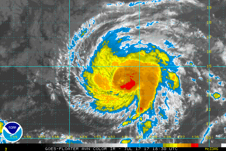
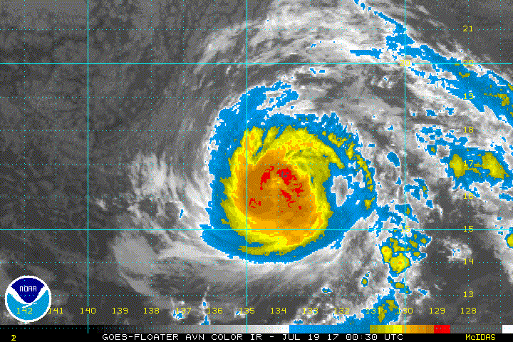
While there are still occasional glimpses of the eye in infrared
imagery, the convective cloud pattern of Fernanda continues to
slowly decay. The initial intensity is thus reduced a little more,
to 75 kt, based on a blend of various satellite intensity
estimates. Water vapor imagery shows that the outflow is becoming
restricted in the southwestern quadrant, which is a reflection of
10-15 kt of southwesterly vertical shear affecting the cyclone.

The initial motion is 310/7. Fernanda is expected to turn
west-northwest later today and continue this motion through 72 h as
it is steered by a strong low- to mid-level ridge to the north.
This ridge is forecast to persist after 72 h. However, the
guidance becomes more divergent during that time, likely due to how
quickly the various large-scale models weaken Fernanda. The NAVGEM
and Canadian models, which weaken the cyclone quickly, show a
generally westward motion of the remnants. The GFS and the HWRF,
which maintain a stronger vortex, show a more northerly motion on
the right side of the guidance envelope. The ECMWF is between these
extremes, and this part of new track forecast is a little to the
north of the ECMWF and a little south of the model consensus.
Overall, the new forecast is little changed through 72 h, then
nudged north of the previous forecast thereafter.

Fernanda is expected to steadily weaken through the forecast period
due to various combinations of cool sea surface temperatures,
southwesterly to southerly shear, and dry air entrainment. Thus,
the new forecast again follows the trend of the previous advisory
and calls for Fernanda to weaken to a tropical storm in less than 24
h, a post-tropical low by 72 h, and a remnant low by 96 h. The new
forecast is little changed from the previous forecast and lies
close to the intensity consensus. It should be noted that the GFS
and ECMWF show the possibility that Fernanda could interact with an
upper-level trough north of the Hawaiian Islands in a way that
could prolong its life as a tropical cyclone. Currently, the
confidence in this happening is too low to justify a change to the
forecast.


FORECAST POSITIONS AND MAX WINDS

INIT 19/1500Z 17.4N 135.5W 75 KT 85 MPH
12H 20/0000Z 17.9N 136.5W 65 KT 75 MPH
24H 20/1200Z 18.5N 138.0W 55 KT 65 MPH
36H 21/0000Z 19.0N 139.6W 45 KT 50 MPH
48H 21/1200Z 19.5N 141.3W 40 KT 45 MPH
72H 22/1200Z 20.5N 144.5W 35 KT 40 MPH...POST-TROPICAL
96H 23/1200Z 22.0N 149.0W 30 KT 35 MPH...POST-TROP/REMNT LOW
120H 24/1200Z 23.0N 153.5W 25 KT 30 MPH...POST-TROP/REMNT LOW

$$
Forecaster Beven
0 likes   
Visit the Caribbean-Central America Weather Thread where you can find at first post web cams,radars
and observations from Caribbean basin members Click Here

RL3AO
Moderator-Pro Met
Moderator-Pro Met
Posts: 16308
Joined: Thu Jun 14, 2007 10:03 pm
Location: NC

Re: EPAC: FERNANDA - Hurricane

#418 Postby RL3AO » Wed Jul 19, 2017 2:02 pm

ATCF Best Track
System ID: EP06 (FERNANDA)
1800 UTC Jul 19, 2017
Location: 17.5°N, 135.9°W
Central Pressure: 985 mb
Maximum Winds (1-min): 70 kt (80 mph)
Type: Category 1 Hurricane (HU)
ACE (Storm Total): 26.3575

Image
0 likes   

User avatar
cycloneye
Admin
Admin
Posts: 139060
Age: 67
Joined: Thu Oct 10, 2002 10:54 am
Location: San Juan, Puerto Rico

Re: EPAC: FERNANDA - Hurricane

#419 Postby cycloneye » Wed Jul 19, 2017 3:41 pm

Hurricane Fernanda Discussion Number 32
NWS National Hurricane Center Miami FL EP062017
200 PM PDT Wed Jul 19 2017

Fernanda continues to slowly weaken, with the convection gradually
decreasing in coverage and intensity due to cool sea surface
temperatures and increasing shear. The initial intensity is
reduced to 70 kt based on a blend of the various satellite
intensity estimates, and this value is on good agreement with the
CIMSS satellite consensus.

The initial motion is now 300/7. Fernanda is expected to continue
this motion through 72 h as it is steered by a strong low- to
mid-level ridge to the north. This ridge is forecast to persist
after 72 h. However, the guidance continues to show divergence
during that time, with the models that forecast Fernanda to weaken
more quickly showing a more westward motion. One change in the
guidance since the last advisory is that the GFS and the HWRF show a
more westward motion after 72 h than previously, and this has helped
shift the consensus models southward to near the old forecast track.
Based on this, the new forecast track is changed little since the
previous advisory, and lies near the current runs of the consensus
models.

Fernanda is expected to steadily weaken through the forecast period
due to various combinations of cool sea surface temperatures,
southwesterly to southerly shear, and dry air entrainment. One
change from the previous advisory is to keep the system as a
tropical cyclone at 72 h based on the GFS and ECMWF forecasting
associated organized convection at that time. Otherwise, the new
intensity is similar to the previous forecast and in good agreement
with the intensity consensus.

The initial and forecast wind radii have been revised based on a
just-received scatterometer overpass.


FORECAST POSITIONS AND MAX WINDS

INIT 19/2100Z 17.7N 136.3W 70 KT 80 MPH
12H 20/0600Z 18.1N 137.3W 60 KT 70 MPH
24H 20/1800Z 18.7N 139.0W 50 KT 60 MPH
36H 21/0600Z 19.2N 140.6W 40 KT 45 MPH
48H 21/1800Z 19.7N 142.2W 35 KT 40 MPH
72H 22/1800Z 21.0N 145.5W 30 KT 35 MPH
96H 23/1800Z 22.0N 149.5W 25 KT 30 MPH...POST-TROP/REMNT LOW
120H 24/1800Z 23.0N 155.0W 25 KT 30 MPH...POST-TROP/REMNT LOW

$$
Forecaster Beven
0 likes   
Visit the Caribbean-Central America Weather Thread where you can find at first post web cams,radars
and observations from Caribbean basin members Click Here

RL3AO
Moderator-Pro Met
Moderator-Pro Met
Posts: 16308
Joined: Thu Jun 14, 2007 10:03 pm
Location: NC

Re: EPAC: FERNANDA - Hurricane

#420 Postby RL3AO » Wed Jul 19, 2017 7:47 pm

ATCF Best Track
System ID: EP06 (FERNANDA)
0000 UTC Jul 20, 2017
Location: 18.0°N, 136.8°W
Central Pressure: 987 mb
Maximum Winds (1-min): 65 kt (75 mph)
Type: Category 1 Hurricane (HU)
ACE (Storm Total): 26.78

Image
0 likes   


Return to “2017”

Who is online

Users browsing this forum: No registered users and 92 guests