
ATL: ALBERTO - Post-Tropical
Moderator: S2k Moderators
-
Aric Dunn
- Category 5

- Posts: 21228
- Age: 41
- Joined: Sun Sep 19, 2004 9:58 pm
- Location: Ready for the Chase.
- Contact:
Re: ATL: INVEST 90L - Models
and 96 hours. another circ starts to come out of the NW .. looking better than last run still.
0 likes
Note: If I make a post that is brief. Please refer back to previous posts for the analysis or reasoning. I do not re-write/qoute what my initial post said each time.
If there is nothing before... then just ask
Space & Atmospheric Physicist, Embry-Riddle Aeronautical University,
I believe the sky is falling...
If there is nothing before... then just ask
Space & Atmospheric Physicist, Embry-Riddle Aeronautical University,
I believe the sky is falling...
-
Aric Dunn
- Category 5
- Posts: 21228
- Age: 41
- Joined: Sun Sep 19, 2004 9:58 pm
- Location: Ready for the Chase.
- Contact:
Re: ATL: INVEST 90L - Models
better through 90 hours then loses composure again lol
CMC has gone a little crazy too. the sheared convection is causing multiple circ to develop.. going to be a trick next 3 days..
CMC has gone a little crazy too. the sheared convection is causing multiple circ to develop.. going to be a trick next 3 days..
Last edited by Aric Dunn on Mon May 21, 2018 11:12 pm, edited 1 time in total.
0 likes
Note: If I make a post that is brief. Please refer back to previous posts for the analysis or reasoning. I do not re-write/qoute what my initial post said each time.
If there is nothing before... then just ask
Space & Atmospheric Physicist, Embry-Riddle Aeronautical University,
I believe the sky is falling...
If there is nothing before... then just ask
Space & Atmospheric Physicist, Embry-Riddle Aeronautical University,
I believe the sky is falling...
-
AdamFirst

- S2K Supporter

- Posts: 2487
- Age: 34
- Joined: Thu Aug 14, 2008 10:54 am
- Location: Port Saint Lucie, FL
Re: ATL: INVEST 90L - Models
GFS not backing down from its Florida solution.
1 likes
Dolphins Marlins Canes Golden Panthers HEAT
Andrew 1992 - Irene 1999 - Frances 2004 - Jeanne 2004 - Wilma 2005 - Fay 2008 - Isaac 2012 - Matthew 2016 - Irma 2017 - Dorian 2019 - Ian 2022 - Nicole 2022
Andrew 1992 - Irene 1999 - Frances 2004 - Jeanne 2004 - Wilma 2005 - Fay 2008 - Isaac 2012 - Matthew 2016 - Irma 2017 - Dorian 2019 - Ian 2022 - Nicole 2022
-
MississippiWx

- S2K Supporter
- Posts: 1535
- Joined: Sat Aug 14, 2010 1:44 pm
- Location: Hattiesburg, Mississippi
Re: ATL: INVEST 90L - Models
Canadian took a big jump east on this 0z run. Landall in Florida Panhandle. Hope this isn’t the start of a trend for those of us who need rain in the Northern Gulf.
1 likes
This post is not an official forecast and should not be used as such. It is just the opinion of MississippiWx and may or may not be backed by sound meteorological data. It is not endorsed by any professional institution including storm2k.org. For Official Information please refer to the NHC and NWS products.
-
USTropics
- Category 5
- Posts: 2409
- Joined: Sun Aug 12, 2007 3:45 am
- Location: Florida State University
Re: ATL: INVEST 90L - Models
If the GFS is correct, watch the coast of Columbia in about ~48 hours. Seems to eject a piece of vorticity that eventually catches up and interacts with 90L. The solution is similar to the 00z run from the UKMET last night, actually.
0 likes
-
Aric Dunn
- Category 5
- Posts: 21228
- Age: 41
- Joined: Sun Sep 19, 2004 9:58 pm
- Location: Ready for the Chase.
- Contact:
Re: ATL: INVEST 90L - Models
MississippiWx wrote:Canadian took a big jump east on this 0z run. Landall in Florida Panhandle. Hope this isn’t the start of a trend for those of us who need rain in the Northern Gulf.
we cant really talk track trends until the model can resolve the center. track north is likely given the steering. all of these track changes are do to the multiple circs rotating around.
0 likes
Note: If I make a post that is brief. Please refer back to previous posts for the analysis or reasoning. I do not re-write/qoute what my initial post said each time.
If there is nothing before... then just ask
Space & Atmospheric Physicist, Embry-Riddle Aeronautical University,
I believe the sky is falling...
If there is nothing before... then just ask
Space & Atmospheric Physicist, Embry-Riddle Aeronautical University,
I believe the sky is falling...
-
Twisted-core
- Category 1

- Posts: 252
- Joined: Fri May 11, 2018 9:20 pm
Re: ATL: INVEST 90L - Models
Mon May 21 23:49:20 EDT 2018
WTNT80 EGRR 211603
MET OFFICE TROPICAL CYCLONE GUIDANCE FOR NORTH-EAST PACIFIC
AND ATLANTIC NEW TROPICAL STORM FORECAST TO DEVELOP AFTER 120 HOURS
FORECAST POSITION AT T+120 : 19.8N 86.3W
VERIFYING TIME POSITION STRENGTH TENDENCY
-------------- -------- -------- --------
12UTC 26.05.2018 19.8N 86.3W WEAK
00UTC 27.05.2018 21.4N 85.6W WEAK LITTLE CHANGE
12UTC 27.05.2018 24.3N 85.5W MODERATE LITTLE CHANGE
THIS INFORMATION IS PROVIDED AS GUIDANCE FOR TROPICAL CYCLONE
RSMCS. IT REQUIRES INTERPRETATION BY TROPICAL CYCLONE SPECIALISTS
AND SHOULD NOT BE CONSIDERED AS A FINAL PRODUCT.
East of Yucatan genesis,then a short life in GOM thinks the unified ukmet model.
0 likes
-
Shell Mound
- Category 5
- Posts: 2434
- Age: 31
- Joined: Thu Sep 07, 2017 3:39 pm
- Location: St. Petersburg, FL → Scandinavia
Re: ATL: INVEST 90L - Models
The 00Z ECMWF is notably faster and significantly farther E vs. previous runs, suggesting a landfall between the MS River Delta and the FL Panhandle.
The structure also seems more subtropical than tropical, given co-location with the cutoff low. The strongest winds are well N and E of the LLC.
The structure also seems more subtropical than tropical, given co-location with the cutoff low. The strongest winds are well N and E of the LLC.
2 likes
CVW / MiamiensisWx / Shell Mound
The posts in this forum are NOT official forecasts and should not be used as such. They are just the opinion of the poster and may or may not be backed by sound meteorological data. They are NOT endorsed by any professional institution or STORM2K. For official information, please refer to products from the NHC and NWS.
-
Dylan

- Professional-Met

- Posts: 337
- Age: 29
- Joined: Mon May 31, 2010 9:50 am
- Location: New Orleans, LA
Re: ATL: INVEST 90L - Models
Looks like 90L’s destination on the 0z Euro is the Mississippi Gulf Coast. Similar track to the 12z run.
1 likes
Georges('98), Allison('01), Isidore('02), Lili('02), Frances('04) Ivan('04), Cindy('05), Katrina('05), Rita('05), Gustav('08), Isaac('12), Matthew('16), Harvey('17), Irma('17), Nate ('17), Ida ('21).
-
Sciencerocks
- Category 5
- Posts: 7282
- Age: 38
- Joined: Thu Jul 06, 2017 1:51 am
-
northjaxpro

- S2K Supporter
- Posts: 8900
- Joined: Mon Sep 27, 2010 11:21 am
- Location: Jacksonville, FL
Re: ATL: INVEST 90L - Models
06Z GFS run just rolling in this morning continues its persistent solution of having a weak, 1004 mb sloppy, sheared Invest 90L in the extreme Southeast Gulf of Mexico by 12Z Sunday morning, then moving across the Florida peninsula Sunday afternoon at 18Z. GFS moves Invest 90L off the coast of Jacksonville by 0Z Sunday evening.
Should the GFS verify, water-logged conditions are in store for the peninsula this upcoming holiday weekend for sure!
Should the GFS verify, water-logged conditions are in store for the peninsula this upcoming holiday weekend for sure!
2 likes
NEVER, EVER SAY NEVER in the tropics and weather in general, and most importantly, with life itself!!
________________________________________________________________________________________
Fay 2008 Beryl 2012 Debby 2012 Colin 2016 Hermine 2016 Julia 2016 Matthew 2016 Irma 2017 Dorian 2019
________________________________________________________________________________________
Fay 2008 Beryl 2012 Debby 2012 Colin 2016 Hermine 2016 Julia 2016 Matthew 2016 Irma 2017 Dorian 2019
-
cycloneye

- Admin

- Posts: 139049
- Age: 67
- Joined: Thu Oct 10, 2002 10:54 am
- Location: San Juan, Puerto Rico
Re: ATL: INVEST 90L - Discussion
Cone more to the right than the last one.
Special Tropical Weather Outlook
NWS National Hurricane Center Miami FL
745 AM EDT Tue May 22 2018
For the North Atlantic...Caribbean Sea and the Gulf of Mexico:
A broad surface low centered just east of Belize is producing a
large area of cloudiness and showers extending from the northwestern
Caribbean Sea across Cuba into the Florida peninsula. While strong
upper-level winds and dry air aloft are expected to limit
organization during the next couple of days, some gradual
subtropical or tropical development is possible late this week while
the system moves slowly northward into the central or eastern Gulf
of Mexico. Regardless of development, locally heavy rainfall is
possible across western Cuba, the Cayman Islands, and much of
Florida during the next several days. For more information on the
heavy rain threat, please see products issued by your local weather
office. The next Special Tropical Weather Outlook on this system
will be issued by 800 PM EDT.
* Formation chance through 48 hours...low...near 0 percent.
* Formation chance through 5 days...medium...40 percent.
$$
Forecaster Blake
2 likes
Visit the Caribbean-Central America Weather Thread where you can find at first post web cams,radars
and observations from Caribbean basin members Click Here
and observations from Caribbean basin members Click Here
-
northjaxpro
- S2K Supporter
- Posts: 8900
- Joined: Mon Sep 27, 2010 11:21 am
- Location: Jacksonville, FL
Re: ATL: INVEST 90L - Discussion: STWO-0%-40%- Cone more to the right
Well, this is an indication with the yellow circle now shifting east that the NHC is putting more weight to what the GFS has long been persisting all along. An Eastern Gulf solution or N/NNE motion potential solution looks reasonable.
1 likes
NEVER, EVER SAY NEVER in the tropics and weather in general, and most importantly, with life itself!!
________________________________________________________________________________________
Fay 2008 Beryl 2012 Debby 2012 Colin 2016 Hermine 2016 Julia 2016 Matthew 2016 Irma 2017 Dorian 2019
________________________________________________________________________________________
Fay 2008 Beryl 2012 Debby 2012 Colin 2016 Hermine 2016 Julia 2016 Matthew 2016 Irma 2017 Dorian 2019

Re: ATL: INVEST 90L - Discussion: STWO-0%-40%- Cone more to the right
northjaxpro wrote:Well, this is an indication with the yellow circle now shifting east that the NHC is putting more weight to what the GFS has long been persisting all along. An Eastern Gulf solution or N/NNE motion potential solution looks reasonable.
Wxman57 said as much. Seems NHC agrees with him. I am so glad we have knowledgeable mets on here. I love this forum. I already see a lot of convection on the east side of the low. Regardless of landfall if any, we will see tons of rain.
4 likes
Robbielyn McCrary
I know just about enough to sound like I know what I'm talking about sometimes. But for your safety please follow the nhc for truly professional forecasting.
I know just about enough to sound like I know what I'm talking about sometimes. But for your safety please follow the nhc for truly professional forecasting.

Re: ATL: INVEST 90L - Discussion
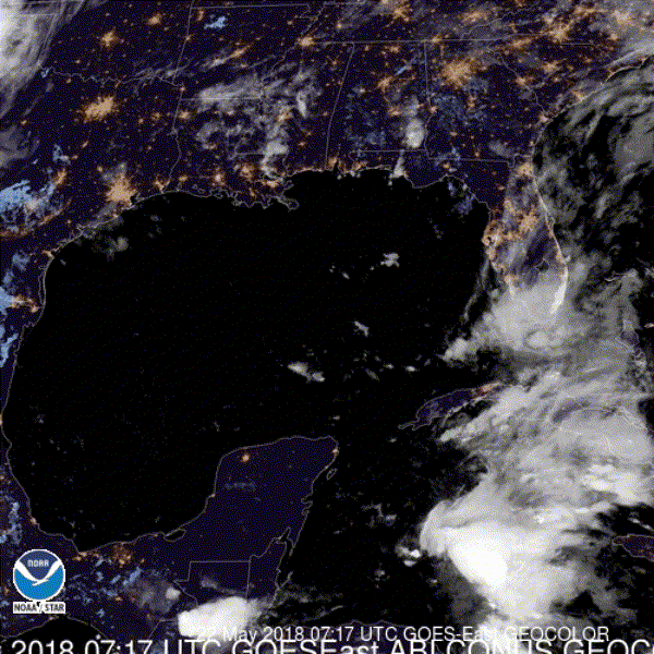
Broad surface circulation seen on vis satellite this morning is just east of Belize while all the convection is well east of it.

0 likes
-
stormlover2013
- Category 5
- Posts: 2312
- Joined: Thu Aug 22, 2013 12:06 pm
- Location: Lumberton, Texas
Re: ATL: INVEST 90L - Discussion
Still need a center then we got business but until then models will be back and forth
0 likes
Re: ATL: INVEST 90L - Models
USTropics wrote:Trend of last 4 runs of the GFS, valid for 18z Friday night:
https://i.imgur.com/bj0rrBm.gif
This is the reason why the NHC is still not putting all weight into the GFS, it has been inconsistent withing this range while the Euro has been a little more consistent.
0 likes
-
cycloneye
- Admin
- Posts: 139049
- Age: 67
- Joined: Thu Oct 10, 2002 10:54 am
- Location: San Juan, Puerto Rico
Re: ATL: INVEST 90L - Models
12z SHIP output:
Code: Select all
          * ATLANTIC     SHIPS INTENSITY FORECAST          *
                    * IR SAT DATA PROXY USED,      OHC AVAILABLE     *
                    *  INVEST      AL902018  05/22/18  12 UTC        *

TIME (HR)          0     6    12    18    24    36    48    60    72    84    96   108   120
V (KT) NO LAND    25    26    26    27    27    29    30    35    36    40    44    47    52
V (KT) LAND       25    26    26    27    27    28    29    34    31    29    34    37    42
V (KT) LGEM       25    25    24    24    23    23    25    25    23    25    28    28    30
Storm Type      TROP  TROP  TROP  TROP  TROP  TROP  TROP  TROP  TROP  TROP  TROP  TROP  TROP

SHEAR (KT)        26    24    25    24    21    20    14    15    18    17    16    19    23
SHEAR ADJ (KT)     2     2     1     0     2     2     0     0    -4    -6    -4     0    -3
SHEAR DIR        284   275   266   275   276   263   282   237   248   239   255   271   282
SST (C)         28.8  29.0  29.1  29.2  29.3  29.3  29.1  29.0  28.9  28.8  28.6  28.2  28.1
POT. INT. (KT)   147   149   150   151   152   153   150   149   147   147   145   141   141
ADJ. POT. INT.   136   135   135   135   136   138   136   138   135   138   139   137   137
200 MB T (C)   -54.0 -53.7 -53.3 -53.4 -53.6 -53.1 -53.5 -52.9 -53.3 -52.6 -53.1 -52.6 -53.3
200 MB VXT (C)   0.2   0.3   0.5   0.4   0.4   0.3   0.3   0.6   0.4   0.5   0.3   0.3   0.2
TH_E DEV (C)       8    10    11     9     8    10     8    10     8     9     7     9     9
700-500 MB RH     58    55    60    60    59    63    63    66    69    71    69    70    66
MODEL VTX (KT)     6     6     6     6     5     6     5     7     7     9    10    10    13
850 MB ENV VOR    59    54    54    56    45    48    44    70    84   101    86    69    42
200 MB DIV        44    37    29    33    32    46    29    58    67    81    74    66    47
700-850 TADV      -2     0     0    -1    -2     0     0    -2     0     1     1     7    16
LAND (KM)        107    63    31    10     0     0    71    45   -16   -16    78   346    80
LAT (DEG N)     17.5  17.4  17.3  17.2  17.1  17.1  16.7  16.2  15.6  15.7  16.5  18.4  21.1
LONG(DEG W)     87.1  87.6  87.9  88.1  88.2  88.2  87.6  87.1  86.4  85.5  84.1  82.4  80.4
STM SPEED (KT)     6     4     3     2     1     2     3     4     3     7    10    14    18
HEAT CONTENT      40    39    39    29    20    20    45    44    55    54    33    47    37

  FORECAST TRACK FROM TABM      INITIAL HEADING/SPEED (DEG/KT):270/  8      CX,CY:  -7/  0
  T-12 MAX WIND:  25            PRESSURE OF STEERING LEVEL (MB):  758  (MEAN=618)
  GOES IR BRIGHTNESS TEMP. STD DEV.  50-200 KM RAD:  20.7 (MEAN=14.5)
  % GOES IR PIXELS WITH T < -20 C    50-200 KM RAD:  38.0 (MEAN=65.0)
  PRELIM RI PROB (DV .GE. 55 KT IN 48 HR):            0.1

                        INDIVIDUAL CONTRIBUTIONS TO INTENSITY CHANGE
                         6   12   18   24   36   48   60   72   84   96  108  120
                        ----------------------------------------------------------
  SAMPLE MEAN CHANGE     1.   2.   3.   4.   6.   8.   9.  10.  11.  12.  13.  13.
  SST POTENTIAL          0.   1.   1.   3.   6.  11.  17.  22.  26.  30.  32.  35.
  VERTICAL SHEAR MAG     1.   1.   1.   1.   0.  -1.  -3.  -4.  -6.  -7.  -8. -10.
  VERTICAL SHEAR ADJ    -0.  -0.  -0.  -0.  -0.  -1.  -0.   0.   2.   3.   3.   3.
  VERTICAL SHEAR DIR    -0.  -1.  -1.  -1.  -2.  -3.  -5.  -7.  -9. -10. -11. -12.
  PERSISTENCE           -0.  -1.  -1.  -1.  -1.  -1.  -1.  -1.  -0.   0.   0.   1.
  200/250 MB TEMP.      -0.  -0.  -0.  -0.  -1.  -1.  -1.  -1.  -1.  -1.  -2.  -2.
  THETA_E EXCESS         0.   0.   0.   0.   0.   0.   0.   0.   0.   0.   0.   0.
  700-500 MB RH         -0.  -0.  -0.  -0.  -1.  -1.  -2.  -3.  -4.  -4.  -4.  -4.
  MODEL VTX TENDENCY    -0.  -0.  -1.  -2.  -2.  -4.  -2.  -3.  -2.  -1.  -1.   2.
  850 MB ENV VORTICITY   0.   0.   0.   0.   1.   1.   1.   1.   2.   3.   3.   3.
  200 MB DIVERGENCE      0.   0.   0.   0.   0.   0.   0.   0.   1.   1.   0.  -1.
  850-700 T ADVEC        0.  -0.  -0.  -0.  -0.  -0.  -0.  -1.  -1.  -1.  -0.  -0.
  ZONAL STORM MOTION    -0.   0.   0.   0.   1.   1.   1.   1.   1.   1.   1.   1.
  STEERING LEVEL PRES   -0.  -0.  -0.  -1.  -1.  -1.  -1.  -2.  -2.  -2.  -2.  -2.
  DAYS FROM CLIM. PEAK   0.   0.   0.   0.   0.   0.   1.   1.   1.   2.   2.   2.
  GOES PREDICTORS       -0.  -1.  -1.  -1.  -2.  -3.  -3.  -4.  -3.  -3.  -2.  -2.
  OCEAN HEAT CONTENT    -0.  -0.  -0.  -0.  -0.  -1.  -1.  -1.  -1.  -1.  -1.  -0.
                        ----------------------------------------------------------
  TOTAL CHANGE           1.   1.   2.   2.   4.   5.  10.  11.  15.  19.  22.  27.

                CURRENT MAX WIND (KT):   25. LAT, LON:   17.5    87.1

      ** 2017 ATLANTIC RI INDEX AL902018 INVEST     05/22/18  12 UTC **
 (SHIPS-RII PREDICTOR TABLE for 30 KT OR MORE MAXIMUM WIND INCREASE IN NEXT 24-h)

     Predictor             Value   RI Predictor Range  Scaled Value(0-1) % Contribution
 12 HR PERSISTENCE (KT):     0.0     -49.5  to   33.0       0.60         999.0
 850-200 MB SHEAR (KT) :    24.0      30.1  to    2.9       0.22         999.0
 HEAT CONTENT (KJ/cm2) :    33.4       0.0  to  156.2       0.21         999.0
 2nd PC OF IR BR TEMP  :  9999.0       2.4  to   -3.0     999.00         999.0
 STD DEV OF IR BR TEMP :   999.0      36.6  to    2.8     999.00         999.0
 MAXIMUM WIND (kt)     :    25.0      22.5  to  121.0       0.07         999.0
 POT = MPI-VMAX (KT)   :   110.3      28.4  to  139.6       0.74         999.0
 D200 (10**7s-1)       :    35.0     -29.7  to  181.5       0.31         999.0
 BL DRY-AIR FLUX (w/m2):   110.4     961.4  to  -67.1       0.83         999.0
 % AREA WITH TPW <45 mm:    34.5     100.0  to    0.0       0.65         999.0

 SHIPS Prob RI for 20kt/ 12hr RI threshold= 999% is 999.0 times sample mean ( 5.4%)
 SHIPS Prob RI for 25kt/ 24hr RI threshold= 999% is 999.0 times sample mean (11.5%)
 SHIPS Prob RI for 30kt/ 24hr RI threshold= 999% is 999.0 times sample mean ( 7.4%)
 SHIPS Prob RI for 35kt/ 24hr RI threshold= 999% is 999.0 times sample mean ( 4.3%)
 SHIPS Prob RI for 40kt/ 24hr RI threshold= 999% is 999.0 times sample mean ( 2.8%)
 SHIPS Prob RI for 45kt/ 36hr RI threshold= 999% is 999.0 times sample mean ( 5.1%)
 SHIPS Prob RI for 55kt/ 48hr RI threshold= 999% is 999.0 times sample mean ( 5.3%)
 SHIPS Prob RI for 65kt/ 72hr RI threshold= 999% is 999.0 times sample mean ( 6.0%)

Matrix of RI probabilities
------------------------------------------------------------------------------
  RI (kt / h)  | 20/12 | 25/24 | 30/24 | 35/24 | 40/24 | 45/36 | 55/48  |65/72
------------------------------------------------------------------------------
   SHIPS-RII:   999.0%  999.0%  999.0%  999.0%  999.0%  999.0%  999.0%  999.0%
    Logistic:   999.0%  999.0%  999.0%  999.0%  999.0%  999.0%  999.0%  999.0%
    Bayesian:   999.0%  999.0%  999.0%  999.0%  999.0%  999.0%  999.0%  999.0%
   Consensus:   999.0%  999.0%  999.0%  999.0%  999.0%  999.0%  999.0%  999.0%

   ##         ANNULAR HURRICANE INDEX (AHI) AL902018 INVEST     05/22/18  12 UTC         ##
   ##         ERR=2, BOTH IR FILES BAD OR MISSING

** PROBLTY OF AT LEAST 1 SCNDRY EYEWL FORMTN EVENT AL902018 INVEST     05/22/2018  12 UTC **
TIME(HR)   0-12  12-24(0-24)  24-36(0-36)  36-48(0-48)
CLIMO(%)     0      0(  0)       0(  0)       0(  0)     <-- PROB BASED ON INTENSITY ONLY
PROB(%)      0      0(  0)       0(  0)       0(  0)     PC4 UNAVAIL...MODEL SKILL DEGRADED

** DSHIPS INTENSITY FORECAST ADJUSTED RELATIVE TO ONSET OF ERC WEAKENING PHASE **
      TIME (HR)      0     6    12    18    24    36    48    60    72    84    96   108   120
>24HR AGO (DSHIPS)  25    26    26    27    27    28    29    34    31    29    34    37    42
 18HR AGO           25    24    24    25    25    26    27    32    29    27    32    35    40
 12HR AGO           25    22    21    22    22    23    24    29    26    24    29    32    37
  6HR AGO           25    19    16    15    15   DIS   DIS   DIS   DIS   DIS   DIS   DIS   DIS
      NOW                              CURRENT INTENSITY < 83 KT
  IN  6HR                              INTENSITY IN  6HR < 83 KT
  IN 12HR                              INTENSITY IN 12HR < 83 KT
0 likes
Visit the Caribbean-Central America Weather Thread where you can find at first post web cams,radars
and observations from Caribbean basin members Click Here
and observations from Caribbean basin members Click Here
-
cycloneye
- Admin
- Posts: 139049
- Age: 67
- Joined: Thu Oct 10, 2002 10:54 am
- Location: San Juan, Puerto Rico
Re: ATL: INVEST 90L - Discussion
12z Best Track: NDG,you nailed the location.
Location: 17.5°N 87.1°W
Maximum Winds: 25 kt Gusts: N/A
Minimum Central Pressure: 1009 mb
Environmental Pressure: 1011 mb
Radius of Circulation: 180 NM
Radius of Maximum Wind: 120 NM

Location: 17.5°N 87.1°W
Maximum Winds: 25 kt Gusts: N/A
Minimum Central Pressure: 1009 mb
Environmental Pressure: 1011 mb
Radius of Circulation: 180 NM
Radius of Maximum Wind: 120 NM
0 likes
Visit the Caribbean-Central America Weather Thread where you can find at first post web cams,radars
and observations from Caribbean basin members Click Here
and observations from Caribbean basin members Click Here
Who is online
Users browsing this forum: No registered users and 47 guests