EPAC: WILLA - Remnants

Moderator: S2k Moderators

Message
Author
User avatar
cycloneye
Admin
Admin
Posts: 139027
Age: 67
Joined: Thu Oct 10, 2002 10:54 am
Location: San Juan, Puerto Rico

Re: EPAC: INVEST 99E

#21 Postby cycloneye » Thu Oct 18, 2018 8:55 am

12z Best Track:

Location: 13.4°N 94.9°W
Maximum Winds: 25 kt Gusts: N/A
Minimum Central Pressure: 1007 mb
Environmental Pressure: 1010 mb
Radius of Circulation: 150 NM
Radius of Maximum Wind: 70 NM


Image
0 likes   
Visit the Caribbean-Central America Weather Thread where you can find at first post web cams,radars
and observations from Caribbean basin members Click Here

User avatar
cycloneye
Admin
Admin
Posts: 139027
Age: 67
Joined: Thu Oct 10, 2002 10:54 am
Location: San Juan, Puerto Rico

Re: EPAC: INVEST 99E

#22 Postby cycloneye » Thu Oct 18, 2018 10:46 am

1 likes   
Visit the Caribbean-Central America Weather Thread where you can find at first post web cams,radars
and observations from Caribbean basin members Click Here

zeehag
Tropical Storm
Tropical Storm
Posts: 172
Age: 75
Joined: Sun Jul 17, 2011 9:49 pm
Location: mazatlan,sinaloa, mexico, fixing patricia's mess.
Contact:

Re: EPAC: INVEST 99E

#23 Postby zeehag » Thu Oct 18, 2018 12:30 pm

looks like i get another patricia..hoping not so .
yes in mazatlan marina at present, unable to seek other waters for htis event. hoping not major. please send it elsewhere. i already did patty baby, not looking forward to major cane while immobile.
the more times i look a track the more come into mazatlan.
i guess our time of peace with momma nature is over.
0 likes   
life is an adventure meant to be LIVED!!!

http://www.sksolitarybird.org

User avatar
cycloneye
Admin
Admin
Posts: 139027
Age: 67
Joined: Thu Oct 10, 2002 10:54 am
Location: San Juan, Puerto Rico

Re: EPAC: INVEST 99E

#24 Postby cycloneye » Thu Oct 18, 2018 12:42 pm

Is taking longer to develop. Down to 70%/80%.

An extensive area of disorganized showers and thunderstorms extends
from Central America westward to the south of the coast of Mexico
for several hundred miles. A broad area of low pressure is
embedded within this region of disturbed weather near the Gulf of
Tehuantepec, but satellite images indicate that the system has lost
organization compared to the past couple of days. Still,
environmental conditions appear conducive for development, and a
tropical depression or tropical storm is likely to form over the
weekend or early next week while the system moves generally
west-northwestward at 10 to 15 mph near or just offshore the coast
of southern Mexico. Additional information on this system can be
found in High Seas Forecasts issued by the National Weather Service.
* Formation chance through 48 hours...high...70 percent.
* Formation chance through 5 days...high...80 percent.
0 likes   
Visit the Caribbean-Central America Weather Thread where you can find at first post web cams,radars
and observations from Caribbean basin members Click Here

User avatar
cheezyWXguy
Category 5
Category 5
Posts: 5528
Joined: Mon Feb 13, 2006 12:29 am
Location: Dallas, TX

Re: EPAC: INVEST 99E

#25 Postby cheezyWXguy » Thu Oct 18, 2018 2:31 pm

cycloneye wrote:Is taking longer to develop. Down to 70%/80%.

An extensive area of disorganized showers and thunderstorms extends
from Central America westward to the south of the coast of Mexico
for several hundred miles. A broad area of low pressure is
embedded within this region of disturbed weather near the Gulf of
Tehuantepec, but satellite images indicate that the system has lost
organization compared to the past couple of days. Still,
environmental conditions appear conducive for development, and a
tropical depression or tropical storm is likely to form over the
weekend or early next week while the system moves generally
west-northwestward at 10 to 15 mph near or just offshore the coast
of southern Mexico. Additional information on this system can be
found in High Seas Forecasts issued by the National Weather Service.
* Formation chance through 48 hours...high...70 percent.
* Formation chance through 5 days...high...80 percent.


I think the main issue is that the organizing circulation we were tracking with this system was ex-94L, which is south of the western-most extent of the Gulf of Tehuantepec. But based on visible imagery, whatever circulation existed there seems nearly gone, and a more concentrated one with more consistent convection seems to be forming just south of Guatemala. I imagine it will take another day or so to get all of those diffuse swirls consolidated into a single circulation, but I have a hard time believing nothing will come of this area with such strong model support.
2 likes   

User avatar
cycloneye
Admin
Admin
Posts: 139027
Age: 67
Joined: Thu Oct 10, 2002 10:54 am
Location: San Juan, Puerto Rico

Re: EPAC: INVEST 99E

#26 Postby cycloneye » Thu Oct 18, 2018 6:56 pm

They now have two separated areas one 99E and the new one south of Guatemala.

A trough of low pressure continues to produce disorganized showers
and thunderstorms a couple of hundred miles south of the southern
coast of Mexico. This system has become less organized since
yesterday, however, environmental conditions are expected to become
more favorable for development and a tropical depression is still
likely to form over the weekend or early next week while the system
moves generally west-northwestward at 10 to 15 mph, near or just
offshore the coast of southern Mexico.
* Formation chance through 48 hours...high...70 percent.
* Formation chance through 5 days...high...80 percent.
0 likes   
Visit the Caribbean-Central America Weather Thread where you can find at first post web cams,radars
and observations from Caribbean basin members Click Here

Ntxw
Storm2k Moderator
Storm2k Moderator
Posts: 21495
Joined: Wed Oct 21, 2009 6:34 pm
Location: DFW, Texas

Re: EPAC: INVEST 99E

#27 Postby Ntxw » Thu Oct 18, 2018 7:12 pm

I have to agree with CheezyWX that whatever ex-94L was muddled up the models. Messy right now.

Image
1 likes   
The above post and any post by Ntxw is NOT an official forecast and should not be used as such. It is just the opinion of the poster and may or may not be backed by sound meteorological data. It is NOT endorsed by any professional institution including Storm2k. For official information, please refer to NWS products.

  Help support Storm2K!
Help Support Storm2K

zeehag
Tropical Storm
Tropical Storm
Posts: 172
Age: 75
Joined: Sun Jul 17, 2011 9:49 pm
Location: mazatlan,sinaloa, mexico, fixing patricia's mess.
Contact:

Re: EPAC: INVEST 99E

#28 Postby zeehag » Fri Oct 19, 2018 8:39 am

messy with 2 tryinaformations coming at ME!!!
yeah some self absorbed attitude here.... but i worry about the others in lesser boats and on flooding land here
0 likes   
life is an adventure meant to be LIVED!!!

http://www.sksolitarybird.org

Ntxw
Storm2k Moderator
Storm2k Moderator
Posts: 21495
Joined: Wed Oct 21, 2009 6:34 pm
Location: DFW, Texas

Re: EPAC: INVEST 99E

#29 Postby Ntxw » Fri Oct 19, 2018 9:55 am

99E actually does not look to bad this morning either. It may actually be getting closer to TC designation. It's a dueling match between this and the system further east. Some models have this one absorbing the other, or merging...who knows. Maybe twin cyclones.

Image
2 likes   
The above post and any post by Ntxw is NOT an official forecast and should not be used as such. It is just the opinion of the poster and may or may not be backed by sound meteorological data. It is NOT endorsed by any professional institution including Storm2k. For official information, please refer to NWS products.


  Help support Storm2K!

Help Support Storm2K


User avatar
EquusStorm
Category 5
Category 5
Posts: 1649
Age: 33
Joined: Thu Nov 07, 2013 1:04 pm
Location: Jasper, AL
Contact:

Re: EPAC: INVEST 99E

#30 Postby EquusStorm » Fri Oct 19, 2018 10:19 am

I can't imagine it will be beneficial to either to have them both that close together; interaction could lead to some weird track gyrations awfully close to land
0 likes   
Colors of lost purpose on the canvas of irrelevance

Not a meteorologist, in fact more of an idiot than anything. You should probably check with the NHC or a local NWS office for official information.

User avatar
cycloneye
Admin
Admin
Posts: 139027
Age: 67
Joined: Thu Oct 10, 2002 10:54 am
Location: San Juan, Puerto Rico

Re: EPAC: INVEST 99E

#31 Postby cycloneye » Fri Oct 19, 2018 12:34 pm

Showers and thunderstorms associated with an area of low pressure
centered a few hundred miles south-southwest of Zihuatanejo, Mexico,
are gradually becoming better organized. Environmental conditions
are expected to become increasingly favorable for further
development, and a tropical depression is expected to form later
today or tomorrow while the low moves west-northwestward at about 10
mph, well offshore of the coast of southwestern Mexico.
* Formation chance through 48 hours...high...80 percent.
* Formation chance through 5 days...high...90 percent.
0 likes   
Visit the Caribbean-Central America Weather Thread where you can find at first post web cams,radars
and observations from Caribbean basin members Click Here

User avatar
cycloneye
Admin
Admin
Posts: 139027
Age: 67
Joined: Thu Oct 10, 2002 10:54 am
Location: San Juan, Puerto Rico

Re: EPAC: INVEST 99E

#32 Postby cycloneye » Fri Oct 19, 2018 3:16 pm

Shear will not be a big factor.

* EAST PACIFIC 2018 SHIPS INTENSITY FORECAST *
* IR SAT DATA AVAILABLE, OHC AVAILABLE *
* INVEST EP992018 10/19/18 18 UTC *

TIME (HR) 0 6 12 18 24 36 48 60 72 84 96 108 120
V (KT) NO LAND 25 27 30 33 38 47 57 69 78 89 97 101 96
V (KT) LAND 25 27 30 33 38 47 57 69 78 89 97 101 96
V (KT) LGEM 25 26 27 29 31 35 41 49 59 71 82 84 80
Storm Type TROP TROP TROP TROP TROP TROP TROP TROP TROP TROP TROP TROP TROP

SHEAR (KT) 11 10 8 7 6 5 5 6 11 7 7 4 4
SHEAR ADJ (KT) -4 -3 -4 -6 -6 -2 -3 -1 -2 -3 -1 4 9
SHEAR DIR 53 54 62 85 110 113 104 53 16 15 281 179 191
SST (C) 29.1 29.5 29.9 29.9 29.8 29.8 29.8 29.9 30.0 29.7 28.0 27.8 27.9
POT. INT. (KT) 156 160 163 162 161 159 160 160 162 160 144 142 143
200 MB T (C) -53.5 -53.2 -53.5 -53.7 -53.4 -53.4 -53.4 -53.3 -53.2 -52.9 -52.5 -52.1 -51.9
200 MB VXT (C) -0.2 -0.1 0.0 0.1 0.1 0.2 0.2 0.3 0.3 0.3 0.3 0.7 0.8
TH_E DEV (C) 7 8 6 6 6 7 6 6 6 6 6 6 6
700-500 MB RH 76 77 77 76 75 75 70 73 74 74 72 64 58
MODEL VTX (KT) 8 8 9 10 11 11 13 15 18 24 30 32 30
850 MB ENV VOR 2 -4 -16 -22 -19 -13 -18 -23 13 23 31 62 63
200 MB DIV 38 44 41 42 54 76 62 36 73 81 90 66 90
700-850 TADV -4 -3 -3 -2 -1 -2 -1 -2 -1 0 1 1 4
LAND (KM) 415 444 459 472 481 517 566 618 598 500 376 432 478
LAT (DEG N) 14.1 14.2 14.4 14.6 14.8 14.9 14.7 14.2 14.2 15.1 16.8 18.2 18.7
LONG(DEG W) 103.0 104.1 104.9 105.5 106.0 106.7 107.2 107.3 107.0 106.7 107.3 109.1 111.0
STM SPEED (KT) 12 9 7 6 5 2 3 2 3 7 10 11 9
HEAT CONTENT 40 29 29 30 27 25 26 31 32 24 19 16 11

FORECAST TRACK FROM TABM INITIAL HEADING/SPEED (DEG/KT):270/ 13 CX,CY: -12/ 0
T-12 MAX WIND: 25 PRESSURE OF STEERING LEVEL (MB): 326 (MEAN=584)
GOES IR BRIGHTNESS TEMP. STD DEV. 50-200 KM RAD: 16.7 (MEAN=14.5)
% GOES IR PIXELS WITH T < -20 C 50-200 KM RAD: 74.0 (MEAN=65.0)
PRELIM RI PROB (DV .GE. 55 KT IN 48 HR): 13.3

INDIVIDUAL CONTRIBUTIONS TO INTENSITY CHANGE
6 12 18 24 36 48 60 72 84 96 108 120
----------------------------------------------------------
SAMPLE MEAN CHANGE 0. 0. 1. 1. 1. 1. 1. 0. -1. -1. -2. -3.
SST POTENTIAL -1. -2. -3. -2. 1. 8. 16. 25. 31. 35. 37. 36.
VERTICAL SHEAR MAG 1. 2. 3. 4. 5. 7. 7. 6. 5. 5. 6. 8.
VERTICAL SHEAR ADJ 0. 0. 0. 0. 1. 1. 0. 0. -1. -1. -1. -1.
VERTICAL SHEAR DIR 0. 1. 2. 3. 4. 6. 8. 8. 8. 7. 5. 4.
PERSISTENCE 0. 0. 0. -1. -1. -1. 0. 0. 0. 0. 0. 0.
200/250 MB TEMP. 0. 0. 0. -1. -2. -2. -3. -4. -5. -5. -4. -2.
THETA_E EXCESS 0. 0. 0. 0. 1. 1. 1. 1. 1. 0. 1. 0.
700-500 MB RH 0. 0. 1. 1. 1. 2. 2. 3. 3. 3. 3. 3.
MODEL VTX TENDENCY 0. 1. 2. 3. 3. 5. 8. 14. 22. 31. 33. 29.
850 MB ENV VORTICITY 0. 0. 0. 0. 0. 1. 1. 2. 2. 2. 1. 1.
200 MB DIVERGENCE 0. 0. 0. 0. 1. 1. 1. 1. 2. 2. 3. 3.
850-700 T ADVEC 0. 0. 0. 0. 0. 0. 0. 0. 0. 0. 0. 0.
ZONAL STORM MOTION 0. 1. 1. 1. 2. 2. 2. 2. 1. 1. 1. 1.
STEERING LEVEL PRES 0. -1. -1. -1. -2. -2. -2. -3. -4. -5. -5. -5.
DAYS FROM CLIM. PEAK 0. 0. 0. 0. 0. 0. -1. -1. -1. -2. -2. -2.
GOES PREDICTORS 1. 1. 2. 2. 2. 1. 0. 0. 0. -1. -1. -1.
OCEAN HEAT CONTENT 0. 0. 0. 1. 0. 0. 1. 0. 0. 0. 0. 0.
RI POTENTIAL 0. 0. 1. 1. 3. 3. 3. 1. 0. 0. -1. -1.
----------------------------------------------------------
TOTAL CHANGE 2. 5. 8. 13. 22. 32. 44. 53. 64. 72. 76. 71.

CURRENT MAX WIND (KT): 25. LAT, LON: 14.1 103.0

** 2018 E. Pacific RI INDEX EP992018 INVEST 10/19/18 18 UTC **
(SHIPS-RII PREDICTOR TABLE for 30 KT OR MORE MAXIMUM WIND INCREASE IN NEXT 24-h)

Predictor Value RI Predictor Range Scaled Value(0-1) % Contribution
POT = MPI-VMAX (KT) : 139.5 40.5 to 149.3 0.91 7.9
12 HR PERSISTENCE (KT) : 0.0 -22.0 to 44.0 0.33 3.4
850-200 MB SHEAR (KT) : 8.5 19.6 to 1.4 0.61 5.0
HEAT CONTENT (KJ/CM2) : 31.0 1.8 to 106.7 0.28 1.8
D200 (10**7s-1) : 43.8 -33.0 to 156.2 0.41 2.9
STD DEV OF IR BR TEMP : 16.7 37.8 to 2.1 0.59 3.5
MAXIMUM WIND (KT) : 25.0 22.5 to 132.0 0.07 0.4
BL DRY-AIR FLUX (W/M2) : 30.2 721.6 to -82.5 0.86 -4.3
%area of TPW <45 mm upshear : 0.0 62.3 to 0.0 1.00 0.6
2nd PC OF IR BR TEMP : -0.9 2.2 to -1.9 0.75 0.7

SHIPS Prob RI for 20kt/ 12hr RI threshold= 0% is 0.0 times climatological mean ( 6.1%)
SHIPS Prob RI for 25kt/ 24hr RI threshold= 24% is 2.0 times climatological mean (12.5%)
SHIPS Prob RI for 30kt/ 24hr RI threshold= 22% is 2.6 times climatological mean ( 8.4%)
SHIPS Prob RI for 35kt/ 24hr RI threshold= 0% is 0.0 times climatological mean ( 6.0%)
SHIPS Prob RI for 40kt/ 24hr RI threshold= 0% is 0.0 times climatological mean ( 4.0%)
SHIPS Prob RI for 45kt/ 36hr RI threshold= 20% is 3.1 times climatological mean ( 6.5%)
SHIPS Prob RI for 55kt/ 48hr RI threshold= 23% is 3.9 times climatological mean ( 5.9%)
SHIPS Prob RI for 65kt/ 72hr RI threshold= 0% is 0.0 times climatological mean ( 4.8%)

Matrix of RI probabilities
------------------------------------------------------------------------------
RI (kt / h) | 20/12 | 25/24 | 30/24 | 35/24 | 40/24 | 45/36 | 55/48 |65/72
------------------------------------------------------------------------------
SHIPS-RII: 0.0% 24.4% 21.9% 0.0% 0.0% 20.1% 23.1% 0.0%
Logistic: 5.8% 43.4% 24.4% 14.2% 14.1% 43.6% 66.6% 53.1%
Bayesian: 0.2% 7.8% 1.5% 0.2% 0.3% 2.5% 6.4% 2.7%
Consensus: 2.0% 25.2% 15.9% 4.8% 4.8% 22.0% 32.1% 18.6%
DTOPS: 999.0% 999.0% 999.0% 999.0% 999.0% 999.0% 999.0% 999.0%

## ANNULAR HURRICANE INDEX (AHI) EP992018 INVEST 10/19/18 18 UTC ##
## STORM NOT ANNULAR, SCREENING STEP FAILED, NPASS=4 NFAIL=3 ##
## AHI= 0 (AHI OF 100 IS BEST FIT TO ANN. STRUC., 1 IS MARGINAL, 0 IS NOT ANNULAR) ##

CONTRIBUTIONS TO ANNULAR INDEX
0 likes   
Visit the Caribbean-Central America Weather Thread where you can find at first post web cams,radars
and observations from Caribbean basin members Click Here

User avatar
cycloneye
Admin
Admin
Posts: 139027
Age: 67
Joined: Thu Oct 10, 2002 10:54 am
Location: San Juan, Puerto Rico

Re: EPAC: INVEST 99E

#33 Postby cycloneye » Fri Oct 19, 2018 6:15 pm

Almost a TD if not already.

howers and thunderstorms associated with an area of low pressure
centered a few hundred miles south-southwest of Zihuatanejo, Mexico
continue to show signs of organization. Environmental conditions
are expected to remain favorable for further development, and a
tropical depression is expected to form tonight or tomorrow
while the low moves west-northwestward at about 10 mph, well
offshore of the coast of southwestern Mexico.
* Formation chance through 48 hours...high...90 percent.
* Formation chance through 5 days...high...90 percent.
1 likes   
Visit the Caribbean-Central America Weather Thread where you can find at first post web cams,radars
and observations from Caribbean basin members Click Here

User avatar
cheezyWXguy
Category 5
Category 5
Posts: 5528
Joined: Mon Feb 13, 2006 12:29 am
Location: Dallas, TX

Re: EPAC: INVEST 99E

#34 Postby cheezyWXguy » Fri Oct 19, 2018 11:04 pm

Looks like ASCAT missed missed this area today, but windsat got it, and doesn't show much at the surface. However, if 99E keeps generating convection as intense as it is (-80 to -90C) overnight, classification is a good bet for tomorrow.
1 likes   

User avatar
DioBrando
Category 4
Category 4
Posts: 917
Age: 27
Joined: Sun Aug 12, 2018 12:45 pm

Re: EPAC: INVEST 99E

#35 Postby DioBrando » Sat Oct 20, 2018 3:48 am

Ayo bbs hit up the nhc website WE ALL HAVE A TD!!!
4 likes   
blonde stacey (xe/xem/xir)

User avatar
DioBrando
Category 4
Category 4
Posts: 917
Age: 27
Joined: Sun Aug 12, 2018 12:45 pm

Re: EPAC: INVEST 99E

#36 Postby DioBrando » Sat Oct 20, 2018 3:50 am

HERE COMES WILLAAAAAAAAAA

1,2...1,2,3,4

000 WTPZ34 KNHC 200837 TCPEP4 BULLETIN Tropical Depression Twenty-Four-E Advisory Number 2 NWS National Hurricane Center Miami FL EP242018 400 AM CDT Sat Oct 20 2018 ...NEW TROPICAL DEPRESSION FORMS WELL SOUTH OF MANZANILLO MEXICO... ...NO THREAT TO LAND OVER THE WEEKEND... SUMMARY OF 400 AM CDT...0900 UTC...INFORMATION ---------------------------------------------- LOCATION...15.1N 104.9W ABOUT 270 MI...440 KM S OF MANZANILLO MEXICO MAXIMUM SUSTAINED WINDS...35 MPH...55 KM/H PRESENT MOVEMENT...W OR 280 DEGREES AT 9 MPH...15 KM/H MINIMUM CENTRAL PRESSURE...1007 MB...29.74 INCHES WATCHES AND WARNINGS -------------------- There are no coastal watches or warnings in effect. DISCUSSION AND OUTLOOK ---------------------- At 400 AM CDT (0900 UTC), the center of newly formed Tropical Depression Twenty-Four-E was located near latitude 15.1 North, longitude 104.9 West. The depression is moving toward the west near 9 mph (15 km/h) and this motion is expected to continue this morning, followed by a turn toward the west-northwest by this afternoon. A motion toward the northwest is forecast on Sunday and Monday, with the tropical cyclone remaining well offshore the southwestern coast of Mexico. Maximum sustained winds are near 35 mph (55 km/h) with higher gusts. Steady strengthening is forecast during the next few days, and the depression is expected to become a tropical storm later this morning and reach hurricane strength by Sunday night or Monday morning. The estimated minimum central pressure is 1007 mb (29.74 inches). HAZARDS AFFECTING LAND ---------------------- None. NEXT ADVISORY ------------- Next complete advisory at 1000 AM CDT. $$ Forecaster Stewart
1 likes   
blonde stacey (xe/xem/xir)

User avatar
TorSkk
Category 2
Category 2
Posts: 514
Joined: Thu Jul 05, 2018 5:08 am

Re: EPAC: INVEST 99E

#37 Postby TorSkk » Sat Oct 20, 2018 4:53 am

BULLETIN
Tropical Depression Twenty-Four-E Advisory Number 1...Corrected
NWS National Hurricane Center Miami FL EP242018
400 AM CDT Sat Oct 20 2018

Corrected advisory number form 2 to 1

...NEW TROPICAL DEPRESSION FORMS WELL SOUTH OF MANZANILLO MEXICO...
...NO THREAT TO LAND OVER THE WEEKEND...


SUMMARY OF 400 AM CDT...0900 UTC...INFORMATION
----------------------------------------------
LOCATION...15.1N 104.9W
ABOUT 270 MI...440 KM S OF MANZANILLO MEXICO
MAXIMUM SUSTAINED WINDS...35 MPH...55 KM/H
PRESENT MOVEMENT...W OR 280 DEGREES AT 9 MPH...15 KM/H
MINIMUM CENTRAL PRESSURE...1007 MB...29.74 INCHES


WATCHES AND WARNINGS
--------------------
There are no coastal watches or warnings in effect.
Tropical Depression Twenty-Four-E Discussion Number 1...Corrected
NWS National Hurricane Center Miami FL EP242018
400 AM CDT Sat Oct 20 2018

Corrected advisory number from 2 to 1

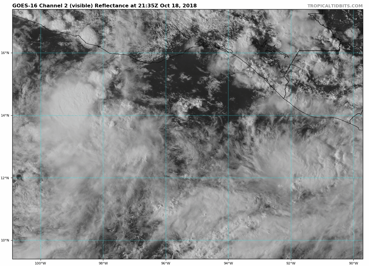
Various satellite data indicate that the area of low pressure that
NHC has been monitoring off the coast of southern Mexico for thew
past few days has acquired enough convective organization to be
designated as a tropical depression, the twenty-fourth one of the
very busy 2018 eastern North Pacific hurricane season. Although the
depression is a sheared system, some banding features have recently
developed south of the center, while overshooting cloud tops just
west of the center are quite cold -85 to -91 deg C). The initial
intensity is set to 30 kt based on a satellite intensity estimate of
T2.0/30 kt from both TAFB and SAB.

The initial motion estimate is 280/08 kt, based primarily on passive
microwave fixes and GOES-16 nighttime imagery. A gradual turn toward
the west-northwest is expected by this afternoon, followed by a
slower northwestward motion on Sunday as the system moves along the
southwestern periphery of a weakening mid-level ridge. A slow
northwestward motion is expected to continue into early next week
while the ridge to the north changes little. On days 4 and 5,
however, a series of weak shortwave troughs are forecast to move
through the larger scale southwesterly flow locked in over the
southwestern U.S. and northern Mexico, causing an erosion of the
western portion of the ridge, which should allow the cyclone to
gradually recurve northward and north-northeastward. The NHC model
guidance is in good agreement overall on this developing track
scenario, and the official forecast track lies between the HCCA and
TVCE track consensus aids.

The depression is expected to steadily strengthen during the next 96
hours due to very favorable environmental conditions consisting of
low vertical wind shear (less than 10 kt), high amounts of mid-level
moisture, and warm 28-30 deg C SSTs. As a result, the cyclone is
expected to become a tropical storm later this morning, a hurricane
by Sunday night, and be near major hurricane strength by Wednesday.
Given the very favorable conditions expected on Sunday and Monday,
there is a fair chance of rapid intensification occurring similar to
that depicted by the COAMPS-TC and HMON models, which bring the
cyclone to category-4 status around 72 hours. The NHC official
intensity forecast near the HCCA and IVCN consensus models through
96 hours, and then a little above the guidance at 120 hours despite
an increase in the shear expected at that time.

FORECAST POSITIONS AND MAX WINDS

INIT 20/0900Z 15.1N 104.9W 30 KT 35 MPH
12H 20/1800Z 15.5N 105.7W 40 KT 45 MPH
24H 21/0600Z 15.9N 106.6W 50 KT 60 MPH
36H 21/1800Z 16.5N 107.4W 60 KT 70 MPH
48H 22/0600Z 17.1N 108.0W 75 KT 85 MPH
72H 23/0600Z 18.0N 109.0W 90 KT 105 MPH
96H 24/0600Z 19.2N 109.4W 100 KT 115 MPH
120H 25/0600Z 21.7N 108.5W 95 KT 110 MPH

$$
Forecaster Stewart
0 likes   

shiny-pebble
Category 1
Category 1
Posts: 299
Joined: Thu Jul 05, 2018 1:38 pm

Re: EPAC: TWENTY-FOUR-E - Tropical Depression

#38 Postby shiny-pebble » Sat Oct 20, 2018 5:09 am

Did anyone else see the nhc epac map? Has 24 as a post trop/remnant that says "unknown"

Sent from my LG-H700 using Tapatalk
2 likes   
Not an meteorologist! Just someone who is interested in weather. Please refer to the NHC and local weather officials to make decisions.
-Jack 8-)

User avatar
cycloneye
Admin
Admin
Posts: 139027
Age: 67
Joined: Thu Oct 10, 2002 10:54 am
Location: San Juan, Puerto Rico

Re: EPAC: TWENTY-FOUR-E - Tropical Depression

#39 Postby cycloneye » Sat Oct 20, 2018 7:50 am

We have TS Willa.

Location: 14.7°N 105.4°W
Maximum Winds: 35 kt Gusts: N/A
Minimum Central Pressure: 1005 mb
Environmental Pressure: 1010 mb
Radius of Circulation: 210 NM
Radius of Maximum Wind: 40 NM
1 likes   
Visit the Caribbean-Central America Weather Thread where you can find at first post web cams,radars
and observations from Caribbean basin members Click Here

zeehag
Tropical Storm
Tropical Storm
Posts: 172
Age: 75
Joined: Sun Jul 17, 2011 9:49 pm
Location: mazatlan,sinaloa, mexico, fixing patricia's mess.
Contact:

Re: EPAC: TWENTY-FOUR-E - Tropical Depression

#40 Postby zeehag » Sat Oct 20, 2018 9:13 am

shiny-pebble wrote:Did anyone else see the nhc epac map? Has 24 as a post trop/remnant that says "unknown"

Sent from my LG-H700 using Tapatalk


what i see on nhc is a hurricane coming at MAZATLAN yup i was right dammit. now tell me how the major weakens before hitting mazatlan when the intensification is occurring so close to our location. please.
and yes i am chikkining out this time and going to land tomorrow. my home, a formosa 41 ketch , will be in marina mazatlan on opposite side from main marina.
0 likes   
life is an adventure meant to be LIVED!!!

http://www.sksolitarybird.org


Return to “2018”

Who is online

Users browsing this forum: No registered users and 57 guests