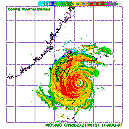
TROPICAL DEPRESSION 1006 HPA
AT 23.9N 134.3E SEA SOUTH OF JAPAN MOVING WESTNORTHWEST SLOWLY.
POSITION FAIR.
MAX WINDS 30 KNOTS NEAR CENTER.


Remarkably far north for formation... east of Okinawa!
WTPN21 PGTW 220230
MSGID/GENADMIN/NAVPACMETOCCEN PEARL HARBOR HI/JTWC//
SUBJ/TROPICAL CYCLONE FORMATION ALERT//
RMKS/
1. FORMATION OF A SIGNIFICANT TROPICAL CYCLONE IS POSSIBLE WITHIN
140 NM EITHER SIDE OF A LINE FROM 23.8N 134.7E TO 25.8N 130.0E
WITHIN THE NEXT 12 TO 24 HOURS. AVAILABLE DATA DOES NOT JUSTIFY
ISSUANCE OF NUMBERED TROPICAL CYCLONE WARNINGS AT THIS TIME.
WINDS IN THE AREA ARE ESTIMATED TO BE 15 TO 20 KNOTS. METSAT IM-
AGERY AT 220130Z INDICATES THAT A CIRCULATION CENTER IS LOCATED
NEAR 24.1N 134.0E. THE SYSTEM IS MOVING WEST-NORTHWESTWARD AT 08
KNOTS.
2. REMARKS: RECENT ANIMATED MULTISPECTRAL SATELLITE IMAGERY REVEALS
A WELL-DEFINED, PARTIALLY-EXPOSED LOW-LEVEL CIRCULATION CENTER (LLCC)
WITH FLARING, PERSISTENT DEEP CONVECTION OVER THE NORTH QUADRANT.
A 212047Z QUIKSCAT IMAGE INDICATED AT LEAST 20-KNOT UNFLAGGED WINDS
NEAR THE CENTER WITH SUSPECT 25-KNOT UNFLAGGED WINDS UNDER THE DEEP
CONVECTION. A 212325Z TRMM IMAGE DEPICTS WEAK CONVECTIVE BANDING
AND CONVERGENT FLOW OVER THE EASTERN SEMI-CIRCLE WITH A LARGE BURST
OF DEEP CONVECTION OVER THE NORTHEAST QUADRANT. UPPER LEVEL ANALYSIS
INDICATES MODERATE VERTICAL WIND SHEAR OVER THE WESTERN HALF OF THE
DISTURBANCE DUE TO AN UPPER LOW LOCATED JUST NORTH OF OKINAWA WHICH
IS PRODUCING CONVERGENT UPPER FLOW AND HINDERING OUTFLOW. THIS LOW
IS FORECAST TO DISSIPATE OVER THE NEXT 24 HOURS WITH A CORRESPONDING
DECREASE IN SHEAR. THEREFORE, THE LLCC IS EXPECTED TO SLOWLY
CONSOLIDATE UNDER AN IMPROVING ENVIRONMENT. MAXIMUM SUSTAINED SURFACE
WINDS ARE ESTIMATED AT 18 TO 22 KNOTS. MINIMUM SEA LEVEL PRESSURE
IS ESTIMATED TO BE NEAR 1005 MB. THE POTENTIAL FOR THE DEVELOPMENT
OF A SIGNIFICANT TROPICAL CYCLONE WITHIN THE NEXT 24 HOURS IS
UPGRADED TO GOOD.
3. THIS ALERT WILL BE REISSUED, UPGRADED TO WARNING OR CANCELLED
BY 230230Z.//