Hurricane FELIX: Caribbean-Discussions
Moderator: S2k Moderators
- Tampa Bay Hurricane
- Category 5

- Posts: 5594
- Age: 36
- Joined: Fri Jul 22, 2005 7:54 pm
- Location: St. Petersburg, FL
Re: TD 6 Discussions
The posts in this forum are NOT official forecast and should not be used as such. They are just the opinion of the poster and may or may not be backed by sound meteorological data. They are NOT endorsed by any professional institution or storm2k.org. For official information, please refer to the NHC and NWS products.
This will get intense!! Look how convection is just exploding (I lost the
link sorry)!
Hurricane by Sunday
Major Hurricane by Tuesday.
-little shear
-explosive heat content of oceans
-lots of moisture
-this looks like a beast of a storm!!!
This will get intense!! Look how convection is just exploding (I lost the
link sorry)!
Hurricane by Sunday
Major Hurricane by Tuesday.
-little shear
-explosive heat content of oceans
-lots of moisture
-this looks like a beast of a storm!!!
0 likes
- Typhoon_Willie
- Category 5

- Posts: 1042
- Joined: Mon Jun 09, 2003 3:19 pm
- Location: Greenacres City, Florida
Re: TD 6 Near Windwards-Discussions-Analysis & Imagery
Forecast Advisory number 1 on TD#6...
000
WTNT21 KNHC 312045
TCMAT1
TROPICAL DEPRESSION SIX FORECAST/ADVISORY NUMBER 1
NWS TPC/NATIONAL HURRICANE CENTER MIAMI FL AL062007
2100 UTC FRI AUG 31 2007
AT 5 PM AST...2100 UTC...THE GOVERNMENT OF BARBADOS HAS ISSUED A
TROPICAL STORM WARNING FOR THE ISLANDS OF ST. VINCENT AND THE
GRENADINES. A TROPICAL STORM WARNING MEANS THAT TROPICAL STORM
CONDITIONS ARE EXPECTED WITHIN THE WARNING AREA WITHIN THE NEXT 24
HOURS.
AT 5 PM AST...THE GOVERNMENT OF TRINIDAD AND TOBAGO HAS ISSUED A
TROPICAL STORM WARNING FOR TOBAGO AND THE METEOROLOGICAL SERVICE OF
TRINIDAD AND TOBAGO HAS ISSUED A TROPICAL STORM WARNING FOR GRENADA
AND ITS DEPENDENCIES.
AT 5 PM AST...THE GOVERNMENT OF THE NETHERLANDS ANTILLES AND ARUBA
HAS ISSUED A TROPICAL STORM WATCH FOR THE ISLANDS OF
ARUBA...BONAIRE AND CURACAO. A TROPICAL STORM WATCH MEANS THAT
TROPICAL STORM CONDITIONS ARE POSSIBLE WITHIN THE WATCH
AREA...GENERALLY WITHIN 36 HOURS.
AT 5 PM AST...THE GOVERNMENT OF VENEZUELA HAS ISSUED A TROPICAL
STORM WATCH FOR THE NORTHERN COAST OF VENEZUELA FROM CUMANA TO
PEDERNALES INCLUDING THE ISLAND OF MARGARITA.
TROPICAL STORM CONDITIONS MAY SPREAD OVER ST. LUCIA OVERNIGHT.
TROPICAL DEPRESSION CENTER LOCATED NEAR 11.8N 58.6W AT 31/2100Z
POSITION ACCURATE WITHIN 30 NM
PRESENT MOVEMENT TOWARD THE WEST OR 280 DEGREES AT 14 KT
ESTIMATED MINIMUM CENTRAL PRESSURE 1008 MB
MAX SUSTAINED WINDS 30 KT WITH GUSTS TO 40 KT.
WINDS AND SEAS VARY GREATLY IN EACH QUADRANT. RADII IN NAUTICAL
MILES ARE THE LARGEST RADII EXPECTED ANYWHERE IN THAT QUADRANT.
REPEAT...CENTER LOCATED NEAR 11.8N 58.6W AT 31/2100Z
AT 31/1800Z CENTER WAS LOCATED NEAR 11.6N 57.9W
FORECAST VALID 01/0600Z 12.2N 60.8W
MAX WIND 35 KT...GUSTS 45 KT.
34 KT... 30NE 0SE 0SW 30NW.
FORECAST VALID 01/1800Z 12.9N 64.0W
MAX WIND 40 KT...GUSTS 50 KT.
34 KT... 40NE 0SE 0SW 40NW.
FORECAST VALID 02/0600Z 13.6N 67.4W
MAX WIND 45 KT...GUSTS 55 KT.
34 KT... 50NE 30SE 30SW 50NW.
FORECAST VALID 02/1800Z 14.3N 71.1W
MAX WIND 50 KT...GUSTS 60 KT.
50 KT... 30NE 0SE 0SW 0NW.
34 KT... 60NE 40SE 40SW 60NW.
FORECAST VALID 03/1800Z 15.3N 78.0W
MAX WIND 55 KT...GUSTS 65 KT.
50 KT... 30NE 0SE 0SW 30NW.
34 KT... 75NE 45SE 45SW 75NW.
EXTENDED OUTLOOK. NOTE...ERRORS FOR TRACK HAVE AVERAGED NEAR 225 NM
ON DAY 4 AND 300 NM ON DAY 5...AND FOR INTENSITY NEAR 20 KT EACH DAY
OUTLOOK VALID 04/1800Z 16.0N 83.0W
MAX WIND 65 KT...GUSTS 80 KT.
OUTLOOK VALID 05/1800Z 17.0N 88.0W
MAX WIND 75 KT...GUSTS 90 KT.
Last edited by Typhoon_Willie on Fri Aug 31, 2007 3:51 pm, edited 1 time in total.
0 likes
- El Nino
- Category 1

- Posts: 454
- Age: 46
- Joined: Sun Oct 16, 2005 3:18 pm
- Location: Lima - Miraflores (Peru)
- Contact:
Re: TD SIX Near Windwards-Discussions-Analysis & Imagery
Maybe a major hurricane, but not as strong as Dean. But C-America should look out : a TS is enough to destroy a lot of things over there !
0 likes
Re: TD SIX Near Windwards-Discussions-Analysis & Imagery
That seems like a fairly conservative intensity forecast...
0 likes
- chadtm80
- Category 5

- Posts: 20381
- Age: 43
- Joined: Tue Oct 08, 2002 8:35 am
- Location: East Central Florida
- Contact:
Re: TD SIX Near Windwards-Discussions-Analysis & Imagery
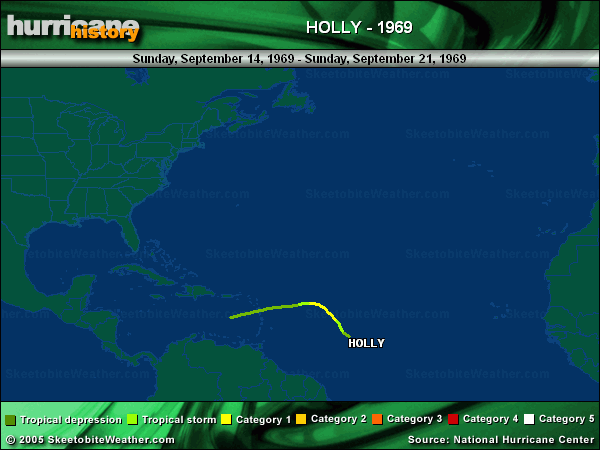
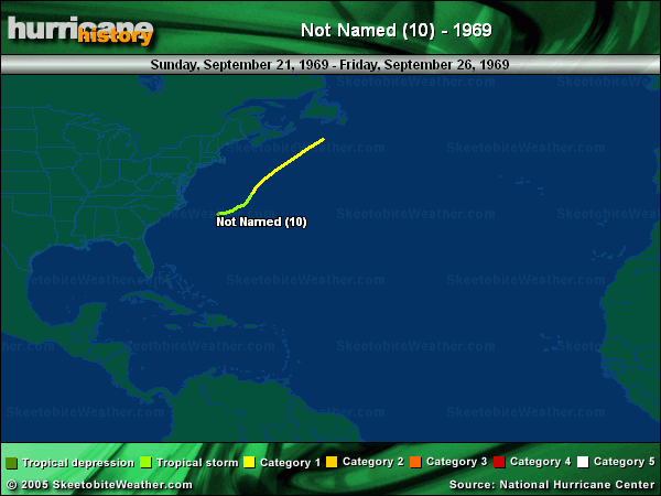
storms in similar area, similar time frame, similar track...


0 likes
- Extremeweatherguy
- Category 5

- Posts: 11095
- Joined: Mon Oct 10, 2005 8:13 pm
- Location: Houston, TX
-
Ed Mahmoud
-
Hello32020
- Tropical Low

- Posts: 37
- Age: 31
- Joined: Fri Aug 31, 2007 12:52 pm
- Location: Pennsylvania, USA
- Contact:
Re: TD SIX Near Windwards-Discussions-Analysis & Imagery
Ed Mahmoud wrote:Still a 988 mb per AccuWeather
http://pro.accuweather.com/adcbin/profe ... de=uhad6_1
Amazing how that hasn't been fixed.
0 likes
-
Ed Mahmoud
Re: TD SIX Near Windwards-Discussions-Analysis & Imagery
NHC intensity probabilities aren't that high thru 72 hours...


0 likes
- Blown Away
- S2K Supporter

- Posts: 9861
- Joined: Wed May 26, 2004 6:17 am
Re: TD SIX Near Windwards-Discussions-Analysis & Imagery
(2) low riders through the Caribbean. Are these steering currents part of a developing La Nina? What years had similar pattern with a late season La Nina?
0 likes
-
weatherguru18
- Category 1

- Posts: 392
- Age: 38
- Joined: Wed Aug 01, 2007 3:23 pm
- Location: The Woodlands, TX
Re: TD SIX Near Windwards-Discussions-Analysis & Imagery
Was Edith the last storm to affect the island of Aruba directly? If not, what was the last storm?
Last edited by weatherguru18 on Fri Aug 31, 2007 4:16 pm, edited 1 time in total.
0 likes
- ConvergenceZone
- Category 5

- Posts: 4833
- Joined: Fri Jul 29, 2005 1:40 am
- Location: Northern California
Re: TD SIX Near Windwards-Discussions-Analysis & Imagery
It's very possible that this can effect the USA. The models do tend to bend it more north towards the end of the track, so it's possible they are sensing it will get picked up and pushed North. Although I called "Mexico" far off in Advance when Dean was in this position, I don't feel quite as comfortable saying "Mexico" with this TD. I think this has a better shot of hitting Texas in the long run, although the current track it's on looks good prior to recurvature.
0 likes
- hurricanetrack
- HurricaneTrack.com

- Posts: 1774
- Joined: Tue Dec 02, 2003 10:46 pm
- Location: Wilmington, NC
- Contact:
You know, I was just thinking about that- a bend out of the BOC is possible if the cyclone is not destroyed over Yucatan- assuming it gets to the Yucatan.
I wonder if the GFS will ever "see" it?
Most likely this is headed almost due west for a long, long time but that turn to the north later on- 7 days from now- is not out of the realm of possibilty.
I wonder if the GFS will ever "see" it?
Most likely this is headed almost due west for a long, long time but that turn to the north later on- 7 days from now- is not out of the realm of possibilty.
0 likes
- AnnularCane
- S2K Supporter

- Posts: 2634
- Joined: Thu Jun 08, 2006 9:18 am
- Location: Wytheville, VA
Re: TD SIX,Near Windwards-Discussions-Analysis & Imagery
Well, hopefully, unlike Edith, this one won't bounce off the coast and head NE. 
0 likes
Who is online
Users browsing this forum: No registered users and 111 guests


