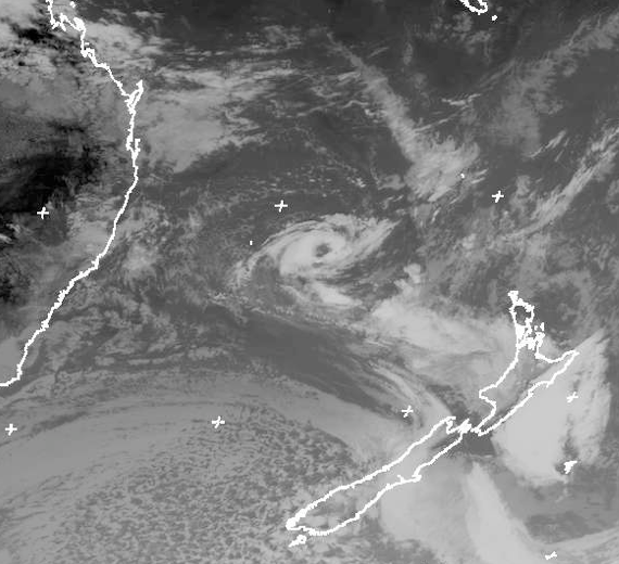
This affects ocean area: SUBTROPIC
AT 070000UTC
Over waters east of 160E.
Low 1009hPa near 33S 161E moving eastnortheast 15kt.
Within 240 miles of low in southwest semicircle: Clockwise 35kt.
Gale area moving with low.
This warning cancels and replaces warning 143.
Issued at 01:55:31Z on 07-Jun-2008
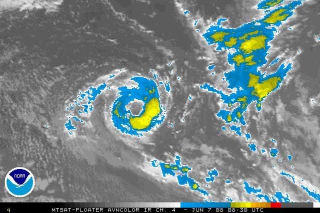
This satellite fix just came in from SAB:
WWPS20 KNES 070505
A. TROPICAL DISTURBANCE (98P)
B. 07/0230Z
C. 32.4S
D. 162.4E
E. THREE/MTSAT
F. ST3.0/3.0/DX.X/24HRS
G. IR/EIR/VIS/QUIKSCAT
H. REMARKS...SUBTROPICAL SYSTEM HAS GAINED ORGANIZATION PAST 12
HOURS WITH A CONVECTIVE RING OF MG SURROUNDING CENTER THAT HAS BEEN
COOLING/EXPANDING. SYSTEM IS MOVING RAPIDLY TO THE NORTHEAST THEREBY
MINIMIZING RELATIVE SHEAR OVER SYSTEM. QUIKSCAT PASS FROM 2004Z HAD MAX
WINDS OF 45 KTS ON WEST SIDE WITH 35 KTS ON EAST EDGE OF CENTER...RUMINSKI
Feel free to move to active storms, but TCWC Wellington/RSMC Fiji haven't picked up on this, and neither has NRL.