
GALE WARNING 162
This affects ocean area: SUBTROPIC
AT 071800UTC
Over waters east of 160E and south of 25S.
In a belt 240 miles wide centred on a line 35S 167E 32S 164E 27S
162E: Southeast 35kt.
Gale area moving northnortheast 10kt.
This warning cancels and replaces warning 158.
Issued at 19:37:41Z on 07-Jun-2008
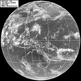
Subtropical storm NW of New Zealand
Moderator: S2k Moderators


GALE WARNING 170
This affects ocean area: SUBTROPIC
AT 080000UTC
Over waters east of 160E and south of 25S.
In a belt 240 miles wide centred on a line 34S 167E 31S 164E 26S
162E: Southeast 35kt easing next 6-12 hours.
Gale area moving northnortheast 10kt.
This warning cancels and replaces warning 162.
Issued at 01:40:48Z on 08-Jun-2008
0 likes
-
Janie2006

- Category 5

- Posts: 1293
- Joined: Mon Sep 18, 2006 3:28 pm
- Location: coastal Ms aka home of the hurricanes
Re:
HURAKAN wrote:
Vince, this storm and the Mediterranean cyclones or hurricanes are very similar.

It seems to me that these four also share some commonalities with strong Arctic storms as well.
0 likes

Its really complicated to know what they are actually are. What is interesting is that they all seemed to form within a strong pool of colder upper air and yet appear to have a warm core so its an interesting mix, I suppose most of the examples would be hybrid systems, esp the Med system as it formed in Jan...SST's would be too low BUT with a strong cold pool probably alofdt that may well have helped to reduce the sea temps needed to kick off convective instablity, we saw the same thing with Epsilon and probably with Vince as well.
0 likes
-
Derek Ortt

-
StormspinnerD2

-
Category 5

- Category 5
- Posts: 10074
- Age: 34
- Joined: Sun Feb 11, 2007 10:00 pm
- Location: New Brunswick, NJ
- Contact:
Re: Subtropical storm NW of New Zealand
Dumb question, how uncommon is it to have a storm in this area? I'm sure it's uncommon at this time of year at the least.
0 likes
-
StormspinnerD2
http://australiasevereweather.com/storm ... 080603.htm
Here is another animated loop that focuses more on the storm itself.
As for their rarity, that I am not sure of; someone more in touch with tropical climatology in this area might know.
Here is another animated loop that focuses more on the storm itself.
As for their rarity, that I am not sure of; someone more in touch with tropical climatology in this area might know.
0 likes
Who is online
Users browsing this forum: No registered users and 114 guests