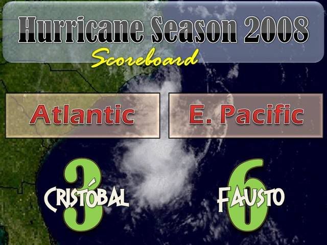
ATL: Tropical Storm Cristobal in North Atlantic
Moderator: S2k Moderators

Re: ATL: Tropical Storm Cristobal near Southeast U.S
This is what this guy was talking about.LoL.
0 likes
-
Downdraft

- S2K Supporter

- Posts: 906
- Joined: Wed Oct 09, 2002 8:45 pm
- Location: Sanford, Florida
- Contact:
Every year I wonder and shake my head at all the people who dismiss depressions and weak tropical storms as not worth anyone's time. A tropical cyclone is still just that a tropical cyclone and none of them from weakest to strongest should be dismissed or written off anytime they are near land. Now back to the thread the Skew-T from Morehead City once again shows a cap building. From 500mb up it really gets strong. That's what is inhibiting the convection with this system.
0 likes
Re: ATL: Tropical Storm Cristobal near Southeast U.S
exactly it's the cap, look at all the dry air , the convection is about 80 miles from the LLC
however it has given some people some needed rain, so this has been a non event outside some
average cold front type gusts (maybe) and the couple inches or rain received.
Very lucky that the dry air was settled in, and i suppose it should for awhile?
however it has given some people some needed rain, so this has been a non event outside some
average cold front type gusts (maybe) and the couple inches or rain received.
Very lucky that the dry air was settled in, and i suppose it should for awhile?
0 likes
-
Hybridstorm_November2001

- S2K Supporter
- Posts: 2802
- Joined: Sat Aug 21, 2004 2:50 pm
- Location: SW New Brunswick, Canada
- Contact:
Re: ATL: Tropical Storm Cristobal near Southeast U.S
WOCN31 CWHX 201200
TROPICAL STORM CRISTOBAL INFORMATION STATEMENT ISSUED BY THE
CANADIAN HURRICANE CENTRE OF ENVIRONMENT CANADA AT 9.00 AM ADT
SUNDAY 20 JULY 2008.
THE NEXT STATEMENT WILL BE ISSUED BY 3.00 PM ADT
... CRISTOBAL TO MOVE ALONG CAROLINA COAST TODAY ...
1. CURRENT POSITION, STRENGTH, CENTRAL PRESSURE AND MOTION
AT 9.00 AM ADT... TROPICAL STORM CRISTOBAL WAS LOCATED NEAR
LATITUDE 34.1 N AND LONGITUDE 76.8 W... ABOUT 45 NAUTICAL MILES
OR 85 KM SOUTH OF CHERRY POINT . MAXIMUM SUSTAINED WINDS ARE
ESTIMATED AT 45 KNOTS... 83 KM/H... AND CENTRAL PRESSURE AT 1007
MB. CRISTOBAL IS MOVING NORTHEAST AT 9 KNOTS... 17 KM/H.
2. FORECAST POSITION, CENTRAL PRESSURE AND STRENGTH
DATE TIME LAT LON MSLP MAX WIND
ADT MB KTS KMH
JUL 20 9.00 AM 34.1N 76.8W 1007 45 83
JUL 20 9.00 PM 35.2N 75.2W 1000 50 93
JUL 21 9.00 AM 36.6N 73.2W 997 55 102
JUL 21 9.00 PM 38.9N 70.4W 999 50 93
JUL 22 9.00 AM 42.2N 66.6W 1002 40 74
JUL 22 9.00 PM 45.2N 63.0W 1008 30 56
3. PUBLIC WEATHER IMPACTS AND WARNINGS SUMMARY
GIVEN FORECAST TRACK, EXPECT SOME RAIN AND GUSTY WINDS ON TUESDAY
OVER NORTHEASTERN NOVA SCOTIA.
4. MARINE WEATHER IMPACTS AND WARNINGS SUMMARY
TROPICAL STORM FORCE WINDS BEGINNING OVER GEORGES BANK TUESDAY
MORNING AND SPREADING NORTHEASTWARD THROUGH THE DAY.
5. TECHNICAL DISCUSSION
A. ANALYSIS
WILMINGTON AND NEWPORT/MOREHEAD RADAR.. COMBINED WITH OFFSHORE
BOUYS GIVE GOOD APPROXIMATION OF POSITION. CONVECTION ON SAT PIX
CONTINUES TO REMAIN DISORGANISED.
B. PROGNOSTIC
LITTLE SIGNIFICANT CHANGE IN FORECAST TRACK. AS MENTIONED
CRISTOBAL IS EMBEDDED IN A BROAD UPPER RIDGE. THIS RIDGE LIES
ROUGHLY ALONG THE 28 NORTH LATITUDE SO THIS SHOULD NUDGE THE
SYSTEM SLOWLY INTO THE UPPER LATITUDES. WESTERLIES
KICK IN AT 40 NORTH. THE UPPER TROUGH DOES NOT APPROACH UNTIL
MONDAY MORNING SO AT THAT TIME WE SHOULD BEGIN TO GET A
GOOD HANDLE ON CRISTOBAL AS IT GETS CAUGHT UP IN THE UPPER WINDS
AND ACCELERATES NORTHEASTWARD. CRISTOBAL WILL CROSS THE NORTH WALL
OF THE GULF STREAM MONDAY EVENING SO WEAKENING IS ANTICIPATED
THEREAFTER.
C. PUBLIC WEATHER
A WARM FRONT WILL CAUSE RAIN ON MONDAY FOR NOVA SCOTIA. WITH
TROPICAL MOISTURE FEEDING INTO FRONTAL SYSTEM ON TUESDAY.. WE
EXPECT MUCH THE SAME FOR TUESDAY WITH LOCALLY HEAVIER AMOUNTS.
THE CDN GEM AND AMERICAN GFS INDICATES FAIRLY HEAVY PCPN WITH
THE FRONT ON MONDAY WHICH BEGS ONE TO WONDER IF THE PUBLIC AND
MEDIA WILL THINK THAT CRISTOBAL HAS ARRIVED EARLIER THAN
FORECAST.
D. MARINE WEATHER
GALE FORCE WINDS PLACED INTO EXTENDED FORCAST FOR
SOUTHWESTERN WATERS OF THE MARITIME MARINE DISTRICT.
PREDICTED WIND RADII (NM)
TIME GALES STORMS HURRICANE
NE SE SW NW NE SE SW NW NE SE SW NW
20/12Z 20 60 20 0 0 0 0 0 0 0 0 0
21/00Z 90 150 80 40 0 40 0 0 0 0 0 0
21/12Z 120 180 90 60 0 90 0 0 0 0 0 0
22/00Z 120 180 90 50 0 45 0 0 0 0 0 0
22/12Z 120 180 75 40 0 0 0 0 0 0 0 0
23/00Z 0 0 0 0 0 0 0 0 0 0 0 0
END CAMPBELL/MCILDOON
Source:
http://www.atl.ec.gc.ca/weather/hurricane/bulletins/20080720121306.Cristobal.txt.en
0 likes
-
OuterBanker
- S2K Supporter
- Posts: 1704
- Joined: Wed Feb 26, 2003 10:53 am
- Location: Nags Head, NC
- Contact:
Re: ATL: Tropical Storm Cristobal near Southeast U.S
Sure enough, another Gabrielle. No rain, beautiful mid level layer clouds in which you can see rotation. Not one drop of rain (well there we a couple showers from some stray bands two days ago). A little breezy, and surf is up a little but thats it, a non event. Of course it is only July 20.
0 likes
-
Hybridstorm_November2001
- S2K Supporter
- Posts: 2802
- Joined: Sat Aug 21, 2004 2:50 pm
- Location: SW New Brunswick, Canada
- Contact:
Re: ATL: Tropical Storm Cristobal near Southeast U.S
OuterBanker wrote:Sure enough, another Gabrielle. No rain, beautiful mid level layer clouds in which you can see rotation. Not one drop of rain (well there we a couple showers from some stray bands two days ago). A little breezy, and surf is up a little but thats it, a non event. Of course it is only July 20.
Indeed, it would seem so thus far, but one never knows these things can blow up rather quickly at times. As such it isn't over yet, but I'm keeping my fingers crossed this TS stays mild rather than turning wild.
0 likes
-
UpTheCreek

- Category 1

- Posts: 397
- Age: 60
- Joined: Tue Aug 31, 2004 5:28 pm
- Location: Vassalboro, Maine
-
Category 5

- Category 5

- Posts: 10074
- Age: 34
- Joined: Sun Feb 11, 2007 10:00 pm
- Location: New Brunswick, NJ
- Contact:
Re:
UpTheCreek wrote:Well, the storm appears to be just east of Morehead City now. We got a good, 3 minute downpour late last night and that has been IT!!! I was really counting on some more rain from this system, very disappointing but better than nothing.....
Looks like some dry air is going to prevent much of anything. Much like Gabrielle last year.
0 likes


-
HURAKAN

- Professional-Met

- Posts: 46086
- Age: 37
- Joined: Thu May 20, 2004 4:34 pm
- Location: Key West, FL
- Contact:

Loop: http://rammb.cira.colostate.edu/product ... 190015.GIF
Convection coming back to the center and no landfall will occur based on the loop.
0 likes
-
UpTheCreek
- Category 1
- Posts: 397
- Age: 60
- Joined: Tue Aug 31, 2004 5:28 pm
- Location: Vassalboro, Maine
Re:
Bane wrote:hate to hear you guys missed out. we got real lucky down here. looks like good chances for thunderstorms later this week.
Getting a band over us now, but very light and almost misty-like. T-storms are a good thing, hope they come!
0 likes

-
txwatcher91
- Category 5
- Posts: 1498
- Joined: Tue Aug 02, 2005 2:29 pm
Re:
KWT wrote:If the convection can get back over the center as it moves past the outer banks I trhink we could see some development given we do have a pretty potent center.
Yeah, the LLC is pretty strong because I have had sustained 10-20 mph winds today even though it is sunny. Had a gust to 30 a few minutes ago.
0 likes
-
JonathanBelles
- Professional-Met
- Posts: 11430
- Age: 33
- Joined: Sat Dec 24, 2005 9:00 pm
- Location: School: Florida State University (Tallahassee, FL) Home: St. Petersburg, Florida
- Contact:
-
Ed Mahmoud
Re:
fact789 wrote:any western nudge could endanger Cape Cod (ironically) and Maine, while a threat to NS looks eminent (as a EX).
Not sure the irony of a Nantucket sideswipe. Unless it passed awfully close, it'd be no worse than a bad winter Nor'Easter.
But they should definitely keep an eye on the forecasts, especially boaters.
0 likes
Re: ATL: Tropical Storm Cristobal near Southeast U.S
dry air appears to be eroding. I will be paying attention to this system again, Big t'storm developing on the southen side, closer to LLC. Outer banks need to stay on alert.
when i saw the forecast today from NHC of central pressure going from 1007 to 1000mb (from 9am to 9 pm) i said hmm, i wondered wether the cap was forecast to erode, anyway this things not moving that much and is close to gulf stream and still has a vigourous LLC so may see attention come back to this thread.
when i saw the forecast today from NHC of central pressure going from 1007 to 1000mb (from 9am to 9 pm) i said hmm, i wondered wether the cap was forecast to erode, anyway this things not moving that much and is close to gulf stream and still has a vigourous LLC so may see attention come back to this thread.
0 likes
-
storms in NC

- S2K Supporter
- Posts: 2338
- Joined: Thu Jul 28, 2005 2:58 pm
- Location: Wallace,NC 40 miles NE of Wilm
- Contact:
Take a look at this. Am I seeing it wrong? To it looks like it has moved west and looks like it wants to make a loop. But I am nuts. the sun has baked my brain.
http://www.ssd.noaa.gov/goes/flt/t3/loop-vis.html
http://www.ssd.noaa.gov/goes/flt/t3/loop-vis.html
0 likes
Who is online
Users browsing this forum: No registered users and 115 guests