ATL: Tropical Storm Cristobal in North Atlantic
Moderator: S2k Moderators

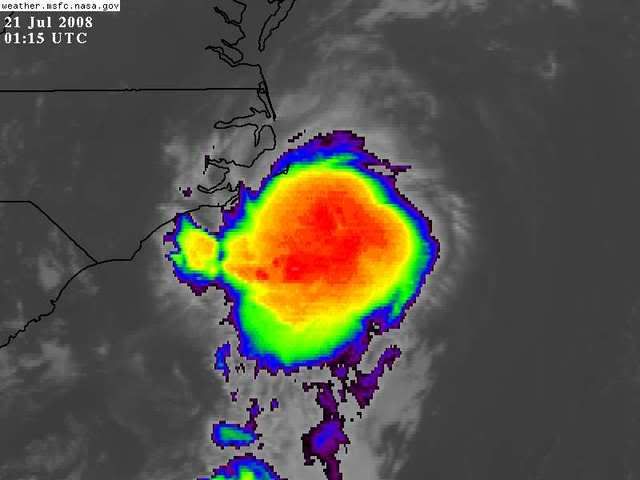
seems like our friend is being pushed a little more due east of late, perhaps just south of east into the deep convection?
http://cimss.ssec.wisc.edu/tropic/real- ... 8dlm6.html
http://www.ssd.noaa.gov/goes/flt/t3/loop-vis.html
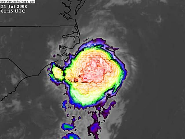
http://cimss.ssec.wisc.edu/tropic/real- ... 8dlm6.html
http://www.ssd.noaa.gov/goes/flt/t3/loop-vis.html
0 likes


-
brunota2003

- S2K Supporter

- Posts: 9476
- Age: 33
- Joined: Sat Jul 30, 2005 9:56 pm
- Location: Stanton, KY...formerly Havelock, NC
- Contact:


-
dixiebreeze

- S2K Supporter
- Posts: 5140
- Joined: Wed Sep 03, 2003 5:07 pm
- Location: crystal river, fla.
Re: ATL: Tropical Storm Cristobal near Southeast U.S
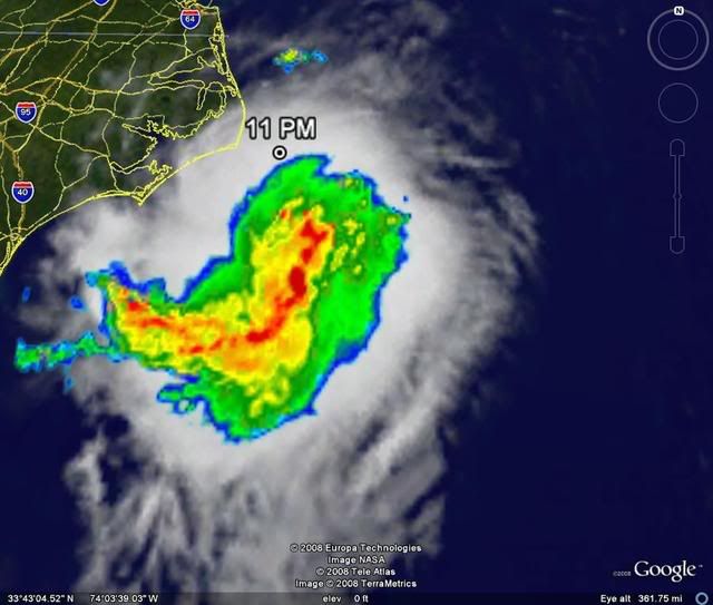
He should be looking pretty good, Hurakan, she's up to 2.5/2.5 and holding.
0 likes
-
Matt-hurricanewatcher

- Category 5

- Posts: 11649
- Age: 38
- Joined: Fri Nov 26, 2004 11:09 pm
- Location: Portland,OR
- Contact:
Re: ATL: Tropical Storm Cristobal near Southeast U.S
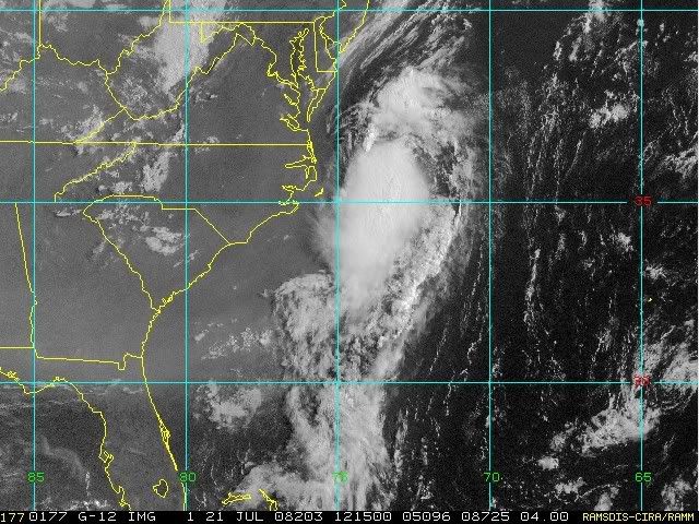
Wow, if this was over the Eastern Pacific or Atlantic this would be just becoming a tropical storm. People remember this when you see something that looks like this outside of recon range.
0 likes


-
Hybridstorm_November2001

- S2K Supporter
- Posts: 2802
- Joined: Sat Aug 21, 2004 2:50 pm
- Location: SW New Brunswick, Canada
- Contact:
Re: ATL: Tropical Storm Cristobal near Southeast U.S
Due to the possible threat to Nova Scotia posed by Cristobal (my area of responsible with my blog encompasses Maine, New Brunswick, Nova Scotia & P.E.I.). I'll now be updating my blog at least one per day (more often if warranted). Just a heads up for all my buddies here who might be interested.
http://hybridstorm-weatherblog.blogspot.com/
http://hybridstorm-weatherblog.blogspot.com/
0 likes


-
HarlequinBoy

- Category 5
- Posts: 1400
- Age: 33
- Joined: Wed Nov 29, 2006 1:57 am
- Location: Memphis
Re: ATL: Tropical Storm Cristobal near Southeast U.S

It really doesn't like North Carolina..
0 likes

Well hello there! 55 kt!
WTNT43 KNHC 211457
TCDAT3
TROPICAL STORM CRISTOBAL DISCUSSION NUMBER 11
NWS TPC/NATIONAL HURRICANE CENTER MIAMI FL AL032008
1100 AM EDT MON JUL 21 2008
SATELLITE IMAGES INDICATE THAT CONVECTION REMAINS QUITE STRONG IN
THE SOUTHERN PORTION OF THE STORM. ON THE LAST PASS THROUGH THE
STORM...THE AIR FORCE PLANE FOUND A FALLING PRESSURE AND SOME
EVIDENCE OF A CENTER REFORMATION TO THE SOUTH. A QUIKSCAT PASS FROM
THIS MORNING SUGGESTS THE MAXIMUM WINDS WERE 50-55 KT...WHICH ISN'T
TOO FAR FROM THE SFMR DATA COLLECTED BY THE PLANE. THE INITIAL
INTENSITY IS INCREASED TO 55 KT FOR THIS ADVISORY. SOME
INTENSIFICATION IS POSSIBLE WHILE THE CENTER MOVES ACROSS THE GULF
STREAM AND THE SHEAR REMAINS LOW DURING THE NEXT 24 HR OR SO.
THEREAFTER...CRISTOBAL IS FORECAST TO MOVE NORTH OF THE GULF STREAM
AND INTO A STRONGER SHEARING ENVIRONMENT...WHICH SHOULD BEGIN THE
WEAKENING PROCESS. THE OFFICIAL FORECAST IS IN GOOD AGREEMENT WITH
THE SHIPS/LGEM MODELS WHICH SHOW THIS SYSTEM STAYING JUST BELOW
HURRICANE STRENGTH.
THE INITIAL MOTION IS A LITTLE UNCERTAIN DUE TO TO CENTER
REFORMATION BUT IS ESTIMATED AT 055/11. A TRACK TO THE NORTHEAST
WITH INCREASING FORWARD SPEED IS LIKELY IN RESPONSE TO AN
APPROACHING MID-TROPOSPHERIC TROUGH. THIS SYSTEM SHOULD TURN MORE
TO THE EAST WITH TIME AS IT MOVES INTO MORE WESTERLY FLOW. THE
BIGGEST CHANGE FROM THE LAST ADVISORY IS THAT MORE MODELS SUGGEST
THAT THE STORM WON'T BE FULLY ABSORBED BY A TROUGH OVER NORTH
AMERICA AND INSTEAD ROTATE AROUND THE SOUTHERN END OF THE TROUGH.
THE OFFICIAL FORECAST IS SHIFTED SOUTHWARD AT THE END OF THE PERIOD
AND IS EXTENDED TO 96 HR IN LINE WITH THE GUIDANCE.
FORECAST POSITIONS AND MAX WINDS
INITIAL 21/1500Z 36.6N 72.6W 55 KT
12HR VT 22/0000Z 37.9N 70.6W 60 KT
24HR VT 22/1200Z 40.5N 67.5W 60 KT
36HR VT 23/0000Z 43.3N 63.5W 55 KT...BECOMING EXTRATROPICAL
48HR VT 23/1200Z 45.0N 59.0W 45 KT...EXTRATROPICAL
72HR VT 24/1200Z 45.0N 47.0W 40 KT...EXTRATROPICAL
96HR VT 25/1200Z 41.0N 40.0W 35 KT...EXTRATROPICAL
120HR VT 26/1200Z...DISSIPATED
$$
FORECASTER BLAKE
0 likes
Who is online
Users browsing this forum: No registered users and 39 guests