Wow - I just read some of those "I'm going to cry that 90L didn't develop" comments, so, I've said it before and I'll say it again:
On August 22, 1992, I heard the late Dr. Burpee (HRD) say that Hurricane Andrew was heading northwest (away from South Florida), and, my dumb comment was, "Aw - I just wanted to have some fun!".
Well, as we know Andrew didn't turn northwest, but, on August 24, 1992, came straight across South Florida as a Cat 4/5 hurricane - and took my roof with it - and, that started a very unpleasant, stressful (a/k/a miserable) period in my life, so, before you start wishing for bad things, believe me, you better know what your wishing for...
As others here said in reply to some of these posts - apparently, these are posters who are too young to know the suffering and misery Hugo, or Andrew, or even Katrina brough to thousands or even millions of people, who had their houses ruined, their jobs lost, their schools destroyed, and, even the loss of their life - all due to a natural disaster, so, as the Bible says, "Let those who have ears listen!"
Sure, we are all weather enthusiasts, some even being professional meteorologists, or, others, such as myself, having worked in that field in a supporting role, otherwise, we would not be visiting this site, but, to wish for something bad to come, well, that's not right, but, human nature being what it is, sometimes, we just have to learn the hard way, as I did many years ago...
Frank
Ex Invest 90L
Moderator: S2k Moderators
Re: Ex Invest 90L in Central Atlantic
Our post Charley experience here was nothing but work, pain in the *** problems, August heat and humidity with no electricity, lack of community and services for months, house repairs that took over a year to find workers for, and major expenses.
Florida should have a mandatory hurricane code for buildings and infrastructure.
Florida should have a mandatory hurricane code for buildings and infrastructure.
0 likes

-
Gustywind

- Category 5

- Posts: 12334
- Joined: Mon Sep 03, 2007 7:29 am
- Location: Baie-Mahault, GUADELOUPE
Re:
jhamps10 wrote:would this at 9N,33W be our old 90L, even though it is solidly attched to the ITCZ?
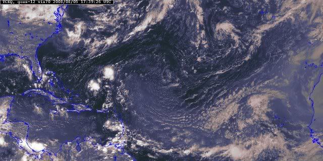
updating image:
i don't tkink so; hummm.... ex 90 L would be at:
A TROPICAL WAVE IS ALONG 44W S OF 17N MOVING W NEAR 20 KT. THIS
IS A LOW AMPLITUDE WAVE WAVE WITH NO SIGNIFICANT CONVECTION.
SCATTERED SHOWERS ARE CONFINED TO THE ITCZ.
Latest from ssd positions Sunday was 03/0545 UTC 11.9N 34.0W T1.0/1.0 90L http://www.ssd.noaa.gov/PS/TROP/positions.html
So, i'm a little dubtfull about a position at 9N 33w today ...or maybe my eyes are deceiving me lol
0 likes
-
Gustywind
- Category 5
- Posts: 12334
- Joined: Mon Sep 03, 2007 7:29 am
- Location: Baie-Mahault, GUADELOUPE
000
AXNT20 KNHC 050604
TWDAT
TROPICAL WEATHER DISCUSSION
NWS TPC/NATIONAL HURRICANE CENTER MIAMI FL
205 AM EDT TUE AUG 05 2008
TROPICAL WEATHER DISCUSSION FOR NORTH AMERICA...CENTRAL
AMERICA...GULF OF MEXICO...CARIBBEAN SEA...NORTHERN SECTIONS
OF SOUTH AMERICA...AND ATLANTIC OCEAN TO THE AFRICAN COAST
FROM THE EQUATOR TO 32N. THE FOLLOWING INFORMATION IS BASED
ON SATELLITE IMAGERY...METEOROLOGICAL ANALYSIS...WEATHER
OBSERVATIONS...AND RADAR.
BASED ON 0000 UTC SURFACE ANALYSIS AND SATELLITE IMAGERY THROUGH
0515 UTC.
A TROPICAL WAVE IS ALONG 44W S OF 17N MOVING W NEAR 20 KT. THIS
IS A LOW AMPLITUDE WAVE WAVE WITH NO SIGNIFICANT CONVECTION.
SCATTERED SHOWERS ARE CONFINED TO THE ITCZ.
0 likes
-
Tampa Bay Hurricane

- Category 5
- Posts: 5594
- Age: 36
- Joined: Fri Jul 22, 2005 7:54 pm
- Location: St. Petersburg, FL
Re: Ex Invest 90L in Central Atlantic
Frank2 wrote:Wow - I just read some of those "I'm going to cry that 90L didn't develop" comments, so, I've said it before and I'll say it again:
On August 22, 1992, I heard the late Dr. Burpee (HRD) say that Hurricane Andrew was heading northwest (away from South Florida), and, my dumb comment was, "Aw - I just wanted to have some fun!".
Well, as we know Andrew didn't turn northwest, but, on August 24, 1992, came straight across South Florida as a Cat 4/5 hurricane - and took my roof with it - and, that started a very unpleasant, stressful (a/k/a miserable) period in my life, so, before you start wishing for bad things, believe me, you better know what your wishing for...
As others here said in reply to some of these posts - apparently, these are posters who are too young to know the suffering and misery Hugo, or Andrew, or even Katrina brough to thousands or even millions of people, who had their houses ruined, their jobs lost, their schools destroyed, and, even the loss of their life - all due to a natural disaster, so, as the Bible says, "Let those who have ears listen!"
Sure, we are all weather enthusiasts, some even being professional meteorologists, or, others, such as myself, having worked in that field in a supporting role, otherwise, we would not be visiting this site, but, to wish for something bad to come, well, that's not right, but, human nature being what it is, sometimes, we just have to learn the hard way, as I did many years ago...
Frank
Very powerful post Frank and it is very important for people to have this perspective.
In previous years, when I wasn't the most rational person around,
I would wishfully forecast big ones into my region.
But gradually, I have matured and increased in knowledge about
the misery of hurricanes.
0 likes


-
Blown Away

- S2K Supporter

- Posts: 9863
- Joined: Wed May 26, 2004 6:17 am


-
Fego

- S2K Supporter
- Posts: 767
- Age: 64
- Joined: Sun Apr 18, 2004 7:58 pm
- Location: San Juan, Puerto Rico
- Contact:
Re: Ex Invest 90L in Central Atlantic
Unless 90L moved back to the central Atlantic, this wave-blob is NOT related with that invest... then, there is a misunderstood. In any case, there is a topic related with the wave-blob (Large Wave in Central Atlantic) .
Last edited by Fego on Tue Aug 05, 2008 1:54 pm, edited 1 time in total.
0 likes
-
cycloneye

- Admin

- Posts: 139086
- Age: 67
- Joined: Thu Oct 10, 2002 10:54 am
- Location: San Juan, Puerto Rico
Re: Ex Invest 90L in Central Atlantic
Fego wrote:Unless 90L moved back to the central Atlantic, this wave-blob is NOT related with that invest... then, there is a misunderstood. In any case, is better to open a new topic about this wave-blob.
There is a thread about that wave "Large Wave in Eastern Atlantic".
viewtopic.php?f=31&t=102269&p=1760378#p1760378
0 likes
-
bvigal

- S2K Supporter
- Posts: 2275
- Joined: Sun Jul 24, 2005 8:49 am
- Location: British Virgin Islands
- Contact:
Re: Ex Invest 90L in Central Atlantic
Hello neighbor Luis! I thought that thread was talking about the next wave after 90L, LOL! Maybe we should name these threads: "Large wave approx 30W Sunday Aug 3" or similar, since they keep moving.cycloneye wrote:Fego wrote:Unless 90L moved back to the central Atlantic, this wave-blob is NOT related with that invest... then, there is a misunderstood. In any case, is better to open a new topic about this wave-blob.
There is a thread about that wave "Large Wave in Eastern Atlantic".
viewtopic.php?f=31&t=102269&p=1760378#p1760378
Frank and Sanibel, I don't even have to have lost a roof, etc. to be afraid to ever say something like that. I've too many friends in the area who tell stories of going MONTHS (not days) with no electricity, and shortages of things like safe drinking water, toilet paper, gasoline; with the only road(s) 'from here to there' closed due to slides! No one comes rushing in with truckloads of supplies, they have to come by boat, and first be paid for through banks that stay closed until electricity is back on, etc. No thanks, they can all fizzle except the fish, and I'm happy!!!
0 likes


-
Gustywind
- Category 5
- Posts: 12334
- Joined: Mon Sep 03, 2007 7:29 am
- Location: Baie-Mahault, GUADELOUPE
It's awfully fair weather down the road for the Carib,
http://cimss.ssec.wisc.edu/tropic/real- ... ds/m8split
Where can you with that? I have the answer in the Olympics SAL GAMES
0 likes

-
Blown Away
- S2K Supporter
- Posts: 9863
- Joined: Wed May 26, 2004 6:17 am
Re: Ex Invest 90L in Central Atlantic
This wave (9N/35W) has maintained its convection for a while now and has a little spin to it. Can't be much keeping this from invest status.
http://www.ssd.noaa.gov/goes/east/catl/loop-avn.html
http://www.ssd.noaa.gov/goes/east/catl/loop-avn.html
0 likes

Re: Ex Invest 90L in Central Atlantic
Blown_away wrote:This wave (9N/35W) has maintained its convection for a while now and has a little spin to it. Can't be much keeping this from invest status.
http://www.ssd.noaa.gov/goes/east/catl/loop-avn.html
Is this a wave or just part of the ITCZ?
EDIT: It's a wave, per NWS's surface analysis map:

0 likes
Who is online
Users browsing this forum: No registered users and 87 guests