Ex Invest 90L
Moderator: S2k Moderators
- Extremeweatherguy
- Category 5

- Posts: 11095
- Joined: Mon Oct 10, 2005 8:13 pm
- Location: Houston, TX
Re: ATL: Invest 90L WSW of Cape Verde Islands
I think this one just made the climatology train to reconvect further west with August. We could have a spinner here folks after this d-min.
0 likes
-
fasterdisaster
- Category 5

- Posts: 1868
- Joined: Mon Sep 19, 2005 4:41 pm
- Location: Miami, Florida
-
Ed Mahmoud
Re: ATL: Invest 90L WSW of Cape Verde Islands
After a bit of a lull, both Atlantic invests starting to fire new convection.


0 likes
Re:
Extremeweatherguy wrote:I have a feeling that this will try to become a player a few days down the line once it can break free from the approaching SAL.
I would agree with you EWG on that....and my GUT doesnt tell me this other than I need a snack before bed...
BTW- we miss you here in Houston.
0 likes
Re: ATL: Invest 90L WSW of Cape Verde Islands
TROPICAL WEATHER OUTLOOK
NWS TPC/NATIONAL HURRICANE CENTER MIAMI FL
200 AM EDT SUN AUG 3 2008
FOR THE NORTH ATLANTIC...CARIBBEAN SEA AND THE GULF OF MEXICO...
A SURFACE TROUGH OF LOW PRESSURE ACCOMPANIED BY SHOWERS AND
THUNDERSTORMS IS LOCATED IN THE NORTH-CENTRAL GULF OF MEXICO.
SURFACE PRESSURES ARE FALLING IN THE AREA...AND ENVIRONMENTAL
CONDITIONS APPEAR TO BE FAVORABLE FOR SLOW DEVELOPMENT. THIS
SYSTEM COULD BECOME A TROPICAL DEPRESSION DURING THE NEXT COUPLE OF
DAYS AS IT MOVES SLOWLY TO THE WEST OR WEST-SOUTHWEST. A
RECONNAISSANCE PLANE WILL INVESTIGATE THE AREA THIS AFTERNOON...IF
NECESSARY.
SHOWER AND THUNDERSTORM ACTIVITY ASSOCIATED WITH AN AREA OF LOW
PRESSURE LOCATED ABOUT 900 MILES EAST OF THE NORTHERN LEEWARD
ISLANDS IS POORLY-ORGANIZED. UPPER-LEVEL WINDS ARE FORECAST TO
BECOME LESS CONDUCIVE FOR DEVELOPMENT...SO THE CHANCES OF THIS
SYSTEM DEVELOPING INTO A TROPICAL DEPRESSION ARE DECREASING. THE
LOW IS EXPECTED TO MOVE TOWARD THE WEST OR WEST-NORTHWEST AT 15 TO
20 MPH.
A SMALL AREA OF DISTURBED WEATHER ASSOCIATED WITH A TROPICAL WAVE
LOCATED ABOUT 650 MILES WEST-SOUTHWEST OF THE CAPE VERDE ISLANDS
REMAINS POORLY ORGANIZED. SIGNIFICANT DEVELOPMENT OF THIS SYSTEM
IS NOT EXPECTED OVER THE NEXT COUPLE OF DAYS AS THE WAVE MOVES
WESTWARD AT ABOUT 20 MPH.
ELSEWHERE...TROPICAL CYCLONE FORMATION IS NOT EXPECTED DURING THE
NEXT 48 HOURS.
$$
FORECASTER PASCH
http://www.nhc.noaa.gov/text/refresh/MIATWOAT+shtml/030538.shtml
0 likes
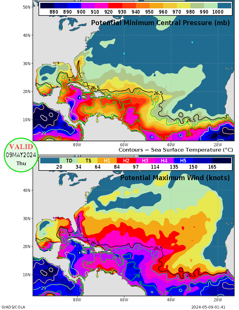
Hmmm.....fairly mediocre-looking ocean for this time of year (except right off Africa, where it looks above normal).
Anyone know what made that cool pocket at 45W? (99L is on the north side of it right now, but it's extremely weak left-flank westerlies shouldn't amount to anything, and the data is probably a day old, meaning 99L wasn't even there yet.)

Anyone know what made that cool pocket at 45W? (99L is on the north side of it right now, but it's extremely weak left-flank westerlies shouldn't amount to anything, and the data is probably a day old, meaning 99L wasn't even there yet.)

0 likes
- Gustywind
- Category 5

- Posts: 12334
- Joined: Mon Sep 03, 2007 7:29 am
- Location: Baie-Mahault, GUADELOUPE
03/0545 UTC 11.9N 34.0W T1.0/1.0 90L -- Atlantic Ocean
http://www.ssd.noaa.gov/PS/TROP/positions.html
A little "more to the north" approaching the 12°north and racing west intensity has not changed....
http://www.ssd.noaa.gov/PS/TROP/positions.html
A little "more to the north" approaching the 12°north and racing west intensity has not changed....
0 likes
Put a fork in 90L; it's done.
http://www.ssd.noaa.gov/goes/east/catl/loop-avn.html
Why? That bright blob to the southeast is stealing its inflow, and 99L's resurgence is prompting the SAL layer to follow in behind it more vigorously. So not only is 90L getting robbed of juice, it's being stretched. In the end, it'll be cannibalized by the energetic systems.
0 likes
- Gustywind
- Category 5

- Posts: 12334
- Joined: Mon Sep 03, 2007 7:29 am
- Location: Baie-Mahault, GUADELOUPE
000
FXCA62 TJSJ 030844
AFDSJU
AREA FORECAST DISCUSSION
NATIONAL WEATHER SERVICE SAN JUAN PR
444 AM AST SUN AUG 3 2008
THE TYPICAL DIURNALLY INDUCED SHOWER ACTIVITY WILL RETURN TO THE FA FOR THE REST OF THE WEEK BEFORE ANOTHER TROPICAL WAVE REACH THE REGION BY THE UPCOMING WEEKEND...WITH THE BULK OF MOISTURE THIS TIME JUST ACROSS THE FA...INCREASING AGAIN THE WINDS...SHOWERS AND THUNDERSTORMS ACROSS
THE REGION. GOOD SIGNALS THAT AUGUST IS HERE.
0 likes
- Gustywind
- Category 5

- Posts: 12334
- Joined: Mon Sep 03, 2007 7:29 am
- Location: Baie-Mahault, GUADELOUPE
http://cimss.ssec.wisc.edu/tropic/real- ... g8sht.html
Low shear near 90L , ahead too...winds are abating a bit
Low shear near 90L , ahead too...winds are abating a bit
0 likes
But the blob you mention Honeyko is really so far away to the SE I wouldn't have thought it would be much of a factor to be honest, also 99L has only got going in the last 6hrs so I don't think that causing too many issues just yet either.
Still firing convection but still no real decent circulation, reminds me more and more of pre-dolly but given the set-up this one still needs close watching as it will get into the Caribbean.
Still firing convection but still no real decent circulation, reminds me more and more of pre-dolly but given the set-up this one still needs close watching as it will get into the Caribbean.
0 likes
- Gustywind
- Category 5

- Posts: 12334
- Joined: Mon Sep 03, 2007 7:29 am
- Location: Baie-Mahault, GUADELOUPE
http://www.nrlmry.navy.mil/tc-bin/tc_home
From NRL site this morning: 1045 UTC
11,6 34,0W 1010 hpa 25 kts
From NRL site this morning:
11,6 34,0W 1010 hpa 25 kts
0 likes
Re:
KWT wrote:But the blob you mention Honeyko is really so far away to the SE I wouldn't have thought it would be much of a factor to be honest
Look more closely at the loop for the low cloud motions -- the blob is sucking 'em in from the northwest, which is where 90L should be drawing them in from the southeast.
The little guy is stepping on his garden-hose, cutting off the juice.
(That blob is very, very low, too; right about where Ivan started.)
0 likes
- Gustywind
- Category 5

- Posts: 12334
- Joined: Mon Sep 03, 2007 7:29 am
- Location: Baie-Mahault, GUADELOUPE
Re: Re:
Honeyko wrote:KWT wrote:But the blob you mention Honeyko is really so far away to the SE I wouldn't have thought it would be much of a factor to be honest
Look more closely at the loop for the low cloud motions -- the blob is sucking 'em in from the northwest, which is where 90L should be drawing them in from the southeast.
The little guy is stepping on his garden-hose, cutting off the juice.
(That blob is very, very low, too; right about where Ivan started.)
Are you sure, Ivan was not much lower? At 9,5 north 25,4 west? when he was classified as a TD ???
0 likes
- Gustywind
- Category 5

- Posts: 12334
- Joined: Mon Sep 03, 2007 7:29 am
- Location: Baie-Mahault, GUADELOUPE
000
AXNT20 KNHC 031046
TWDAT
TROPICAL WEATHER DISCUSSION
NWS TPC/NATIONAL HURRICANE CENTER MIAMI FL
805 AM EDT SUN AUG 03 2008
TROPICAL WEATHER DISCUSSION FOR NORTH AMERICA...CENTRAL
AMERICA...GULF OF MEXICO...CARIBBEAN SEA...NORTHERN SECTIONS
OF SOUTH AMERICA...AND ATLANTIC OCEAN TO THE AFRICAN COAST
FROM THE EQUATOR TO 32N. THE FOLLOWING INFORMATION IS BASED
ON SATELLITE IMAGERY...METEOROLOGICAL ANALYSIS...WEATHER
OBSERVATIONS...AND RADAR.
BASED ON 0600 UTC SURFACE ANALYSIS AND SATELLITE IMAGERY THROUGH
1015 UTC.
...TROPICAL WAVES...
TROPICAL WAVE IS ALONG 33W/34W S OF 15N WITH A 1010 MB LOW
ANALYZED ALONG THE WAVE NEAR 11N MOVING W 20-25 KT. FAST MOVING
LOW CENTER THAT IS BEGINNING TO LOSE ITS IDENTITY. CLUSTERS OF
SCATTERED MODERATE CONVECTION ARE FROM 10N-13N BETWEEN 37W-40W
0 likes
Who is online
Users browsing this forum: No registered users and 114 guests


