WPac: TD KAMMURI (10W) - Over SE China
Moderator: S2k Moderators


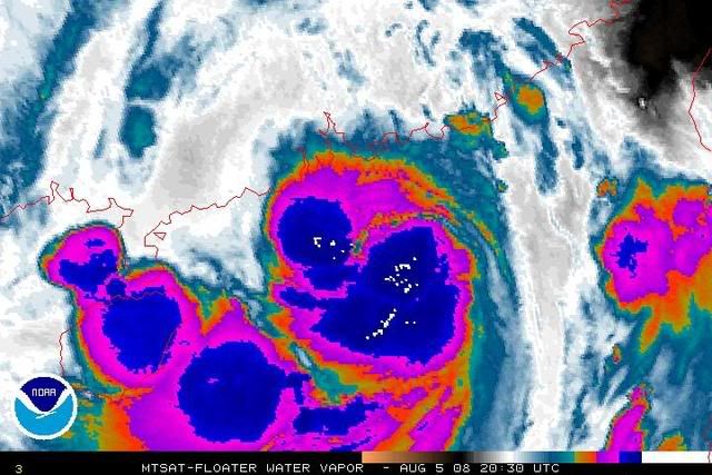
I mean in terms of looks at the time when Ed was a weak TS with the southern side being fairly convective whilst the northern quadrants being hit a little by mid level dry air...
Of course pressure are much lower with this, partly due to the much lower background pressures in the WPAC compared to the Gulf.
Of course pressure are much lower with this, partly due to the much lower background pressures in the WPAC compared to the Gulf.
0 likes
Hong Kong now reporting 30 kt sustained.
VHHH 060113Z 09030G40KT 7000 R07R/1100V1500U R25L/1300VP2000U R07L/1500VP2000U R25R/1100V1800U -SHRA FEW012 SCT018 BKN050 27/24 Q0991 RERA TEMPO 09035G45KT 1200 +SHRA
Macau reporting 23 kt.
VMMC 060100Z 07023KT 360V110 8000 R16/0900V2000U R34/1000V1400N -SHRA FEW004 SCT012 BKN060 26/25 Q0989 NOSIG
VHHH 060113Z 09030G40KT 7000 R07R/1100V1500U R25L/1300VP2000U R07L/1500VP2000U R25R/1100V1800U -SHRA FEW012 SCT018 BKN050 27/24 Q0991 RERA TEMPO 09035G45KT 1200 +SHRA
Macau reporting 23 kt.
VMMC 060100Z 07023KT 360V110 8000 R16/0900V2000U R34/1000V1400N -SHRA FEW004 SCT012 BKN060 26/25 Q0989 NOSIG
0 likes
Well hello there!
JMA has upped to STS.
WTPQ20 RJTD 060000
RSMC TROPICAL CYCLONE ADVISORY
NAME STS 0809 KAMMURI (0809) UPGRADED FROM TS
ANALYSIS
PSTN 060000UTC 20.9N 113.9E FAIR
MOVE W SLOWLY
PRES 975HPA
MXWD 050KT
GUST 070KT
30KT 210NM SOUTH 150NM NORTH
FORECAST
24HF 070000UTC 21.2N 110.2E 70NM 70%
MOVE W 08KT
PRES 975HPA
MXWD 050KT
GUST 070KT
48HF 080000UTC 21.3N 106.6E 110NM 70% TROPICAL DEPRESSION =
PAGASA no longer warning on the storm.
HKO now has Signal 8:
Bulletin issued at 08:45 HKT 06/Aug/2008
Tropical Cyclone Bulletin
Here is the latest Tropical Cyclone Bulletin issued by the
Hong Kong Observatory.
The No. 8 Southeast Gale or Storm Signal is in force.
This means that winds with mean speeds of 63 kilometres per
hour or more are expected from the southeast quarter.
At 9 a.m., Severe Tropical Storm Kammuri was centred about
150 kilometres south of Hong Kong (near 21.0 degrees north
113.9 degrees east) and is forecast to move west-northwest
at about 14 kilometres per hour, edging closer to Hong
Kong.
As Kammuri continued to move west-northwest , gale force
winds are affecting the territory with storm force winds
over offshore waters and high grounds. Local wind is
changing from northeast to southeast. Areas previously
sheltered from the winds will become exposed. Members of
the public should beware of the change in wind direction
and take precautions as soon as possible.
In the past hour, the maximum sustained winds recorded at
Waglan Island, Sai Kung and Cheung Chau were 87, 66 and 88
kilometres per hour respectively.
Macau:
TROPICAL CYCLONE WARNINGS
BULLETIN ISSUED AT 09:12 L.T. 06-AUGUST-2008
HERE IS THE LATEST TROPICAL CYCLONE ADVISORY BULLETIN ISSUED BY THE MACAU METEOROGICAL AND GEOPHYSICAL BUREAU.
A TROPICAL CYCLONE ALERT IS NOW IN EFFECT AND THE SIGNAL NO. 8NE IS HOISTED.
THIS MEANS THAT THE CENTER OF A TROPICAL CYCLONE IS NEARING AND WINDS RECORDED IN MSAR, FROM THE QUARTER INDICATED, MAY POSSIBLY RANGE FROM 63 TO 117 KM/H WITH GUSTS REACHING ABOUT 180 KM/H.
AT 09:00, (0809) SEVERE TROPICAL STORM "KAMMURI" WAS ESTIMATED TO BE ABOUT 130 KILOMETRES SSE OF MACAU (NEAR 21.0ºN, 113.9ºE). IT IS FORECAST TO MOVE WNW AT AROUND 10KM/H.
THE GALE SIGNAL NO. 8 NE IS STILL HOISTED.
0 likes


-
beaufort12
- S2K Supporter

- Posts: 70
- Joined: Thu Sep 02, 2004 9:18 am
- Location: Lorton VA
-
Typhoon Hunter
- WesternPacificWeather.com

- Posts: 1215
- Age: 40
- Joined: Wed Oct 11, 2006 11:37 am
- Location: Hong Kong
- Contact:
Re: WPac: STS KAMMURI (TS 10W) - Near Hong Kong
Ngong Ping, not far from Hong Kong airport recorded some insane winds. Admittedly it is at 500m! I'd love to get up there with my anemometer!

0 likes


A storm has caused the suspension of training for British athletes and disrupted preparation for the Olympic equestrian events in Hong Kong.
Tropical storm Kammuri brought heavy rain and strong winds to Macau, where Team GB's holding camp is based.
British heptathlete Kelly Sotherton said the squad was told to stay inside.
Meanwhile, the arrival of two planes carrying 24 show jumping horses from China, America and the United Arab Emirates was delayed.
All are expected to arrive in Hong Kong, ready for the competition which starts on Saturday, as soon as the weather clears.
"It will weaken gradually by Saturday," Leung Wing-mo, a senior scientific officer with the Hong Kong observatory said. "If anything, a trough of low pressure will just bring showers."
Sotherton, a bronze medallist in Athens four years ago, said the conditions were frustrating for the athletes.
"We can't leave the hotel because when there's a typhoon at this Level 8 all the transport is cancelled, so unfortunately we are all holed up in a hotel," she said.
http://news.bbc.co.uk/sport2/hi/olympics/7544476.stm
0 likes
Downgraded to TS. It's been inland but paralleling the coast.
WTPQ20 RJTD 061200
RSMC TROPICAL CYCLONE ADVISORY
NAME TS 0809 KAMMURI (0809) DOWNGRADED FROM STS
ANALYSIS
PSTN 061200UTC 21.6N 111.1E FAIR
MOVE W 15KT
PRES 980HPA
MXWD 045KT
GUST 065KT
30KT 210NM SOUTH 150NM NORTH
FORECAST
24HF 071200UTC 21.1N 105.9E 75NM 70% TROPICAL DEPRESSION =
WTPQ20 RJTD 061200
RSMC TROPICAL CYCLONE ADVISORY
NAME TS 0809 KAMMURI (0809) DOWNGRADED FROM STS
ANALYSIS
PSTN 061200UTC 21.6N 111.1E FAIR
MOVE W 15KT
PRES 980HPA
MXWD 045KT
GUST 065KT
30KT 210NM SOUTH 150NM NORTH
FORECAST
24HF 071200UTC 21.1N 105.9E 75NM 70% TROPICAL DEPRESSION =
0 likes

Who is online
Users browsing this forum: No registered users and 56 guests