
URNT12 KNHC 161846
VORTEX DATA MESSAGE AL062008
A. 16/18:19:50Z
B. 19 deg 04 min N
074 deg 30 min W
C. 700 mb 3123 m
D. NA kt
E. 000 deg nm
F. 114 deg 038 kt
G. 039 deg 095 nm
H. 1008 mb
I. 8 C/ 3050 m
J. 9 C/ 3049 m
K. 9 C/ NA
L. NA
M. NA
N. 1345/7
O. 0.02 / 8 nm
P. AF304 0906A FAY OB 05
MAX FL WIND 38 KT NE QUAD 17:48:00 Z
UNABLE TO FIX CNTR DUE TO UNDERCAST
Can some tell me what undercast means
Tropical Storm Fay RECON Discussions
Moderator: S2k Moderators
-
senorpepr

- Military Met/Moderator

- Posts: 12542
- Age: 41
- Joined: Fri Aug 22, 2003 9:22 pm
- Location: Mackenbach, Germany
- Contact:
Re: Tropical Storm Fay RECON Discussions
tailgater wrote:Can some tell me what undercast means
Well, it's similar to overcast. Overcast is observed when the sky is 8/8ths covered with clouds. Undercast is the same, except for the fact the instead of the clouds being over, they're under.
Bottom line... clouds below the aircraft are obscuring, preventing a center fix.
0 likes
-
cycloneye

- Admin

- Posts: 139067
- Age: 67
- Joined: Thu Oct 10, 2002 10:54 am
- Location: San Juan, Puerto Rico
Re: Tropical Storm Fay RECON Discussions
Crazy,what is the position where the lowest pressure (1005 mbs) was seen?
0 likes
-
CrazyC83
- Professional-Met

- Posts: 33393
- Joined: Tue Mar 07, 2006 11:57 pm
- Location: Deep South, for the first time!
Re: Tropical Storm Fay RECON Discussions
cycloneye wrote:Crazy,what is the position where the lowest pressure (1005 mbs) was seen?
19.3N 75.4W
0 likes

Re: Tropical Storm Fay RECON Discussions
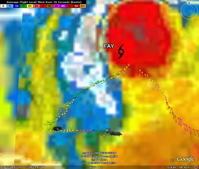
From the recon obs thread. Wanted to see what others think. Looks like it's beginning to stack up from the surface upwards. By the sharpness of the windshift at 850mb, it may only have stacked to that level, and may be on its way to stacking up deeper:
Did you notice that when they flew through the low pressure center a couple hours ago, the wind direction didn't change, suggesting that the system was disorganized. Now as they pass through it seems the wind is shifting as expected for an organized system. Could be Fay is getting her act together?
Did you notice that when they flew through the low pressure center a couple hours ago, the wind direction didn't change, suggesting that the system was disorganized. Now as they pass through it seems the wind is shifting as expected for an organized system. Could be Fay is getting her act together?
CrazyC83 wrote:URNT15 KNHC 162317
AF304 0906A FAY HDOB 46 20080816
230830 1859N 07519W 8417 01548 0080 +139 +139 191009 013 033 012 00
230900 1901N 07520W 8440 01528 0071 +154 +154 251006 007 031 011 00
230930 1902N 07521W 8428 01540 0066 +159 +159 240007 007 025 003 00
231000 1903N 07522W 8426 01542 0066 +160 +160 236006 006 023 003 00
231030 1904N 07523W 8431 01538 0063 +165 +165 233006 006 023 003 00
231100 1905N 07524W 8432 01536 0063 +165 +165 221005 005 022 004 00
231130 1907N 07526W 8426 01541 0061 +166 +166 220006 007 021 002 00
231200 1908N 07527W 8428 01538 0059 +168 +168 219006 006 019 002 00
231230 1909N 07528W 8430 01536 0062 +165 +165 185003 005 020 002 00
231300 1910N 07529W 8427 01542 0063 +163 +163 176004 005 021 002 00
231330 1912N 07530W 8422 01543 0060 +165 +165 168006 007 024 000 00
231400 1913N 07531W 8436 01528 0060 +166 +166 181006 007 020 002 00
231430 1914N 07532W 8427 01546 0062 +163 +163 192006 007 022 001 03
231500 1915N 07534W 8428 01536 0059 +163 +163 222005 006 023 001 00
231530 1915N 07535W 8429 01532 0058 +161 +161 219003 004 024 000 00
231600 1916N 07537W 8429 01534 0057 +164 +164 241005 006 019 002 00
231630 1917N 07538W 8428 01533 0053 +167 +167 305002 003 023 000 00
231700 1918N 07540W 8427 01533 0050 +170 +170 018003 005 023 001 00
231730 1918N 07540W 8427 01533 0050 +170 +170 024006 007 021 001 00
231800 1919N 07543W 8431 01529 0053 +165 +165 008008 009 021 001 00
$$
Center at 19.3N 75.6W. Pressure 1005mb.
0 likes

FLIGHT FOUR -- TEAL 72
A. 17/0600Z,1200Z
B. AFXXX 12DDA CYCLONE
C. 17/0230Z
D. 20.6N 75.7W
E. 17/0500Z TO 17/1200Z
F. SFC TO 10,000 FT
AF flight takes off at 10:30pm EDT and begins the mission at 1:00 am EDT.
A. 17/0600Z,1200Z
B. AFXXX 12DDA CYCLONE
C. 17/0230Z
D. 20.6N 75.7W
E. 17/0500Z TO 17/1200Z
F. SFC TO 10,000 FT
AF flight takes off at 10:30pm EDT and begins the mission at 1:00 am EDT.
Last edited by RL3AO on Sat Aug 16, 2008 7:30 pm, edited 1 time in total.
0 likes

Re: Tropical Storm Fay RECON Discussions
SouthFLTropics wrote:Does anyone know if recon has been given the ok to fly in and around Cuban airspace...Without recon this could be a dicey call coming up in and over Cuba towards SF. We need the Christopher Walken picture... "NEED MORE RECON BABY!"
SFT
yes.
0 likes
-
senorpepr
- Military Met/Moderator
- Posts: 12542
- Age: 41
- Joined: Fri Aug 22, 2003 9:22 pm
- Location: Mackenbach, Germany
- Contact:
Re: Tropical Storm Fay RECON Discussions
SouthFLTropics wrote:We need the Christopher Walken picture... "NEED MORE RECON BABY!"

0 likes
-
Canelaw99

- S2K Supporter

- Posts: 2112
- Age: 47
- Joined: Tue Aug 31, 2004 8:27 am
- Location: Homestead, FL
Re: Tropical Storm Fay RECON Discussions
LOL - yep...figured that out when I clicked back over there and saw the comment about descending that much in that little loop. Pretty impressive.
0 likes
-
cycloneye
- Admin
- Posts: 139067
- Age: 67
- Joined: Thu Oct 10, 2002 10:54 am
- Location: San Juan, Puerto Rico
Re: Tropical Storm Fay RECON Discussions
RL3AO,at the end of set,the pressure continues to fall,suggesting that they havent reached it.
0 likes
-
Dean4Storms
- S2K Supporter
- Posts: 6355
- Age: 61
- Joined: Sun Aug 31, 2003 1:01 pm
- Location: Miramar Bch. FL


Re: Tropical Storm Fay RECON Discussions
Maybe the low did relocate farther SW towards Jamaica. That's what I gather based on the winds versus their track so far. There's been speculation of such a thing on the general discussion thread.
0 likes
-
Dean4Storms
- S2K Supporter
- Posts: 6355
- Age: 61
- Joined: Sun Aug 31, 2003 1:01 pm
- Location: Miramar Bch. FL
Re: Tropical Storm Fay RECON Discussions
Hmmm, they are down around the area I suspected the LLC to be.
0 likes
Who is online
Users browsing this forum: No registered users and 97 guests