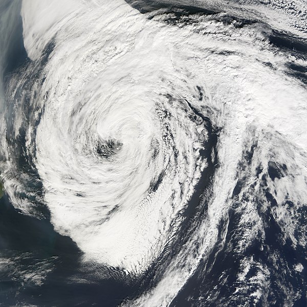
ATL INVEST 94L: Discussion

Moderator: S2k Moderators

Message
Author
Ed Mahmoud

Re: ATL INVEST 94L: Discussion

#281 Postby Ed Mahmoud » Thu Sep 25, 2008 2:32 pm

hurricanefloyd5 wrote:
Ed Mahmoud wrote:Soon to be Kyle has less temperature differential to the core than extratropical no-name 94L...


where dose it say NO-NAME94L at?????


Didn't mean to imply an NRL style "NO-NAME" used for tropical/sub-tropical depressions.


Just pointing out what will likely be Tropical Storm Kyle has less of a warm core than a 50 knot plus warm core 992 mb extra-tropical storm.
0 likes   

User avatar
weatherwoman
Category 1
Category 1
Posts: 364
Joined: Sun Sep 05, 2004 9:09 pm
Location: Newport North Carolina
Contact:

#282 Postby weatherwoman » Thu Sep 25, 2008 2:40 pm

0 likes   

User avatar
El Nino
Category 1
Category 1
Posts: 454
Age: 46
Joined: Sun Oct 16, 2005 3:18 pm
Location: Lima - Miraflores (Peru)
Contact:

Re: ATL INVEST 94L: Discussion

#283 Postby El Nino » Thu Sep 25, 2008 2:47 pm

Laura is for next Invest ... but there could some nice interaction between this one and Kyle.
0 likes   

User avatar
weatherwoman
Category 1
Category 1
Posts: 364
Joined: Sun Sep 05, 2004 9:09 pm
Location: Newport North Carolina
Contact:

Re: ATL INVEST 94L: Discussion

#284 Postby weatherwoman » Thu Sep 25, 2008 2:48 pm

hurricanefloyd5 wrote:we Have Kyle now


where is kyle what one did they name kyle
0 likes   

User avatar
wxman57
Moderator-Pro Met
Moderator-Pro Met
Posts: 22480
Age: 66
Joined: Sat Jun 21, 2003 8:06 pm
Location: Houston, TX (southwest)

Re: ATL INVEST 94L: Discussion

#285 Postby wxman57 » Thu Sep 25, 2008 2:49 pm

weatherwoman wrote:
hurricanefloyd5 wrote:we Have Kyle now


where is kyle what one did they name kyle


93L by the Bahamas.
0 likes   

User avatar
Matt-hurricanewatcher
Category 5
Category 5
Posts: 11649
Age: 38
Joined: Fri Nov 26, 2004 11:09 pm
Location: Portland,OR
Contact:

Re:

#286 Postby Matt-hurricanewatcher » Thu Sep 25, 2008 2:55 pm

HURAKAN wrote:Image

Image


That is a subtropical storm. That is my option and if you don't like it don't read it, that is how I feel.
0 likes   

User avatar
jabber
Category 2
Category 2
Posts: 688
Joined: Mon Mar 24, 2003 5:36 pm
Location: Raleigh, NC (former Boynton Beach, Fl)

Re: ATL INVEST 94L: Discussion

#287 Postby jabber » Thu Sep 25, 2008 2:56 pm

Winds are starting to really pick up in Raleigh. Its misty as well but in the mid 60s. Not what I am used with a , lets just call it a low pressure system.
0 likes   

User avatar
Matt-hurricanewatcher
Category 5
Category 5
Posts: 11649
Age: 38
Joined: Fri Nov 26, 2004 11:09 pm
Location: Portland,OR
Contact:

Re: ATL INVEST 94L: Discussion

#288 Postby Matt-hurricanewatcher » Thu Sep 25, 2008 3:08 pm

quote="Category 5"]
Ed Mahmoud wrote:Anyway, if HPC analyzing an occluded front settles the matter, why doesn't NHC just cancel the mission now. What point is there flying around on a system they won't upgrade?


I give up

Image[/quote]


Can't answer the question? I'd give up as well.[/quote]

If they haven't named it because it isn't subtropical isn't enough, nothing is.[/quote]


This has a warm core and is developing a eye. Convection is increasing...How much does it take to upgrade. That is fact...Nothing is clean cut and I believe that more then enough of the data weighting towards a tropical cyclone far out pulls any that says other wise.
0 likes   

User avatar
Matt-hurricanewatcher
Category 5
Category 5
Posts: 11649
Age: 38
Joined: Fri Nov 26, 2004 11:09 pm
Location: Portland,OR
Contact:

Re: ATL INVEST 94L: Discussion

#289 Postby Matt-hurricanewatcher » Thu Sep 25, 2008 3:27 pm

Ed Mahmoud wrote:
hurricanefloyd5 wrote:
Ed Mahmoud wrote:Soon to be Kyle has less temperature differential to the core than extratropical no-name 94L...


where dose it say NO-NAME94L at?????


Didn't mean to imply an NRL style "NO-NAME" used for tropical/sub-tropical depressions.


Just pointing out what will likely be Tropical Storm Kyle has less of a warm core than a 50 knot plus warm core 992 mb extra-tropical storm.


Nothing is clear cut. In if there is a front it is very very weak...I would go ahead and name it...This is the kind of systems Pro-mets get into fights over in the office.
0 likes   

Ed Mahmoud

Re: ATL INVEST 94L: Discussion

#290 Postby Ed Mahmoud » Thu Sep 25, 2008 3:32 pm

Our non-tropical 992 mb 50 knot warm core storm is triggering possible tornadoes in the spiral bands coming ashore now.


SEVERE WEATHER STATEMENT
NATIONAL WEATHER SERVICE NEWPORT/MOREHEAD CITY NC
424 PM EDT THU SEP 25 2008

NCC133-252045-
/O.CON.KMHX.TO.W.0051.000000T0000Z-080925T2045Z/
ONSLOW NC-
424 PM EDT THU SEP 25 2008

...A TORNADO WARNING REMAINS IN EFFECT UNTIL 445 PM EDT FOR SOUTHERN
ONSLOW COUNTY...

AT 422 PM EDT...NATIONAL WEATHER SERVICE DOPPLER RADAR CONTINUED TO
INDICATE A TORNADO. THIS TORNADO WAS LOCATED NEAR SNEADS FERRY...OR
ABOUT 7 MILES NORTHEAST OF NORTH TOPSAIL BEACH...MOVING WEST AT 38
MPH.

THE TORNADO WILL BE NEAR...
FOLKSTONE AND DIXON BY 430 PM EDT...
HOLLY RIDGE BY 435 PM EDT...
0 likes   

Ed Mahmoud

Re: ATL INVEST 94L: Discussion

#291 Postby Ed Mahmoud » Thu Sep 25, 2008 3:37 pm

We can watch the 992 mb and falling, 50 knot plus, 3ºC warmer core non-tropical storm/Nor'Easter make landfall. Just 40ºF colder and it would be snowing.

Image


Since 94L can never become a non-tropical system with an HPC analyzed front, maybe this thread should be moved to the 'Winter Weather' forum.
0 likes   

User avatar
Matt-hurricanewatcher
Category 5
Category 5
Posts: 11649
Age: 38
Joined: Fri Nov 26, 2004 11:09 pm
Location: Portland,OR
Contact:

Re: ATL INVEST 94L: Discussion

#292 Postby Matt-hurricanewatcher » Thu Sep 25, 2008 3:40 pm

Ed Mahmoud wrote:We can watch the 992 mb and falling, 50 knot plus, 3ºC warmer core non-tropical storm/Nor'Easter make landfall. Just 40ºF colder and it would be snowing.

Image


Since 94L can never become a non-tropical system with an HPC analyzed front, maybe this thread should be moved to the 'Winter Weather' forum.


I agree a million percent. If it is not tropical and won't be then it needs to be moved to the other thread...You will never convince me that this was not a tropical cyclone.
0 likes   

User avatar
HURAKAN
Professional-Met
Professional-Met
Posts: 46086
Age: 37
Joined: Thu May 20, 2004 4:34 pm
Location: Key West, FL
Contact:

Re: ATL INVEST 94L: Discussion

#293 Postby HURAKAN » Thu Sep 25, 2008 3:46 pm

Image

Convection developing over or very near the LLC.
0 likes   

User avatar
Matt-hurricanewatcher
Category 5
Category 5
Posts: 11649
Age: 38
Joined: Fri Nov 26, 2004 11:09 pm
Location: Portland,OR
Contact:

Re: ATL INVEST 94L: Discussion

#294 Postby Matt-hurricanewatcher » Thu Sep 25, 2008 3:46 pm

Plane on run way. Lets see how much warmer the core is now, also lets see if it strengthen any.
0 likes   

User avatar
Matt-hurricanewatcher
Category 5
Category 5
Posts: 11649
Age: 38
Joined: Fri Nov 26, 2004 11:09 pm
Location: Portland,OR
Contact:

Re: ATL INVEST 94L: Discussion

#295 Postby Matt-hurricanewatcher » Thu Sep 25, 2008 3:48 pm

HURAKAN wrote:Image

Convection developing over or very near the LLC.


I can't see it already doesn't have a warm core, but this might be making it even warmer. Also might be making it strengthen in a more tropical storm like way.
0 likes   

Ed Mahmoud

Re: ATL INVEST 94L: Discussion

#296 Postby Ed Mahmoud » Thu Sep 25, 2008 4:09 pm

Matt-hurricanewatcher wrote:Plane on run way. Lets see how much warmer the core is now, also lets see if it strengthen any.


On the one hand, it would be nice to know how much warmer the center became over and above the 3º (5.4ºF) differential due to the purely baroclinic processes caused by the well defined occluded front, and how much further below 992 mb the pressure is, on the other hand, since this will never be anything but an extra-tropical Nor'Easter, it would seem to be a waste.

However, since the Hurricane Hunters fly occasional missions into winter storms, I guess this could be considered practice.
0 likes   

tolakram
Admin
Admin
Posts: 19165
Age: 60
Joined: Sun Aug 27, 2006 8:23 pm
Location: Florence, KY (name is Mark)

Re: ATL INVEST 94L: Discussion

#297 Postby tolakram » Thu Sep 25, 2008 4:36 pm

Ok, here is Florence after transitioning to extra tropical

Image

Look familiar?

From the Wikipedia article http://en.wikipedia.org/wiki/Extratropical_low

The wind shear over top of 94L appears to be very high:

Image

So with my limited knowledge of how to classify low pressure systems I see no reason to call this sub tropical just because the core is a few degrees warmer. An 'eye' does not make it tropical, strong winds do not make it tropical. Maybe it will become more tropical but I see no reason whatsoever to doubt the NHC. AS USUAL.
0 likes   

User avatar
Extremeweatherguy
Category 5
Category 5
Posts: 11095
Joined: Mon Oct 10, 2005 8:13 pm
Location: Houston, TX

#298 Postby Extremeweatherguy » Thu Sep 25, 2008 4:50 pm

I am shocked that this was never upgraded! Recon has presented enough evidence, IMO, to have warranted a TD or TS status for 94L. I bet that the NHC will end up upgrading this one in the post season.
0 likes   

Ed Mahmoud

Re: ATL INVEST 94L: Discussion

#299 Postby Ed Mahmoud » Thu Sep 25, 2008 4:54 pm

Image

Image


Hmmm, except that Florence at this point appears to have little deep convection near the center, and is clearly attaching to the warm front to its North, 94L and Florence are practically twins.


Keep up the good work.
0 likes   

User avatar
HURAKAN
Professional-Met
Professional-Met
Posts: 46086
Age: 37
Joined: Thu May 20, 2004 4:34 pm
Location: Key West, FL
Contact:

#300 Postby HURAKAN » Thu Sep 25, 2008 5:09 pm

Image

Image
0 likes   


Return to “2008”

Who is online

Users browsing this forum: No registered users and 98 guests