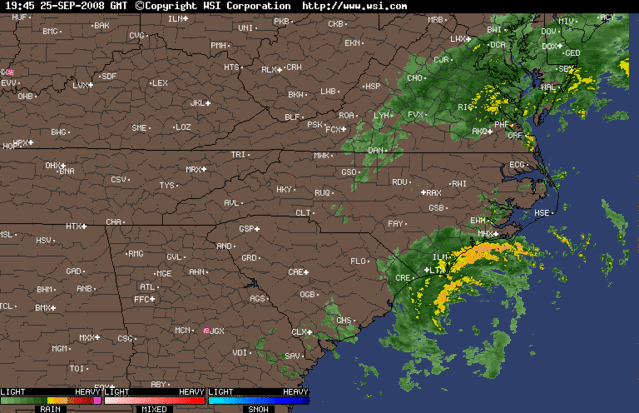
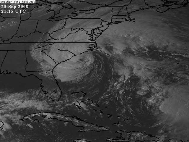
ATL INVEST 94L: Discussion

Moderator: S2k Moderators

Message
Author
User avatar
Category 5
Category 5
Category 5
Posts: 10074
Age: 34
Joined: Sun Feb 11, 2007 10:00 pm
Location: New Brunswick, NJ
Contact:

Re: ATL INVEST 94L: Discussion

#301 Postby Category 5 » Thu Sep 25, 2008 5:13 pm

Matt-hurricanewatcher wrote:
Ed Mahmoud wrote:We can watch the 992 mb and falling, 50 knot plus, 3ºC warmer core non-tropical storm/Nor'Easter make landfall. Just 40ºF colder and it would be snowing.

Image


Since 94L can never become a non-tropical system with an HPC analyzed front, maybe this thread should be moved to the 'Winter Weather' forum.


I agree a million percent. If it is not tropical and won't be then it needs to be moved to the other thread...You will never convince me that this was not a tropical cyclone.


Even if I told you it was frontal?
0 likes   

capepoint
Category 1
Category 1
Posts: 414
Joined: Sat Jul 19, 2008 7:13 pm
Location: Beaufort, NC

#302 Postby capepoint » Thu Sep 25, 2008 5:29 pm

Oh, this was tropical all right. As we got out of the gradient winds this morning, and began feeling the winds from this, it got VERY much warmer outside, and instead of overcast and steadier rains, we began having periods of sun, and then LOW DARK clouds bringing wind gusts and TORENTAL RAIN, then would clear back to sunshine.
Yesterday the wind was cold and dry, today it was warm and muggy.
So today it did in fact look, act, smell, and feel like a tropical storm. Along with a bunch of waterspouts coming ashore.

On the other side of the argument, why waste a name on something that they new would NEVER make hurricane status.
0 likes   

User avatar
HURAKAN
Professional-Met
Professional-Met
Posts: 46086
Age: 37
Joined: Thu May 20, 2004 4:34 pm
Location: Key West, FL
Contact:

#303 Postby HURAKAN » Thu Sep 25, 2008 5:39 pm

Image
0 likes   

emeraldislencguy
S2K Supporter
S2K Supporter
Posts: 207
Joined: Sun Aug 27, 2006 4:35 pm
Location: emerald isle nc
Contact:

Re: ATL INVEST 94L: Discussion

#304 Postby emeraldislencguy » Thu Sep 25, 2008 5:47 pm

the weather has really turned warm this afternoon
it sure feels like a tropical system now
we had several water spouts and lots of heavy rain
been through several hurricanes and tropical storms here over the past years
this really feel like a tropical system
0 likes   

jconsor
Professional-Met
Professional-Met
Posts: 533
Joined: Mon Jun 30, 2008 9:31 pm
Location: Jerusalem, Israel
Contact:

Re: ATL INVEST 94L: Discussion

#305 Postby jconsor » Thu Sep 25, 2008 5:51 pm

emeraldislencguy wrote:the weather has really turned warm this afternoon
it sure feels like a tropical system now
we had several water spouts and lots of heavy rain
been through several hurricanes and tropical storms here over the past years
this really feel like a tropical system


I'm not sure where this mythical cold front is, but there is no more than a 3C temperature and dew point difference from west to east over between the coastal Carolinas and FL coast and 500 miles out in the Atlantic, based on buoy reports. A 0.5C/100 mile temperature/dew point gradient does not indicate a cold front.

http://coolwx.com/buoydata/data/curr/atl-seus.png
0 likes   

HenkL
S2K Supporter
S2K Supporter
Posts: 2401
Joined: Fri Sep 10, 2004 5:33 pm
Location: Groningen, The Netherlands
Contact:

#306 Postby HenkL » Thu Sep 25, 2008 5:55 pm

It isn't a cold front, but an occlusion.
0 likes   

User avatar
webke
S2K Supporter
S2K Supporter
Posts: 290
Age: 68
Joined: Sun Sep 05, 2004 12:39 pm
Location: North Myrtle Beach SC

Re: ATL INVEST 94L: Discussion

#307 Postby webke » Thu Sep 25, 2008 5:55 pm

emeraldislencguy wrote:the weather has really turned warm this afternoon
it sure feels like a tropical system now
we had several water spouts and lots of heavy rain
been through several hurricanes and tropical storms here over the past years
this really feel like a tropical system


Here in North MyrtleBeach is hasn't warmed up, however the winds are not that strong, the rain has been steay all day and the temperature has stayed around 60 degrees. It looks like it is going to come ashore near the NC/SC border, but it is definitely a weaker storm than Hannah was.
0 likes   

jconsor
Professional-Met
Professional-Met
Posts: 533
Joined: Mon Jun 30, 2008 9:31 pm
Location: Jerusalem, Israel
Contact:

Re: ATL INVEST 94L: Discussion

#308 Postby jconsor » Thu Sep 25, 2008 6:22 pm

Meteorologist Joe Lundberg's blog at accuweather.com:

The storm that has been steadily deepening over the past 24 hours off the North Carolina coast is for all intents and purposes a tropical storm. The only thing it lacks at this writing is the official name tag of being one! But if you look at the radar and satellite signature, the observations, the buoy reports and recon reports, it all looks pretty well like a tropical storm with a central pressure down to at least 994mb at this juncture.

http://www.accuweather.com/mt-news-blog ... g=lundberg
0 likes   

Ed Mahmoud

Re: ATL INVEST 94L: Discussion

#309 Postby Ed Mahmoud » Thu Sep 25, 2008 6:31 pm

I'd like to see obs, we had plenty from recon, that show a discontinuity in airmass, with a pronounced wind shift, indicative of a front in/near the center.
0 likes   

User avatar
Thunder44
Category 5
Category 5
Posts: 5922
Age: 43
Joined: Mon Jun 09, 2003 7:53 pm
Location: New York City

Re: ATL INVEST 94L: Discussion

#310 Postby Thunder44 » Thu Sep 25, 2008 6:39 pm

000
ABNT20 KNHC 252336
TWOAT
TROPICAL WEATHER OUTLOOK
NWS TPC/NATIONAL HURRICANE CENTER MIAMI FL
800 PM EDT THU SEP 25 2008

FOR THE NORTH ATLANTIC...CARIBBEAN SEA AND THE GULF OF MEXICO...

THE NATIONAL HURRICANE CENTER IS ISSUING ADVISORIES ON NEWLY FORMED
TROPICAL STORM KYLE LOCATED ABOUT 645 MILES SOUTH-SOUTHWEST OF
BERMUDA.

A WELL-DEFINED NON-TROPICAL LOW PRESSURE SYSTEM CENTERED ABOUT 60
MILES SOUTHEAST OF THE SOUTH CAROLINA-NORTH CAROLINA BORDER IS
MOVING WEST-NORTHWESTWARD NEAR 10 MPH. THE LOW CONTINUES TO BE
EMBEDDED WITHIN A FRONTAL ZONE AND THE POSSIBILITY THAT THIS SYSTEM
DEVELOPS INTO A SUBTROPICAL OR TROPICAL CYCLONE BEFORE MOVING
INLAND OVERNIGHT IS DIMINISHING. STRONG WINDS...COASTAL
FLOODING...HIGH SURF...AND DANGEROUS RIP CURRENTS WILL CONTINUE
ALONG PORTIONS OF THE U.S. EAST COAST DURING THE NEXT DAY OR TWO.
INTERESTS ALONG THE U.S. EAST COAST FROM SOUTH CAROLINA NORTHWARD
TO THE MID-ATLANTIC REGION SHOULD CLOSELY MONITOR STATEMENTS FROM
THEIR LOCAL NATIONAL WEATHER SERVICE FORECAST OFFICES...AND ALSO
HIGH SEAS FORECASTS ISSUED BY THE OCEAN PREDICTION CENTER FOR
ADDITIONAL INFORMATION AND WARNINGS.

AN AREA OF DISTURBED WEATHER HAS FORMED IN THE BAY OF CAMPECHE.
THERE ARE NO SIGNS OF ORGANIZATION AT THIS TIME BUT THIS SYSTEM
COULD BRING HEAVY RAINS TO PORTIONS SOUTHERN MEXICO DURING THE NEXT
COUPLE OF DAYS.

ELSEWHERE...TROPICAL CYCLONE FORMATION IS NOT EXPECTED DURING THE
NEXT 48 HOURS.

PUBLIC ADVISORIES ON KYLE ARE ISSUED UNDER WMO HEADER WTNT31
AND UNDER AWIPS HEADER MIATCPAT1. FORECAST/ADVISORIES ARE ISSUED
UNDER WMO HEADER WTNT21 AND UNDER AWIPS HEADER MIATCMAT1.

$$

FORECASTER AVILA/BERG
0 likes   

User avatar
HURAKAN
Professional-Met
Professional-Met
Posts: 46086
Age: 37
Joined: Thu May 20, 2004 4:34 pm
Location: Key West, FL
Contact:

#311 Postby HURAKAN » Thu Sep 25, 2008 6:47 pm

:uarrow: Down to yellow.

882
URNT12 KNHC 252337
VORTEX DATA MESSAGE AL942008
A. 25/23:19:10Z
B. 33 deg 07 min N
078 deg 10 min W
C. 850 mb 1334 m
D. 59 kt
E. 211 deg 17 nm
F. 334 deg 32 kt
G. 220 deg 68 nm
H. 993 mb
I. 14 C / 1526 m
J. 16 C / 1524 m
K. 16 C / NA

L. NA
M. NA
N. 12345 / 8
O. 0.02 / 1 nm
P. AF303 03GGA LOW OB 05
MAX FL WIND 32 KT SW QUAD 22:58:20Z
MAX OUTBOUND FL WIND 58 KT NE QUAD 23:31:30Z
;

14/16/16 at about 1526 m. How does this translate to the surface?
0 likes   

CrazyC83
Professional-Met
Professional-Met
Posts: 33393
Joined: Tue Mar 07, 2006 11:57 pm
Location: Deep South, for the first time!

#312 Postby CrazyC83 » Thu Sep 25, 2008 6:53 pm

In my opinion, it is two systems in one - an unnamed (sub)tropical storm embedded into a larger extratropical storm. There seems to be two low centers.
0 likes   

User avatar
webke
S2K Supporter
S2K Supporter
Posts: 290
Age: 68
Joined: Sun Sep 05, 2004 12:39 pm
Location: North Myrtle Beach SC

Re: ATL INVEST 94L: Discussion

#313 Postby webke » Thu Sep 25, 2008 7:16 pm

To give you a new update the winds have picked up to my estimate of 35 MPH and the teperature has risen 3 degrees from 61 to 64. The rain is now being blown sideways like I would expect from a tropical storm, howeverI do not think it will get much worse as the center is getting to the coast.
0 likes   

User avatar
george_r_1961
S2K Supporter
S2K Supporter
Posts: 3171
Age: 62
Joined: Sat Oct 12, 2002 9:14 pm
Location: Hampton, Virginia

Re:

#314 Postby george_r_1961 » Thu Sep 25, 2008 7:16 pm

CrazyC83 wrote:In my opinion, it is two systems in one - an unnamed (sub)tropical storm embedded into a larger extratropical storm. There seems to be two low centers.


Pretty much what I was thinking. And I think thats a big reason why its not being named.
0 likes   

User avatar
HURAKAN
Professional-Met
Professional-Met
Posts: 46086
Age: 37
Joined: Thu May 20, 2004 4:34 pm
Location: Key West, FL
Contact:

#315 Postby HURAKAN » Thu Sep 25, 2008 7:23 pm

TROPICAL WEATHER DISCUSSION...UPDATED
NWS TPC/NATIONAL HURRICANE CENTER MIAMI FL
805 PM EDT THU SEP 25 2008

TROPICAL WEATHER DISCUSSION FOR NORTH AMERICA...CENTRAL
AMERICA...GULF OF MEXICO...CARIBBEAN SEA...NORTHERN SECTIONS
OF SOUTH AMERICA...AND ATLANTIC OCEAN TO THE AFRICAN COAST
FROM THE EQUATOR TO 32N. THE FOLLOWING INFORMATION IS BASED
ON SATELLITE IMAGERY...METEOROLOGICAL ANALYSIS...WEATHER
OBSERVATIONS...AND RADAR.

BASED ON 1800 UTC SURFACE ANALYSIS AND SATELLITE IMAGERY THROUGH
2315 UTC.

...SPECIAL FEATURES...
A SURFACE LOW IS CENTERED ABOUT 65 NM SOUTHEAST OF THE SOUTH
CAROLINA-NORTH CAROLINA BORDER. THIS LOW IS MOVING
WEST-NORTHWEST NEAR 10 KT. THERE IS A SLIGHT POSSIBILITY THAT
THIS SYSTEM COULD DEVELOP INTO A SUBTROPICAL OR TROPICAL CYCLONE
TONIGHT BEFORE LANDFALL...HOWEVER TIME IS LIMITED. REGARDLESS...
STRONG WINDS...COASTAL FLOODING...HIGH SURF...AND DANGEROUS RIP
CURRENTS WILL CONTINUE TONIGHT ALONG PORTIONS OF THE U.S. EAST
COAST. OUTER RAINBANDS AND GUSTY WINDS CONTINUE SPREADING
ONSHORE FROM SOUTH CAROLINA TO VIRGINIA.
0 likes   

User avatar
Category 5
Category 5
Category 5
Posts: 10074
Age: 34
Joined: Sun Feb 11, 2007 10:00 pm
Location: New Brunswick, NJ
Contact:

Re: Re:

#316 Postby Category 5 » Thu Sep 25, 2008 7:23 pm

george_r_1961 wrote:
CrazyC83 wrote:In my opinion, it is two systems in one - an unnamed (sub)tropical storm embedded into a larger extratropical storm. There seems to be two low centers.


Pretty much what I was thinking. And I think thats a big reason why its not being named.


That's all I can think of if there's no front attached.
0 likes   

User avatar
Jam151
Category 1
Category 1
Posts: 276
Joined: Fri Aug 26, 2005 12:09 pm

Re: ATL INVEST 94L: Discussion

#317 Postby Jam151 » Thu Sep 25, 2008 7:34 pm

that reason would not make sense seeing how there have been many named systems in the past that were embedded in larger, UL lows (olga, vince, andrea, etc). the perfect storm was like that and they didn't name that one but 1)the larger system had already made a huge name for itself, not the case here, and 2)they still issued advisories, just as an unnamed system.
0 likes   

CrazyC83
Professional-Met
Professional-Met
Posts: 33393
Joined: Tue Mar 07, 2006 11:57 pm
Location: Deep South, for the first time!

Re: ATL INVEST 94L: Discussion

#318 Postby CrazyC83 » Thu Sep 25, 2008 7:37 pm

Jam151 wrote:that reason would not make sense seeing how there have been many named systems in the past that were embedded in larger, UL lows (olga, vince, andrea, etc). the perfect storm was like that and they didn't name that one but 1)the larger system had already made a huge name for itself, not the case here, and 2)they still issued advisories, just as an unnamed system.


The larger system, centered over about Pamlico Sound with the fronts attached, is what is responsible for most of the winds and rain up the coast. The "central" system over water is only affecting a smaller part of the coast.
0 likes   

User avatar
HURAKAN
Professional-Met
Professional-Met
Posts: 46086
Age: 37
Joined: Thu May 20, 2004 4:34 pm
Location: Key West, FL
Contact:

#319 Postby HURAKAN » Thu Sep 25, 2008 7:43 pm

The Perfect Storm

Image


94L

Image

No comparison in intensity and satellite presentation, but you can see what Crazy is talking about.
0 likes   

tolakram
Admin
Admin
Posts: 19165
Age: 60
Joined: Sun Aug 27, 2006 8:23 pm
Location: Florence, KY (name is Mark)

Re: ATL INVEST 94L: Discussion

#320 Postby tolakram » Thu Sep 25, 2008 7:45 pm

Image
0 likes   


Return to “2008”

Who is online

Users browsing this forum: No registered users and 41 guests