MiamiensisWx wrote:Tampa Bay Hurricane wrote:I agree Cat 5. It is a blessing. Unfortunately Fay did cause flood damage to many parts,
but thank goodness we had no major hurricane. And Fay actually helped refill Lake Ockeechobee.
Intense (Cat 3+) landfalls are very rare... I also believe this year proved (again) that you don't need a Cat 3+ to induce significant effects. Look at Ike (Cat 2) and Claudette (borderline Cat 1/2) in Texas...
Contributors forget very easily...
ATL SIXTEEN: Tropical Depression - Discussion
Moderator: S2k Moderators
Re: ATL: Tropical Depression 16 - Discussion
Agree...depending upon location, population density, an area's vulnerability to surge or flooding from rain.....a storm of any category, even a depression or tropical storm, can be devastating.
0 likes
-
HURAKAN

- Professional-Met

- Posts: 46086
- Age: 37
- Joined: Thu May 20, 2004 4:34 pm
- Location: Key West, FL
- Contact:
Loop: http://rammb.cira.colostate.edu/ramsdis ... _floater_1
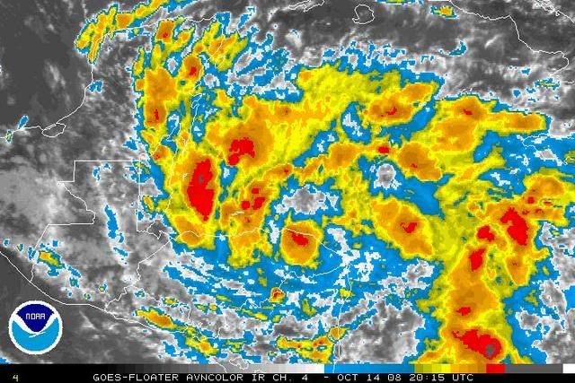
Appears to be mostly stationary and organizing.
Appears to be mostly stationary and organizing.
0 likes
-
CourierPR

- Category 5

- Posts: 1325
- Age: 70
- Joined: Tue Aug 31, 2004 7:53 pm
- Location: Pompano Beach, Florida
Re: ATL SIXTEEN: Tropical Depression - Discussion
A local met said on Monday that a front would approach our area by week's end. Will this affect the future course of TD16?
0 likes
-
gatorcane

- S2K Supporter

- Posts: 23499
- Age: 46
- Joined: Sun Mar 13, 2005 3:54 pm
- Location: Boca Raton, FL
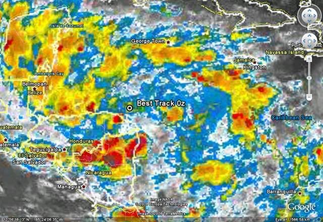
I have no idea how NHC gets a WNW movement at 7mph at the 5pm advisory. It is not moving over the last few hours as shown by this close-up visible:
http://metofis.rsmas.miami.edu/~dortt/s ... 1_loop.gif
http://metofis.rsmas.miami.edu/~dortt/s ... 1_loop.gif
0 likes

Re:
gatorcane wrote:I have no idea how NHC gets a WNW movement at 7mph at the 5pm advisory. It is not moving over the last few hours as shown by this close-up visible:
http://metofis.rsmas.miami.edu/~dortt/s ... 1_loop.gif
In the 5pm discussion, they said that the plane fixed center recently further WNW of their advisory position. So they may have to reposition the center later on to the WNW, anyway.
0 likes

Re: ATL SIXTEEN: Tropical Depression - Discussion
Too much land interaction. Should remain weak.
0 likes

-
MiamiensisWx
Is it possible that a small piece of 850 mb LL vorticity is "breaking off" and moving east into the Caribbean Sea SW of Jamaica? I believe similar scenarios have occurred in some previous cases.
http://www.ssd.noaa.gov/goes/east/tatl/loop-ir2.html
CIMSS 850 mb vorticity data is not available... can anyone offer other resources?
http://www.ssd.noaa.gov/goes/east/tatl/loop-ir2.html
CIMSS 850 mb vorticity data is not available... can anyone offer other resources?
0 likes

Re: ATL SIXTEEN: Tropical Depression - Discussion
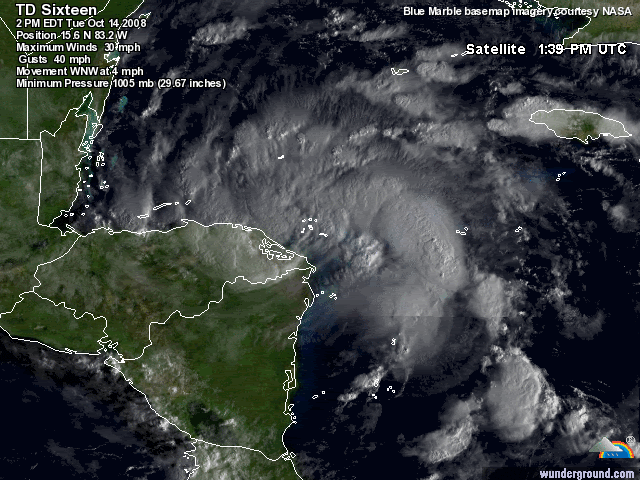
I see the center going overland near 15.7N-84W
0 likes
-
HURAKAN
- Professional-Met
- Posts: 46086
- Age: 37
- Joined: Thu May 20, 2004 4:34 pm
- Location: Key West, FL
- Contact:
Re: ATL SIXTEEN: Tropical Depression - Discussion
Sanibel wrote:I see the center going overland near 15.7N-84W
At 5 PM the NHC said that the overall circulation or borad circulation is not the real center as the RECON found it to be 45 nm to the NW of the center observed in the images.
0 likes
-
Tampa Bay Hurricane

- Category 5
- Posts: 5594
- Age: 36
- Joined: Fri Jul 22, 2005 7:54 pm
- Location: St. Petersburg, FL
Re: ATL: Tropical Depression 16 - Discussion
MiamiensisWx wrote:Tampa Bay Hurricane wrote:I agree Cat 5. It is a blessing. Unfortunately Fay did cause flood damage to many parts,
but thank goodness we had no major hurricane. And Fay actually helped refill Lake Ockeechobee.
Intense (Cat 3+) landfalls are very rare... I also believe this year proved (again) that you don't need a Cat 3+ to induce significant effects. Look at Ike (Cat 2) and Claudette (borderline Cat 1/2) in Texas...
Contributors forget very easily...
I did not forget anything- I never said a category 1/2 was weak. Category 1 Jeanne was like a tornado
when it hit Tampa Bay 4 years ago, after hitting the east coast as a Category 3.
Last edited by Tampa Bay Hurricane on Wed Oct 15, 2008 8:53 am, edited 1 time in total.
0 likes
-
canetracker

- S2K Supporter
- Posts: 746
- Age: 61
- Joined: Wed Jul 27, 2005 8:49 pm
- Location: Suburbia New Orleans...Harahan, LA
Re: ATL SIXTEEN: Tropical Depression - Discussion
Why is the NRL showing Invest 99L and TD 16 in the same area? Are they 2 different circulations?
http://www.nrlmry.navy.mil/tc-bin/tc_home2.cgi?YEAR=2008&MO=10&BASIN=ATL&STORM_NAME=99L.INVEST&PROD=track_vis&PHOT=yes&ARCHIVE=active&NAV=tc&AGE=Latest&SIZE=Thumb&STYLE=tables&AID_DIR=/data/www/atlantic/tropics/microvap/dmsp&TYPE=ssmi
http://www.nrlmry.navy.mil/tc-bin/tc_home2.cgi?YEAR=2008&MO=10&BASIN=ATL&STORM_NAME=99L.INVEST&PROD=track_vis&PHOT=yes&ARCHIVE=active&NAV=tc&AGE=Latest&SIZE=Thumb&STYLE=tables&AID_DIR=/data/www/atlantic/tropics/microvap/dmsp&TYPE=ssmi
0 likes
Who is online
Users browsing this forum: No registered users and 109 guests