

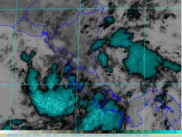
There is a large circulation that stretches between the Caribbean and EPAC. If the center is not inland, it's very close.
Loop: http://rammb.cira.colostate.edu/ramsdis ... _floater_1
ATL : INVEST 94L
Moderator: S2k Moderators
-
Evil Jeremy

- S2K Supporter

- Posts: 5459
- Age: 31
- Joined: Mon Apr 10, 2006 2:10 pm
- Location: Los Angeles, CA
Re: ATL : INVEST 94L
The convection is still there, but not anymore organized than before. I would say overall chances of development are around 20%, perhaps lower. I am not that concerned. It needs to do something today to prove that it is still a contender to be our season's "I" storm.
0 likes
Frances 04 / Jeanne 04 / Katrina 05 / Wilma 05 / Fay 08 / Debby 12 / Andrea 13 / Colin 16 / Hermine 16 / Matthew 16 / Irma 17
-
Blown Away

- S2K Supporter
- Posts: 9867
- Joined: Wed May 26, 2004 6:17 am
Re: ATL : INVEST 94L - Models
On the latest ECMWF run is that 94L's low that jumps around near Jamaica/Haiti then moves NNW over Cuba then through the Florida peninsula?
http://www.ecmwf.int/products/forecasts ... 12!!!step/
http://www.ecmwf.int/products/forecasts ... 12!!!step/
0 likes
Hurricane Eye Experience: David 79, Irene 99, Frances 04, Jeanne 04, Wilma 05... EYE COMING MY WAY IN 2024…
Hurricane Brush Experience: Andrew 92, Erin 95, Floyd 99, Matthew 16, Irma 17, Ian 22, Nicole 22…
Hurricane Brush Experience: Andrew 92, Erin 95, Floyd 99, Matthew 16, Irma 17, Ian 22, Nicole 22…
-
cycloneye

- Admin

- Posts: 139409
- Age: 67
- Joined: Thu Oct 10, 2002 10:54 am
- Location: San Juan, Puerto Rico
Re: ATL : INVEST 94L
TROPICAL WEATHER OUTLOOK
NWS TPC/NATIONAL HURRICANE CENTER MIAMI FL
800 AM EDT WED OCT 21 2009
FOR THE NORTH ATLANTIC...CARIBBEAN SEA AND THE GULF OF MEXICO...
A NEARLY STATIONARY AREA OF LOW PRESSURE OVER THE SOUTHWESTERN
CARIBBEAN SEA AND CENTRAL AMERICA IS PRODUCING A LARGE AREA OF
CLOUDINESS AND SHOWERS. THIS SYSTEM REMAINS POORLY ORGANIZED AND
DEVELOPMENT...IF ANY...WILL BE SLOW TO OCCUR. HEAVY RAINS WILL
LIKELY TO CONTINUE OVER COSTA RICA...NICARAGUA...AND HONDURAS
DURING THE NEXT FEW DAYS. THERE IS A LOW CHANCE... LESS THAN 30
PERCENT...OF THIS SYSTEM BECOMING A TROPICAL CYCLONE DURING THE
NEXT 48 HOURS.
ELSEWHERE...TROPICAL CYCLONE FORMATION IS NOT EXPECTED DURING THE
NEXT 48 HOURS.
$$
FORECASTER AVILA
0 likes
Visit the Caribbean-Central America Weather Thread where you can find at first post web cams,radars
and observations from Caribbean basin members Click Here
and observations from Caribbean basin members Click Here
-
AJC3

- Admin
- Posts: 3876
- Age: 60
- Joined: Tue Aug 31, 2004 7:04 pm
- Location: West Melbourne, Florida
- Contact:
Re: ATL : INVEST 94L - Models
Blown_away wrote:On the latest ECMWF run is that 94L's low that jumps around near Jamaica/Haiti then moves NNW over Cuba then through the Florida peninsula?
http://www.ecmwf.int/products/forecasts ... 12!!!step/
Those small L's are just background noise in the model progs. As mentioned above, last night's 00Z ECM pretty much dropped the Caribbean low.
0 likes
-
HURRICANELONNY
- Category 5

- Posts: 1381
- Joined: Wed May 07, 2003 6:48 am
- Location: HOLLYWOOD.FL
Re: ATL : INVEST 94L
As of now. The NWS in Miami said more moisture from the Carribean will spread north next week.
http://www.wunderground.com/DisplayDisc ... Lauderdale
http://www.wunderground.com/DisplayDisc ... Lauderdale
0 likes
hurricanelonny
-
Evil Jeremy
- S2K Supporter
- Posts: 5459
- Age: 31
- Joined: Mon Apr 10, 2006 2:10 pm
- Location: Los Angeles, CA
Re: ATL : INVEST 94L
I wonder if the fact that 93L and 94L are no longer on the S2K map has anything to do with the fact that SFWMD is no longer hosting their models at the moment:
http://my.sfwmd.gov/sfwmd/common/images ... plots.html
http://my.sfwmd.gov/sfwmd/common/images ... plots.html
0 likes
Frances 04 / Jeanne 04 / Katrina 05 / Wilma 05 / Fay 08 / Debby 12 / Andrea 13 / Colin 16 / Hermine 16 / Matthew 16 / Irma 17
-
wxman57

- Moderator-Pro Met

- Posts: 22484
- Age: 66
- Joined: Sat Jun 21, 2003 8:06 pm
- Location: Houston, TX (southwest)
Re:
Derek Ortt wrote:chances of development now seem quite low
not much to worry about any more
Yep, looking a lot better now as far as any threat to the NW Caribbean or Florida. Satellite shows a good bit of the mid-level rotation in the East Pacific now. Might develop over there.
0 likes

Re: ATL : INVEST 94L
I wouldn't write it off yet - vorticity looks like it split off with one toward the Pacific and another off the coast of Nic. None of the models developed it this early - was Friday at the earliest. NRL jumped the gun with the INVEST too early - still climatologically favored area with low pressure that will not be in any hurry to move out.
0 likes
-
Blown Away
- S2K Supporter
- Posts: 9867
- Joined: Wed May 26, 2004 6:17 am
Re: ATL : INVEST 94L
ronjon wrote:I wouldn't write it off yet - vorticity looks like it split off with one toward the Pacific and another off the coast of Nic. None of the models developed it this early - was Friday at the earliest. NRL jumped the gun with the INVEST too early - still climatologically favored area with low pressure that will not be in any hurry to move out.
Exactly what I was thinking. That vorticy was evident yesterday moving over land towards the Pacific. Everybody is quick to write 94L off because of one model run that shows no development. If you use the TPC's placement of 94L's low, the convection is building rate around that area. The whole area is disorganized, I just don't think the status has changed much compared to yesterday.
0 likes
Hurricane Eye Experience: David 79, Irene 99, Frances 04, Jeanne 04, Wilma 05... EYE COMING MY WAY IN 2024…
Hurricane Brush Experience: Andrew 92, Erin 95, Floyd 99, Matthew 16, Irma 17, Ian 22, Nicole 22…
Hurricane Brush Experience: Andrew 92, Erin 95, Floyd 99, Matthew 16, Irma 17, Ian 22, Nicole 22…
-
wxman57
- Moderator-Pro Met
- Posts: 22484
- Age: 66
- Joined: Sat Jun 21, 2003 8:06 pm
- Location: Houston, TX (southwest)
Re: ATL : INVEST 94L
ronjon wrote:I wouldn't write it off yet - vorticity looks like it split off with one toward the Pacific and another off the coast of Nic. None of the models developed it this early - was Friday at the earliest. NRL jumped the gun with the INVEST too early - still climatologically favored area with low pressure that will not be in any hurry to move out.
Not writing it off, just acknowledging that it's looking less likely that it will develop. Even though it wasn't expected to develop until Friday or Saturday, we should see increasing signs of organization and/or better model support for development by now if it was going to develop. Since things are trending the other way, development chances are lowering.
If I lived in Florida, I'd feel a lot better about this disturbance. But I'd still keep an eye on it until it's gone.
0 likes
-
tolakram
- Admin
- Posts: 19172
- Age: 60
- Joined: Sun Aug 27, 2006 8:23 pm
- Location: Florence, KY (name is Mark)
Re: ATL : INVEST 94L
Energy looks to have moved to the EPAC, and I bet we get an invest out of it soon. How many times have the models sniffed something out down there that ends up being an EPAC disturbance. Seems like it happens on a regular basis.
http://rammb.cira.colostate.edu/ramsdis ... _floater_1

http://rammb.cira.colostate.edu/ramsdis ... _floater_1
0 likes
M a r k
- - - - -
Join us in chat: Storm2K Chatroom Invite. Android and IOS apps also available.
The posts in this forum are NOT official forecasts and should not be used as such. Posts are NOT endorsed by any professional institution or STORM2K.org. For official information and forecasts, please refer to NHC and NWS products.
-
wxman57
- Moderator-Pro Met
- Posts: 22484
- Age: 66
- Joined: Sat Jun 21, 2003 8:06 pm
- Location: Houston, TX (southwest)
Re: ATL : INVEST 94L
I was just going to comment on the East Pac. Sure looks like a storm is about to spin up west of Costa Rica. Energy is shifting westward out of the Caribbean. Surprised there is no "yellow egg" there. This could also be an inhibiting factor for the western Caribbean.

Last edited by wxman57 on Wed Oct 21, 2009 7:58 am, edited 1 time in total.
0 likes
-
Evil Jeremy
- S2K Supporter
- Posts: 5459
- Age: 31
- Joined: Mon Apr 10, 2006 2:10 pm
- Location: Los Angeles, CA
Re: ATL : INVEST 94L
tolakram wrote:Energy looks to have moved to the EPAC, and I bet we get an invest out of it soon. How many times have the models sniffed something out down there that ends up being an EPAC disturbance. Seems like it happens on a regular basis.
http://rammb.cira.colostate.edu/ramsdis ... _floater_1
The center of the energy appears to be between the two. I think this system can end up in either basin at this point. My memory is horrible, so correct me if I am wrong, but didn't we have a similar situation with Tropical Storm Arthur last year? The disturbance that became Arthur was flipping from EPAC to the Caribbean. Either way, 57 put it best for those in Florida. I am remaining cautious, but not worrying at all right now.
0 likes
Frances 04 / Jeanne 04 / Katrina 05 / Wilma 05 / Fay 08 / Debby 12 / Andrea 13 / Colin 16 / Hermine 16 / Matthew 16 / Irma 17
-
wxman57
- Moderator-Pro Met
- Posts: 22484
- Age: 66
- Joined: Sat Jun 21, 2003 8:06 pm
- Location: Houston, TX (southwest)
Re: ATL : INVEST 94L
Yes, it's similar to the Arthur/Alma development last year. NHC named Arthur after it was inland over Nicaragua. Not an uncommon occurrence in the region. But it's looking like the East Pac system may be taking over, and that may inhibit development in the west Caribbean. I don't think the NHC will name another inland system based on questionable ship data. And Arthur did have a well-defined circulation, at least. This system has nothing at the surface in the west Caribbean.
0 likes

Re: ATL : INVEST 94L
Last year Some models were predicting development on the Caribbean and other models on EPAC, at the end Alma formed just off Central American coast and made lanfall in Nicaragua, as it crossed land it degenerated into a remnant low, later the remnants moved again in water and interacted with other systems allowing ex-Alma to redevelop into Arthur. It seems that the two predictions verified there was develoment in both basins.
0 likes
-
wxman57
- Moderator-Pro Met
- Posts: 22484
- Age: 66
- Joined: Sat Jun 21, 2003 8:06 pm
- Location: Houston, TX (southwest)
Re: ATL : INVEST 94L
I made a loop of the area. Don't see any rotation out over the water in the West Caribbean any more. That vorticity is inland into Nicaragua. The primary rotation is in the East Pacific.

0 likes
Who is online
Users browsing this forum: No registered users and 6 guests