No problem my friend you're apologized

! Whereas if you want or have time for that

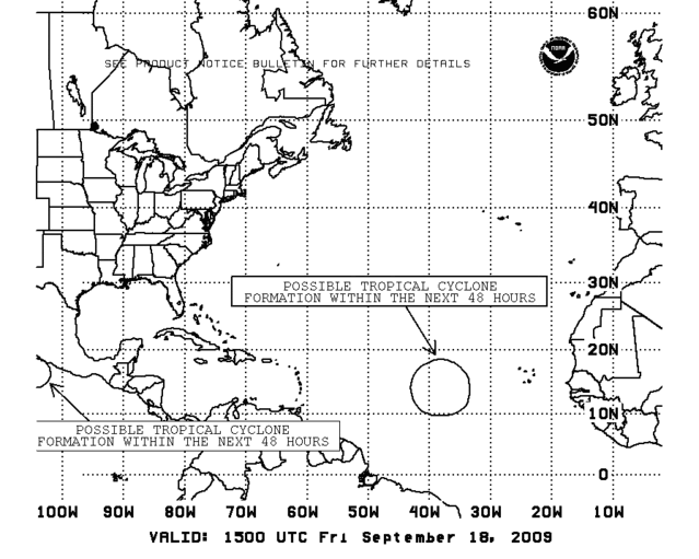
(we will be very glad in the tropics)
i advice you to go more frequently to our TENT :), we will provide you news from the Lesser Antilles :
 viewtopic.php?f=20&t=85676&st=0&sk=t&sd=a
 If you want to have details concerning Ana, Erika's effects in Guadeloupe and the others islands go on the appropriates pages...
Just a remark, don't forget that the season could be quiet in an area of the Atlantic and not on the other part
. For example: 2005 was an rather active year especially for the US (landfall with Dennis, Rita, Wilma...), but nothing in Guadeloupe and most of the Lesser Antilles...Another example 1992 was pretty inactive but Andrew slamed remarquably Florida


That's why i want to emphasize on the fact that this year, anothers systems while they're weak...they could affect us and pose a problem (flooding, muslides, etc. deaths have been reported in PR history, and others islands too, with " only" with this event!) in spite of the weak status (TWave, TD, weak TS). Us in the islands given our roots, history, our philosophy is: we never let or we should not let your guard down in the peak of the season Otowntiger!
Friendly, Regards Gustywind

But that's depens where you live otowtiger.
.