Loop: http://rammb.cira.colostate.edu/ramsdis ... _floater_1
Moderator: S2k Moderators


wxman57 wrote:ozonepete wrote:
Your initial forecast, based on climo, was right.
"Wasn't based on climo, was based on the projected upper-air pattern across the northern Gulf this week. The Gulf has been ripping with shear most of the season."
Time for bed. Another early day tomorrow.


MGC wrote:Hardly any tropical feel to the air tonight, kinda chilly to me. Car temp indicated 64 but Gulfport airport is reporting upper 60's. My first and likely only November TC has been different experience than a TC during the warmer months, kinda like Christmas in July.....The center of Ida is clearly visible on radar south of the MS/AL border. Its a mess down in the Gulf, Ida is badly sheared, cool air is being drawn into the circulation. How Ida has not become ET is beyond me. Hopefully this mess gets out of here for tomorrow. Everyone that is in Ida's way stay safe.....MGC
CrazyC83 wrote:What is all that convection from Florida downward? Looks frontal to me.
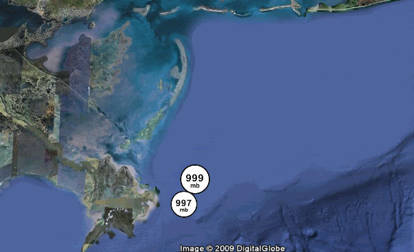
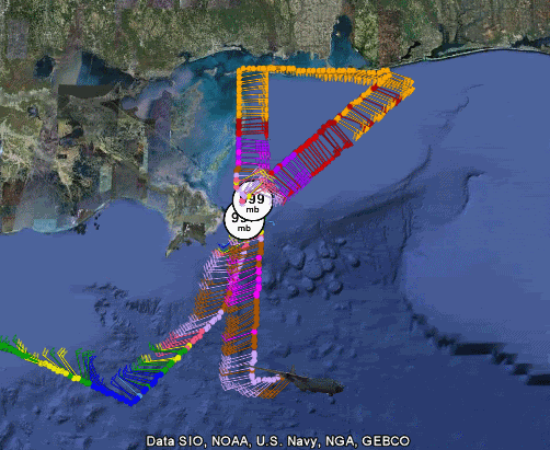
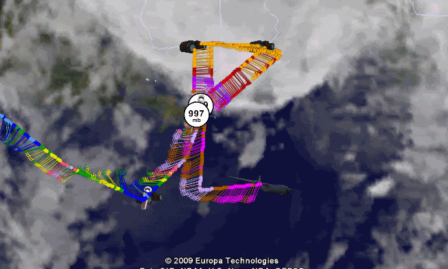
The SFMR also just found 66 and 67 kt winds. I'd say this is a 65 kt extratropical system right now.


CrazyC83 wrote:http://www.wunderground.com/weatherstation/WXDailyHistory.asp?ID=MC9872
Theodore, AL supposedly reporting 77 mph winds, but the accuracy might be suspect.
Janie2006 wrote:CrazyC83 wrote:http://www.wunderground.com/weatherstation/WXDailyHistory.asp?ID=MC9872
Theodore, AL supposedly reporting 77 mph winds, but the accuracy might be suspect.
It's bogus. I'm presently only 3 miles north of that location and have reported nothing like a 77 mph gust.
Users browsing this forum: No registered users and 8 guests