

AXAU01 APRF 260046
IDW27600
TROPICAL CYCLONE TECHNICAL BULLETIN: AUSTRALIA - WESTERN REGION
Issued by PERTH TROPICAL CYCLONE WARNING CENTRE
at: 0045 UTC 26/01/2009
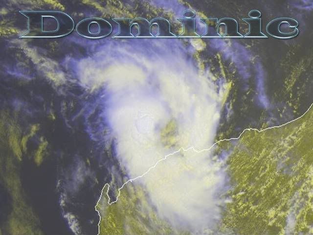
Name: Tropical Low
Data At: 0000 UTC
Latitude: 19.0S
Longitude: 116.2E
Location Accuracy: within 25 nm [46 km]
Movement Towards: southwest [223 deg]
Speed of Movement: 3 knots [5 km/h]
Maximum 10-Minute Wind: 30 knots [55 km/h]
Maximum 3-Second Wind Gust: 45 knots [85 km/h]
Central Pressure: 996 hPa
Radius of 34-knot winds NE quadrant:
Radius of 34-knot winds SE quadrant:
Radius of 34-knot winds SW quadrant:
Radius of 34-knot winds NW quadrant:
Radius of 48-knot winds NE quadrant:
Radius of 48-knot winds SE quadrant:
Radius of 48-knot winds SW quadrant:
Radius of 48-knot winds NW quadrant:
Radius of 64-knot winds:
Radius of Maximum Winds:
Dvorak Intensity Code: T2.5/2.5/D1.0/24HRS
Pressure of outermost isobar: 1002 hPa
Radius of outermost closed isobar: 60 nm [110 km]
Storm Depth: Deep
FORECAST DATA
Date/Time : Location : Loc. Accuracy: Max Wind : Central Pressure
[UTC] : degrees : nm [km]: knots[km/h]: hPa
+12: 26/1200: 19.5S 115.8E: 055 [100]: 040 [075]: 989
+24: 27/0000: 20.2S 115.6E: 085 [155]: 050 [095]: 982
+36: 27/1200: 21.2S 115.8E: 120 [220]: 045 [085]: 986
+48: 28/0000: 22.0S 116.3E: 160 [295]: 030 [055]: 995
+60: 28/1200: 22.7S 116.8E: 210 [390]: 025 [045]: 998
+72: 29/0000: 23.5S 117.3E: 250 [465]: 020 [035]: 1001
REMARKS:
The low level circulation is quite well defined as evident on 37GHz microwave
and radar. Deep convection has slowly improved overnight with an average wrap of
0.4-0.5 evident on a sequence of images from 18Z. Deep convection is also more
tightly focused near the centre than it was overnight. DT/FT/CI is set to 2.5.
Offshore observations are in agreement, with mean winds of around 30 knots being
reported from a number of sites. Shear is currently quite low and SSTs are over
29C. The environment remains favourable in the short term and development is
forecast for later today.
The system has already slowed its westwards movement considerably, and an
approaching mid-level trough will weaken the ridge and should steer the system
toward the coast. There is considerable variance in the models with some models
indicating that the system could weaken significantly and be steered by lower
level flow, never reaching the coast. While this is quite possible, the
forecast track has been constructed from a selective consensus of models that
match the conceptual model of steering for a deeper system. It is notable that
the deterministic run of the UK is an outlier compared with the spread of
ensemble members, suggesting that some NWP may be struggling with the small
scale of the system.
Amongst model runs that bring the system into the coast there is considerable
variance in timing of coastal crossing, and hence there is considerable
uncertainty in this respect.
Copyright Commonwealth of Australia
==
The next bulletin for this system will be issued by: 26/0700 UTC by Perth TCWC.
Australia: DOMINIC - Ex. Tropical Cyclone
Moderator: S2k Moderators


-
HURAKAN

- Professional-Met

- Posts: 46086
- Age: 37
- Joined: Thu May 20, 2004 4:34 pm
- Location: Key West, FL
- Contact:
Australian Government Bureau of Meteorology
Western Australia
Media: The Standard Emergency Warning Signal should NOT be used with this
warning.
TOP PRIORITY FOR IMMEDIATE BROADCAST
TROPICAL CYCLONE ADVICE NUMBER 10
Issued at 12:50 pm WDT on Monday, 26 January 2009
BY THE BUREAU OF METEOROLOGY
TROPICAL CYCLONE WARNING CENTRE PERTH
A Cyclone WARNING is current for coastal areas from Whim Creek to Exmouth
including adjacent inland parts of the west Pilbara.
At midday WDT Tropical Cyclone Dominic, Category 1 was estimated to be
160 kilometres northwest of Karratha and
240 kilometres north northeast of Onslow and
moving southwest at 10 kilometres per hour.
Tropical Cyclone Dominic is moving towards the west Pilbara coast. Gales with
gusts to 120 kilometres per hour may develop in exposed coastal areas later this
afternoon or overnight.
Tides between Exmouth and Whim Creek may rise above the normal high tide mark as
the cyclone approaches the coast, with very rough seas and flooding of low lying
coastal areas.
Details of Tropical Cyclone Dominic at midday WDT:
.Centre located near...... 19.6 degrees South 115.9 degrees East
.Location accuracy........ within 45 kilometres
.Recent movement.......... towards the southwest at 10 kilometres per hour
.Wind gusts near centre... 95 kilometres per hour
.Severity category........ 1
.Central pressure......... 994 hectoPascals
FESA-State Emergency Service advises of the following community alerts:
BLUE ALERT: People in or near the communities of Roebourne, Wickham, Point
Samson, Karratha, Dampier, Onslow and adjacent inland communities should start
taking precautions.
The next advice will be issued by 4:00 pm WDT Monday 26 January.
Cyclone advices and State Emergency Service Community Alerts are available by
dialling 1300 659 210
A map showing the track of the cyclone is available at:
http://www.bom.gov.au/weather/cyclone
0 likes


-
HURAKAN
- Professional-Met
- Posts: 46086
- Age: 37
- Joined: Thu May 20, 2004 4:34 pm
- Location: Key West, FL
- Contact:
UW - CIMSS
ADVANCED DVORAK TECHNIQUE
ADT-Version 7.2.3
Tropical Cyclone Intensity Algorithm
----- Current Analysis -----
Date : 26 JAN 2009 Time : 033000 UTC
Lat : 19:37:00 S Lon : 115:58:48 E
CI# /Pressure/ Vmax
3.0 / 991.0mb/ 45.0kt
Final T# Adj T# Raw T#
(3hr avg)
3.0 3.1 3.4
Latitude bias adjustment to MSLP : +0.0mb
Center Temp : -42.4C Cloud Region Temp : -59.2C
Scene Type : CURVED BAND with 0.71 ARC in LT GRAY
Positioning Method : FORECAST INTERPOLATION
Ocean Basin : INDIAN
Dvorak CI > MSLP Conversion Used : PACIFIC
Tno/CI Rules : Constraint Limits : 0.7T/6hr
Weakening Flag : OFF
Rapid Dissipation Flag : OFF
0 likes
-
HURAKAN
- Professional-Met
- Posts: 46086
- Age: 37
- Joined: Thu May 20, 2004 4:34 pm
- Location: Key West, FL
- Contact:
Australian Government Bureau of Meteorology
Western Australia
Media: Transmitters serving Onslow and adjacent areas are requested to USE the
Standard Emergency Warning Signal before broadcasting the following warning.
TOP PRIORITY FOR IMMEDIATE BROADCAST
TROPICAL CYCLONE ADVICE NUMBER 12
Issued at 6:45 pm WDT on Monday, 26 January 2009
BY THE BUREAU OF METEOROLOGY
TROPICAL CYCLONE WARNING CENTRE PERTH
A Cyclone WARNING is current for coastal areas from Whim Creek to Exmouth
including inland parts of the west Pilbara.
At 6:00 pm WDT Tropical Cyclone Dominic, Category 2 was estimated to be
130 kilometres north northeast of Onslow and
155 kilometres west of Karratha and
moving south southwest at 15 kilometres per hour.
Tropical Cyclone Dominic is moving towards the west Pilbara coast. Gales with
gusts to 120 kilometres per hour are likely to develop in coastal areas this
evening or overnight. The system is likely to cross the west Pilbara coast
between Exmouth and Karratha, most likely in the vicinity of Onslow, overnight.
Destructive gusts to 150 kilometres per hour may be experienced for a period
close to the cyclone's path, however periods of gales are possible in all parts
of the warning area.
Residents of Onslow are specifically warned of the potential of a DANGEROUS
STORM TIDE as the cyclone centre crosses the coast. Tides between Exmouth and
Whim Creek may rise above the normal high tide mark as the cyclone approaches
the coast, with very rough seas and flooding of low lying coastal areas.
Widespread rain is expected in the western Pilbara with heavy falls close to the
cyclone's path.
Details of Tropical Cyclone Dominic at 6:00 pm WDT:
.Centre located near...... 20.5 degrees South 115.4 degrees East
.Location accuracy........ within 37 kilometres
.Recent movement.......... towards the south southwest at 15 kilometres per hour
.Wind gusts near centre... 130 kilometres per hour
.Severity category........ 2
.Central pressure......... 984 hectoPascals
FESA-State Emergency Service advises of the following community alerts:
RED ALERT: People in or near Onslow and adjacent inland communities should move
to shelter.
BLUE ALERT: People in or near the communities of Roebourne, Wickham, Point
Samson, Karratha, Dampier, Pannawonica, Nanutarra and adjacent inland
communities should be taking precautions.
The next advice will be issued by 10:00 pm WDT Monday 26 January.
Cyclone advices and State Emergency Service Community Alerts are available by
dialling 1300 659 210
A map showing the track of the cyclone is available at:
http://www.bom.gov.au/weather/cyclone
0 likes
-
HURAKAN
- Professional-Met
- Posts: 46086
- Age: 37
- Joined: Thu May 20, 2004 4:34 pm
- Location: Key West, FL
- Contact:

SUBJ: TROPICAL CYCLONE 10S (DOMINIC) WARNING NR 004
WTXS31 PGTW 260900
1. TROPICAL CYCLONE 10S (DOMINIC) WARNING NR 004
01 ACTIVE TROPICAL CYCLONE IN SOUTHIO
MAX SUSTAINED WINDS BASED ON ONE-MINUTE AVERAGE
---
WARNING POSITION:
260600Z --- NEAR 20.2S 115.6E
MOVEMENT PAST SIX HOURS - 215 DEGREES AT 08 KTS
POSITION ACCURATE TO WITHIN 060 NM
POSITION BASED ON CENTER LOCATED BY SATELLITE
PRESENT WIND DISTRIBUTION:
MAX SUSTAINED WINDS - 035 KT, GUSTS 045 KT
WIND RADII VALID OVER OPEN WATER ONLY
REPEAT POSIT: 20.2S 115.6E
---
FORECASTS:
12 HRS, VALID AT:
261800Z --- 20.8S 115.2E
MAX SUSTAINED WINDS - 045 KT, GUSTS 055 KT
WIND RADII VALID OVER OPEN WATER ONLY
VECTOR TO 24 HR POSIT: 165 DEG/ 02 KTS
---
24 HRS, VALID AT:
270600Z --- 21.1S 115.3E
MAX SUSTAINED WINDS - 050 KT, GUSTS 065 KT
WIND RADII VALID OVER OPEN WATER ONLY
RADIUS OF 034 KT WINDS - 025 NM NORTHEAST QUADRANT
025 NM SOUTHEAST QUADRANT
030 NM SOUTHWEST QUADRANT
020 NM NORTHWEST QUADRANT
VECTOR TO 36 HR POSIT: 115 DEG/ 04 KTS
---
36 HRS, VALID AT:
271800Z --- 21.4S 116.0E
MAX SUSTAINED WINDS - 035 KT, GUSTS 045 KT
WIND RADII VALID OVER OPEN WATER ONLY
DISSIPATING AS A SIGNIFICANT TROPICAL CYCLONE OVER LAND
VECTOR TO 48 HR POSIT: 115 DEG/ 06 KTS
---
EXTENDED OUTLOOK:
48 HRS, VALID AT:
280600Z --- 21.9S 117.1E
MAX SUSTAINED WINDS - 025 KT, GUSTS 035 KT
WIND RADII VALID OVER OPEN WATER ONLY
DISSIPATED AS A SIGNIFICANT TROPICAL CYCLONE OVER LAND
---
REMARKS:
260900Z POSITION NEAR 20.3S 115.5E.
MAXIMUM SIGNIFICANT WAVE HEIGHT AT 260600Z IS 12 FEET.
NEXT WARNINGS AT 262100Z AND 270900Z.
0 likes
-
HURAKAN
- Professional-Met
- Posts: 46086
- Age: 37
- Joined: Thu May 20, 2004 4:34 pm
- Location: Key West, FL
- Contact:
Australian Government Bureau of Meteorology
Western Australia
Media: Transmitters serving Onslow and adjacent areas are requested to USE the
Standard Emergency Warning Signal before broadcasting the following warning.
TOP PRIORITY FOR IMMEDIATE BROADCAST
TROPICAL CYCLONE ADVICE NUMBER 13
Issued at 9:45 pm WDT on Monday, 26 January 2009
BY THE BUREAU OF METEOROLOGY
TROPICAL CYCLONE WARNING CENTRE PERTH
A Cyclone WARNING is current for coastal areas from Whim Creek to Exmouth
including inland parts of the west Pilbara.
At 9:00 pm WDT Tropical Cyclone Dominic, Category 2 was estimated to be
105 kilometres north of Onslow and
160 kilometres west of Karratha and
moving south southwest at 15 kilometres per hour.
Tropical Cyclone Dominic is continuing to move in a southerly direction towards
the west Pilbara coast. Gales with gusts to 120 kilometres per hour are likely
to develop in coastal areas overnight. The system is likely to cross the west
Pilbara coast between Exmouth and Karratha, most likely in the vicinity of
Onslow, in the early hours of Tuesday morning. Destructive gusts to 130
kilometres per hour may be experienced for a period close to the cyclone's path,
however periods of gales are possible in all parts of the warning area.
Residents of Onslow are specifically warned of the potential of a DANGEROUS
STORM TIDE as the cyclone centre crosses the coast. Tides between Exmouth and
Whim Creek may rise above the normal high tide mark as the cyclone approaches
the coast, with very rough seas and flooding of low lying coastal areas.
Widespread rain is expected in the western Pilbara with heavy falls close to the
cyclone's path.
Details of Tropical Cyclone Dominic at 9:00 pm WDT:
.Centre located near...... 20.7 degrees South 115.3 degrees East
.Location accuracy........ within 37 kilometres
.Recent movement.......... towards the south southwest at 15 kilometres per hour
.Wind gusts near centre... 130 kilometres per hour
.Severity category........ 2
.Central pressure......... 982 hectoPascals
FESA-State Emergency Service advises of the following community alerts:
RED ALERT: People in or near Onslow and adjacent inland communities should move
to shelter.
YELLOW ALERT: People in or near Pannawonica should be taking action in
preparation for the cyclone's arrival.
BLUE ALERT: People in or near the communities of Roebourne, Wickham, Point
Samson, Karratha, Dampier, Exmouth, Nanutarra and adjacent inland communities
should be taking precautions.
The next advice will be issued by 1:00 am WDT Tuesday 27 January.
Cyclone advices and State Emergency Service Community Alerts are available by
dialling 1300 659 210
A map showing the track of the cyclone is available at:
http://www.bom.gov.au/weather/cyclone
0 likes

-
HURAKAN
- Professional-Met
- Posts: 46086
- Age: 37
- Joined: Thu May 20, 2004 4:34 pm
- Location: Key West, FL
- Contact:
Australian Government Bureau of Meteorology
Western Australia
Media: Transmitters serving Onslow and adjacent areas are requested to USE the
Standard Emergency Warning Signal before broadcasting the following warning.
TOP PRIORITY FOR IMMEDIATE BROADCAST
TROPICAL CYCLONE ADVICE NUMBER 14
Issued at 1:05 am WDT on Tuesday, 27 January 2009
BY THE BUREAU OF METEOROLOGY
TROPICAL CYCLONE WARNING CENTRE PERTH
A Cyclone WARNING is current for coastal areas from Karratha to Exmouth
The Cyclone Warning between Whim Creek and Karratha has been cancelled.
At 12:00 am WDT Tropical Cyclone Dominic, Category 2 was estimated to be
80 kilometres north of Onslow and
175 kilometres west of Karratha and
moving south southwest at 9 kilometres per hour.
Tropical Cyclone Dominic is continuing to move in a south southwest direction
towards the west Pilbara coast. Gales with gusts to 120 kilometres per hour are
likely to develop this morning. The system is likely to cross the west Pilbara
coast between Mardie and Exmouth, most likely in the vicinity of Onslow, after
sunrise this morning. Destructive gusts to 130 kilometres per hour may be
experienced for a period close to the cyclone's path, however periods of gales
are possible in all parts of the warning area.
Tides will be higher than expected between Karratha and Exmouth.
Widespread rain is expected in the western Pilbara with heavy falls close to the
cyclone's path.
Details of Tropical Cyclone Dominic at 12:00 am WDT:
.Centre located near...... 20.9 degrees South 115.2 degrees East
.Location accuracy........ within 37 kilometres
.Recent movement.......... towards the south southwest at 9 kilometres per hour
.Wind gusts near centre... 130 kilometres per hour
.Severity category........ 2
.Central pressure......... 982 hectoPascals
FESA-State Emergency Service advises of the following community alerts:
RED ALERT: People in or near Onslow and adjacent inland communities should move
to shelter.
YELLOW ALERT: People in or near Pannawonica should be taking action in
preparation for the cyclone's arrival.
BLUE ALERT: People in or near the communities of Karratha, Dampier, Exmouth,
Nanutarra and adjacent inland communities should be taking precautions.
ALL CLEAR WITH CAUTION: People in communities at Roebourne, Wickham and Point
Samson are advised to proceed with caution.
The next advice will be issued by 4:00 am WDT Tuesday 27 January.
Cyclone advices and State Emergency Service Community Alerts are available by
dialling 1300 659 210
A map showing the track of the cyclone is available at:
http://www.bom.gov.au/weather/cyclone
0 likes
-
HURAKAN
- Professional-Met
- Posts: 46086
- Age: 37
- Joined: Thu May 20, 2004 4:34 pm
- Location: Key West, FL
- Contact:

SUBJ: TROPICAL CYCLONE 10S (DOMINIC) WARNING NR 005
WTXS31 PGTW 261500
1. TROPICAL CYCLONE 10S (DOMINIC) WARNING NR 005
01 ACTIVE TROPICAL CYCLONE IN SOUTHIO
MAX SUSTAINED WINDS BASED ON ONE-MINUTE AVERAGE
---
WARNING POSITION:
261200Z --- NEAR 20.7S 115.3E
MOVEMENT PAST SIX HOURS - 210 DEGREES AT 06 KTS
POSITION ACCURATE TO WITHIN 060 NM
POSITION BASED ON CENTER LOCATED BY A COMBINATION OF
SATELLITE AND RADAR
PRESENT WIND DISTRIBUTION:
MAX SUSTAINED WINDS - 040 KT, GUSTS 050 KT
WIND RADII VALID OVER OPEN WATER ONLY
RADIUS OF 034 KT WINDS - 020 NM NORTHEAST QUADRANT
025 NM SOUTHEAST QUADRANT
020 NM SOUTHWEST QUADRANT
020 NM NORTHWEST QUADRANT
REPEAT POSIT: 20.7S 115.3E
---
FORECASTS:
12 HRS, VALID AT:
270000Z --- 21.6S 115.0E
MAX SUSTAINED WINDS - 040 KT, GUSTS 050 KT
WIND RADII VALID OVER OPEN WATER ONLY
RADIUS OF 034 KT WINDS - 020 NM NORTHEAST QUADRANT
020 NM SOUTHEAST QUADRANT
020 NM SOUTHWEST QUADRANT
020 NM NORTHWEST QUADRANT
VECTOR TO 24 HR POSIT: 165 DEG/ 05 KTS
---
24 HRS, VALID AT:
271200Z --- 22.5S 115.3E
MAX SUSTAINED WINDS - 030 KT, GUSTS 040 KT
WIND RADII VALID OVER OPEN WATER ONLY
DISSIPATED AS A SIGNIFICANT TROPICAL CYCLONE OVER LAND
---
REMARKS:
261500Z POSITION NEAR 20.9S 115.2E.
MAXIMUM SIGNIFICANT WAVE HEIGHT AT 261200Z IS 12 FEET.
NEXT WARNINGS AT 262100Z, 270300Z AND 270900Z.
0 likes
AXAU01 APRF 261224
IDW27600
TROPICAL CYCLONE TECHNICAL BULLETIN: AUSTRALIA - WESTERN REGION
Issued by PERTH TROPICAL CYCLONE WARNING CENTRE
at: 1224 UTC 26/01/2009
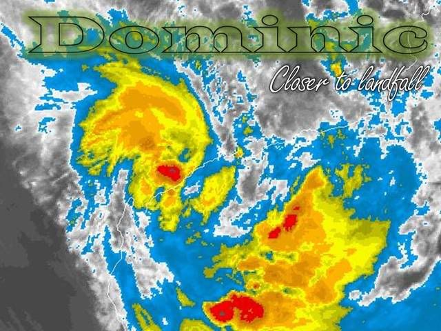
Name: Tropical Cyclone Dominic
Data At: 1200 UTC
Latitude: 20.7S
Longitude: 115.3E
Location Accuracy: within 20 nm [37 km]
Movement Towards: south southwest [205 deg]
Speed of Movement: 8 knots [15 km/h]
Maximum 10-Minute Wind: 50 knots [95 km/h]
Maximum 3-Second Wind Gust: 70 knots [130 km/h]
Central Pressure: 982 hPa
Radius of 34-knot winds NE quadrant: 60 nm [110 km]
Radius of 34-knot winds SE quadrant: 60 nm [110 km]
Radius of 34-knot winds SW quadrant: 60 nm [110 km]
Radius of 34-knot winds NW quadrant: 60 nm [110 km]
Radius of 48-knot winds NE quadrant: 20 nm [37 km]
Radius of 48-knot winds SE quadrant: 20 nm [37 km]
Radius of 48-knot winds SW quadrant: 20 nm [37 km]
Radius of 48-knot winds NW quadrant: 20 nm [37 km]
Radius of 64-knot winds:
Radius of Maximum Winds:
Dvorak Intensity Code: T3.0/3.5/D1.0/24HRS
Pressure of outermost isobar: 1002 hPa
Radius of outermost closed isobar: 75 nm [140 km]
Storm Depth: Deep
FORECAST DATA
Date/Time : Location : Loc. Accuracy: Max Wind : Central Pressure
[UTC] : degrees : nm [km]: knots[km/h]: hPa
+12: 27/0000: 22.1S 115.3E: 055 [100]: 040 [075]: 989
+24: 27/1200: 23.5S 115.8E: 085 [155]: 030 [055]: 996
+36: 28/0000: 24.8S 116.9E: 120 [220]: 025 [045]: 998
+48: 28/1200: 26.0S 118.0E: 160 [295]: 020 [035]: 1001
+60: 29/0000: 27.4S 119.1E: 210 [390]: 020 [035]: 1000
+72: 29/1200: 28.9S 120.1E: 250 [465]: 020 [035]: 1000
REMARKS:
TC Dominic improved in organisation during the day with afternoon VIS imagery
giving DT/FT/CI of 3.5. Recent imagery shows some warming of the cold cloud and
with the system expected to cross the Western Australian coastline within the
next 12 hours maximum intensity has probably been attained.
The system has been moving in a south southwest direction for the last 18 hours
and is expected to move south and then southeasterly after crossing the coast,
under the influence of a mid-level trough. The system is expected to weaken
quickly once it crosses the coast.
Copyright Commonwealth of Australia
==
The next bulletin for this system will be issued by: 26/1900 UTC by Perth TCWC.
IDW27600
TROPICAL CYCLONE TECHNICAL BULLETIN: AUSTRALIA - WESTERN REGION
Issued by PERTH TROPICAL CYCLONE WARNING CENTRE
at: 1224 UTC 26/01/2009
Name: Tropical Cyclone Dominic
Data At: 1200 UTC
Latitude: 20.7S
Longitude: 115.3E
Location Accuracy: within 20 nm [37 km]
Movement Towards: south southwest [205 deg]
Speed of Movement: 8 knots [15 km/h]
Maximum 10-Minute Wind: 50 knots [95 km/h]
Maximum 3-Second Wind Gust: 70 knots [130 km/h]
Central Pressure: 982 hPa
Radius of 34-knot winds NE quadrant: 60 nm [110 km]
Radius of 34-knot winds SE quadrant: 60 nm [110 km]
Radius of 34-knot winds SW quadrant: 60 nm [110 km]
Radius of 34-knot winds NW quadrant: 60 nm [110 km]
Radius of 48-knot winds NE quadrant: 20 nm [37 km]
Radius of 48-knot winds SE quadrant: 20 nm [37 km]
Radius of 48-knot winds SW quadrant: 20 nm [37 km]
Radius of 48-knot winds NW quadrant: 20 nm [37 km]
Radius of 64-knot winds:
Radius of Maximum Winds:
Dvorak Intensity Code: T3.0/3.5/D1.0/24HRS
Pressure of outermost isobar: 1002 hPa
Radius of outermost closed isobar: 75 nm [140 km]
Storm Depth: Deep
FORECAST DATA
Date/Time : Location : Loc. Accuracy: Max Wind : Central Pressure
[UTC] : degrees : nm [km]: knots[km/h]: hPa
+12: 27/0000: 22.1S 115.3E: 055 [100]: 040 [075]: 989
+24: 27/1200: 23.5S 115.8E: 085 [155]: 030 [055]: 996
+36: 28/0000: 24.8S 116.9E: 120 [220]: 025 [045]: 998
+48: 28/1200: 26.0S 118.0E: 160 [295]: 020 [035]: 1001
+60: 29/0000: 27.4S 119.1E: 210 [390]: 020 [035]: 1000
+72: 29/1200: 28.9S 120.1E: 250 [465]: 020 [035]: 1000
REMARKS:
TC Dominic improved in organisation during the day with afternoon VIS imagery
giving DT/FT/CI of 3.5. Recent imagery shows some warming of the cold cloud and
with the system expected to cross the Western Australian coastline within the
next 12 hours maximum intensity has probably been attained.
The system has been moving in a south southwest direction for the last 18 hours
and is expected to move south and then southeasterly after crossing the coast,
under the influence of a mid-level trough. The system is expected to weaken
quickly once it crosses the coast.
Copyright Commonwealth of Australia
==
The next bulletin for this system will be issued by: 26/1900 UTC by Perth TCWC.
0 likes
-
HURAKAN
- Professional-Met
- Posts: 46086
- Age: 37
- Joined: Thu May 20, 2004 4:34 pm
- Location: Key West, FL
- Contact:
Australian Government Bureau of Meteorology
Western Australia
Media: Transmitters serving Onslow and adjacent areas are requested to USE the
Standard Emergency Warning Signal before broadcasting the following warning.
TOP PRIORITY FOR IMMEDIATE BROADCAST
TROPICAL CYCLONE ADVICE NUMBER 15
Issued at 4:00 am WDT on Tuesday, 27 January 2009
BY THE BUREAU OF METEOROLOGY
TROPICAL CYCLONE WARNING CENTRE PERTH
A Cyclone WARNING is current for coastal areas from Karratha to Exmouth
At 3:00 am WDT Tropical Cyclone Dominic, Category 2 was estimated to be
48 kilometres north of Onslow and
190 kilometres west southwest of Karratha and
moving south southwest at 10 kilometres per hour.
Tropical Cyclone Dominic is moving south towards the west Pilbara coast.
Destructive gusts to 130 kilometres per hour may be experienced for a period in
the Onslow region prior to the cyclone crossing the coast. Gales with wind gusts
to 90 kilometres per hour may be experienced elsewhere within the warning area.
The system is likely to cross the west Pilbara coast in the vicinity of Onslow
mid-morning. The cyclone is then expected to then weaken steadily as it moves
inland.
Tides will be higher than expected between Karratha and Exmouth.
Heavy rain is expected close to the cyclone's path.
Details of Tropical Cyclone Dominic at 3:00 am WDT:
.Centre located near...... 21.2 degrees South 115.1 degrees East
.Location accuracy........ within 37 kilometres
.Recent movement.......... towards the south southwest at 10 kilometres per hour
.Wind gusts near centre... 130 kilometres per hour
.Severity category........ 2
.Central pressure......... 982 hectoPascals
FESA-State Emergency Service advises of the following community alerts:
RED ALERT: People in or near Onslow and adjacent inland communities should move
to shelter.
YELLOW ALERT: People in or near Pannawonica should be taking action in
preparation for the cyclone's arrival.
BLUE ALERT: People in or near the communities of Karratha, Dampier, Exmouth,
Nanutarra and adjacent inland communities should be taking precautions.
ALL CLEAR WITH CAUTION: People in communities at Roebourne, Wickham and Point
Samson are advised to proceed with caution.
The next advice will be issued by 7:00 am WDT Tuesday 27 January.
Cyclone advices and State Emergency Service Community Alerts are available by
dialling 1300 659 210
A map showing the track of the cyclone is available at:
http://www.bom.gov.au/weather/cyclone
0 likes
-
HURAKAN
- Professional-Met
- Posts: 46086
- Age: 37
- Joined: Thu May 20, 2004 4:34 pm
- Location: Key West, FL
- Contact:


SUBJ: TROPICAL CYCLONE 10S (DOMINIC) WARNING NR 006
WTXS31 PGTW 262100
1. TROPICAL CYCLONE 10S (DOMINIC) WARNING NR 006
01 ACTIVE TROPICAL CYCLONE IN SOUTHIO
MAX SUSTAINED WINDS BASED ON ONE-MINUTE AVERAGE
---
WARNING POSITION:
261800Z --- NEAR 21.3S 115.2E
MOVEMENT PAST SIX HOURS - 190 DEGREES AT 06 KTS
POSITION ACCURATE TO WITHIN 060 NM
POSITION BASED ON CENTER LOCATED BY A COMBINATION OF
SATELLITE AND RADAR
PRESENT WIND DISTRIBUTION:
MAX SUSTAINED WINDS - 050 KT, GUSTS 065 KT
WIND RADII VALID OVER OPEN WATER ONLY
RADIUS OF 034 KT WINDS - 030 NM NORTHEAST QUADRANT
030 NM SOUTHEAST QUADRANT
030 NM SOUTHWEST QUADRANT
030 NM NORTHWEST QUADRANT
REPEAT POSIT: 21.3S 115.2E
---
FORECASTS:
12 HRS, VALID AT:
270600Z --- 22.2S 115.2E
MAX SUSTAINED WINDS - 035 KT, GUSTS 045 KT
WIND RADII VALID OVER OPEN WATER ONLY
DISSIPATING AS A SIGNIFICANT TROPICAL CYCLONE OVER LAND
VECTOR TO 24 HR POSIT: 160 DEG/ 05 KTS
---
24 HRS, VALID AT:
271800Z --- 23.1S 115.6E
MAX SUSTAINED WINDS - 030 KT, GUSTS 040 KT
WIND RADII VALID OVER OPEN WATER ONLY
DISSIPATED AS A SIGNIFICANT TROPICAL CYCLONE OVER LAND
---
REMARKS:
262100Z POSITION NEAR 21.5S 115.2E.
MAXIMUM SIGNIFICANT WAVE HEIGHT AT 261800Z IS 12 FEET.
NEXT WARNINGS AT 270900Z.
0 likes
AXAU01 APRF 270111
IDW27600
TROPICAL CYCLONE TECHNICAL BULLETIN: AUSTRALIA - WESTERN REGION
Issued by PERTH TROPICAL CYCLONE WARNING CENTRE
at: 0110 UTC 27/01/2009
Name: Tropical Cyclone Dominic
Data At: 0000 UTC
Latitude: 21.7S
Longitude: 115.3E
Location Accuracy: within 15 nm [28 km]
Movement Towards: south southeast [164 deg]
Speed of Movement: 5 knots [9 km/h]
Maximum 10-Minute Wind: 50 knots [95 km/h]
Maximum 3-Second Wind Gust: 70 knots [130 km/h]
Central Pressure: 980 hPa
Radius of 34-knot winds NE quadrant: 40 nm [75 km]
Radius of 34-knot winds SE quadrant: 30 nm [55 km]
Radius of 34-knot winds SW quadrant: 30 nm [55 km]
Radius of 34-knot winds NW quadrant: 40 nm [75 km]
Radius of 48-knot winds NE quadrant: 12 nm [22 km]
Radius of 48-knot winds SE quadrant: 12 nm [22 km]
Radius of 48-knot winds SW quadrant: 12 nm [22 km]
Radius of 48-knot winds NW quadrant: 12 nm [22 km]
Radius of 64-knot winds:
Radius of Maximum Winds:
Dvorak Intensity Code: T3.0/3.5MINUS/S0.0/12HRS
Pressure of outermost isobar: 1000 hPa
Radius of outermost closed isobar: 60 nm [110 km]
Storm Depth: Deep
FORECAST DATA
Date/Time : Location : Loc. Accuracy: Max Wind : Central Pressure
[UTC] : degrees : nm [km]: knots[km/h]: hPa
+12: 27/1200: 23.0S 115.8E: 050 [095]: 030 [060]: 992
+24: 28/0000: 24.4S 116.9E: 080 [150]: 030 [055]: 994
+36: 28/1200: 26.4S 118.5E: 115 [210]: 025 [045]: 997
+48: 29/0000: 28.3S 120.8E: 145 [270]: 020 [035]: 999
+60: 29/1200: : : :
+72: 30/0000: : : :
REMARKS:
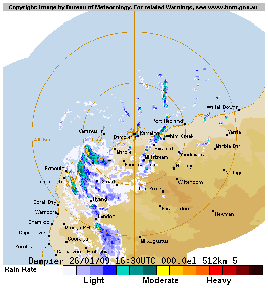
TC Dominic crossed the Pilbara coast near Onslow around 22Z. Highest wind speed
observed was a 10-minute mean wind of 53 knots gusting to 72 knots at Onslow
airport. Observations in the area confirmed the system had very small radii of
storm and gale force winds.
Position based primarily on radar, with radar showing asymmetry and maximum
winds likely to be in western quadrants of system.
The system is expected to weaken steadily during the day and a logarithmic decay
model suggests it should be below gale force within 12 hours.
Motion has been steady in a south southeast direction for the last 6 hours. The
track during today should be between south southeast and southeast depending on
how quickly it weakens. The lower level flow will encourage a more southerly
track but while vertical extent remains deep it should be influenced by
northwesterly flow and follow a more southeast track.
Copyright Commonwealth of Australia
==
The next bulletin for this system will be issued by: 27/0700 UTC by Perth TCWC.
IDW27600
TROPICAL CYCLONE TECHNICAL BULLETIN: AUSTRALIA - WESTERN REGION
Issued by PERTH TROPICAL CYCLONE WARNING CENTRE
at: 0110 UTC 27/01/2009
Name: Tropical Cyclone Dominic
Data At: 0000 UTC
Latitude: 21.7S
Longitude: 115.3E
Location Accuracy: within 15 nm [28 km]
Movement Towards: south southeast [164 deg]
Speed of Movement: 5 knots [9 km/h]
Maximum 10-Minute Wind: 50 knots [95 km/h]
Maximum 3-Second Wind Gust: 70 knots [130 km/h]
Central Pressure: 980 hPa
Radius of 34-knot winds NE quadrant: 40 nm [75 km]
Radius of 34-knot winds SE quadrant: 30 nm [55 km]
Radius of 34-knot winds SW quadrant: 30 nm [55 km]
Radius of 34-knot winds NW quadrant: 40 nm [75 km]
Radius of 48-knot winds NE quadrant: 12 nm [22 km]
Radius of 48-knot winds SE quadrant: 12 nm [22 km]
Radius of 48-knot winds SW quadrant: 12 nm [22 km]
Radius of 48-knot winds NW quadrant: 12 nm [22 km]
Radius of 64-knot winds:
Radius of Maximum Winds:
Dvorak Intensity Code: T3.0/3.5MINUS/S0.0/12HRS
Pressure of outermost isobar: 1000 hPa
Radius of outermost closed isobar: 60 nm [110 km]
Storm Depth: Deep
FORECAST DATA
Date/Time : Location : Loc. Accuracy: Max Wind : Central Pressure
[UTC] : degrees : nm [km]: knots[km/h]: hPa
+12: 27/1200: 23.0S 115.8E: 050 [095]: 030 [060]: 992
+24: 28/0000: 24.4S 116.9E: 080 [150]: 030 [055]: 994
+36: 28/1200: 26.4S 118.5E: 115 [210]: 025 [045]: 997
+48: 29/0000: 28.3S 120.8E: 145 [270]: 020 [035]: 999
+60: 29/1200: : : :
+72: 30/0000: : : :
REMARKS:
TC Dominic crossed the Pilbara coast near Onslow around 22Z. Highest wind speed
observed was a 10-minute mean wind of 53 knots gusting to 72 knots at Onslow
airport. Observations in the area confirmed the system had very small radii of
storm and gale force winds.
Position based primarily on radar, with radar showing asymmetry and maximum
winds likely to be in western quadrants of system.
The system is expected to weaken steadily during the day and a logarithmic decay
model suggests it should be below gale force within 12 hours.
Motion has been steady in a south southeast direction for the last 6 hours. The
track during today should be between south southeast and southeast depending on
how quickly it weakens. The lower level flow will encourage a more southerly
track but while vertical extent remains deep it should be influenced by
northwesterly flow and follow a more southeast track.
Copyright Commonwealth of Australia
==
The next bulletin for this system will be issued by: 27/0700 UTC by Perth TCWC.
0 likes
-
HURAKAN
- Professional-Met
- Posts: 46086
- Age: 37
- Joined: Thu May 20, 2004 4:34 pm
- Location: Key West, FL
- Contact:
Australian Government Bureau of Meteorology
Western Australia
Media: Transmitters serving Onslow and adjacent areas are requested to USE the
Standard Emergency Warning Signal before broadcasting the following warning.
TOP PRIORITY FOR IMMEDIATE BROADCAST
FLASH TROPICAL CYCLONE ADVICE NUMBER 19
Issued at 10:35 am WDT on Tuesday, 27 January 2009
BY THE BUREAU OF METEOROLOGY
TROPICAL CYCLONE WARNING CENTRE PERTH
This Flash Advice has been issued to update the FESA Community Alert status at
Onslow.
A Cyclone WARNING is current for coastal areas from Mardie to Exmouth and inland
parts of the west Pilbara.
At 9:00 am WDT Tropical Cyclone Dominic, Category 2 was estimated to be
20 kilometres east southeast of Onslow and
95 kilometres north northwest of Nanutarra and
moving south southeast at 9 kilometres per hour.
Tropical Cyclone Dominic has crossed the coast near Onslow. Destructive gusts to
135 kilometres per hour were experienced in the Onslow region this morning.
Destructive wind gusts are likely inland from Onslow over the next few hours.
The cyclone will weaken during the day and pass close to Nanutarra this
afternoon where a period of damaging wind gusts to 110 kilometres per hour is
likely. Gales with wind gusts to 90 kilometres per hour may be experienced
elsewhere within the warning area today. Dominic is likely to weaken below
cyclone intensity this evening or tonight.
Heavy rain and local flooding is expected close to the cyclone's path, but
rainfall totals will be highest close to the coast.
Details of Tropical Cyclone Dominic at 9:00 am WDT:
.Centre located near...... 21.7 degrees South 115.3 degrees East
.Location accuracy........ within 28 kilometres
.Recent movement.......... towards the south southeast at 9 kilometres per hour
.Wind gusts near centre... 130 kilometres per hour
.Severity category........ 2
.Central pressure......... 980 hectoPascals
FESA-State Emergency Service advises of the following community alerts:
BLUE ALERT: People in or near Nanutarra and adjacent inland communities should
be taking precautions.
ALL CLEAR WITH CAUTION: People in communities at Onslow, Exmouth, Pannawonica,
Karratha, Dampier, Roebourne, Wickham and Point Samson are advised to proceed
with caution.
The next advice will be issued by 1:00 pm WDT Tuesday 27 January.
Cyclone advices and State Emergency Service Community Alerts are available by
dialling 1300 659 210
A map showing the track of the cyclone is available at:
http://www.bom.gov.au/weather/cyclone
0 likes


Who is online
Users browsing this forum: No registered users and 108 guests