Australian Government Bureau of Meteorology
Queensland
Tropical Cyclone Warning Centre
Media: This message is issued daily for the information of interested parties.
Media are NOT required to broadcast this message.
TROPICAL CYCLONE OUTLOOK
for the Coral Sea West of Longitude 160 East
Issued at 11:19pm on Wednesday the 4th of February 2009
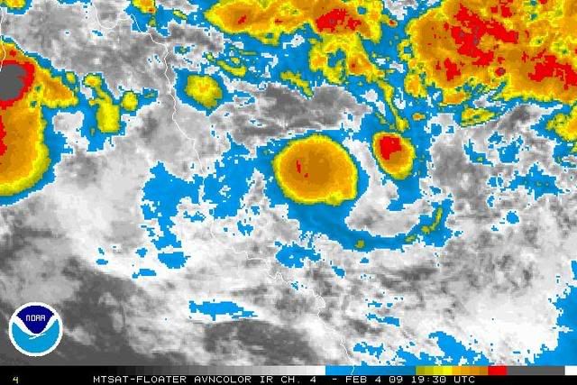
The monsoon trough lies over northern Australia and extends out into the Coral
Sea into a deepening low pressure system [998 hPa] which at 11pm on Wednesday
night lay 220 km east of Cairns.
The chances of a tropical cyclone forming in the trough are assessed as:
Until Thursday afternoon: Moderate
Until Friday afternoon: Moderate
Until Saturday afternoon: Moderate
Tropical Cyclone outlooks issued by Brisbane can be accessed through the
Bureau's Home Page http://www.bom.gov.au.
Please note that the Darwin Regional Forecasting Centre issues Tropical
Cyclone Outlooks that cover the Gulf of Carpentaria. See
http:/www.bom.gov.au/weather/nt/cyclone/ or to subscribe to this service
call Darwin 08 8920 3820.