Australian Government Bureau of Meteorology
Queensland
Tropical Cyclone Warning Centre
Media: The Standard Emergency Warning Signal should NOT be used with this
warning.
PRIORITY
TROPICAL CYCLONE ADVICE NUMBER 2
Issued by the Bureau of Meteorology, Brisbane
Issued at 10:57pm on Thursday the 5th of March 2009
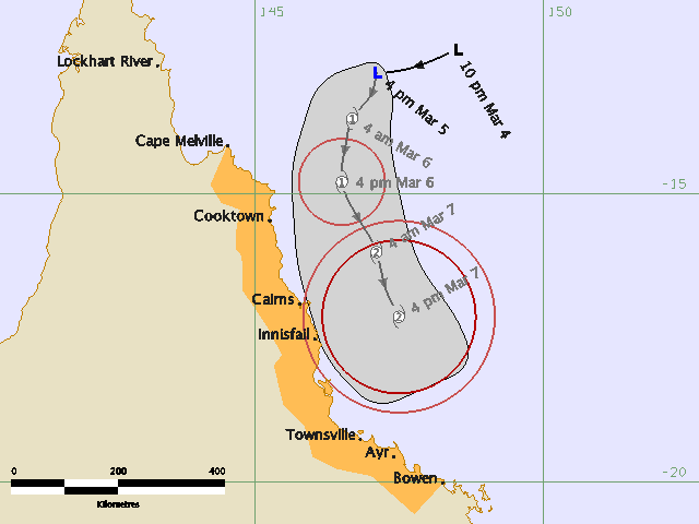
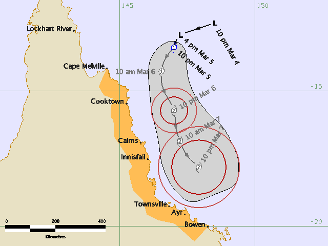
A Cyclone WATCH remains current for coastal and island communities from Cape
Melville to Bowen.
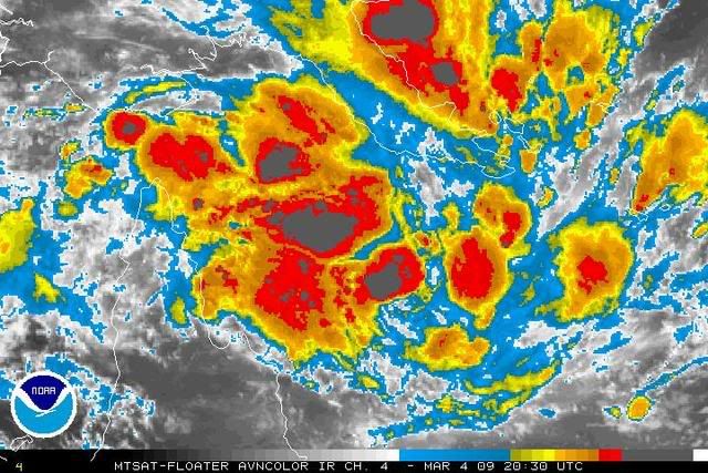
Tropical Cyclone Hamish, a category 1 cyclone, has formed in the northwestern
Coral Sea and at 10:00 pm EST was estimated to be 380 kilometres east of
Lockhart River and 415 kilometres north northeast of Cairns, moving south
southwest at 8 kilometres per hour.
Tropical Cyclone Hamish is expected to continue to move south roughly parallel
to the north tropical coast while deepening. Damaging wind gusts are not
expected to affect coastal or island communities within 24 hours, however they
may develop within 24 to 48 hours.
Details of Tropical Cyclone Hamish at 10:00 pm EST:
.Centre located near...... 13.4 degrees South 147.0 degrees East
.Location accuracy........ within 46 kilometres
.Recent movement.......... towards the south southwest at 8 kilometres per hour
.Wind gusts near centre... 95 kilometres per hour
.Severity category........ 1
.Central pressure......... 997 hectoPascals
People between Cape Melville and Bowen should consider what action they will
need to take if the cyclone threat increases. If you are unsure about the
actions to be taken, information is available from your local government or
local State Emergency Service.
The next advice will be issued by 5:00 am EST Friday 06 March.
This warning is also available through TV and Radio Broadcasts; the Bureau's
website at
http://www.bom.gov.au or call 1300 659 212. The Bureau and the State
Emergency Service would appreciate this warning being broadcast regularly.